The following is a brief summary of the key details of the Loch Lomond West Glens route.
DISTANCE : 36 miles circular
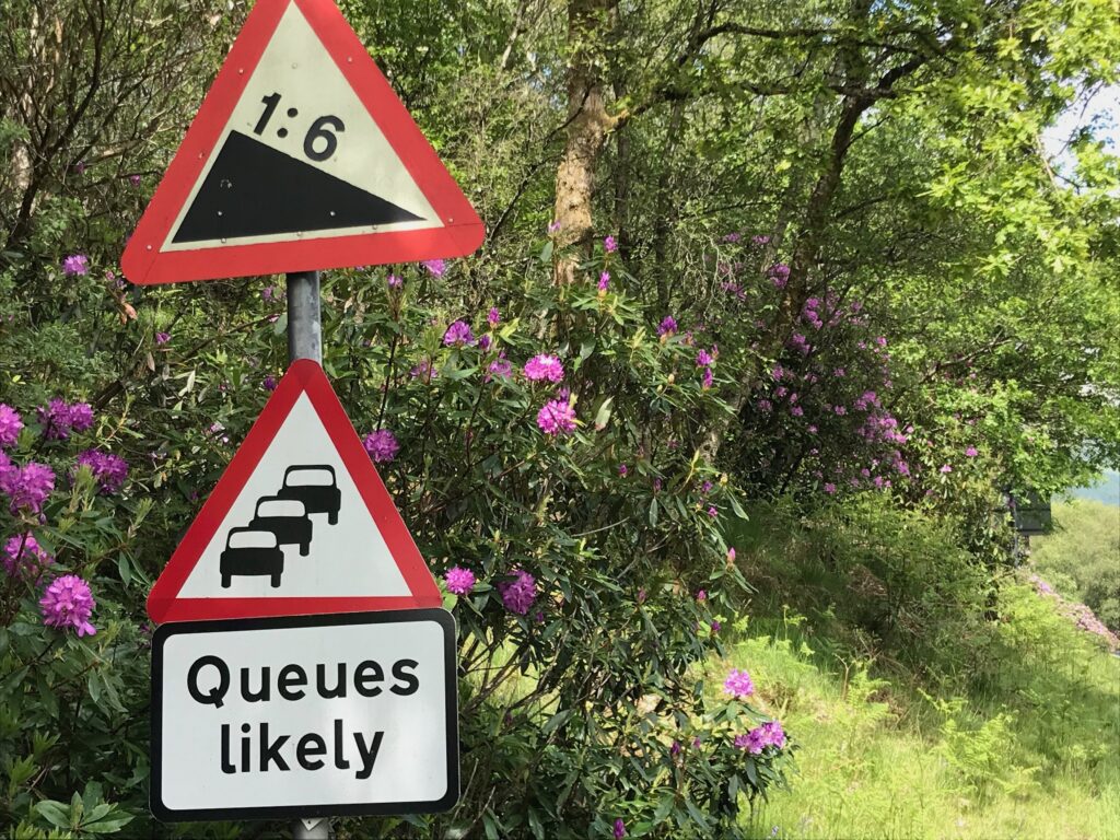
TERRAIN : Three steep hill climbs, one with hairpin bends, flat section at the end
START and FINISH : At the car park at the Loch Lomond Shores centre at Balloch
Route map – Loch Lomond West Glens
The map below is an interactive map of the Loch Lomond West Glens route. If you press “Play” (click on the white triangle in the middle of the screen) you can zoom in or out by pressing the buttons that appear in the top left of the screen. You can move the map by dragging it. Once you press Play the hills profile of the route will appear at the bottom of the map. You can get further comprehensive detailed analysis of the hill profile by clicking on “More Detailed Profile” at the top left of the hills profile section. You can also select full screen mode by clicking on the icon in the top right corner of the map.
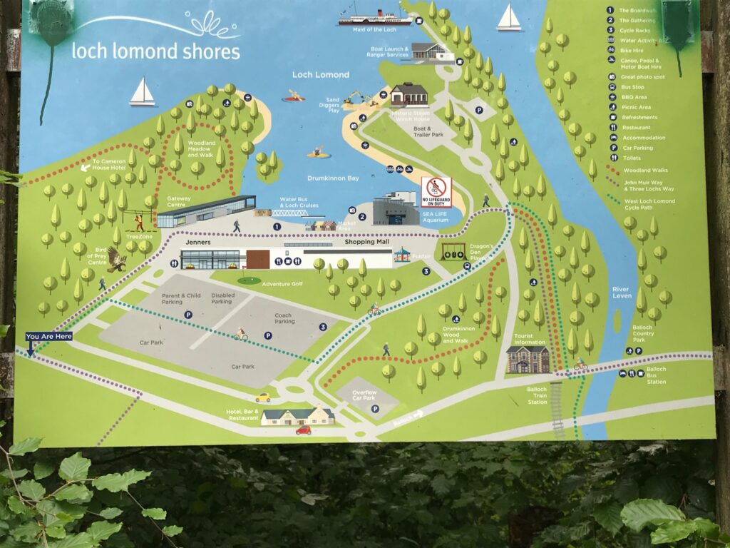
The Loch Lomond West Glens route commences at the Loch Lomond Shores visitor attraction. This is on the outskirts of the town of Balloch. Balloch is located on the southern shores of Loch Lomond. It’s main street is a thriving tourist area.
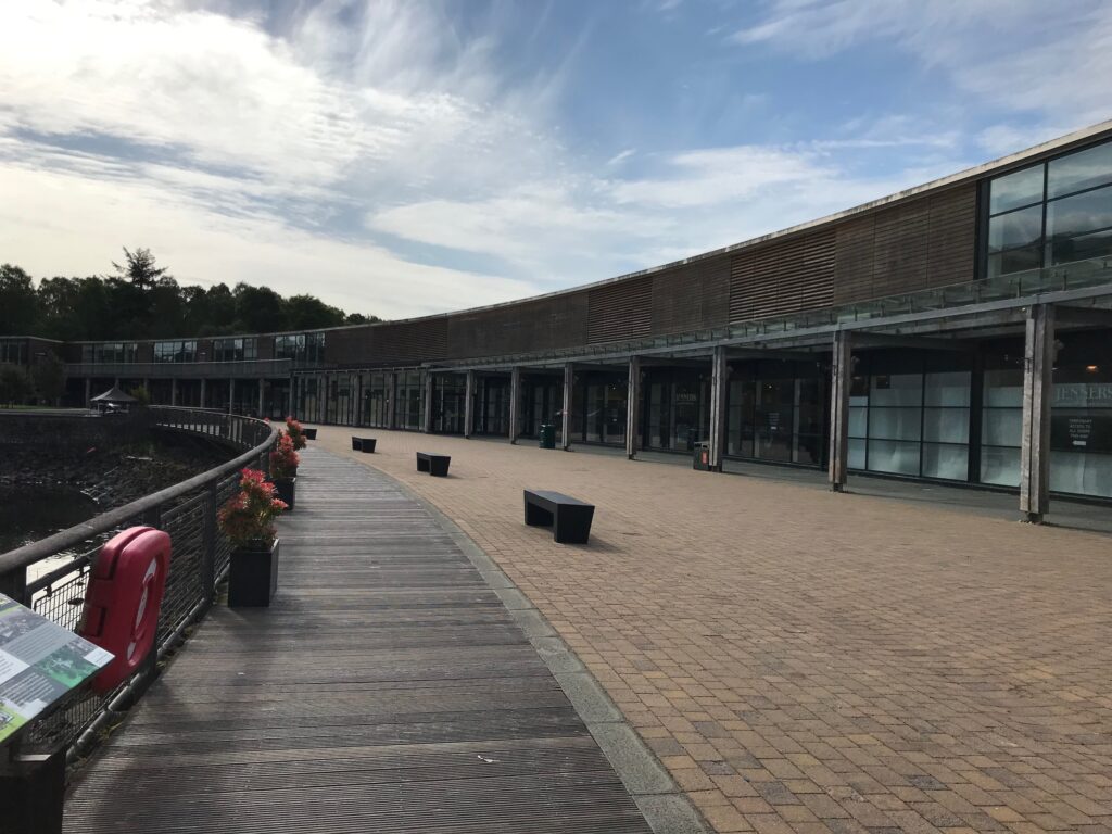
At Loch Lomond Shores there is an indoor shopping mall. There are also attractions like the Bird of Prey Centre, a Tree Zone aerial adventure course and Adventure Golf.
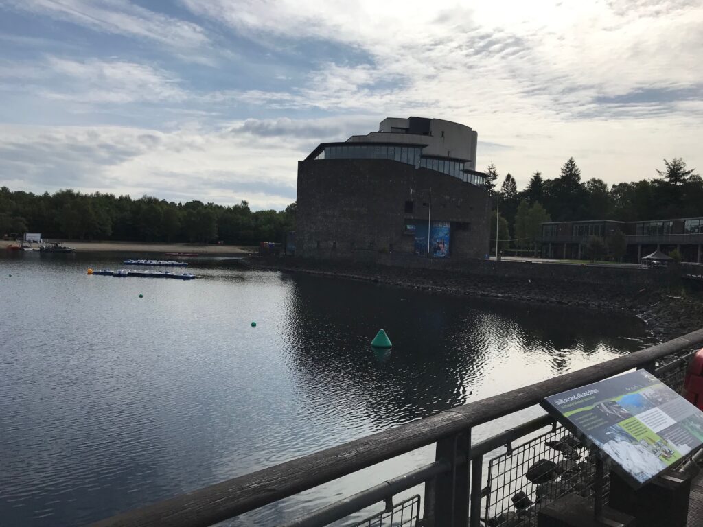
In the large building on the side of the loch there is the Sea Life aquarium.
As well as the indoor shopping mall there are also shops, cafes and restaurants outside overlooking the loch.
Balloch – Glen Fruin
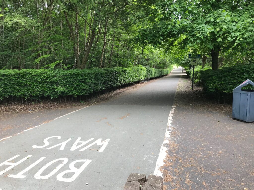
The first section of the Loch Lomond West Glens route is on the West Loch Lomond Cycle path. This path runs along the back of the free car park at Loch Lomond Shores. To get to the cycle path turn left onto the shared use path that runs alongside the car park, heading away from the loch.
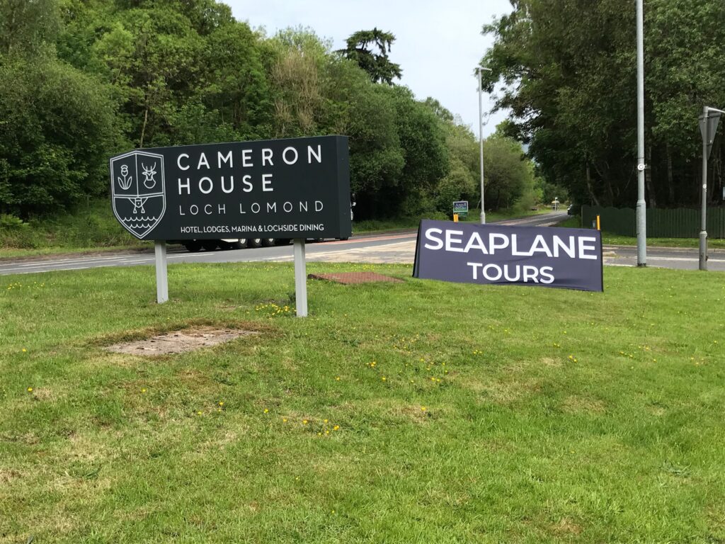
At the end of the shared use path turn right onto a road. Follow this road to the top of the hill. On the right here is the start of the cycle path, which can be narrow and bumpy at times. The path leads past the Cameron House Hotel and Lodges, where seaplane tours are available.
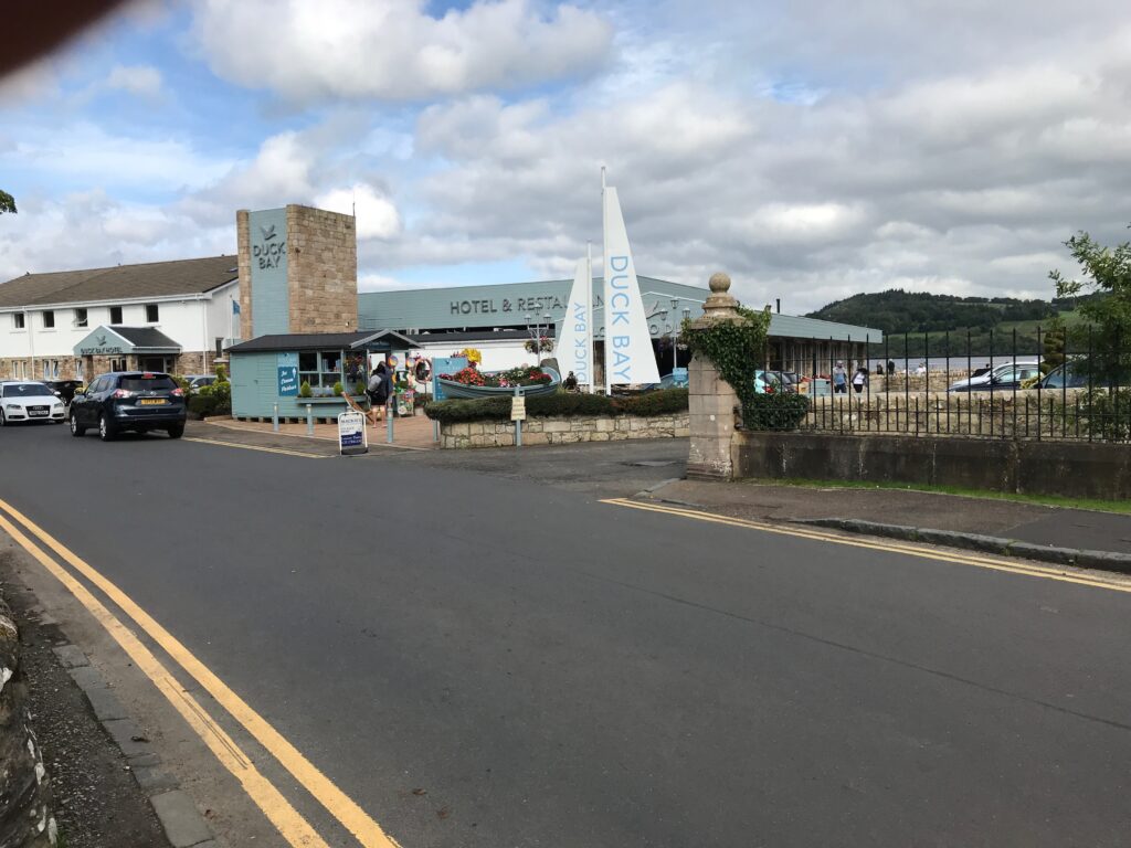
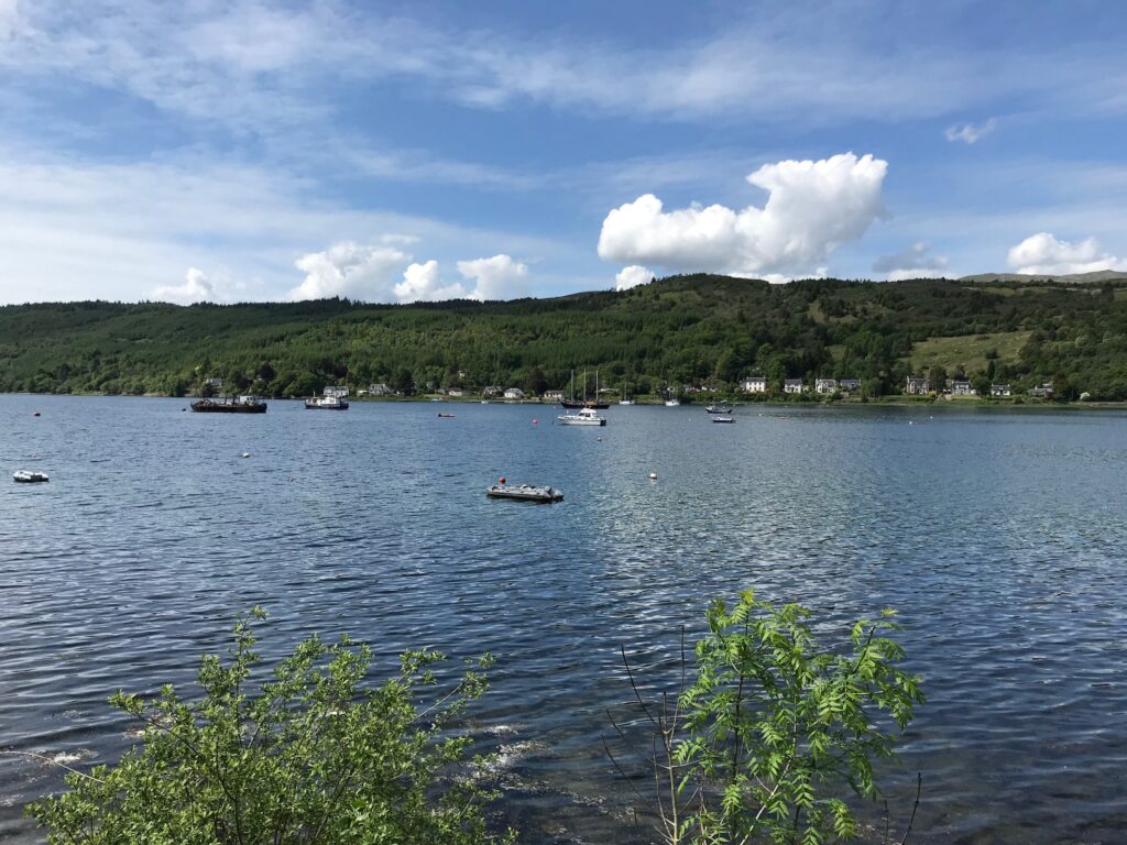
Shortly after leaving Balloch the popular Duck Bay is reached. Here there is a hotel, marina, car park and large grassy area with picnic tables.
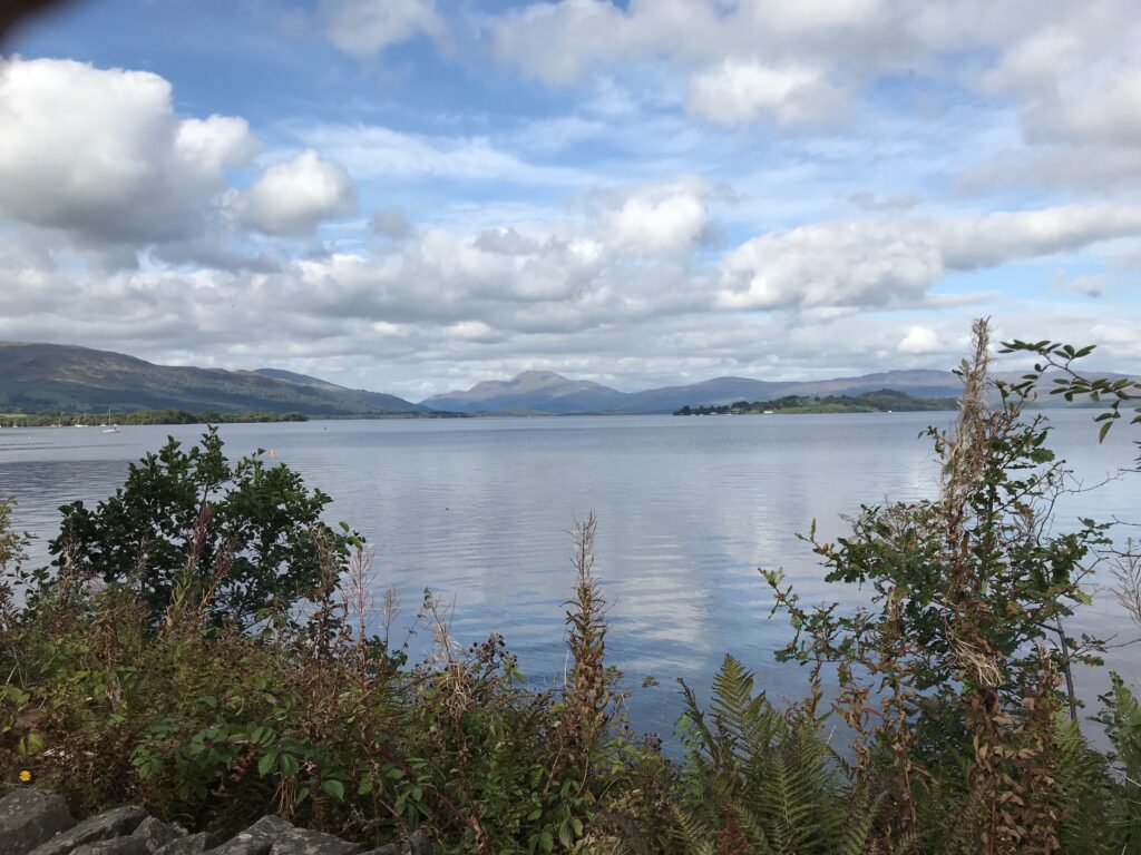
This is a fine location that provides excellent views over Loch Lomond towards Ben Lomond.
Cycle along the narrow road round the bay, past all the parked cars. At the end of the road the cycle path can be picked up again.
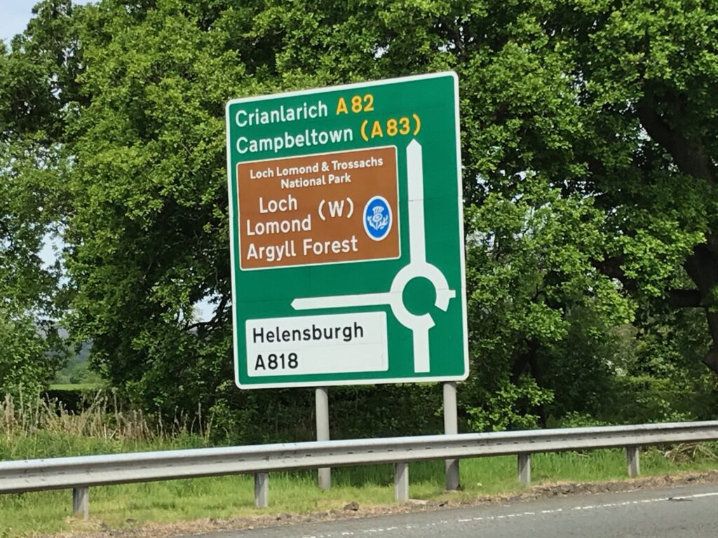
From Duck Bay the path continues alongside the busy A82 road until it reaches a large roundabout called the Arden Roundabout.
Here you will leave the West Loch Lomond Cycle Path by turning left and crossing over the busy road. There are two spots where you can cross the road but it is safer to cross at the second spot where there is an island in the middle of the road.
Glen Fruin
Cycling to the first climb
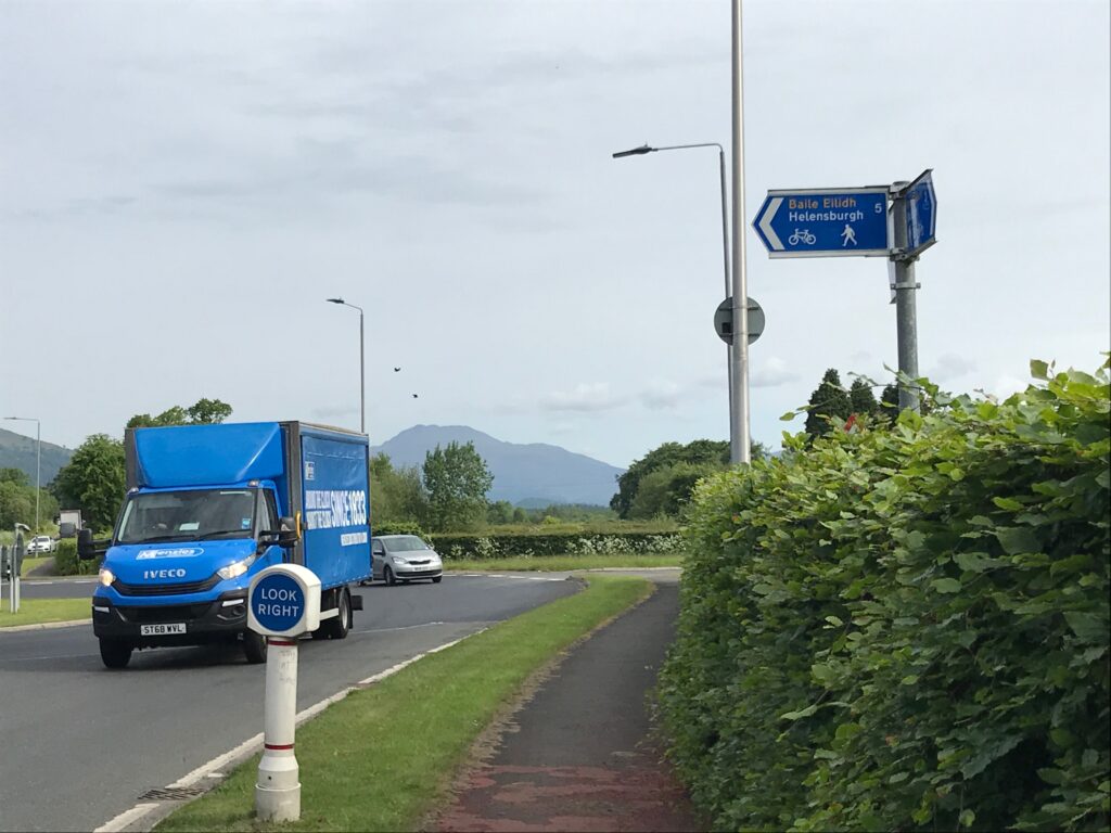
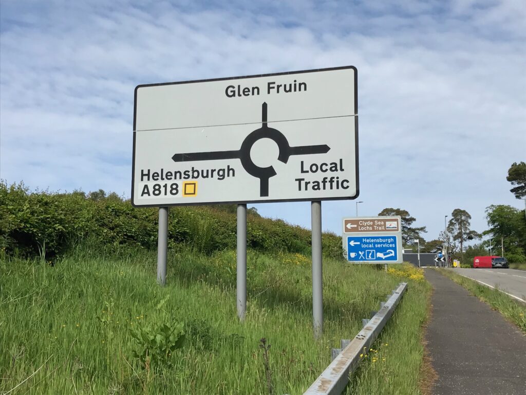
This leads you onto the Helensburgh cycle path section of the Loch Lomond West Glens route. This runs alongside the A818. The cycle path leads up quite a long hill that is a bit steep at the top, where there is a small roundabout. The A818 to Helensburgh continues to the left at the roundabout. The route goes straight on into a narrow single track road that is signposted “Glen Fruin”. Be careful at this point as you need to leave the pavement path and get onto the road.
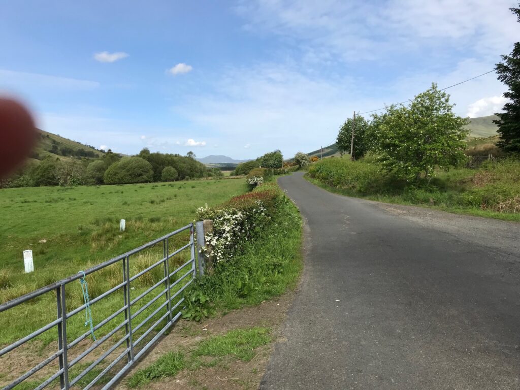
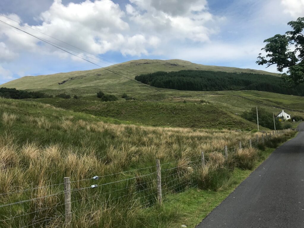
The road up Glen Fruin is a single track road with passing places, but it is quiet with very little traffic. The first section up Glen Fruin is a steady climb but not too steep. After the top of the first climb there is a long, steep winding descent. At the end of this descent there is a road that leads off to the left over a bridge. Ignore this and continue cycling straight on.
The floor of the glen
The road then levels out as it goes along the floor of the glen.
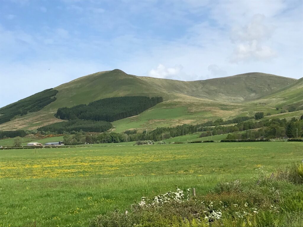
Continue cycling along this pleasant stretch of road. Some distance along on the right the hill called Beinn Tharsuin can be seen. This is a low level hill walk that I climb each year in the winter months. If you complete the circular walk you end up walking back along the Glen Fruin road.
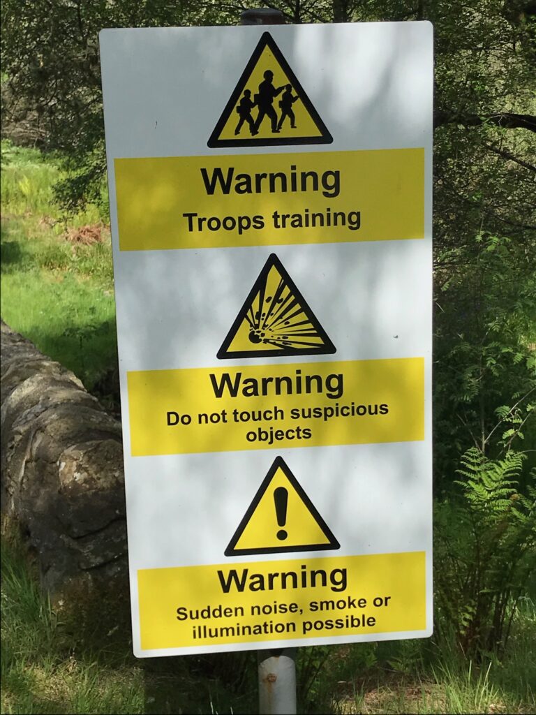
The military area
The military area
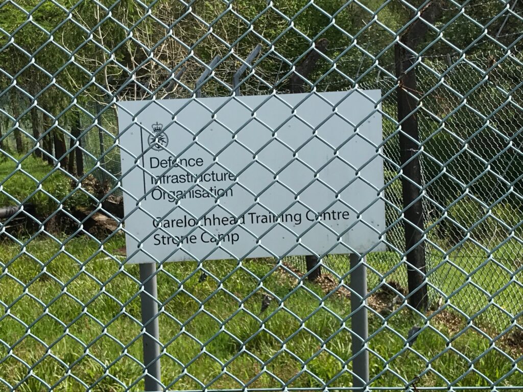
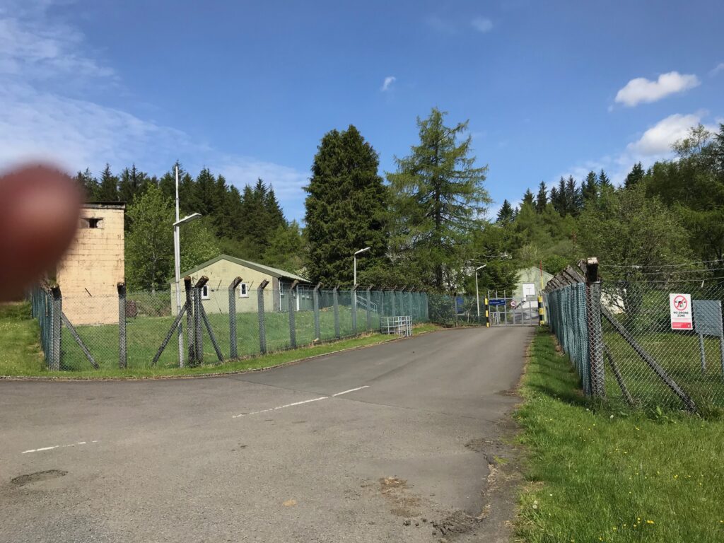
Continue cycling until you reach the other end of the glen. The area around this end of the glen is used by military personnel. This is confirmed by the warning signs that are scattered along the side of the road.
In all the years I’ve cycled this route I’ve never seen anything mentioned in the warning signs, let alone a soldier. Nevertheless just past the first of these signs there are army barracks that are used as a training centre.
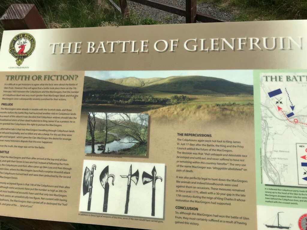
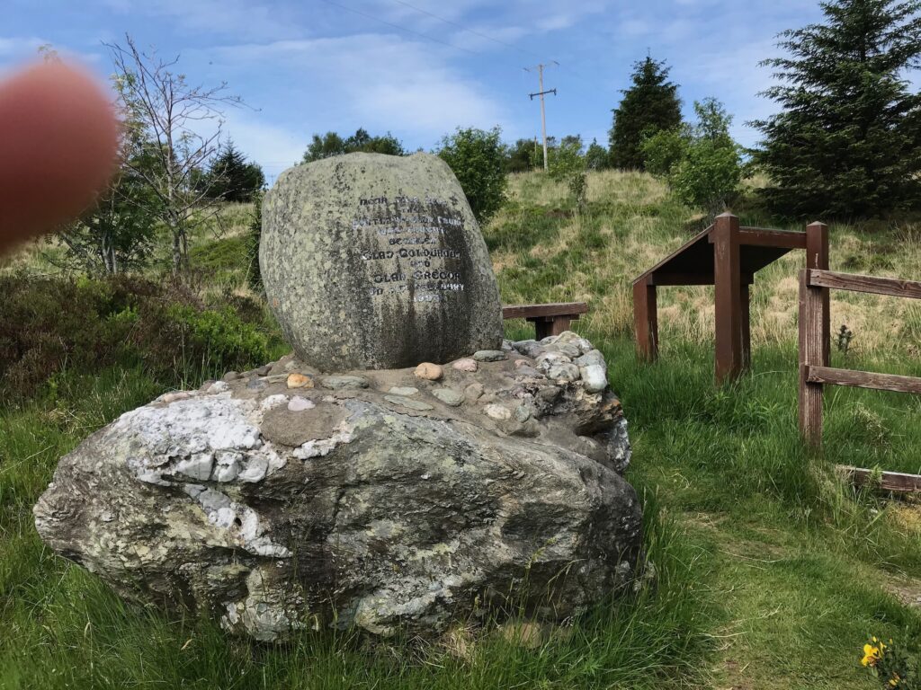
The clan battle
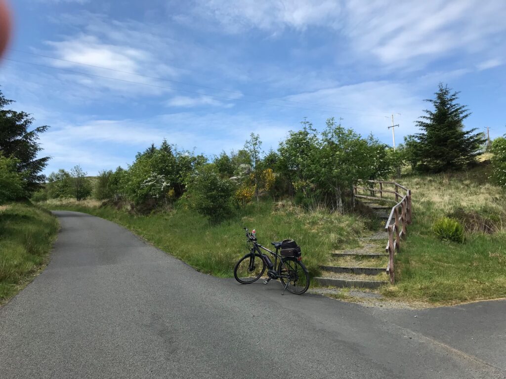
Just past the army barracks there is a monument to a clan battle that was fought near this spot. The monument is accessed via a set of stairs on the right of the road.
The Battle of Glen Fruin took place in 1601. It was between the Colquhouns and the McGregors. An information board and an engraved boulder at the site give full details of the battle.
The high point of the glen
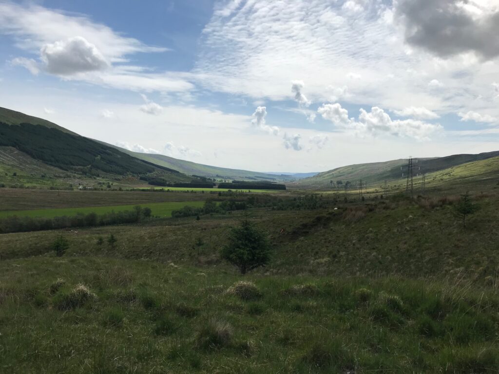
The road then commences to climb steeply up to the high point at this end of the glen. From here there are good views back down the glen.
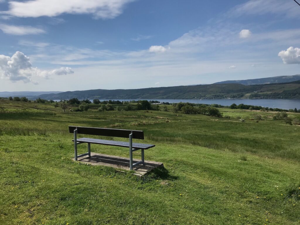
After passing this high point there is a steep descent that affords the opportunity for some welcome free-wheeling. Half-way down the descent there is a bench overlooking the Gareloch,. Here you can have a welcome rest and admire the views.
The view down to the left is good, as shown above. However, the view down to the right I feel is spoiled by the Faslane naval base for nuclear submarines.
The descent from here is very steep and winding in places so great care should be taken.
Faslane – Garelochhead – Loch Long
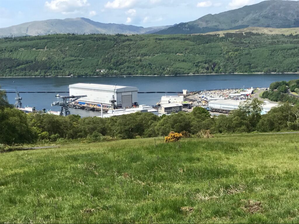
This steep descent emerges at the junction with the A814 road. Here carefully cross over the road to pick up a cycle path on the other side and turn right along this path. The path continues alongside the perimeter of the naval base with it’s very high wire fencing topped with rolls of razor wire and with warning signs at regular intervals.
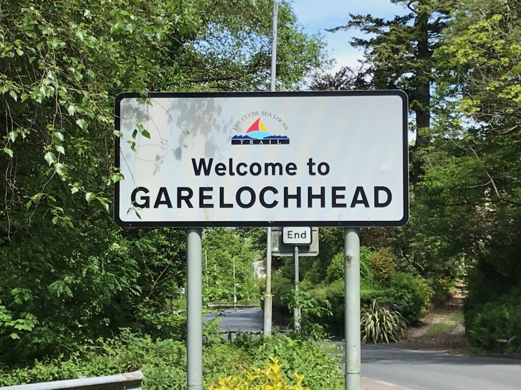
Further on, at the entrance to the naval base, there is a roundabout where you turn left .You then continue cycling on the pavement alongside the B872 road. The cycle path continues on the pavement alongside this road all the way to the outskirts of the village of Garelochhead. Here the pavement narrows so it is best to cycle the last short distance into the village on the narrow road.
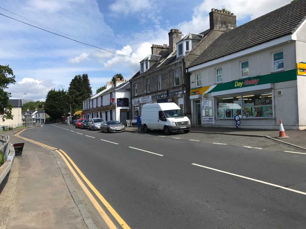
In the village there is a cafe, a deli, a convenience store, etc. Just along the main street, at a telephone box, there is a bench where you can sit and admire the views over the loch.
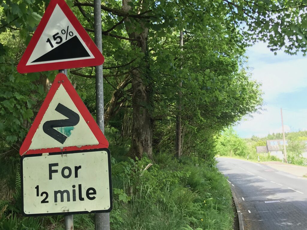
After cycling through the village you continue on the B872 road. Then, just past the junction with the B833 road, the B872 veers round to the right. It then climbs up a long and very steep hill (15% gradient).
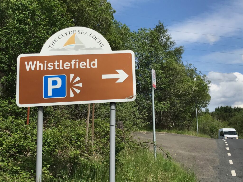
Near the top of this road, on the right, is the Whistlefield picnic area. Here you can rest after the exertions of climbing up the steep hill.
The information board here advises that the name of Whistlefield derives from the days of the stagecoach. The stagecoach driver would blow his whistle when part way up the hill. This would alert the innkeeper at the top of the pass to be ready for customers and horses.
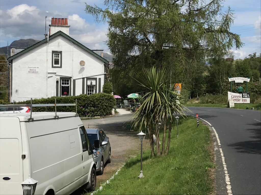
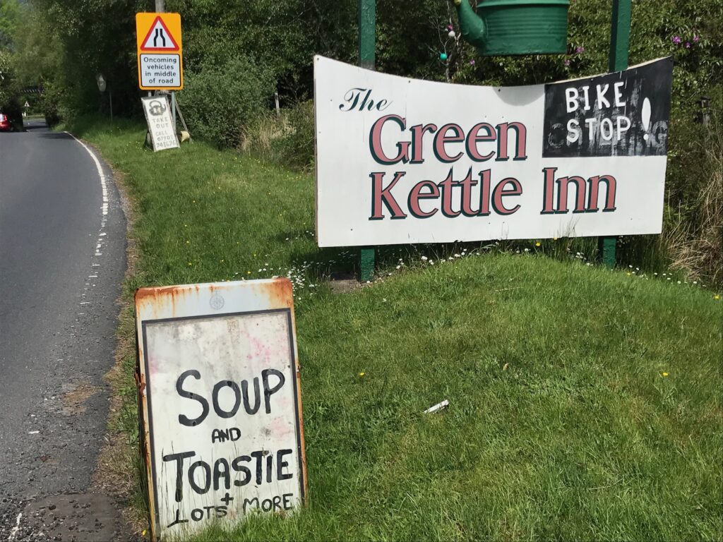
Continue on the B872 road until you reach a roundabout, where you rejoin the A814 road. Further along this road there is the Green Kettle Inn that serves meals and snacks.
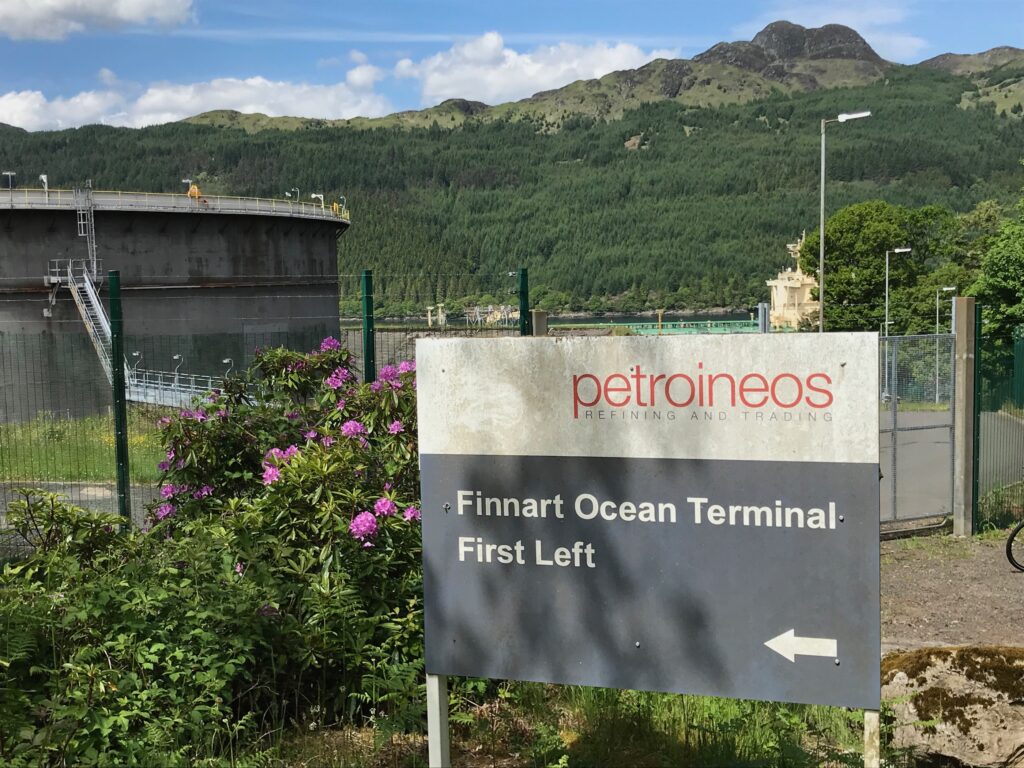
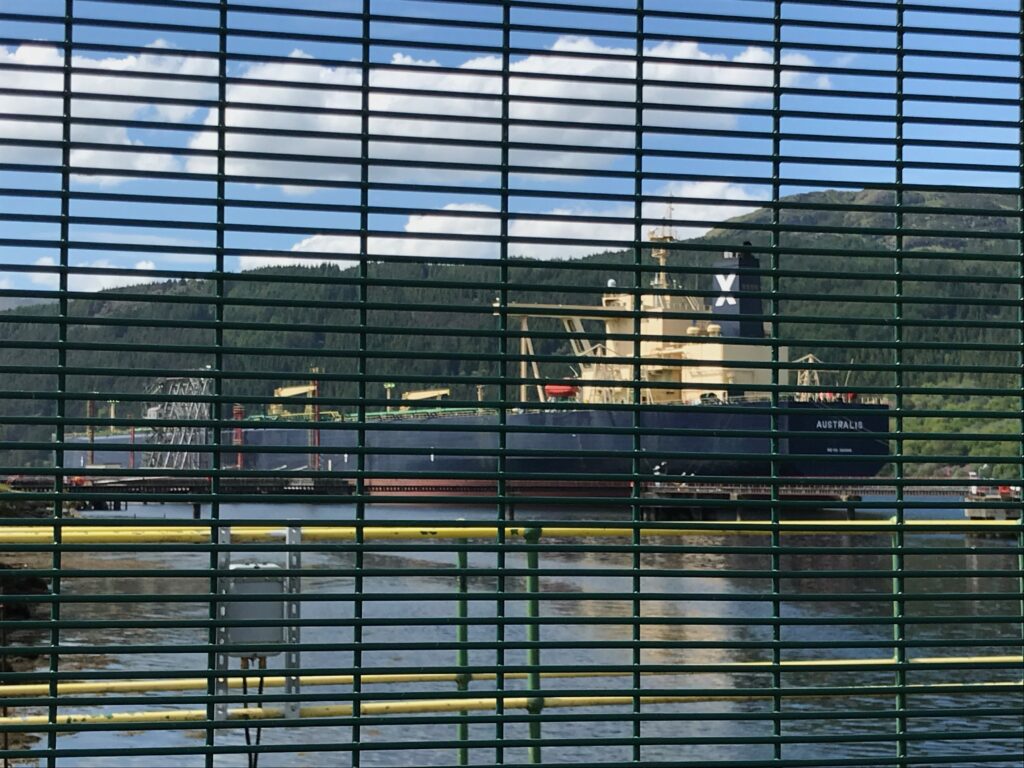
After leaving Whistlefield and the Green Kettle Inn the route is undulating with some quite steep ascents and descents. You then came to a steep descent that leads to the Finnart Ocean Terminal on Loch Long.
Any large oil tankers that are berthed at the terminal can be glimpsed through the wire fencing surrounding the terminal.
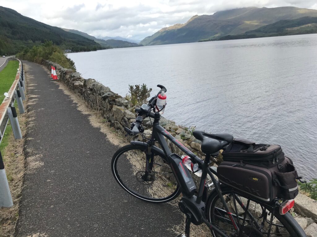
From this point the route continues alongside the shores of Loch Long. The road here is undulating but it isn’t too difficult. This is a fine part of the ride with nice views up Loch Long.
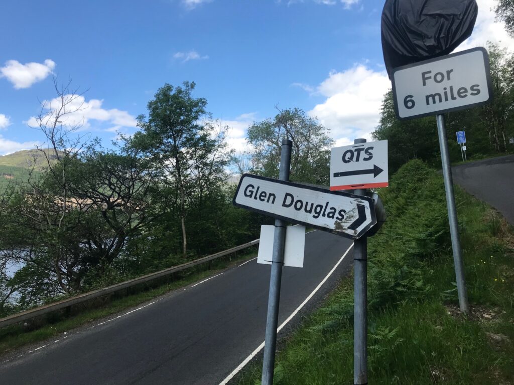
Glen Douglas
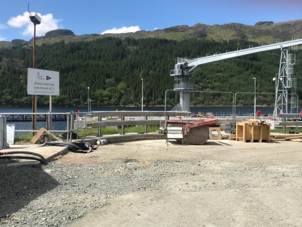
Further along you came to the restricted Ministry of Defence access road to Glen Douglas. This is across from the Glen Mallan Jetty.
Continue cycling past this road and along the loch side for a while. Then look out for the narrow single track road on the right signposted “Glen Douglas”. The sign post is not all that visible so be careful not to cycle past it.
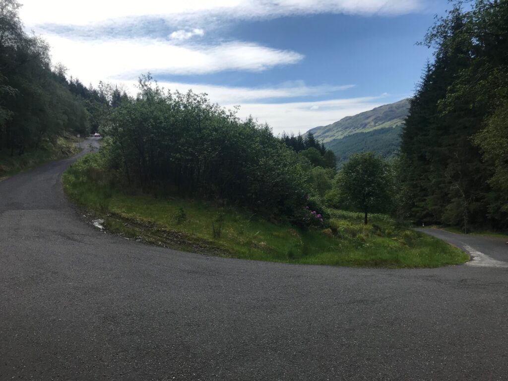
The road up Glen Douglas is very steep right from the start and there are two hairpin bends in the first stretch of the road. It then straightens out and continues steeply to the top of the glen.
After you reach the top there is a short descent then the road passes the Glen Douglas Munitions Depot on the right. There is then another quite steep hill to climb. After this there is a long descent which is really good and welcome. There is then a stretch when the route is undulating, followed by a steady descent again.
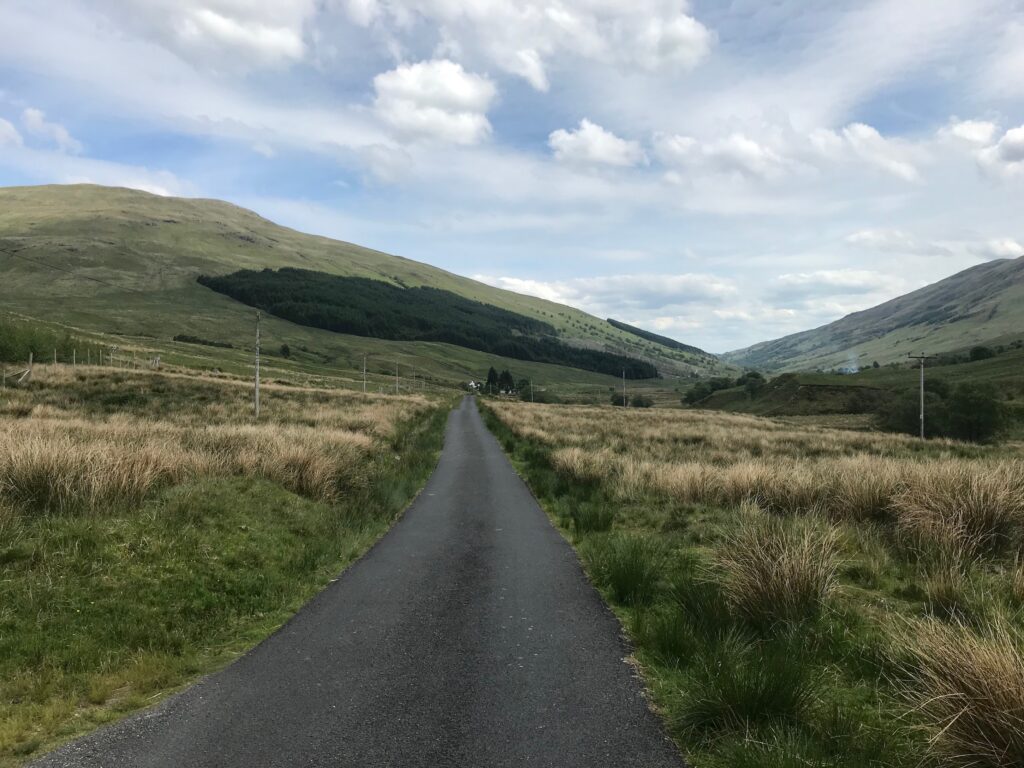
After this the road then winds it’s way along the glen for several miles through rugged scenery. There are several sections of downhill stretches where you can free-wheel.
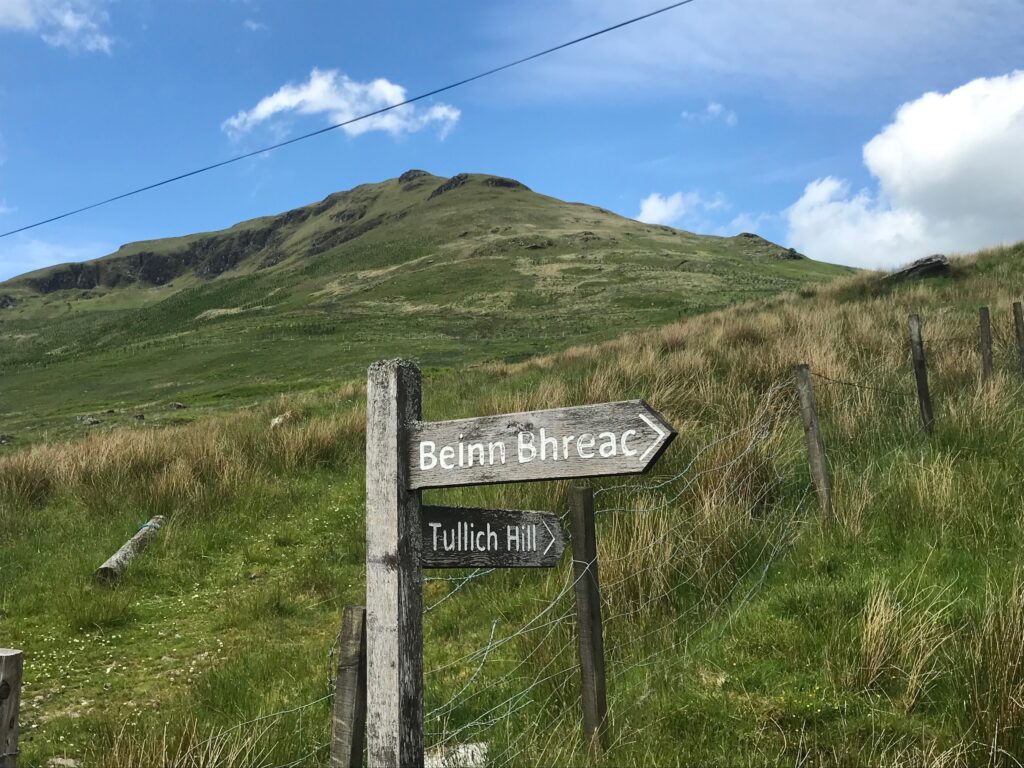
At the other end of the glen there are some farms and just past Invergroin farm there is a rough parking area for hill walkers who climb the nearby hills such as Ben Bhreac or Tullich Hill. There is a signpost for these two hills a short distance before you get to the parking area.
The sign post is at the bottom of Tullich Hill. Beinn Bhreac is a little further on. This is another low level hill that I climb each year in the winter months.
The road continues to wind it’s way along the glen and then a corner of Loch Lomond comes into view. After this a steep descent commences. Great care should be taken on this descent as, although there is not normally a lot of traffic on this road, there is occasionally some farm traffic. There may also be hill walkers or tourists driving up the road from time to time.
High cycling speeds could be obtained on this descent but the road is narrow and winding so it is essential to be very careful, especially at bends where there may be unseen oncoming traffic. My own personal approach to all descents is to apply the brakes frequently to keep my speed down, not only for safety purposes but also so that I can enjoy the views of the wonderful Scottish scenery from different perspectives as I descend.
The road continues it’s steep descent, and near the bottom it winds it’s way past a B & B and then round to a paintings gallery where you turn left and this leads you to the very busy A82 road at Inverbeg, where you need to cross to the other side. You need to be very careful when crossing over this road as it is a main route and carries a high volume of traffic.
Inverbeg – Luss
When you get over to the other side of the road you turn right and you are now on the West Loch Lomond Cycle Path which goes all the way back to the start point at Loch Lomond Shores, Balloch. This is a level route that mostly hugs the shore of Loch Lomond and can be a separate trip in it’s own right (see my Route Details article “West Loch Lomond Cycle Path : Route Details“).
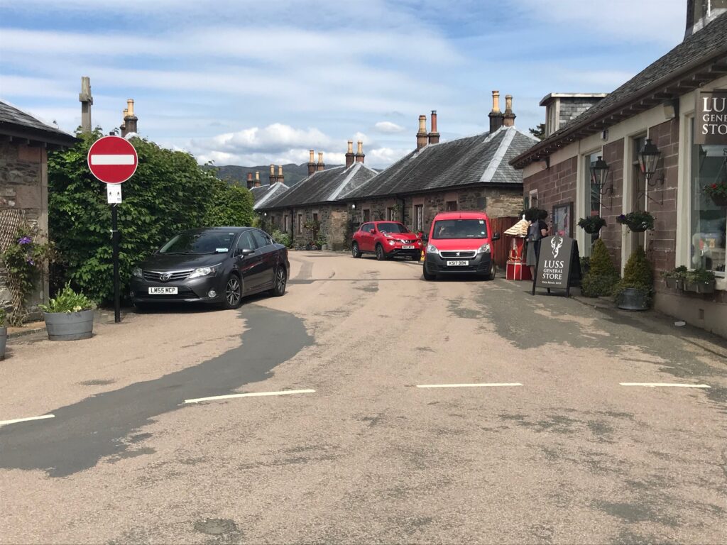
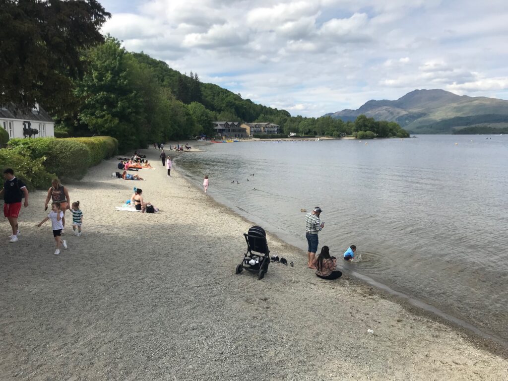
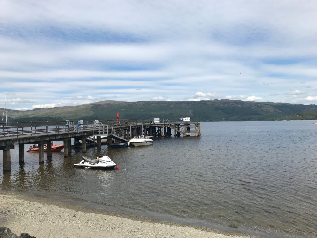
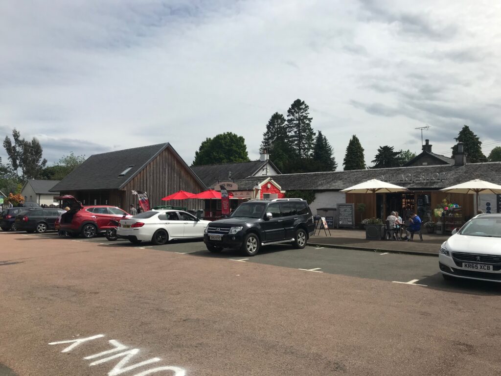
Continue cycling on this path until you reach the picturesque village of Luss. This is a popular tourist village. It has quaint cottages that attract the tourists.
It also has a stony beach and a pier that loch cruises berth at. At the pier there is a gift shop. Also, on the pier there is a takeaway shop that serves tea & coffee, snacks and ice cream.
Due to its popularity it has a large car park that caters for coach parties as well as cars. At this car park there is a shop, a snack bar, a 24 hour automatic petrol station and public toilets.
Due to the pressure of parking on residents a new car park has now been built at the other end of the village.
In the village there is the Loch Lomond Arms Hotel and there are also two coffee shops.
Luss – Balloch
The cycle route from Luss is at first on a quiet road. The road passes through the hamlet of Aldochlay.
This road then eventually veers to the right to join the main A82 road. At that point the cycle route goes left onto another road. This takes you up to large double gates with stone pillars. Just before this you go onto the pavement where you can pick up the cycle path again.
A good bit further on the cycle path comes out onto another road. You cycle along this road and pass through a gatehouse. Further along this road bends round to the left. On the right at this point there are a couple of large boulders off to the side of the road. Behind these boulders is where the cycle path commences again.
Continue cycling on the cycle path until Duck Bay is reached again. Then cycle back to the start of the route at the car park at Loch Lomond Shores in Balloch.
Cafe/toilet stops – Loch Lomond West Glens
At Loch Lomond Shores there are shops and several cafes and restaurants. There are also public toilets in the shopping mall. Also, Lomond Shores is only a short distance from Balloch Main Street where there are many shops, cafes, restaurants, a hotel and public toilets.
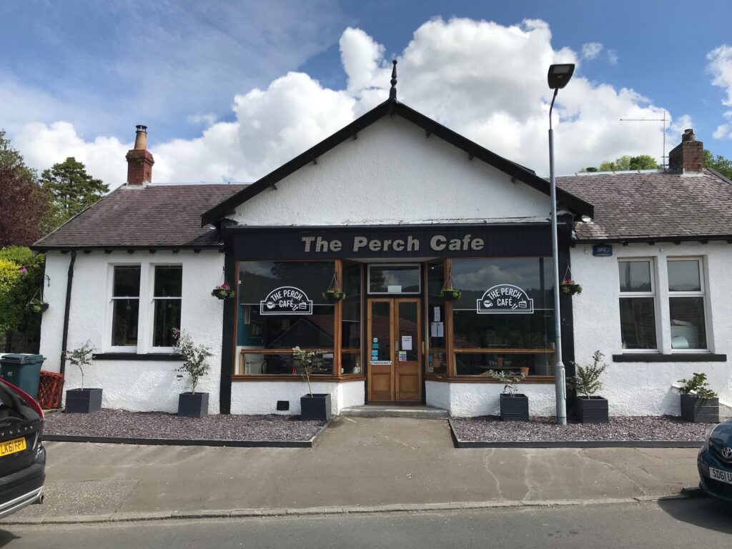
After leaving Lomond Shores and cycling up into Glen Fruin there are no facilities until you descend from Glen Fruin and cycle along to the village of Garelochhead. In Garelochhead the facilities included the Perch cafe, the Anchor Inn, a Chinese takeaway, a deli shop, a convenience store and a hardware store.
About ten minutes cycle from Garelochhead there is the Green Kettle Inn that is also popular with cyclists. It is on the A814 road just after you leave the B872. It is an older establishment which is a bit quirky, with interesting photos on all the walls. As well as a B & B and a bar it is also a cafe serving lunches and snacks.
After this there are no facilities until you descend from Glen Douglas at Inverbeg where there is a hotel with a restaurant.
Further on down the West Loch Lomond Cycle Path you come to the popular tourist village of Luss where there is a shop, a snack bar and public toilets at the main car park. There are two coffee shops in the village. On the pier there is a takeaway shop that sells tea, coffee, snacks and ice cream. There is a hotel with a restaurant just along from the main car park.
Before returning to the start point at Lomond Shores in Balloch there is a hotel with a restaurant at Duck Bay.
Alternative start and end points – Loch Lomond West Glens
Starting from Garelochhead or Luss
If starting from Balloch is not convenient, an alternative would be to start from Garelochhead, where there is a small, free public car park off the main road. You could also start from Luss where there is a large Pay and Display car park at one end of the village, and a new car park that has now been built at the other end of the village.
To shorten the route
To shorten the route you could just do the short Glen Fruin Section by returning via Helensburgh. Once you get to the bottom of Glen Fruin at the junction with the A814, instead of crossing the road and turning right on the cycle path, you turn left onto the A814 that leads via Rhu to Helensburgh.
This route is mostly on level cycle paths, both on road and off road, with a short section in Rhu where both the road and the pavement are narrow. Here you may wish to walk with your bike until you reach the traffic lights where you can cross the road and pick up the off road cycle path that leads all the way to Helensburgh.
This is a pleasant section with views over the esplanade to the sea. To return from Helensburgh turn left onto the A818 road from the esplanade. Cycle up the very long hill until you pick up the Helensburgh – Loch Lomond Cycle path that leads back to the Glen Fruin roundabout. From there return to Balloch via the outward route.
To lengthen the route
To lengthen the route you could start from and return to Helensburgh, where there is a car park on the esplanade. You could cycle on the cycle path mentioned above from Helensburgh and pick up the route where the Glen Fruin road comes down to the A814 road, and continue on the route from there.
The route could also be lengthened by starting at Tarbet, where the West Loch Lomond Cycle path ends. You could cycle down the cycle path to the Arden roundabout and pick up the route from there.
Train options – Loch Lomond West Glens
If you want to access the start of the route by train you can do so from the train station in Balloch, which is just off the main road in Balloch and which is only a short distance away from the start point at Lomond Shores. There is a path from the car park at the Tourist Information office on the main road in Balloch that leads to Lomond Shores.
Your options to get to Balloch by train will of course depend on where you live and what train lines are nearby and where they run to, which each person will need to investigate for themselves. Click on the following website address for a website that can help with this : https://www.thetrainline.com.
There is also a train station at Garelochhead and the Arrochar & Tarbet station is a short distance along the A83 road from Tarbet.