I chose the route Cycling Ben Lawers / Glen Lyon / Loch Tay on 13 Jul 21 due to the time of year. This was to take advantage of the long summer days. I also knew that the weather forecast for today was good.
The route is outwith the normal template for my day trips. I normally cycle 30 – 40 miles on a day trip, with a drive to the start point of up to one hour.
This route, however, is a longer drive to the start point. It can take up to 2 hours to get to the start point in Killin from Glasgow. The travel time depends on the traffic conditions.
It is also a longer route to cycle with a higher total ascent. The last time I cycled this route was five years ago, before I bought my e-bike. I therefore knew that it was about 47 miles long. I also knew that it involved a lot of hard climbing.
So I was looking forward to doing it on my e-bike on a nice summer’s day.
The map above is an interactive map. Press “Play” (click on the white triangle in the middle of the screen) to activate it. You can then zoom in or out by pressing the buttons that appear in the top left of the screen. The map can be moved by dragging it. Once you press Play the hills profile of the route will appear at the bottom of the map. Further comprehensive detailed analysis of the hill profile can be obtained by clicking on “More Detailed Profile” at the top left of the hills profile section. You can also select full screen mode by clicking on the icon in the top right corner of the map.
Timings and Distances -
Cycling Ben Lawers / Glen Lyon / Loch Tay on 13 Jul 21
Anytime I cycle on one of my cycle routes in Scotland I use this section to record trip details. I record the times I took for the various parts of the day and the distances cycled. This includes when I started cycling and how long I cycled for between various points in the route. I also record the distances (in miles) between various points in the route and how long I rested for, etc.
I included this section so that I can look back at the timings and distances to help me plan my day if I decide to do this trip again. This section could also assist others with planning their day if they decide to do this route. Each person, of course, will have to adjust the timings to suit their own circumstances, e.g. cycling speed, rest times, etc.
(Note: The figures in brackets are the cumulative distances in miles from the start of the route.)
Left Glasgow 8.15 / Arrived at parking in Killin 9.45 / Started cycling 10.10 / Cut off to Ben Lawers road 10.40 (4.35) / Lawers Dam 11.20 (7.25) / Bridge of Balgie 12.00 (13.80) / Meggernie Estate picnic area 12.10 (14.44) / Lunch to 12.45 / Kenmore 2.45 – 3.30 (30.38) / Back at car 5.45 (48.05) / Left 6.10 / Home 7.45.
Computer Readings -
Cycling Ben Lawers / Glen Lyon / Loch Tay on 13 Jul 21
At the end of each trip there are a variety of readings on the bike’s computer. Some of them I record for future comparison purposes.
For Cycling Ben Lawers, Glen Lyon & Loch Tay on 13 Jul 21 the readings are as follows :
Cycling Ben Lawers / Glen Lyon / Loch Tay on 13 Jul 21
Getting There
The drive to Killin was a bit quicker than expected.
The traffic over the Kingston Bridge moved quite quickly. Sometimes this can take ten minutes or so.
Then the traffic along the M8 motorway moved freely. This continued all the way to the cut off onto the A84 country road to Callander then Killin.
On this road I didn’t get stuck behind any slow moving vehicles, which quite often happens.
Consequently, as a result of all these things working out I only took 1.5 hours to drive to Killin.
Killin
When I arrived at Killin it was cloudy with some patches of blue sky. It was warm and there was little wind.
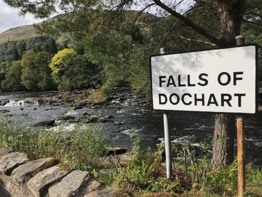
Coming into Killin the road passes over the river on an old single track bridge. The bridge crosses over rapids that are called the Falls of Dochart.
I drove past the Falls of Dochart, over the narrow bridge and on to the end of the Main Street. I knew that there was a quiet free car park there, which is a good place to start the route.
Also, across the road and down Station Road there are public toilets. There is also another free car park there, but I prefer the one on the Main Street.
Killin - Ben Lawers
After walking down to the toilet I returned and unloaded my bike from the car. I pumped up the tyres, sprayed some degreaser/lubricant onto my chain, etc. and tightened some bolts. That was me good to go.
I turned left out of the car park onto the end of the Main Street. Once out of Killin this then becomes the A827 road. It is quite a busy road but not too bad. The first section of this road is a long uphill stretch, but it is not too steep.
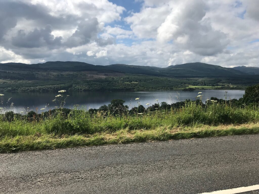
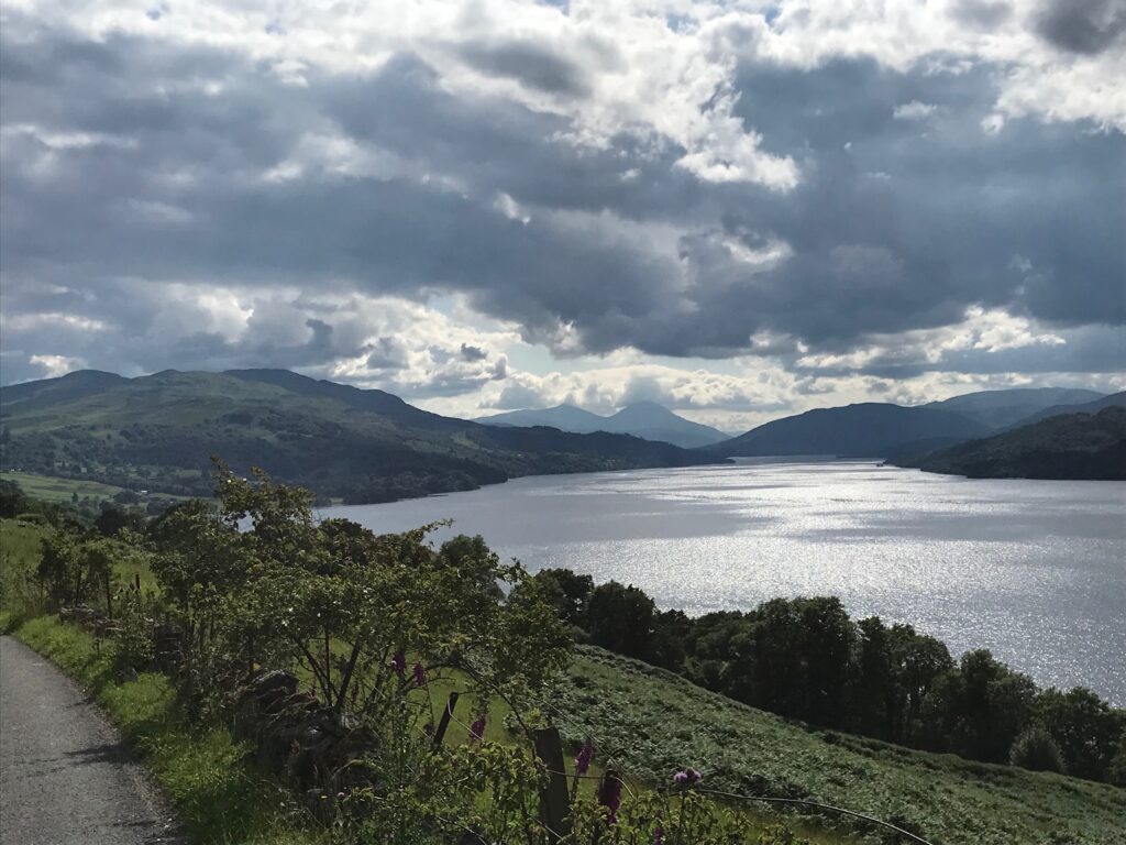
The road runs alongside Loch Tay and this affords some fine views across the loch.
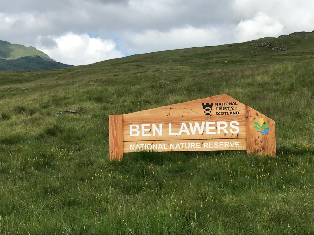
I cycled along this road for just over four miles. Then I turned left at the cut off for the road to Ben Lawers. This road immediately climbed steeply from the A827. It then wound it’s way steeply up through forestry land to the start of the Ben Lawers National Nature Reserve.
Just past the sign for the nature reserve there are two really steep hairpin bends. I cycled slowly and steadily round these bends. Then I continued cycling slowly up the road as it wound it’s way steeply up the glen.
The road eventually passes by a car park for walkers climbing Ben Lawers and other surrounding hills. The car park was full. I’ve used or passed by this car park several times over the years. Sometimes for hill walking and a few times for cycling. In all these times, I can’t remember ever seeing this car park when its not busy.
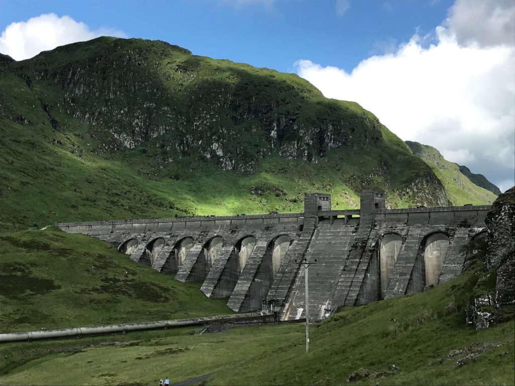
From the car park I cycled on steadily. The road continued it’s steep climb all the way up to Lawers Dam.
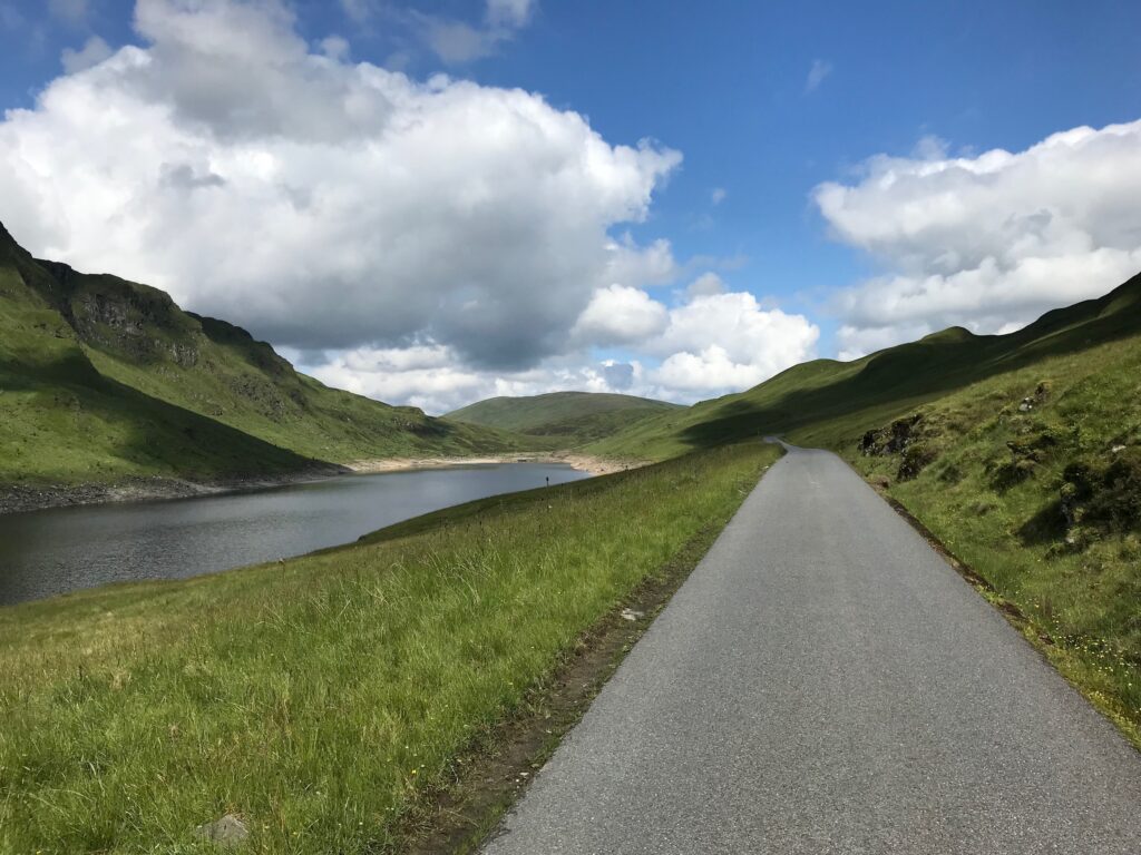
After passing the top of the pass at the dam the road descends to the loch called Lochan na Lairige. The road then levelled off alongside the loch. When I cycled alongside this loch the sun had come out and it was nice and warm.
I really enjoyed this stretch of cycling. It was good to cycle on the level after the hard slog previously. It was also spectacular, rugged scenery. The loch was on my left, hills on my right and hills all around – wonderful!
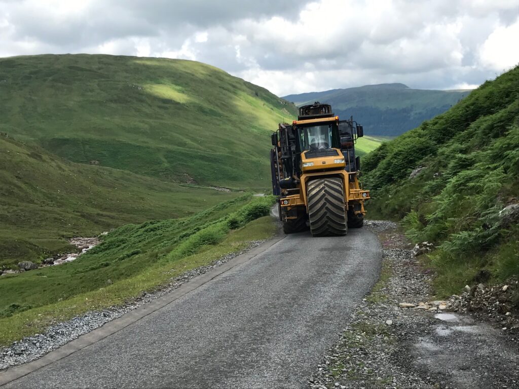
There then followed a bit of a climb. After this the road was undulating for a short stretch. Then there was a long, long steep descent. This continued for at least five miles! So I enjoyed the free wheeling down the glen whilst admiring the scenery.
Part way down the descent I had to move off the road to allow a huge forestry vehicle to pass. There had been warning signs that forestry vehicles were operating in this area.
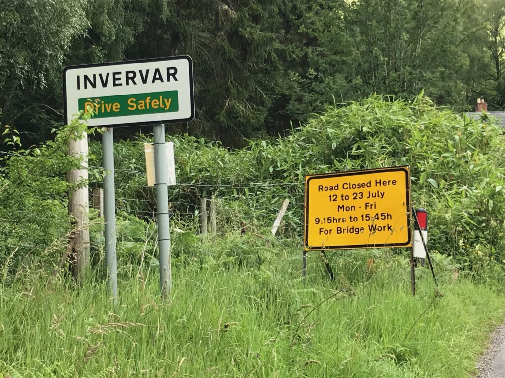
Eventually I arrived at a junction where I turned right. At this junction there was a sign advising that the road was closed at Invervar for bridge works.
I decided just to cycle on to see if there was access for cyclists at the road works. If not I would just cycle back. This, of course, would result in a linear route rather than a circular route.
Not far along from this junction I came to Bridge of Balgie. Here there is a coffee shop that is very popular with cyclists and tourists. There is also a grassy area with picnic tables.
Due to Covid 19 I no longer go into cafes, etc. I am now in the habit of taking sandwiches and juice with me for lunch. It was very busy in Bridge of Balgie today so I decided just to cycle on before stopping for lunch.
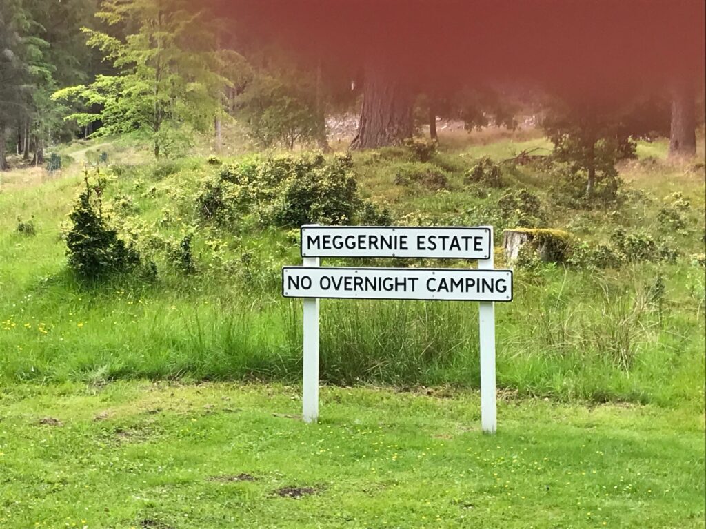
I cycled on for another ten minutes and soon came to a picnic area maintained by the Meggernie Estate.
There were picnic tables and information boards here. There was no-one else at the picnic area. I sat at one of the picnic tables and ate my sandwiches and drank my juice. The sun had come out again so I sat back and soaked up the sun.
After lunch I discovered that there were public toilets here. They are at the back of the information boards and are hidden by a large grassy knoll. The toilets are clean and well kept. They are supplied and maintained by the Meggernie Estate.
Bridge of Balgie is likely to be the most popular stopping point with most people, This is due mainly to the coffee shop there. On reflection I could have stopped there. I could have gone to the picnic tables which are on a grassy area down below the coffee shop. Nevertheless it is good to have discovered the Meggernie picnic area. It is always good to have an alternative.
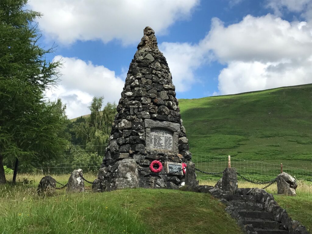
After lunch I cycled out of the picnic area. I immediately came to a large memorial to those from Glen Lyon who perished in the two world wars.
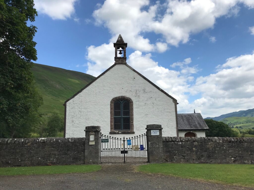
Just across the road from the War Memorial was the Glen Lyon Church.
I continued cycling along the road. The terrain now was a bit more level, with some undulating sections. At times, though, there were some quite steep hills to go up. That meant that there were some quite long descents.
I eventually reached Invervar, where the bridge works were taking place. I was relieved to find that the bridge was still open. There were several vans parked alongside the road and some workmen working away. Thankfully, though, they hadn’t yet closed the bridge to traffic.
I cycled on along the road down the long, long glen. The road now mostly ran alongside the River Lyon. This made for pleasant cycling.
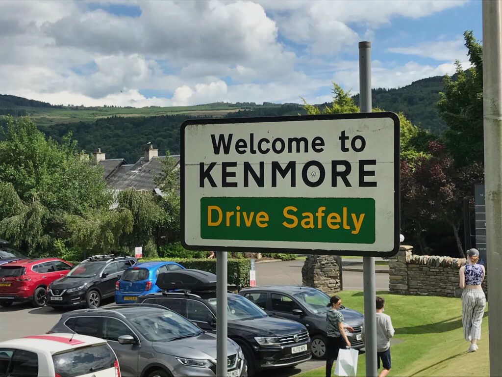
I eventually reached a junction at the end of Glen Lyon. Here I turned right. I continued on this country road until it reached the A827 road. I turned left onto the A827 and cycled the three miles or so into the village of Kenmore.
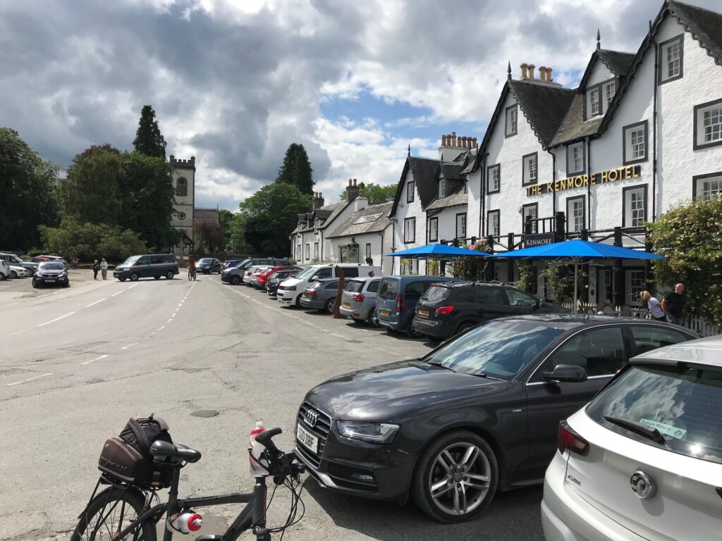
As I cycled into Kenmore there was a large visitors centre with a cafe, public toilets, etc. on the left hand side. I cycled past this and continued on the main road and crossed the river on the old bridge. The road then veered round to the left to where the Kenmore Hotel is.
After this the road continues round to the right. It leads down to the bay at the top of Loch Tay.
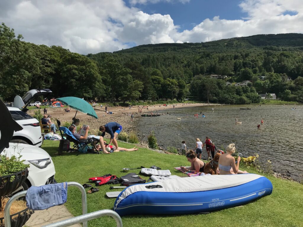
Needless to say, on such a warm, sunny day the bay was very busy and people were in the water enjoying themselves.
I stopped at the bay for a planned rest. I walked along to the boating centre at the side of the loch. There is a cafe there but it was closed. I sat at a picnic bench overlooking the loch and ate a choc bar and drank the rest of my juice.
I knew that the final section of the route was quite hilly so I took a longer rest than I normally would have. Anyway, it was such a beautiful day I was enjoying sitting there soaking up the sun.
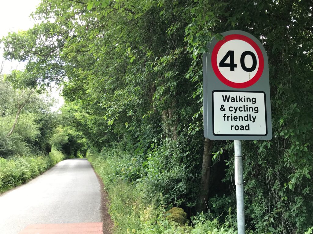
I left Kenmore and cycled along the A827 for a few minutes. At the other end of the loch I turned right onto a narrow country road. This road was signposted as being a “Walking & cycling friendly road”.
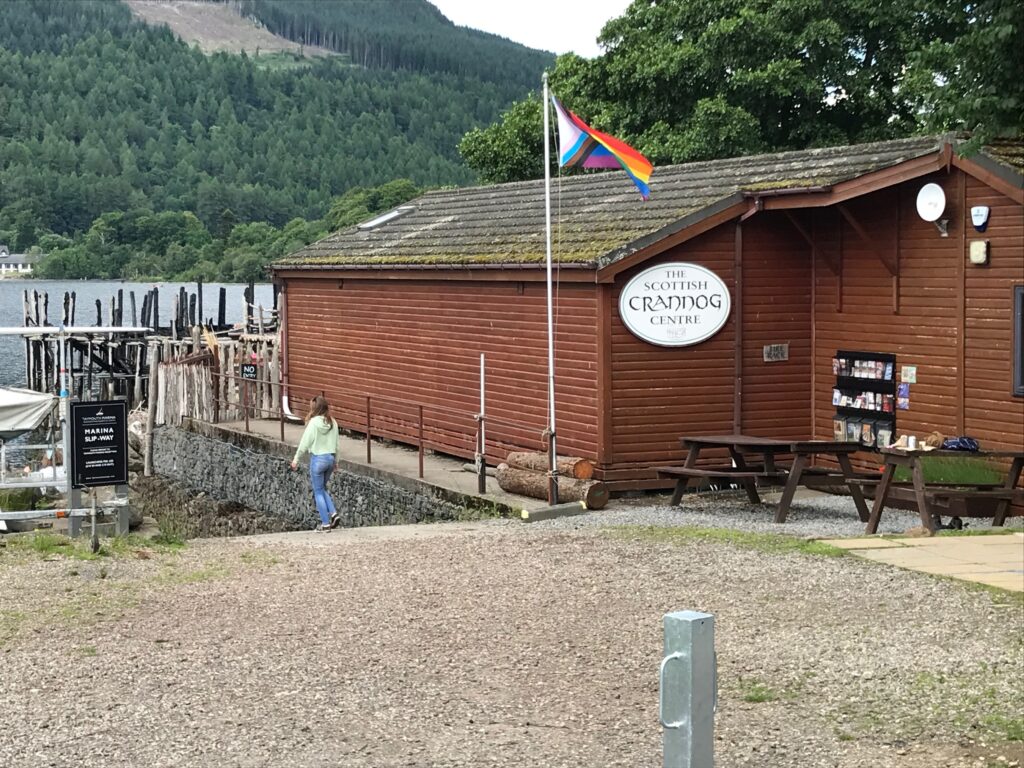
A short distance along this road I came to the Scottish Crannog Centre.
Crannogs are a type of ancient loch dwelling found throughout Scotland. Full details can be found on the Scottish Crannog Centre website. (Click here.)
Next to the Crannog Centre is the Taymouth Marina. It provides luxury self-catering accommodation and it has a cafe bar and restaurant.
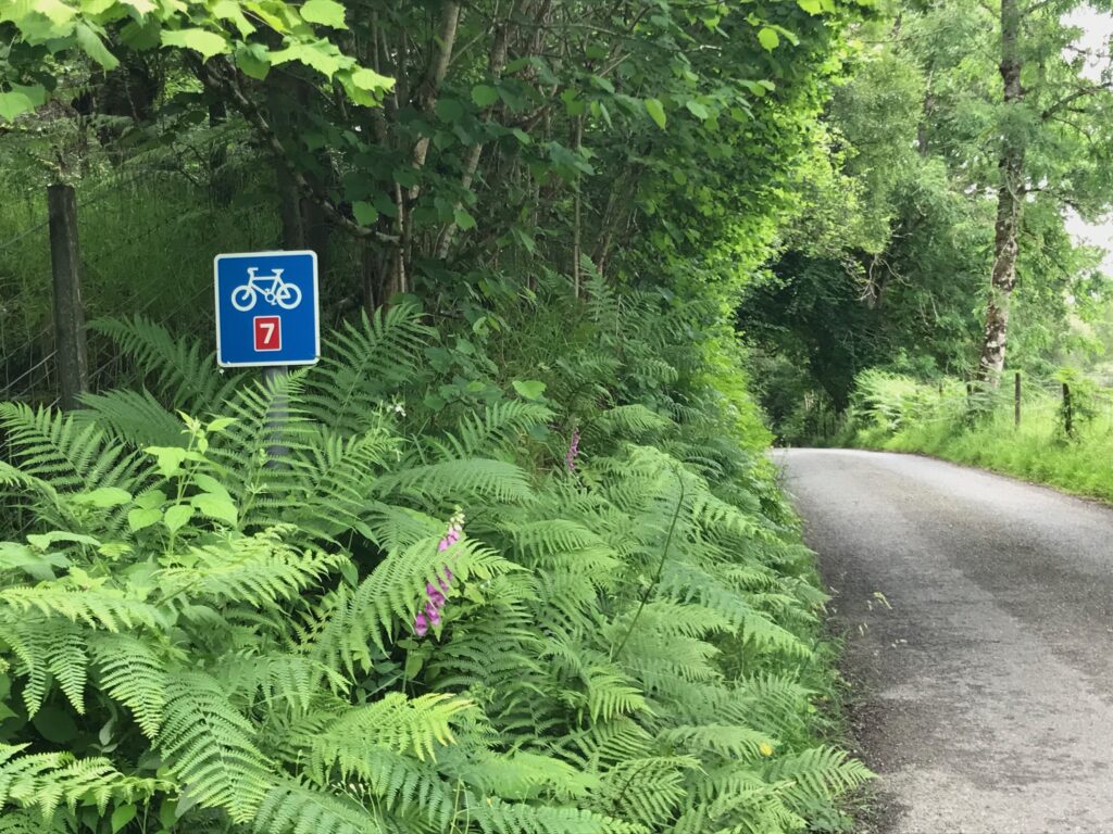
The road from Kenmore continued alongside the loch. It was part of the NCN 7 cycle route.
The road was undulating and this required a bit of effort at times. It reminded me a bit of the route up the east side of Loch Lomond that I had done recently. (Click hereto view this blog.) The hills on that route, though, were more frequent and steeper. The first six miles or so of this route weren’t too bad as the hills were longer.
Once I climbed up to the headlands along the side of the loch there were fantastic views of the loch.
There followed some welcome steep descents. After this the hills were a bit steeper on the rest of the way back to Killin. Consequently the last section was a bit harder going.
The road came out at the Falls of Dochart in Killin. I cycled over the old bridge and along the Main Street and back to the car.
Levels of Assistance Used -
Cycling Ben Lawers , Glen Lyon / Loch Tay on 13 Jul 21
After leaving Killin there was a long hill on the A827 road. Although it wasn’t too steep I decided to use the first level of assistance, the ECO mode, on it. I wanted to reserve my energy as I knew that I had a hard day ahead of me.
This proved to be sensible as it was a long, hard slog up Ben Lawers road. I rarely cycled unassisted all the way up to Lawers Dam. I mostly used the first level of assistance, the ECO mode. Several times, though, I had to use the second level of assistance, the TOUR mode.
After lunch, when I left the Meggernie picnic area the road was occasionally a bit undulating. At times I had to use the ECO mode and a couple of times I used the TOUR mode.
The road alongside Loch Tay after leaving Kenmore was undulating with some steep climbs and descents. For the first six miles or so I had to use ECO mode at times to get me up the hills. On the last section back to Killin the hills were a bit steeper and I had to use TOUR mode at times.
Battery Charging -
Cycling Ben Lawers , Glen Lyon / Loch Tay on 13 Jul 21
At the end of the trip there were four bars displaying on the battery charge level indicator. However, when I put the battery on charge the fourth bar was flashing. This meant that there was only between three and four bars of charge left.
It took about half an hour to get the fourth bar charged. Then it took another hour to get the fifth bar charged. So it took about one and a half hours to fully charge the battery.
Summary -
Cycling Ben Lawers / Glen Lyon / Loch Tay on 13 Jul 21
What a fantastic day! Great weather, a very challenging ride and cycling through rugged glens and alongside Loch Tay. Wonderful!
This is a really good, if demanding, route. Starting at the picturesque village of Killin. A fine, very challenging ride up the glen beside Ben Lawers to Lawers Dam. Then a welcoming descent to Bridge of Balgie and the Meggernie picnic area. Followed by a very pleasant long ride along Glen Lyon. A welcome break at the bay at Kenmore village. Finally, a hilly ride high up above Loch Tay with fantastic views. All this and scorching weather too.
I am very grateful to still be able to do such a wonderful ride at my age and with my exercise induced asthma. This of course is totally due to my e-bike.
I found the climb up the road to Ben Lawers very long and very steep. There is no way I could have done this now without my e-bike.
Also, the trip length was 48 miles. This is outside my norm for day trips of 30 – 40 miles. Again it was thanks to my e-bike that I was still able to do this.