Again I wanted to take advantage of the long hours of daylight during the summer. This is one of the reasons why I chose Cycling Loch Tummel & Kinloch Rannoch on 25 Aug 21. It’s quite a long drive to get there and, for me, it’s a long distance to cycle (41 mls.), so it’s better to do it in the long hours of daylight in the summer.
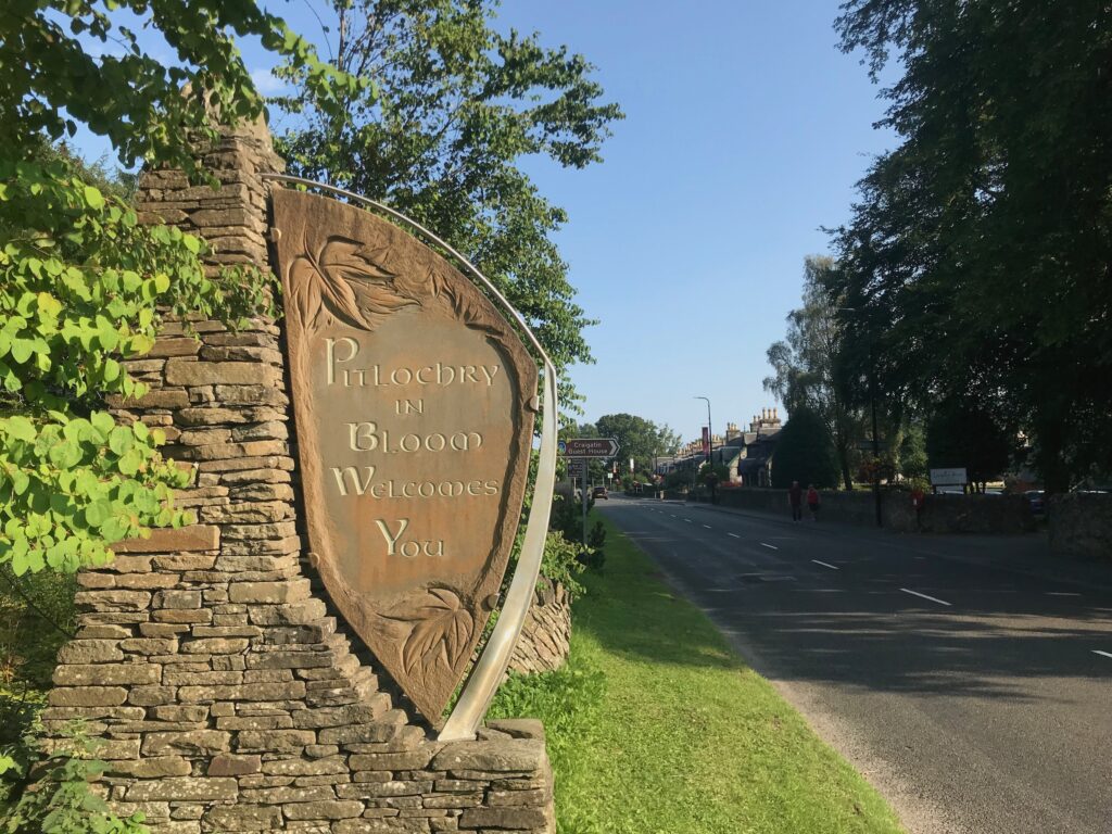
I also wanted to go back to a part of the country I hadn’t been to for a while. This route is in beautiful Perthshire and starts at the lovely small town of Pitlochry. I last cycled this route five years ago, so I was looking forward to going back and cycling it again.
Route Map -
Cycling Loch Tummel & Kinloch Rannoch on 25 Aug 21
The map above is an interactive map. Press “Play” (click on the white triangle in the middle of the screen) to activate it. You can then zoom in or out by pressing the buttons that appear in the top left of the screen. The map can be moved by dragging it. Once you press Play the hills profile of the route will appear at the bottom of the map. Further comprehensive detailed analysis of the hill profile can be obtained by clicking on “More Detailed Profile” at the top left of the hills profile section. You can also select full screen mode by clicking on the icon in the top right corner of the map.
Timings and Distances -
Cycling Loch Tummel & Kinloch Rannoch on 25 Aug 21
Anytime I cycle on one of my cycle routes in Scotland I use this section to record trip details. I record the times I took for the various parts of the day and the distances cycled. This includes when I started cycling and how long I cycled for between various points in the route. I also record the distances (in miles) between various points in the route and how long I rested for, etc.
I included this section so that I can look back at the timings and distances to help me plan my day if I decide to do this trip again. This section could also assist others with planning their day if they decide to do this route. Each person, of course, will have to adjust the timings to suit their own circumstances, e.g. cycling speed, rest times, etc.
(Note: The figures in brackets are the cumulative distances in miles from the start of the route.)
Left Glasgow 07.55 / Arrived at parking in Pitlochry 10.05 / Started cycling 10.30 / Queen’s View Visitors Centre 11.20 – 11.35 (6.51) / Strathtummel 11.55 (9.16) / Tummel Bridge 12.25 (13.23) / Lunch 12.30 – 1.00 / Kinloch Rannoch 2.05 – 2.20 (20.86) / Back at Tummel Bridge 3.05 (28.38) / Rested 3.45 – 4.00 (33.34) / Clunie Arch 4.50 – 4.55 (39.80) / Back at car 5.15 (42.04) / Left 5.40 / Home 7.35.
Computer Readings -
Cycling Loch Tummel & Kinloch Rannoch on 25 Aug 21
At the end of each trip there are a variety of readings on the bike’s computer. Some of them I record for future comparison purposes.
Cycling Loch Tummel & Kinloch Rannoch on 25 Aug 21
Getting There
From the south side of Glasgow I took the M8, then the M80 and M9 to Broxden Roundabout on the outskirts of Perth. I then drove up the A9 to Pitlochry.
The drive up to Pitlochry took a bit longer than I had anticipated. This was mainly due to roadworks at Charing Cross causing a long tail-back on the Kingston Bridge. Consequently it took me about an hour and twenty minutes to get to the Broxden roundabout on the outskirts of Perth. Normally I would expect this to take just over an hour. I also stopped for petrol when I arrived at the outskirts of Pitlochry at 9.50.
On the drive up it was misty and overcast, but when I arrived at Pitlochry the sun broke through and it was nice and bright and sunny.
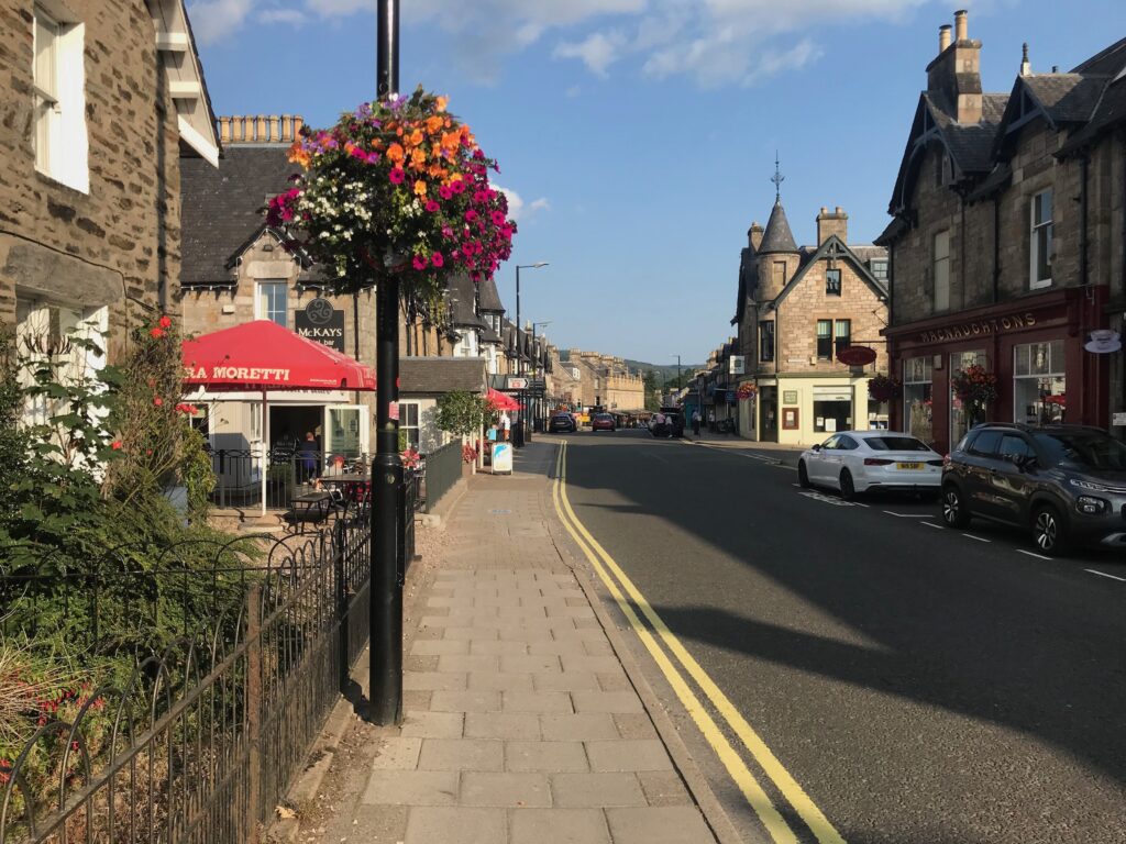
Pitlochry -Cycling Loch Tummel & Kinloch Rannoch on 25 Aug 21
Pitlochry is a bustling tourist town with a busy main street. It has lots of shops, cafes, restaurants and hotels catering for the busy tourist trade. The main street is very picturesque, with lots of flowers and hanging baskets.
In Pitlochry I parked in the Rie Achan Road Car Park, which is just off the main road and just along from the train station.
Pitlochry - Queen’s View
I left the car park and cycled up to the main street, where I turned left. I cycled along this road, which became the A924, for a short distance. Then, where the A924 turns right to join the A9, I turned left onto the B8019 road.
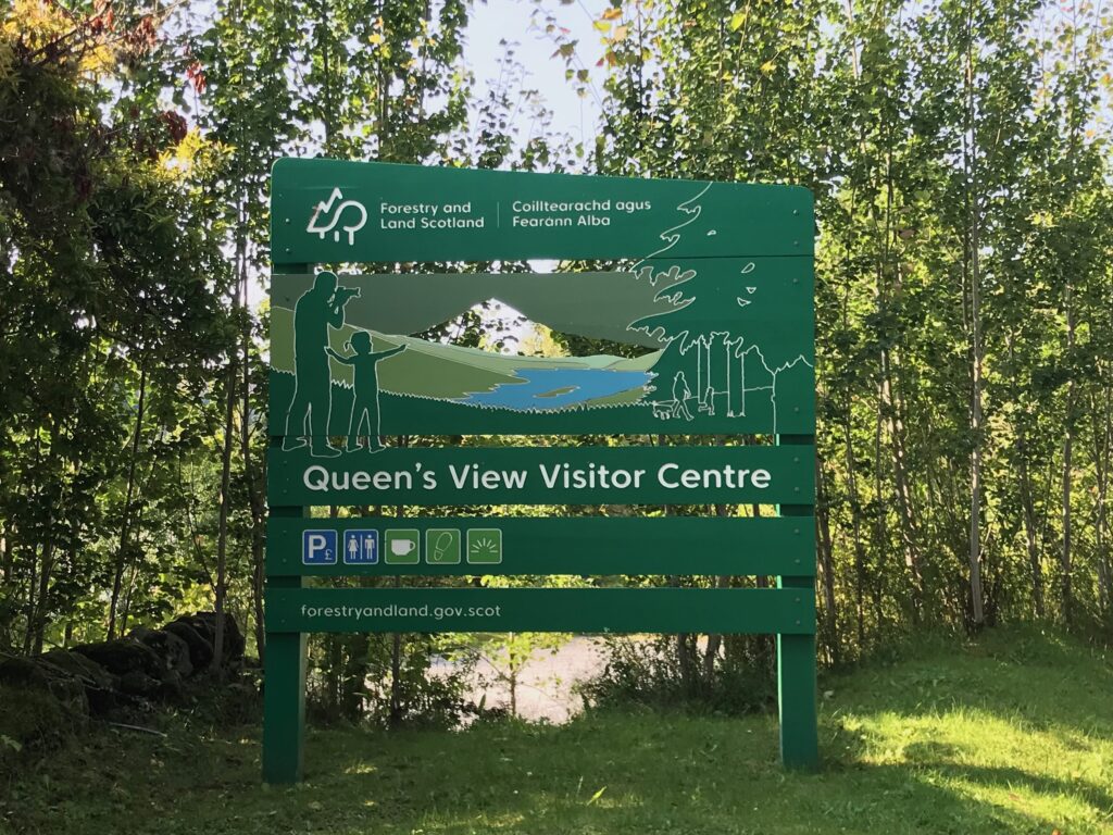
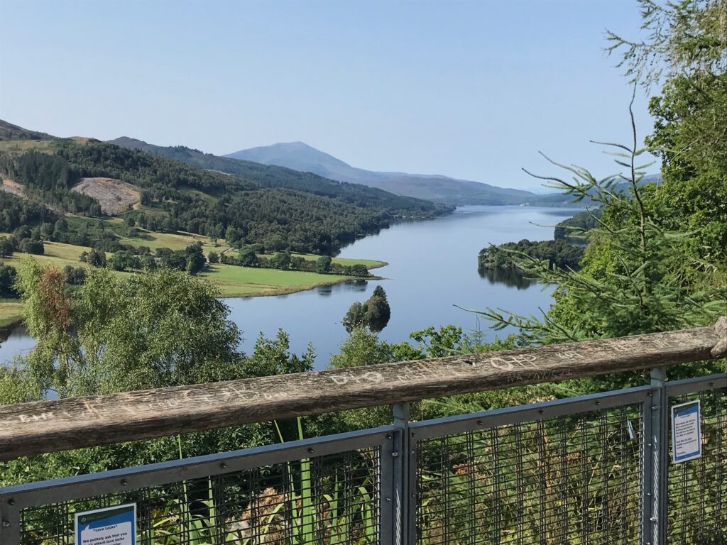
Further along I followed this road as it turned sharply left onto the bridge over the River Garry. The road then wound it’s way gradually up towards Loch Tummel. There then followed a steep climb up to the Queens View Visitors Centre.
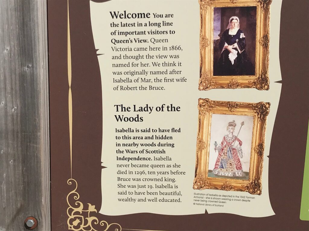
The Visitors Centre is located just down from an observation platform where there are fantastic views all the way up and down Loch Tummel, with the hill called Schiehallion in the background.
At the visitors centre there is a cafe with an outdoor eating area, a shop and toilets.
There are also information boards describing the history of Queen’s View.
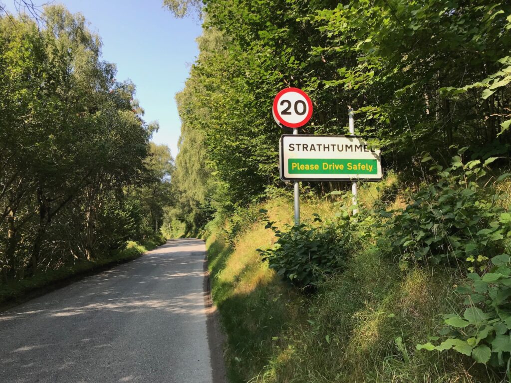
Queen's View - Strathtummel
I left Queen’s View and cycled on and soon came to the small village of Strathtummel.
The main building here was the Strathtummel Hotel, but it was closed at present.
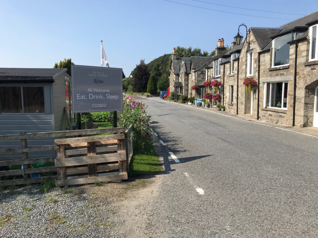
Strathtummel - Tummel Bridge
I cycled on until I reached the small village of Tummel Bridge. Although the village is small there is a large caravan park there called The Tummel Valley Holiday Park.
At the holiday park there is a convenience store and a bar / restaurant.
I cycled to the end of the village looking for a bench or grassy area where I could stop and eat my sandwiches.
At the end of the village there is the old bridge over the River Tummel. This bridge is now closed to traffic and has been replaced by a single track metal bridge. Round the corner from the bridge there is a small car park, but I couldn’t see anywhere I could stop for lunch.
I therefore cycled back to the holiday park and discovered that round the back of the reception and restaurant building there are picnic tables. So I sat at one of the tables and ate my sandwiches and drank my juice. It was still a beautiful warm, sunny day so I sat back and soaked up the sun whilst having my lunch.
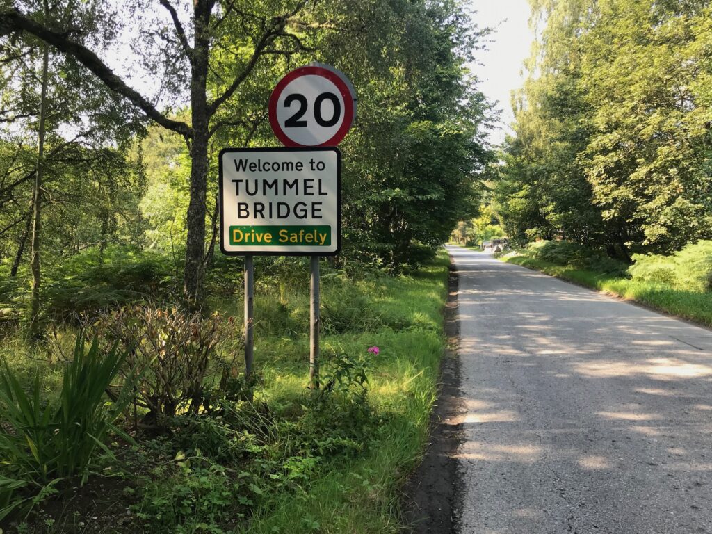
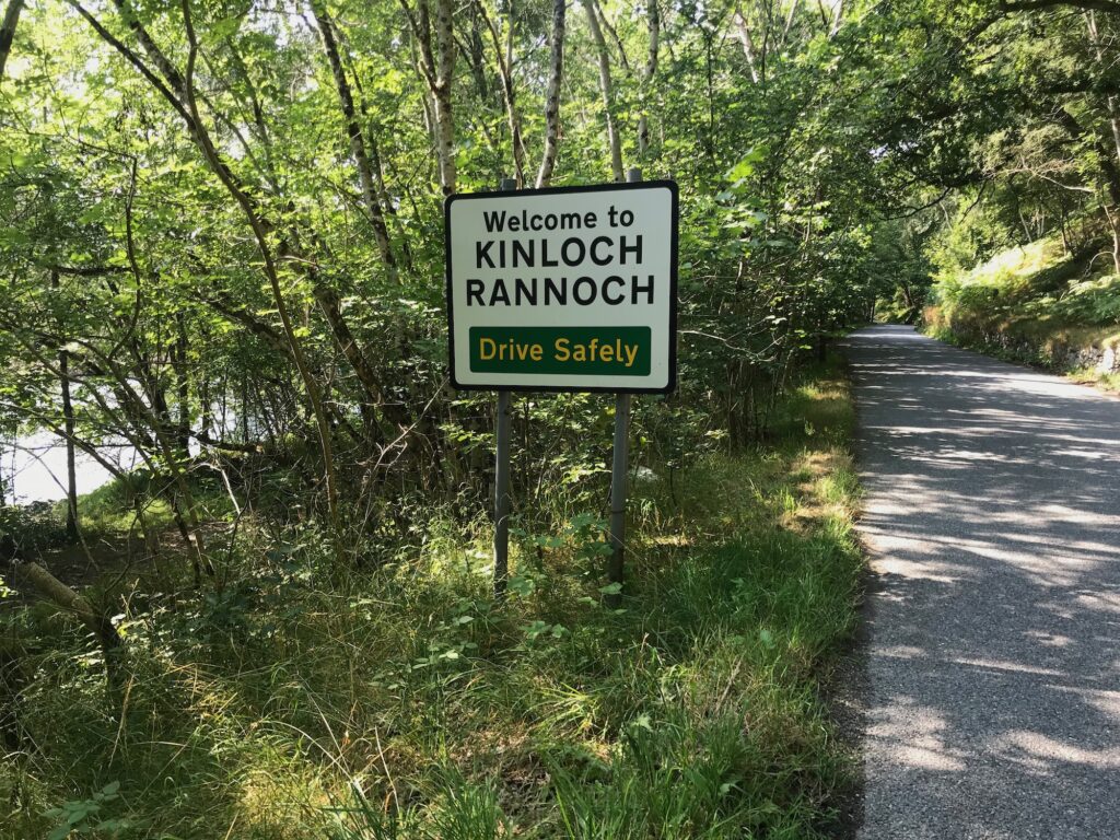
Tummel Bridge - Kinloch Rannoch
After leaving Tummel Bridge the road climbed steadily up and then there was a bit of a descent. Thereafter the road was undulating until it reached Kinloch Rannoch.
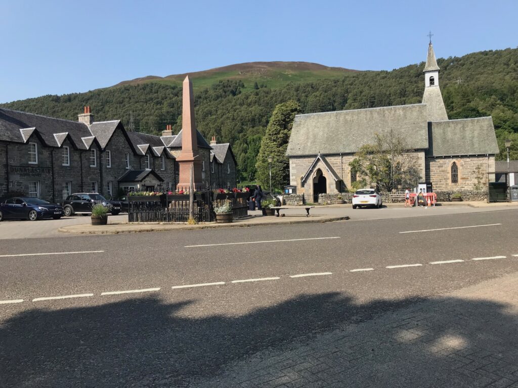
At Kinloch Rannoch I stopped for a rest at a bench in the village square.
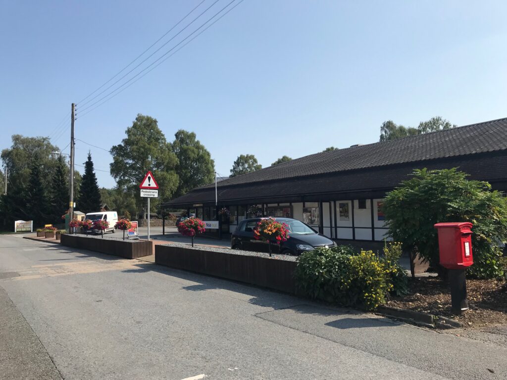
In Kinloch Rannoch there is a hotel, a cafe and, to the left across the river, a village store.
Kinloch Rannoch - Tummel Bridge
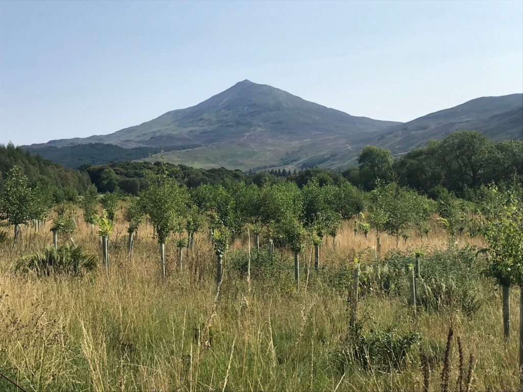
The return journey to Tummel Bridge was dominated by fine views of the hill called Schiehallion. It’s a hill that is very popular with hill walkers. It is one of Scotland’s mountains that are over 3,000 feet high and which are called Munros.
When I got back to Tummel Bridge I turned right onto the single track metal bridge over the River Tummel. This took me onto Loch Tummel’s minor southern road, the B846.
Tummel Bridge - Clunie Arch
I cycled inland along the B846 road until I reached a junction signposted Foss, where I turned left. The road then headed back towards the loch and then hugged the shoreline of the loch.
There were a few bays along the shore with grassy verges. I stopped for a rest at one of the larger bays, where I had stopped the last time I cycled this route. I lay back on the grass at the edge of the loch and ate a choc bar and drank some juice, whilst soaking up the sunshine. There were great views up and down the loch.
I continued cycling alongside the shore of the loch and then the road climbed up to the Clunie Dam. It continued climbing after reaching the dam and then there was a welcome descent.
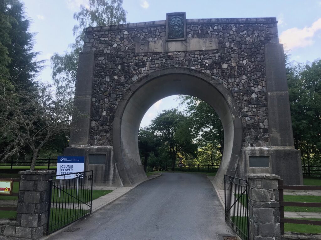
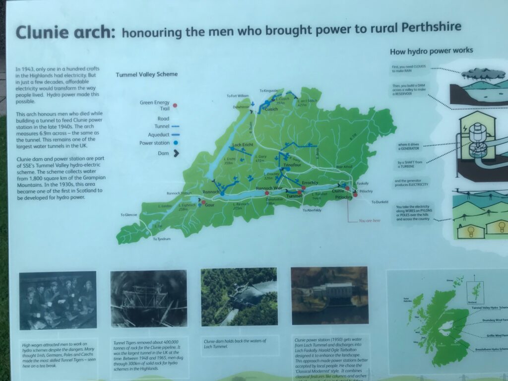
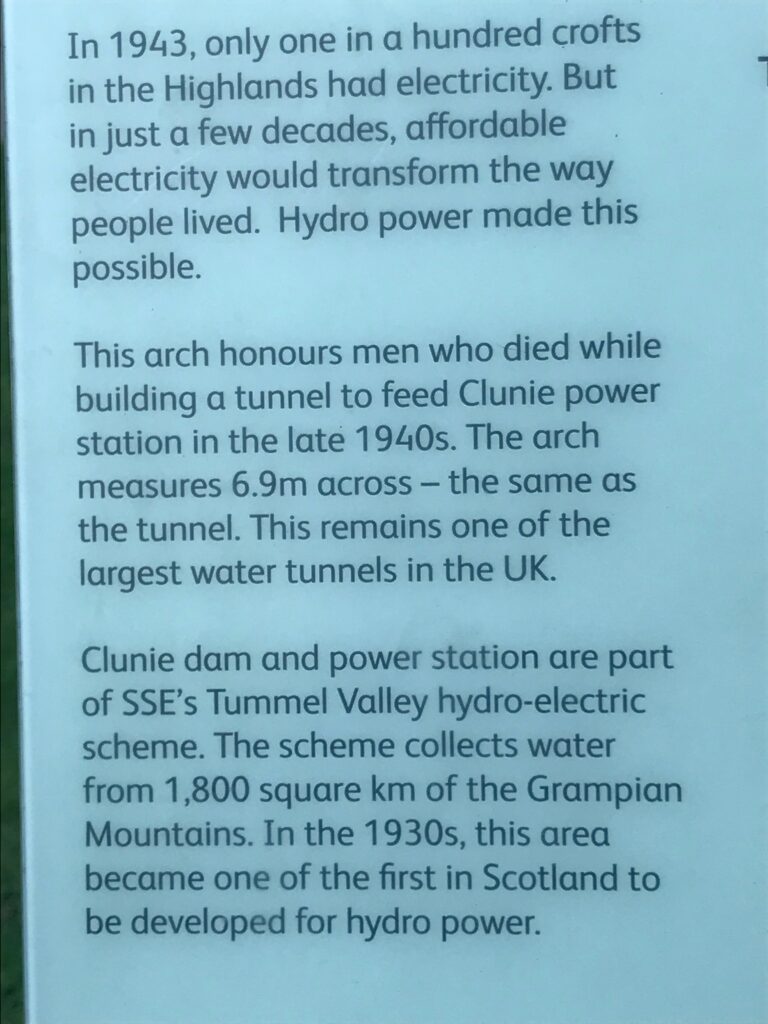
I stopped part way down the descent when I came to a monument called the Clunie Arch, where I stopped for five minutes. This arch honours the men who died while building a tunnel to feed the Clunie power station in the late 1940’s.
There were a couple of information boards at the Arch giving details of the men who worked on the tunnel and those who died. There were also details of the hydro scheme, etc.
Clunie Arch - Pitlochry
I continued on the descent from the Clunie Arch and was soon cycling alongside Loch Faskally and the River Tummel.
I cycled along until I came to the spot where the A9 passes overhead. I stopped just before the overpass and dismounted and turned left onto the pavement.
I walked down a narrow rocky path that took me down to cross over a bridge. At the end of the bridge I turned right and walked up a narrow, steep stony incline. This then took me down to the Pitlochry Boating Station, where there was a cafe, etc.
At the end of the path alongside the Boating Station I turned right onto Clunie Bridge Road. I cycled past the Green Park Hotel and then up an incline that led to the main road into Pitlochry. I turned right here and cycled back to the car park in Pitlochry.
Levels of Assistance Used -
Cycling Loch Tummel & Kinloch Rannoch on 25 Aug 21
After about 3.5 miles of cycling I used the first level of assistance, the ECO mode, for a few hundred yards and then I used it again a couple of times after that. Then on the approach to Queen’s View I used ECO mode at first and then I had to use the second level of assistance, the TOUR mode, to get me to the top.
I don’t think that I needed any assistance from the electric motor from Queen’s View all the way to Tummel Bridge.
When I left Tummel Bridge I was surprised and disappointed that I felt quite tired and that I didn’t have much strength left in my knees. I knew that when I returned to Tummel Bridge from Kinloch Rannoch I was going to cycle along the south shore of Loch Tummel. I remembered that that section was quite hilly and undulating. I therefore decided to conserve my energy on the section to Kinloch Rannoch, so I used ECO mode quite a lot on that section. I did this even on hills that I would normally have managed up without assistance. I also used the TOUR mode to get me up and over the highest hill in this section.
I also adopted this approach on the return journey from Kinloch Rannoch, and from Tummel Bridge back to Pitlochry.
Battery Charging -
Cycling Loch Tummel & Kinloch Rannoch on 25 Aug 21
When I got home the battery level indicator was showing four bars out of five were green.
It took one hour and ten minutes to fully recharge the battery.
Summary -
Cycling Loch Tummel & Kinloch Rannoch on 25 Aug 21
Cycling Loch Tummel & Kinloch Rannoch on 25 Aug 21 was a fine ride through beautiful countryside on a warm, sunny day – fantastic!