The following is a brief summary of the key details for Cycle Routes in Scotland : The Fife Coast (South).
DISTANCE : 37 mls. linear
TERRAIN : Hilly
TOTAL ASCENT : 2,736 ft.
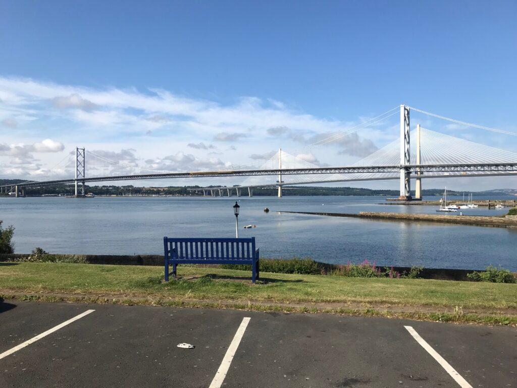
START & FINISH : The small free car park in Battery Road, North Queensferry (KY11 1JZ)
This route is a new route to me, which I can now add to the cycle routes in Scotland that I have cycled over the years. Some of the other wonderful routes I have cycled over the years are listed in the page “Cycle Routes in Scotland”. (Click here to go to this page.)
Route Map
This route follows a section of the NCN 76 cycle path, which is one of the routes on the National Cycle Network run by the charity called Sustrans. Their map of this route can be accessed on their website www.sustrans.org.uk.
However, I also prepared my own map, as shown below. I did this to show the short part of the route at the start from North Queensferry that isn’t on the NCN map. I also plotted a minor adjustment I made at the end of the route, where I cycled straight into Kirkcaldy on the main road rather than on the side roads as shown on the NCN map. Also, I wanted to see the hills profile and the total ascent shown on the map below after you press “Play”.
The map above is an interactive map so if you press “Play” (click on the white triangle in the middle of the screen) you can zoom in or out by pressing the buttons that appear in the top left of the screen, and you can move the map by dragging it. Once you press Play the hills profile of the route will appear at the bottom of the map. You can get further comprehensive detailed analysis of the hill profile by clicking on “More Detailed Profile” at the top left of the hills profile section. You can also select full screen mode by clicking on the icon in the top right corner of the map.
Route Details -
Cycle Routes in Scotland : The Fife Coast (South)
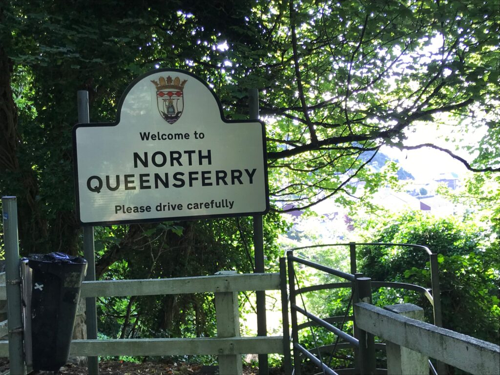
North Queensferry
The route starts at the village of North Queensferry, just across the Firth of Forth from Edinburgh.
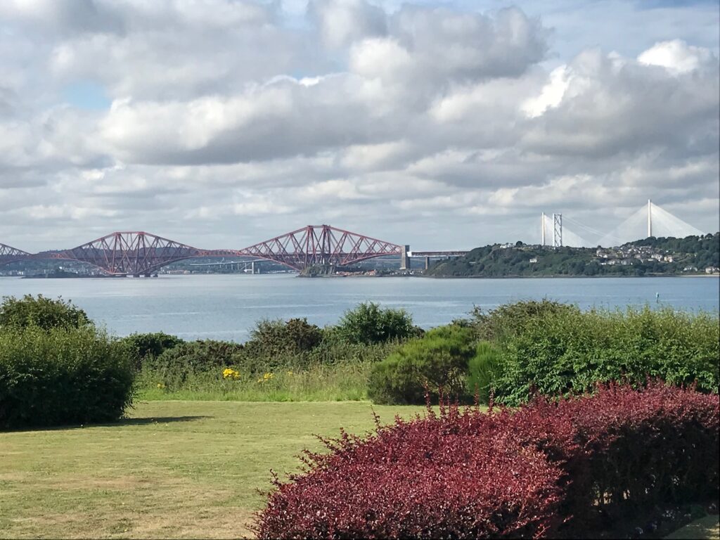
The car park at the start of the route is in a fine, picturesque spot. It provides good views across to the old Forth Road Bridge with the Queensferry Crossing, which is a new road bridge over the Firth of Forth, in the background.
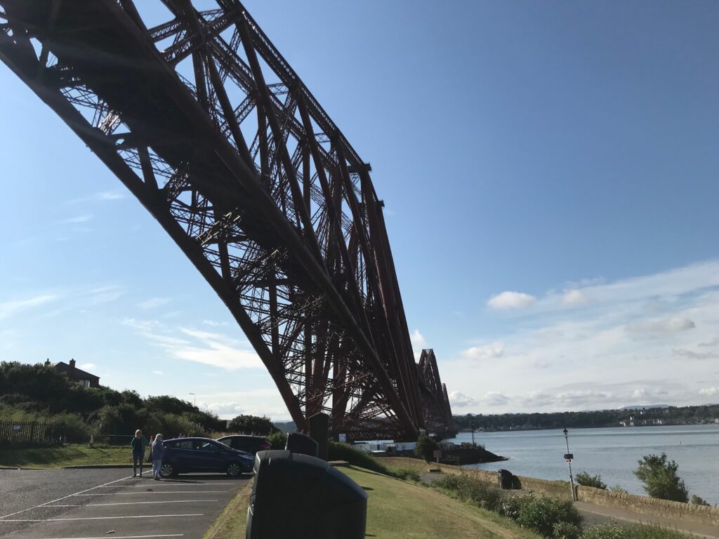
It is also directly below the very impressive Forth Bridge that carries the railway across the Firth of Forth.
North Queensferry - Inverkeithing
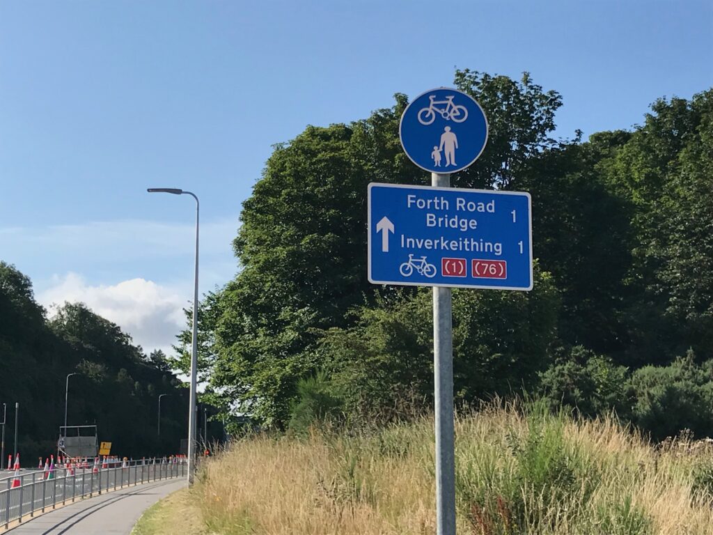
From the car park cycle up the hill out of North Queensferry. Near the top of the hill cross over the road at an NCN sign to a cycle path on the other side. Follow the cycle path round to a road that leads over to the Forth Road Bridge in one direction, and to Inverkething in the other direction. There is another NCN sign at this point.
Cycle along towards the Forth Road Bridge and cross over the road at the traffic lights. On the other side turn left and follow the NCN 1 to Inverkeithing.
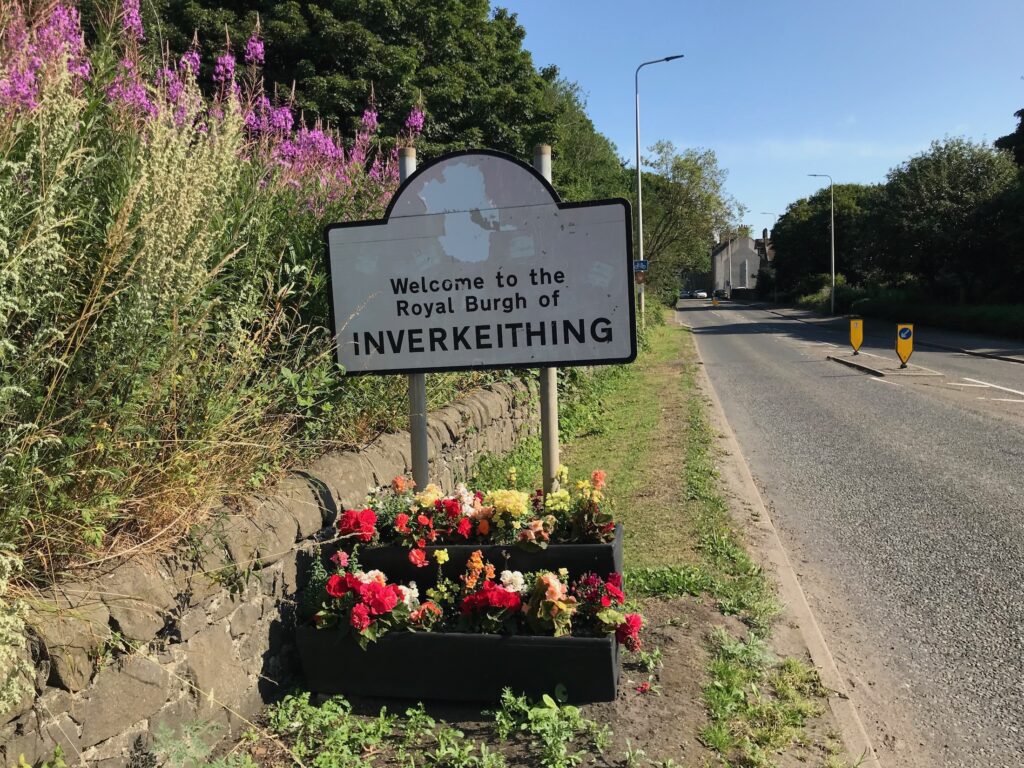
Inverkeithing
In Inverkeithing cycle along the Main Street, which is quite busy. Part way along the Main Street follow the signs for the Fife Coastal Path/NCN 76 that directs you to the right into Townhall Street.
Cycle along Townhall Street until the road veers round to the right at a junction. Here continue on King Street. After a short distance turn right into Commercial Road and then continue to follow the signs for the Fife Coastal Path/NCN 76.
Inverkeithing - Dalgety Bay
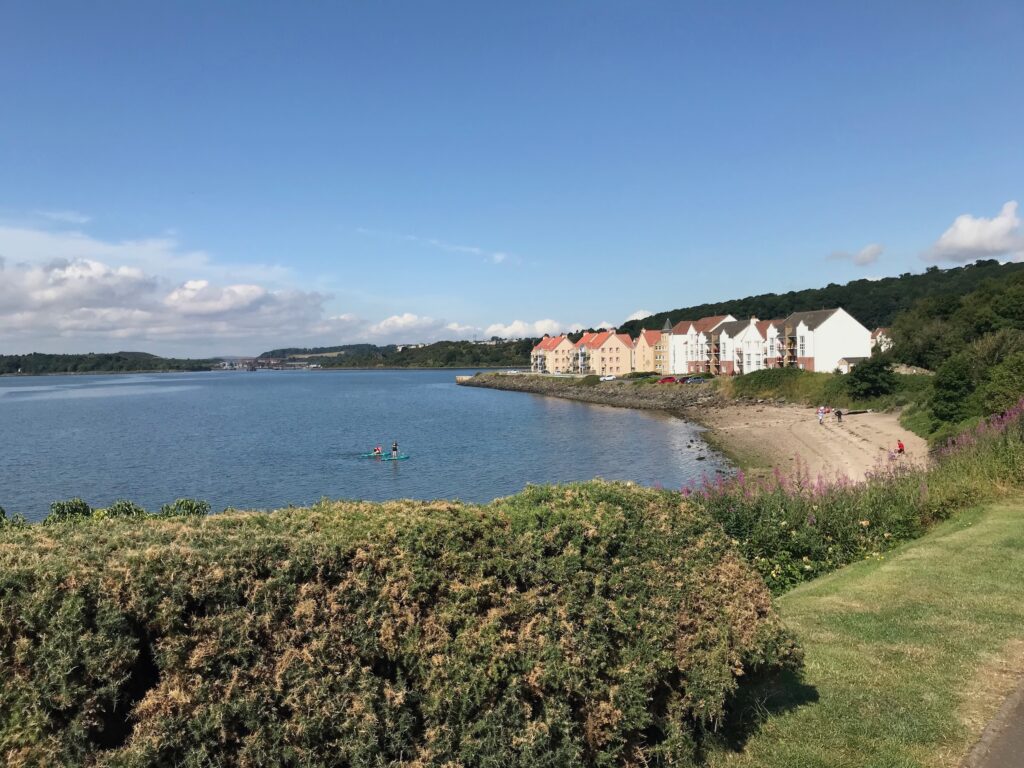
Shortly after leaving Inverkeithing you will come to an area called St.David’s Harbour, which is part of the town called Dalgety Bay. This is a nice area, with modern luxury flats overlooking a sandy bay.
Cycle to the end of these flats and you will come to a narrow path that is rough and stony. This narrow path only lasts for a short distance and then it emerges out onto a road in a housing estate.
To this point the path signs are for the Fife Coastal Path. The NCN 76 follows this section of the path so the Fife Coastal Path signs have a small NCN 76 sign on them.
From here there are fine views back across the bay to the Forth Bridge, with the Queensferry Crossing in the background.
The route then heads inland and winds it’s way through housing estates. Continue following the signs for the Fife Coastal Path, which have the small NCN 76 logos clearly displayed on them.
Once through the housing estates the route continues on a rough stony path. It then winds it’s way round Dalgety Bay.
The route continues through woods on the rough stony path. There are a few steep sections with boulders, etc. that can be difficult to get up. After a while it is a relief to come to a tarmac section that continues for a good distance. Whilst some parts of this section are a bit potholed and stony most of it is nice and smooth.
Dalgety Bay - Aberdour
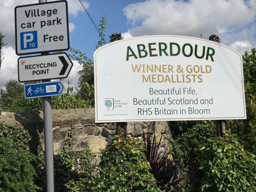
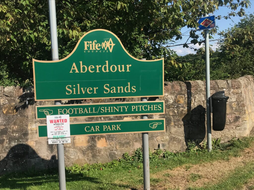
The path continues until the village of Aberdour is reached. Here turn right onto the Main Street.
Continue cycling along the Main Street until you reach the sign for the train station. Here there is a a smaller sign for the Fife Coastal Path pointing down towards the station. Ignore this and climb up the road to the top of the small hill. Here there is the normal sign for the Fife Coastal Path.
Continue on the Main Street and then turn right into Hawkcraig Road.
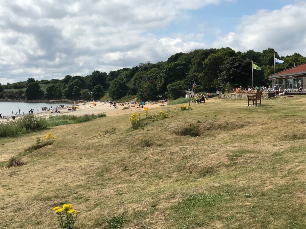
Silver Sands Beach, Aberdour
After cycling along Hawkcraig Road for a short distance you will come to the entrance to Silver Sands Beach.
Turn left onto the path leading to the beach. At the beach there is a large cafe/restaurant with outdoor seating. There are also public toilets here.
In the summer months the beach is busy with families and others, and there are people enjoying themselves in the water.
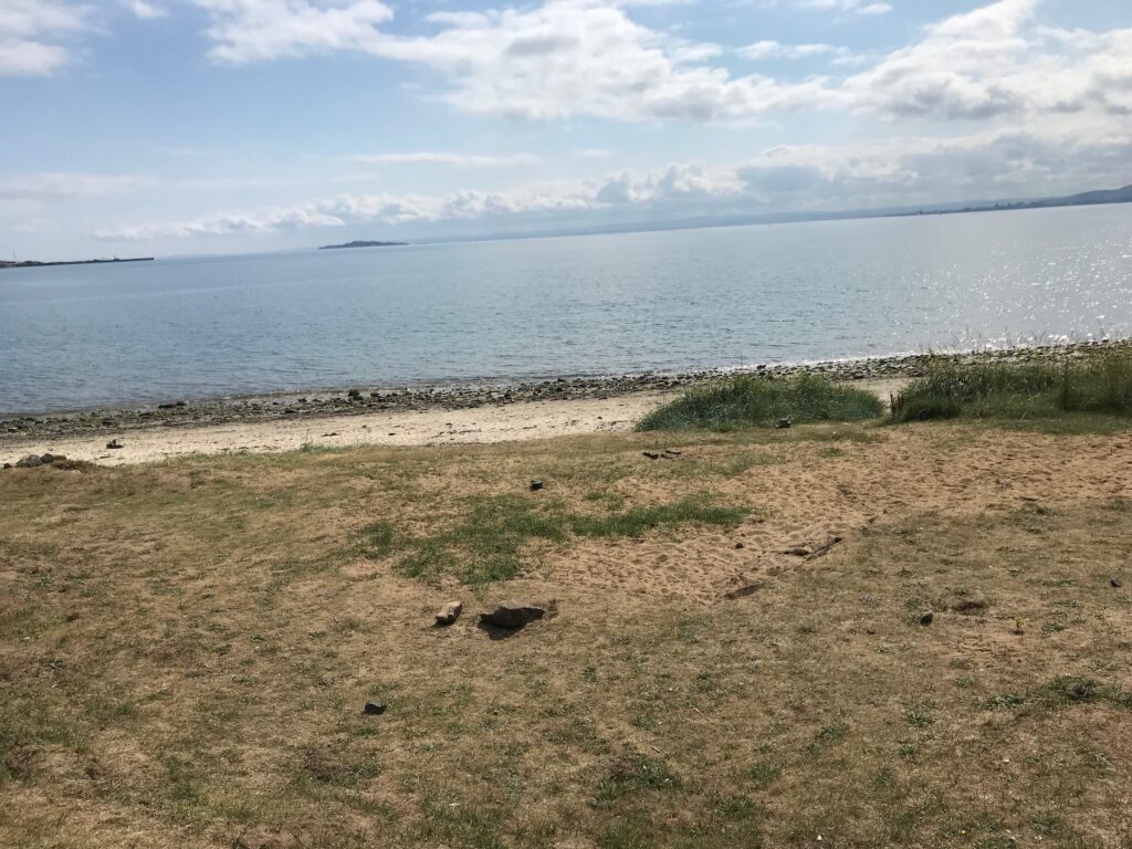
There are fantastic views across the bay from here.
Aberdour - Burntisland
After Silver Sands the path becomes narrow and stoney. There are a lot of short, sharp inclines, some of which are steep.
This next section can be really hard going. This is due to the loose, sharp stones on the path. Because of this it becomes difficult and hard work to get traction to get up the inclines. It is also necessary to be slow and careful on the short descents to make sure you don’t come off the bike.
Also, the path is so narrow that it is necessary to stop if any cyclists or pedestrians are coming towards you. Consequently it can be really slow going over this stretch.
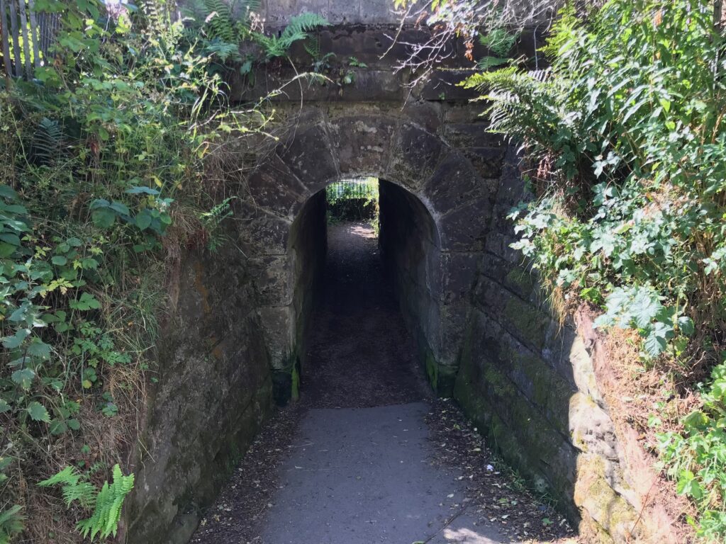
Until this point the path runs alongside railway tracks on the left, with the bay on the right. It then come to a very low, narrow pedestrian tunnel under the railway tracks. It is necessary to walk through this tunnel as it is too low to cycle through.
Eventually you come to a paved section at the back of some houses. This doesn’t last long though. The path turns right into another low, narrow tunnel to go back under the railway tracks again.
Of course you have to walk through the second tunnel as well.
At the other side of the second tunnel the path is flat and leads alongside a pond. It cames out at a wide stony road where you turn left. After a short distance you came out on a road on the outskirts of the small town of Burntisland.
At this point it is a great relief to be back on paved surfaces again.
Burntisland
At the end of the stony road turn right and follow the roads up and round through a built-up area.
The route then comes to a crossroad at the end of West Broomhill Road. Here you should turn right into Lothian Street, although there is no sign here to indicate which way to go. At the bottom of Lothian Street, though, there is a Fife Coastal Path/NCN 76 sign pointing left along the Main Street.
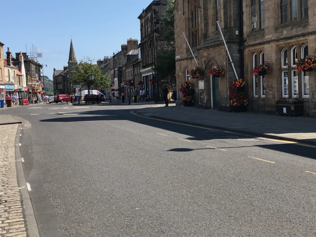
Cycle along the Main Street, which further along is a busy, bustling place. There are several pavement cafes and bar/restaurants and in the summer months there are lots of people about.
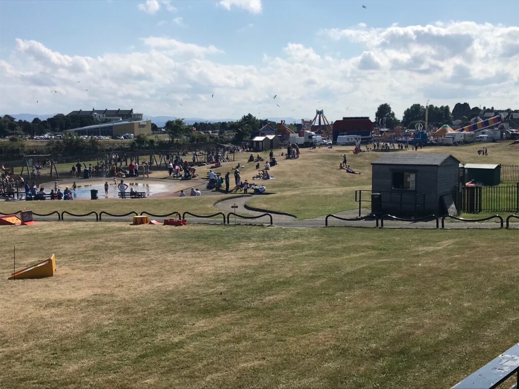
Also in the summer months at the end of the busy Main Street there is a quite a large fairground over on the grassy area on the right. There are also children’s play areas and a paddling pool. They can all all busy too.
Burntisland - Kinghorn
Continue out of Burntisland on the main road. Eventually you will came to a very wide pavement with a large yellow stripe at the edge of the pavement. This is a shared use pavement so you can cycle on it for a while, which is good.
It passes by the Pettycur Bay Holiday Park and the Bay Hotel.
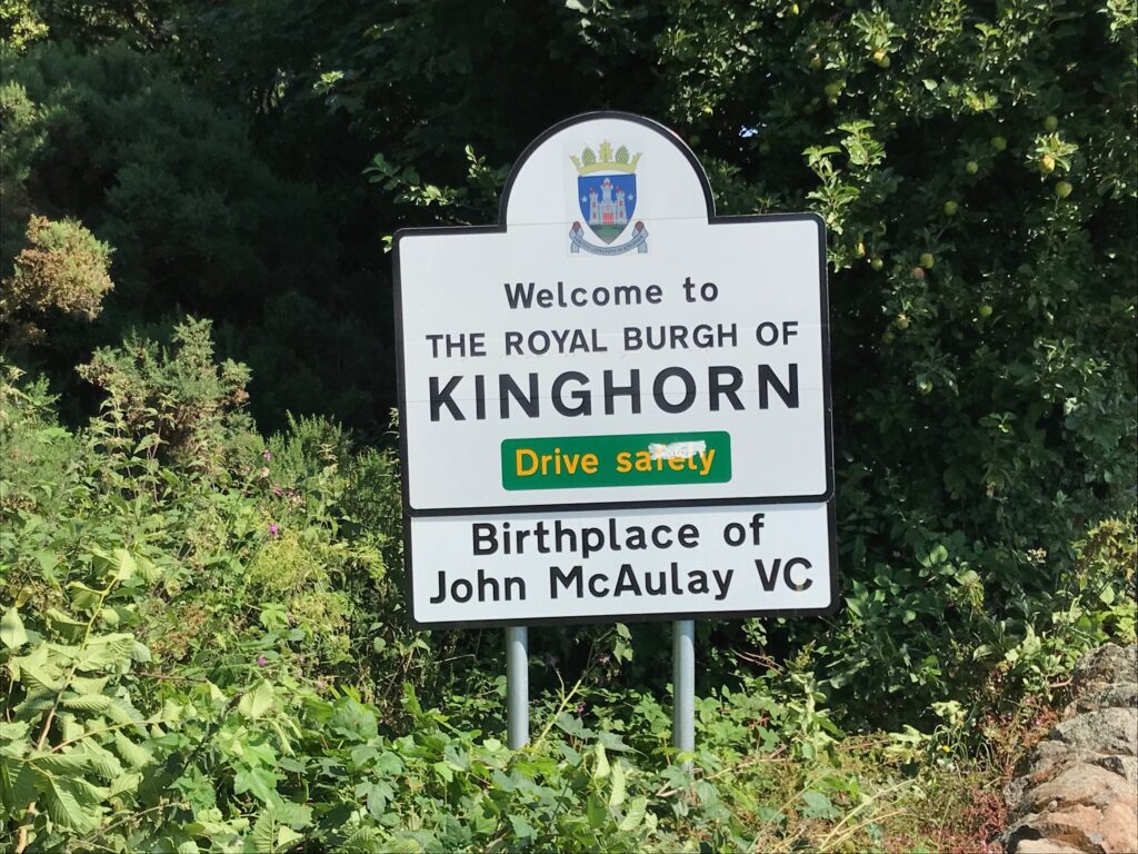
Kinghorn
It soon reaches the small village of Kinghorn.
Cycle along the Main Street in Kinghorn and then you will see a sign to turn left. This takes you up a long hill and eventually ends up at the bottom of Kilcruik Road.
Kinghorn - Kirkcaldy
Here there is a junction with the B823 road, with Kirkcaldy sign posted as 3 miles to the right.
This is the main road into Kirkcaldy, but it should be ignored as the cycle route takes quiet country roads to the left.
Again there was no cycle sign right at this point to indicate this. However, just a few yards further along to the left there is a Fife Coastal Path sign, with an NCN 1 sign on it, pointing to the road to the right at that point.
It is clear then that the cycle route heads up over the hills to Kirkcaldy.
As expected there is a steep hill to begin with but it is a nice quiet country road that is pleasant to cycle on.
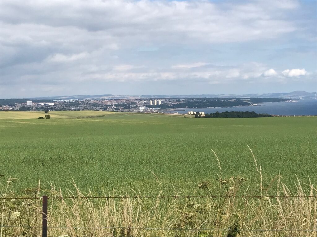
After this first hill the route is undulating and then there is another steep hill. From here there are fantastic views down over the bay towards Kirkcaldy.
Kirkcaldy
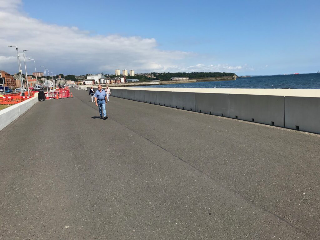
The country road comes down from the hills to a main road, where you turn right. The NCN 76 route at this point takes you left through a built up area to avoid cycling along the main road.
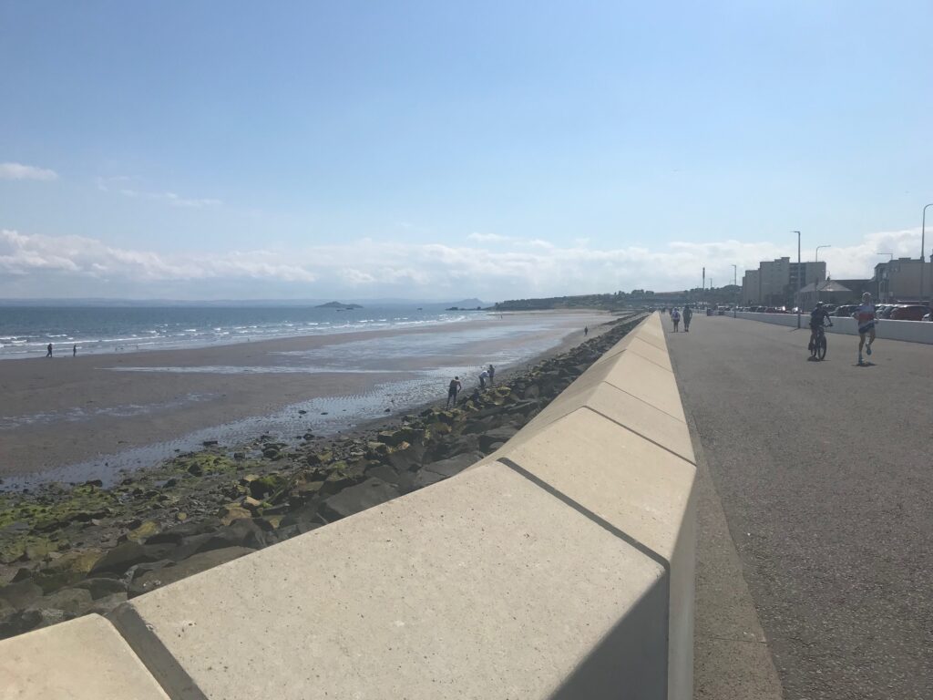
However, the main road is not that busy and the centre of Kirkcaldy is not far from here, so an option is just to cycle along the main road. This will take you to the wide promenade that you can cycle along.
Just across the main road from the promenade is the centre of Kirkcaldy where there is a shopping centre, etc. Here there are plenty of opportunities to have lunch or a refreshment.
If you prefer to have a rest outside there are a few seats on the promenade, although of course there can be a strong wind coming off the sea.
A more sheltered place to rest outside is in a small park called Volunteers Green. It is just across the main road from the promenade.
Return to North Queensferry
To start the return journey you can follow the NCN 76 signs through the built up area to get back to the country road over the hills.
Alternatively, you can go back onto the promenade and cycle along to the end, where there are public toilets.
At the end of the promenade rejoin the main road and cycle back to the country road over the hills, where you turn left.
From there retrace the route all the way back to North Queensferry.
Route Alternatives -
Cycle Routes in Scotland : The Fife Coast (South)
This being a linear route you can of course do it in reverse by starting at and returning to Kirkcaldy.
You could also select any stretch of the route to suit your preferences with regard to distance, time or difficulty.
For example, you could cycle from North Queensferry to Silver Sands beach in Aberdour and return from there. This would result in a shorter route of just over 15 miles. It would also avoid the difficult, stoney section after Silver Sands beach at Aberdour.
Other stretches could be selected to suit individual needs.
Cafe / Toilet Stops -
Cycle Routes in Scotland : The Fife Coast (South)
Eating places in Aberdour were the Aberdour Hotel that serves food all day, and there were several bars and restaurants along the main road.
At the Silver Sands beach in Aberdour there is a large cafe/restaurant with outdoor seating, There are public toilets here as well.
Burntisland is a busy tourist town with lots of shops, cafes and bar/restaurants.
In Kirkcaldy there are many shops, cafes and bar/restaurants. There are public toilets at the end of the promenade in Kirkcaldy.
Train Options -
Cycle Routes in Scotland : The Fife Coast (South)
In North Queensferry there is a train station at Ferryhill Road (post code KY11 1JE).
If you want to access the start of the route by train your options to do so will of course depend on where you live and what train lines are nearby and where they run to, which each person will need to investigate for themselves. For a website that can help with this click on the following website address : https://www.thetrainline.com. Some possible train options are outlined below.