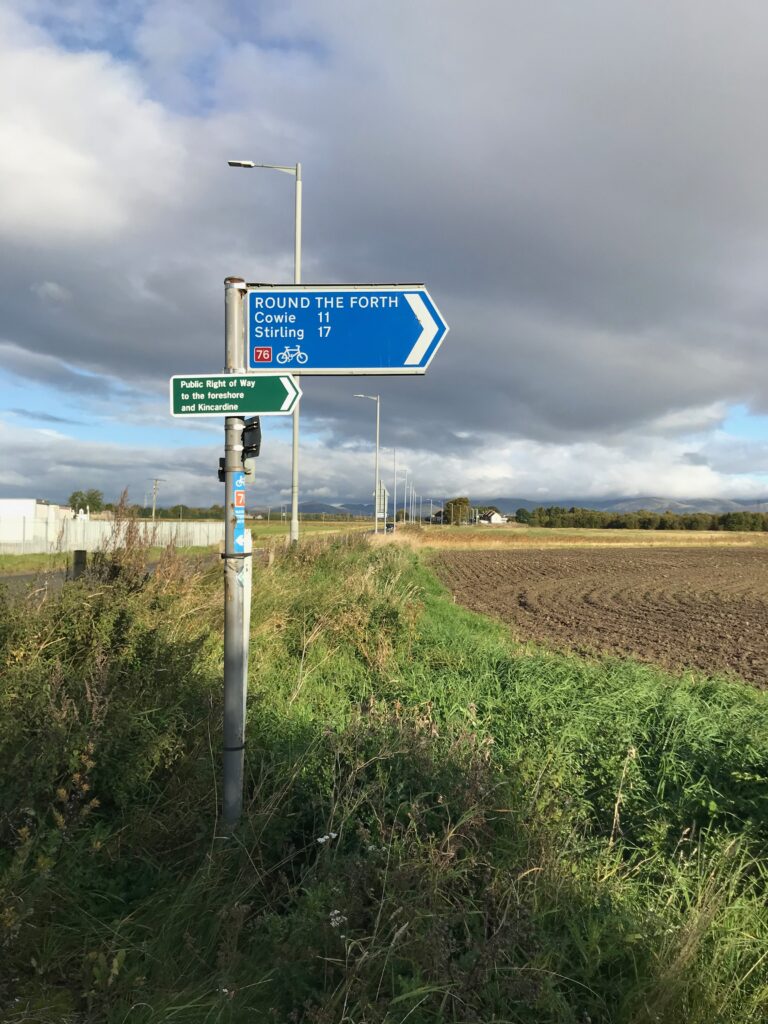
The following is a brief summary of the key details for Cycle Routes in Scotland : Round the Firth of Forth (NCN 76).
DISTANCE : 42 mls. circular
TERRAIN : Mostly flat
TOTAL ASCENT : 2,119 ft.
START & FINISH : Union Road car park in Grangemouth (FK3 8BZ)
This route is one of the cycle routes in Scotland that I have cycled over the years. Some of the other routes I have cycled over the years are listed in the page “Cycle Routes in Scotland”. (Click here to go to this page.)
Route Map
This route follows a section of the NCN 76 cycle path. This is one of the routes on the National Cycle Network run by the charity called Sustrans. Their map of this route can be accessed on their website www.sustrans.org.uk.
However, I also prepared my own map, as shown below. I did this as I wanted to see the hills profile and the total ascent shown on the map below after you press “Play”.
The map above is an interactive map so if you press “Play” (click on the white triangle in the middle of the screen) you can zoom in or out by pressing the buttons that appear in the top left of the screen, and you can move the map by dragging it. Once you press Play the hills profile of the route will appear at the bottom of the map. You can get further comprehensive detailed analysis of the hill profile by clicking on “More Detailed Profile” at the top left of the hills profile section. You can also select full screen mode by clicking on the icon in the top right corner of the map.
Route Details -
Cycle Routes in Scotland : Round the firth of Forth (NCN 76)
Start Point
The start point is at a car park in the town of Grangemouth. There is free parking at a shopping centre at Union Road (FK3 8BZ). This car park is close to the NCN 76 so it is a good start point.
Grangemouth - Kincardine Bridge
Leave the car park and turn right into Union Road. Continue on Union Road until it veers round to the right and then up to Station Road. Turn left into Station Road.
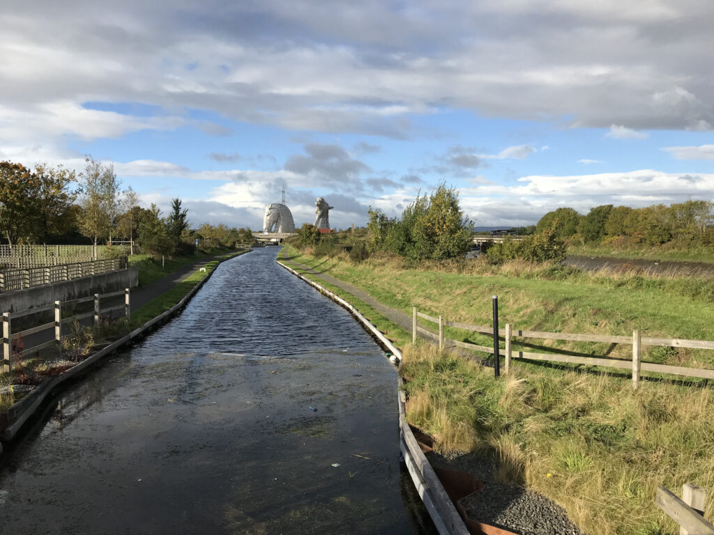
After cycling on roads through some built up areas for a short while the route comes out onto quite a busy road. Here there is a fine view of the Kelpies, which are 30 metre high horse head sculptures. They are the highest equine sculptures in the world and are named after mythical Scottish water horses called kelpies.
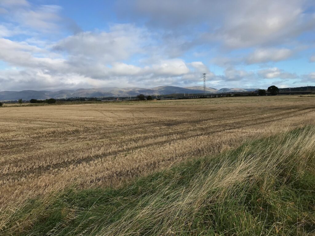
At this point the route cuts off to the right onto a farm road with quite a good surface.
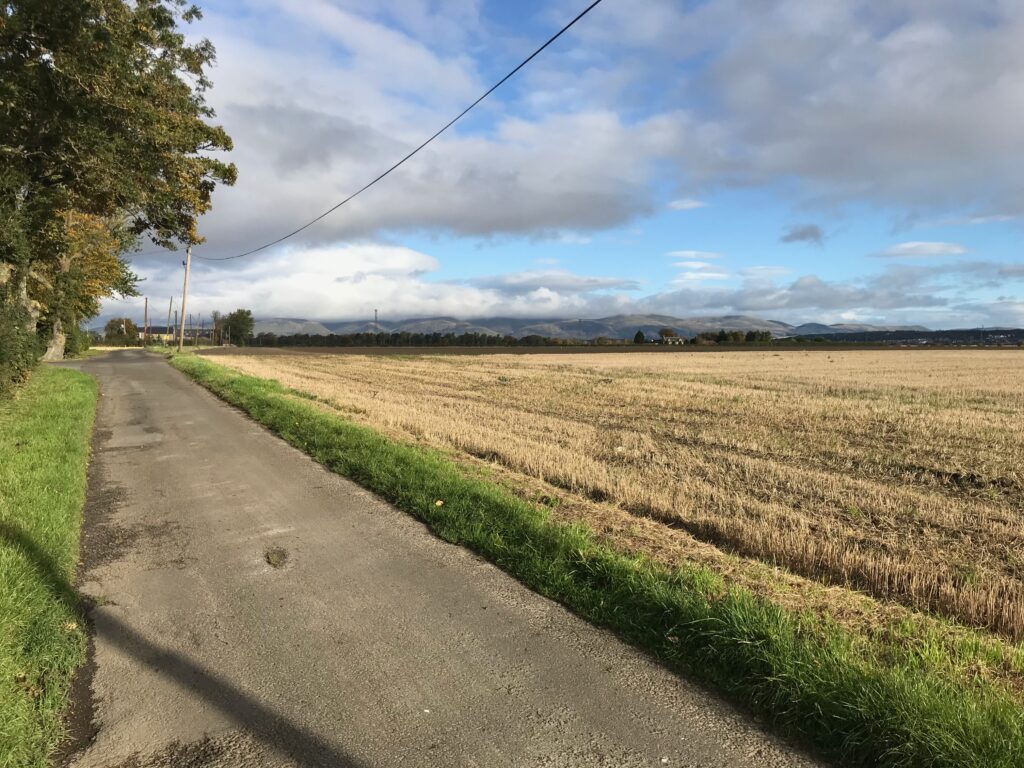
Cycling along this road there are views all around over very large agricultural fields and the hills in the distance.
As you cycle further along this road the hills in the distance come more into view.
The farm road ends at the busy M876 motorway. Here the NCN 76 sign directs you across the M876 on a pedestrian bridge. However, going over the pedestrian bridge would take you on the NCN 76 to Stirling.
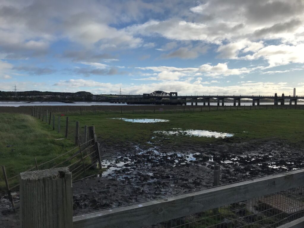
Instead continue cycling straight ahead on a local cycle path and this will take you to the Kincardine Bridge.
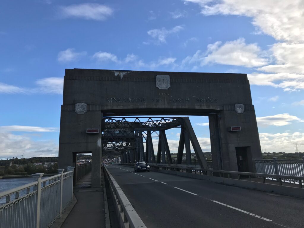
Kincardine Bridge
The Kincardine Bridge dates back to 1936. The bridge was constructed with a swinging central section to allow ships to pass upstream. This feature remained in use until 2008. At the time of construction the Kincardine Bridge was the largest swing bridge in Europe.
Fife
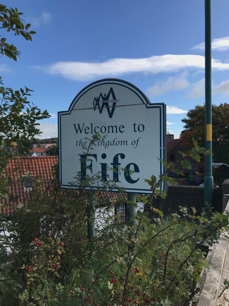
Cross over the Firth of Forth on the shared use path on the Kincardine Bridge. This takes you over to the district of Fife. Historically Fife is held to have been one of the major Pictish kingdoms of Scotland. It is still commonly referred to as “The Kingdom of Fife” within Scotland.
The Fife Coastal Path
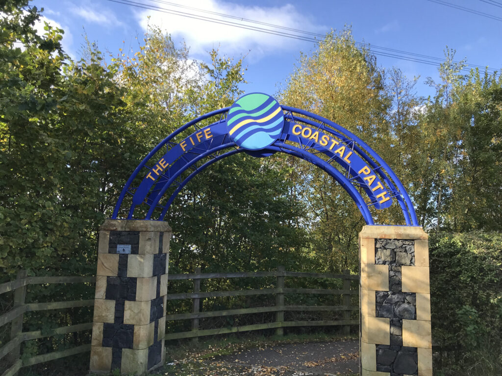
When you come off the Kincardine Bridge turn right immediately onto the A985. Within about ten yards across the road there is a large archway indicating “The Fife Coastal Path”.
Go through this archway and it will take you down to the NCN 76 path.
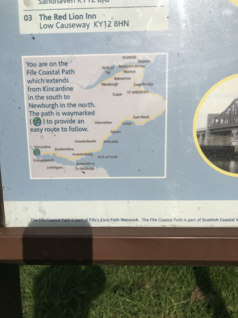
There is a notice board on this path outlining the “Fife Coastal Path”.
Kincardine - Torry Bay
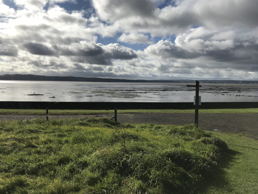
Cycle along on the NCN 76 to Torry Bay, a mile from Culross. So far the paths are mostly quite wide paved sections and quiet roads. However, there are some narrow stoney sections as well.
Torry Bay - Newmills & Torryburn
The path continues on the left of a railway line that is right next to the bay. It then crosses over the railway line via a private level crossing through small gates. At the other side it comes out at the bay. Here the NCN 76 heads inland, although there is a path round the bay following the esplanade.
After a while the path crosses over the railway line again, this time via a pedestrian bridge. Then, after a short distance, the route goes on road through the villages of Newmills and Torryburn.
Torryburn - Limekilns
After Torryburn the path goes off-road again.
It continues alongside the bay and then it eventually comes to a junction.
Here, although the path appears to go to the right, the NCN 76 route continues up the road to the left.
At this point there is what appears to be a home-made sign stating that the road to the right is closed. There is also a large hand painted sign indicating that the coast road for cyclists is to the left. Neighbours at that point had put up the signs. They were fed up with cyclists asking them for directions.
There is no sign here from either NCN or the Fife Coastal Path indicating that the route goes left at this point. I originally thought this was a bad omission.
However, a closer look at the NCN map clearly indicates the route going sharply to the left from an off-road section to an on-road section at this point. Up to this point the route is so well signposted that there rarely is the need to consult the NCN map.
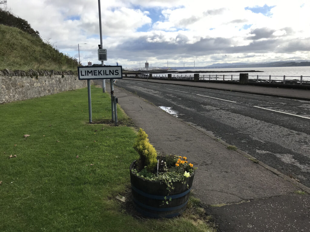
Limekilns
Continue on up the hill to the left and cycle along on the NCN 76 to the village of Limekilns.
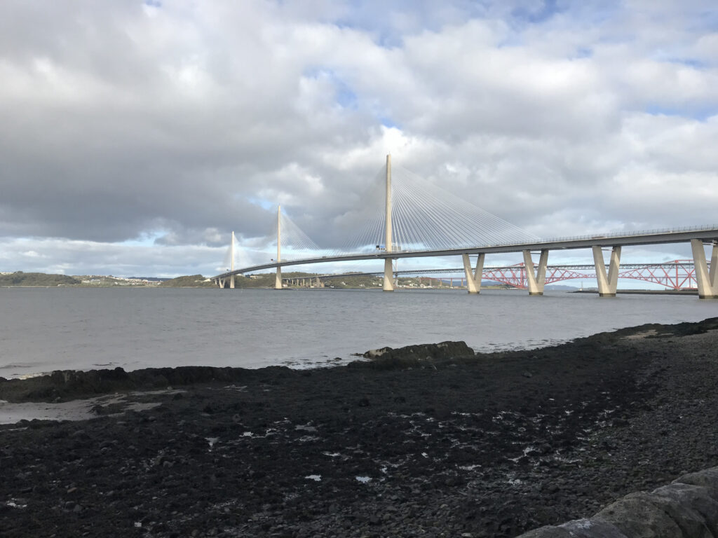
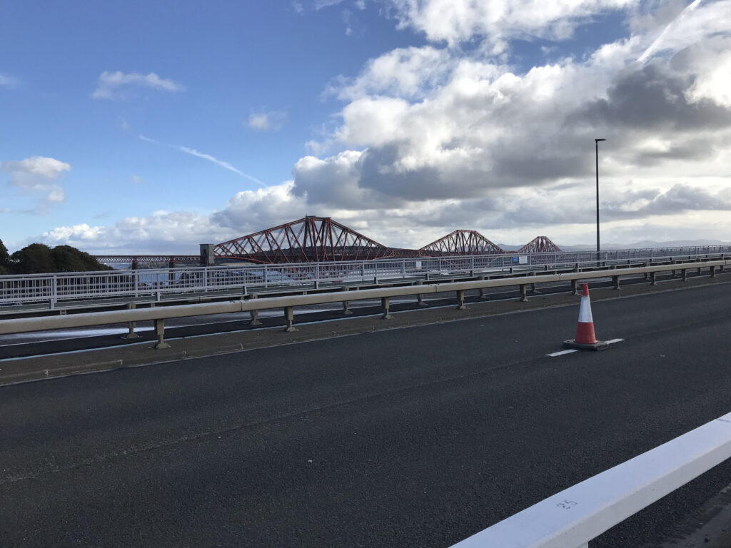
Continue on the NCN 76 to Inverkeithing where you can pick up the NCN 1 to go over the Forth road bridge. There is a good wide cycle path on the bridge, as well as a pedestrian path. On going over the bridge at times the cross winds can be really strong and you can get blown about on both sides.
On one side of the road bridge is the iconic Forth Bridge. This is a railway bridge that had the world’s longest span (541m) when it opened in 1890. It is one of Scotland’s major landmarks and is a UNESCO World Heritage Site.
On the other side of the road bridge is the new Queensferry Crossing. It was opened in 2017 and carries the M90 motorway from Edinburgh to Fife. It is the longest three-tower, cable-stayed bridge in the world.
Forth Road Bridge - Hopetoun Estate
When you come off the bridge you need to make your way to the NCN 76 route to Bo’ness.
Once on the NCN 76 route you cycle along on a narrow country road. Here you can take the opportunity to stop and look back at the view of the three bridges over the Firth of Forth.
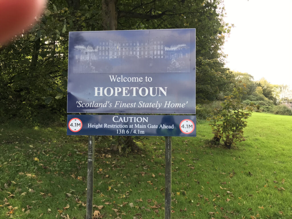
Further along this road the NCN sign indicates you should go to the left off the road and into the grounds of the Hopetoun Estate.
Hopetoun Estate - Blackness
Here the centrepiece is Hopetoun House, which is one of Scotland’s finest stately homes.
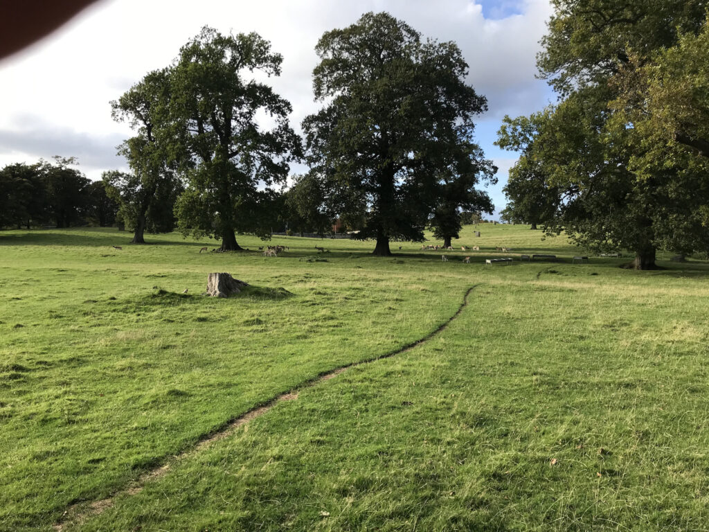
The cycle route goes through the large and very impressive grounds. Here you can see some varied wildlife such as a herd of deer, pheasants, etc., as well as the usual grey squirrels.
The route eventually goes into woods where the path is red and stoney but quite flat. This path seems to go on for ages – I think it is about three miles long. It follows the coast but there are only glimpses of the sea through the trees. When you come out of the woods you will be able to see the Firth of Forth on the right hand side. There is a paved path ahead which is very welcome after the long path through the woods. A little further on you come out at the village of Blackness
Blackness - Bo'ness
Follow the path round the village and you will soon came to a nice tarmac path along the coast.
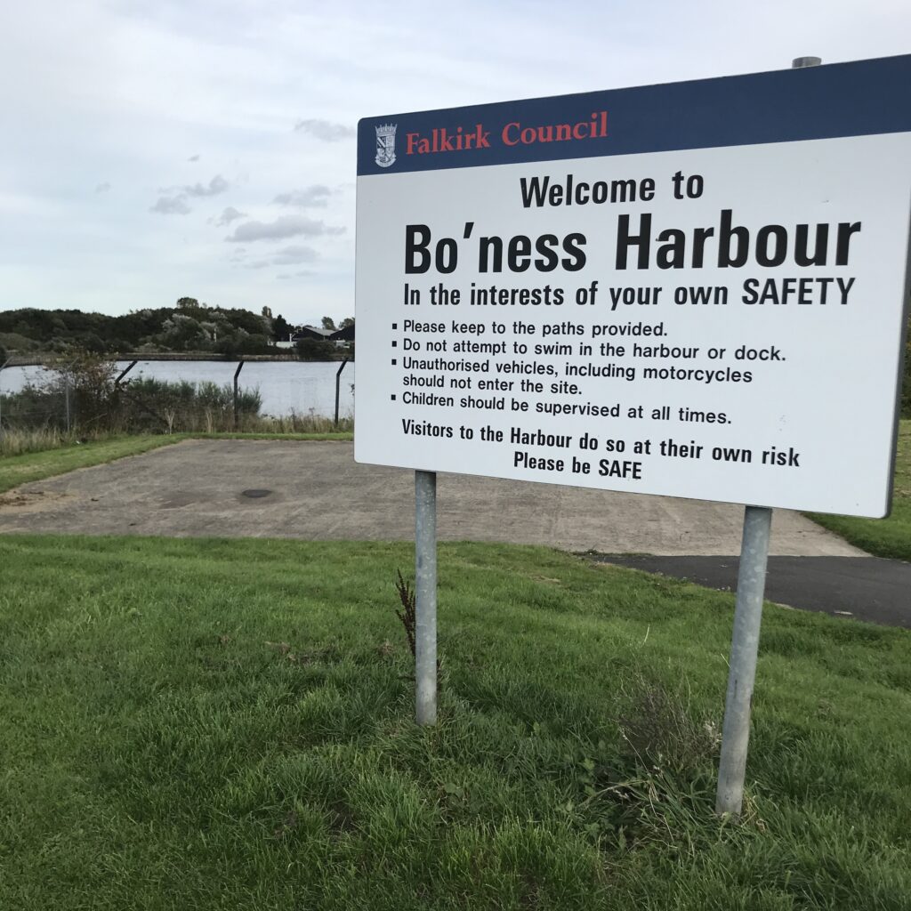
The route continues on to Bo’ness, where it passes by Bo’ness Harbour.
Bo'ness - Grangemouth
After Bo’ness the route goes into Kinneil Wood where there is a flat stoney path.
The paved path resumes after this all the way to the outskirts of Grangemouth.
It comes out at a main road where you follow the NCN signs to the centre of Grangemouth. Then you cut off back to the start of the route at the Union Road car park.
Route Alternatives -
Cycle Routes in Scotland : Round the firth of Forth (NCN 76)
This being a circular route you can start it at any point along the route where there is adequate car parking.
Cafe / Toilet Stops -
Cycle Routes in Scotland : Round the firth of Forth (NCN 76)
The start point at the Union Road car park in Grangemouth is next to a shopping centre. It is also just down from a busy main road. So it is well placed for refreshment opportunities.
After crossing over the Firth of Forth on the Kincardine Bridge, instead of turning right onto the Fife Coastal Path you could cycle straight up the road into the centre of Kincardine. Here you will find places to eat & drink.
Stops could also be made at the many villages along the north coast of the Firth of Forth, such as Culross, Newmills, Torryburn, Charleston, etc.
Other detours could be taken into small towns/villages along the way, such as Rosyth, Inverkeithing, North Queensferry, South Queensferry and Bo’ness.
Train Options -
Cycle Routes in Scotland : Round the firth of Forth (NCN 76)
The train station at Falkirk is just over 2 miles from Grangemouth. Starting and returning here would add about 4.5 miles to the route.
If you want to access the start of the route by train your options to do so will of course depend on where you live and what train lines are nearby and where they run to, which each person will need to investigate for themselves. For a website that can help with this click on the following website address : https://www.thetrainline.com.