The following is a brief summary of the key details for Cycle Routes in Scotland : Paisley – Lochwinnoch (NCN 7).

DISTANCE : 19 mls. linear
TERRAIN : Flat
ASCENT : 778 ft.
START FINISH : Across from the car park at Stow Street, Paisley
This route is one of the cycle routes in Scotland that I have cycled over the years. Some of the other routes I have cycled over the years are listed in the page “Cycle Routes in Scotland”. (Click here to go to this page.)
Route Map
Sustrans
This route is part of the National Cycle Network route number 7 (NCN 7). The National Cycle Network is run by a charity called Sustrans and they have teamed up with Ordnance Survey (OS) to provide an interactive map for the whole of the UK.
To access the NCN map for this route click on the following website address : www.sustrans.org.uk. This will take you to the Home page in Sustrans’ website where you will find interesting articles and information on cycling on the National Cycle Network, as well as access to the NCN map.
NCN Map
To access the map, from the Home page in Sustran’s website click on “National Cycle Network” in the top menu bar. Then scroll down to the section headed “Map of the National Cycle Network” and click on the link “Open the National Cycle Network map”.
A map of the National Cycle Network for the whole of the UK will be displayed, starting in the south of England. Move the map up to the west of Scotland and expand the map using the “+” button in the vertical black bar at the top right of the screen. Keep moving and expanding the map until it is focussed on the NCN 7 route between Paisley and Lochwinnoch.
Route Details –
Cycle Routes in Scotland : Paisley – Lochwinnoch (NCN 7)
[If you are going to do this trip one way obviously you will need to make arrangements to get back from Lochwinnoch. You can do this either by getting someone to pick you up or by returning by train (see “Train options” section below).
Start Point
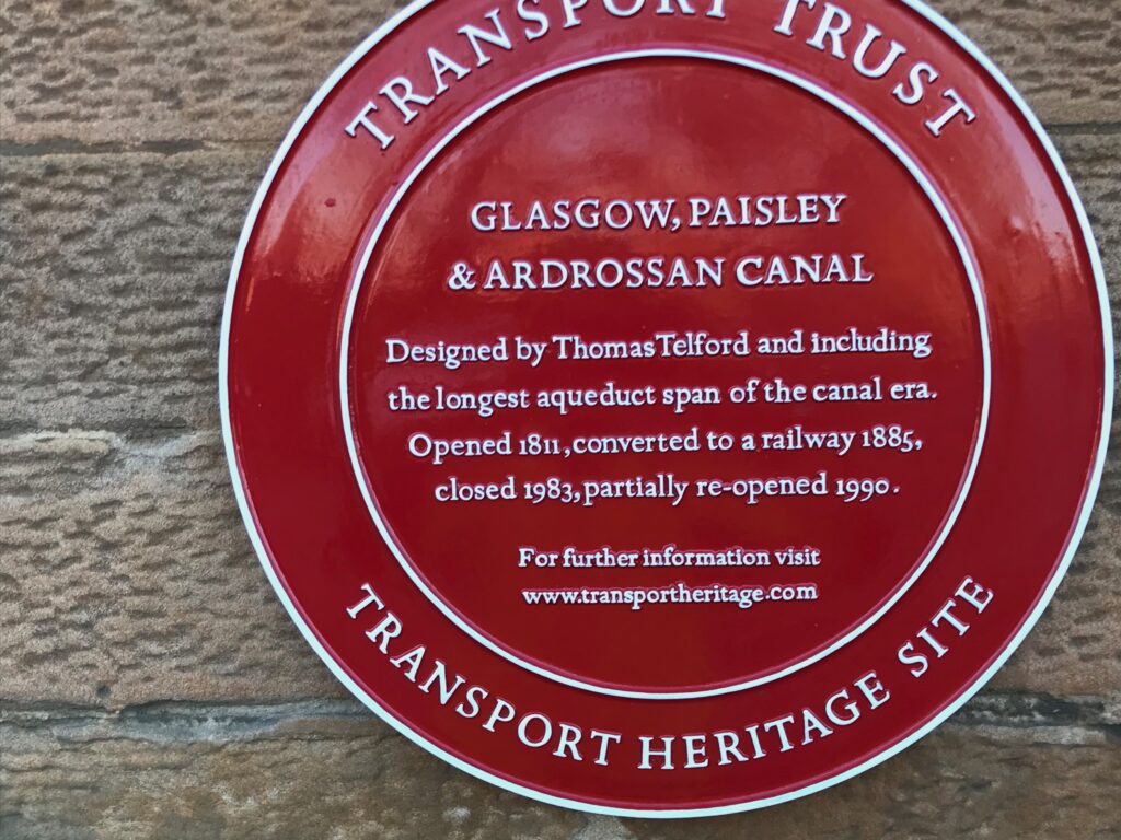
The NCN 7 cycle path runs along the back of the bar / restaurant across from the car park at Stow Street, Paisley. This building was formerly a station building and ticket office. It was for the train line that has now been converted to a cycle path. The bar/restaurant currently using the building is called Telfords. The reason for this choice of name is explained on the plaque on the front of the building.


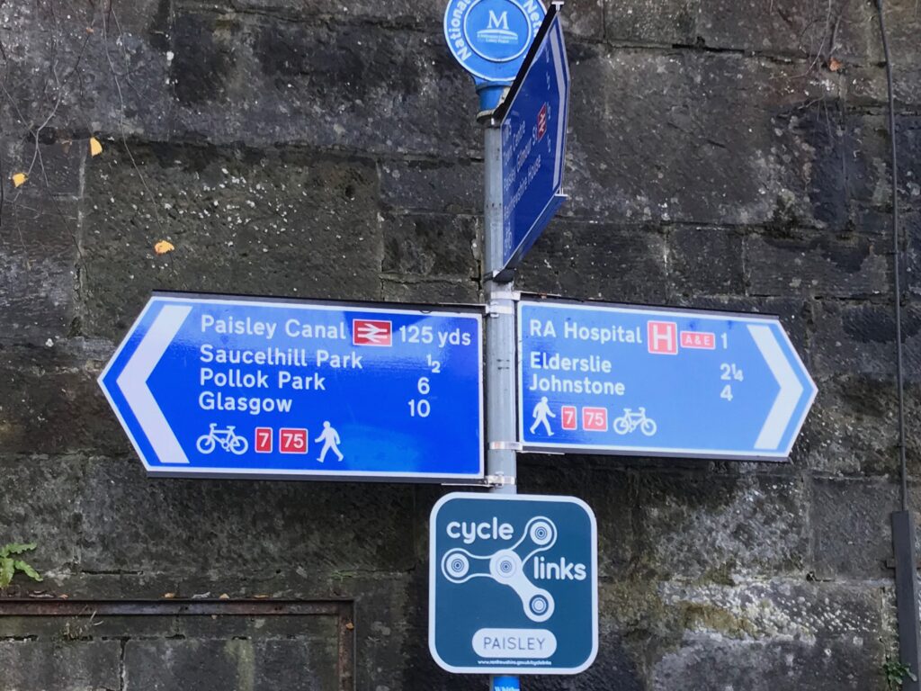
The NCN sign at the start of this route is at the back of this building.

Paisley – Johnstone
Here turn right onto the path, heading for Elderslie, Johnstone.
The route is on a good tarmac surface and is well sign posted, with mileage indicators, all the way to Lochwinnoch and beyond.
However, you should be careful at a couple of junctions on the path to ensure you take the correct turning. The first one is just before reaching the town of Johnstone, where another cycle path cuts off to the right. This path is the NCN 75 that leads all the way to Gourock. (From Gourock you can continue on the NCN 756 all the way down to Inverkip). You should therefore carry straight on at this junction, which is well signposted.

Johnstone – Elderslie
The second one is further on at the town of Johnstone. It is after the path passes the large Morrisons supermarket on the left hand side. You then cross over the busy road at the traffic lights to pick up the path on the other side. A short distance further on from this there is a path leading to Milliken Park. At this point it seems more natural just to cycle straight on along this path. However, the NCN 7 actually does a U-turn to the right here. It then leads to the left and over a pedestrian bridge that crosses the very busy A737 dual carriageway. It is well signposted but it is as well to be aware of it.

There are two points in the route where extra care should be taken.
Elderslie
The first is at the small town of Elderslie (the birthplace of William Wallace). Here you come up a small incline in the path and emerge onto a busy main road. You should carefully cross over to the other side of the road. Here there is a cycle lane painted on the road. Follow this down to a bus stop with a lay-by just before traffic lights. Dismount here and walk down to the traffic lights to cross the road. Then follow the small side road that leads from the traffic lights down a short incline. Here you can pick up the cycle track again.
There is an alternative to crossing the road. You can walk with your bike along the pavement where you come off the cycle track to the traffic lights. The pavement on this side of the road is very narrow.
Even more care should be taken here if you are cycling this route in reverse. Also if you are cycling there and back in the one day. When reaching this section from the other direction it’s a bit more difficult. This is because there is a row of parked cars on the left hand side of the main road. This is before the painted cycle on this side of the road lane commences. Therefore you can either cycle on the main road alongside the parked cars. Alternatively you can walk with your bike along the pavement, but the pavement is very narrow. Remember you will be turning left off the road at the top of the hill to get back onto the cycle path.
The second point in the route where extra care should be taken is at the town of Johnstone. Here there is a large Morrisons supermarket just to the left of the cycle path. Just past Morrisons the path crosses over a very busy road. However, there is a pedestrian/cyclist crossing so it is essential to use that.
Cafe/Toilet Stops –
Cycle Routes in Scotland : Paisley – Lochwinnoch (NCN 7)
Paisley
In Paisley there is of course the bar/restaurant across from the car park where the route commences. There are also a couple of cafes round the corner in Causeyside Street. Plus you are not really that far from Paisley town centre where there are several eating places.
Elderslie
At Elderslie, where you briefly come off the cycle track anyway, there is a coffee shop and a convenience store. They are to the left of the bus stop where you dismount to cross the road at the traffic lights. At the corner at the traffic lights there is a steak bar/grill that also serves burgers. Round the corner there are some Chinese and Indian takeaways. Further along the main road, just before the Wallace Monument, there is a filling station that has a Costa Express facility.
Johnstone
As mentioned above, at the town of Johnstone, there is a large Morrisons supermarket just to the left of the cycle path. Here you can get supplies and there are also toilet facilities. Also, there is an on road route that is signposted at the traffic lights just past Morrisons. That takes you into Johnstone town centre where there are several cafes, etc., although this is a busy road.
Kilbarchan
Further on there is a signed on road cut off from the cycle path to the village of Kilbarchan where there are facilities. If you come off the cycle path here you immediately come onto a side road where you turn left. You then cycle down a short brae and turn right onto the main road.
A short distance further along on the left is the Trust Inn that serves food. Just past this there is a Co-op grocery store. Further on if you turn right into Ewing Street and climb up the steep hill to just past the Steeple building there is a coffee shop called Bobbins. Cycle on and down from Bobbins and turn right onto the main road. Then turn immediately right into New Street. Here you will find a family friendly bar/restaurant called Habbies. (It isnamed after an eighteenth century piper closely associated with Kilbarchan).
Lochwinnoch
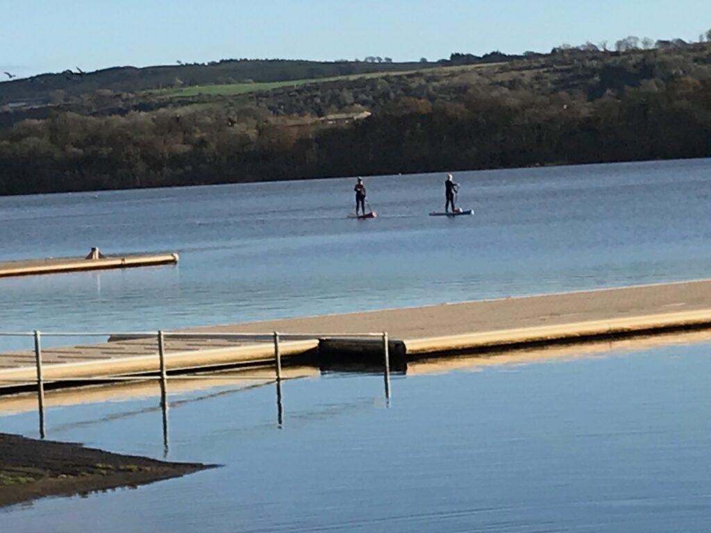
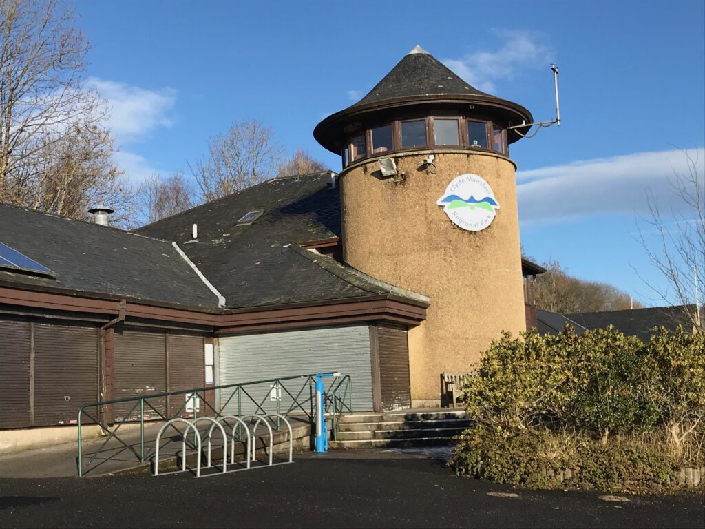
Once you reach Lochwinnoch, Castle Semple Loch is just off to the left from the cycle path. There is a visitors centre there and public toilets. In the visitors centre there is a cafe/shop with toilets, but the cafe only sells sandwiches, tea and coffee, etc. If you want a hot snack or a meal you will need to cycle the short distance into Lochwinnoch village. Here the Junction cafe serves Scottish and Italian food. There is also a bakers that sells take away hot snacks.

Alternative start and end points –
Cycle Routes in Scotland : Paisley – Lochwinnoch (NCN 7)
This route is only a small section of the very long NCN 7 cycle route so it could be extended or shortened to suit individual needs.
For example, if you wanted to shorten the route you could turn back at, say, Johnstone. This would give a round trip of about 9 miles. Or you could continue to the village of Kilbarchan and return from there. This would result in a round trip of about 11 miles..
If you wanted to lengthen the route you could cycle on past Lochwinnoch to Kilbirnie. This would be a round trip of about 28 miles.
Or to extend the route even further you could continue cycling down to the Ayrshire coast to Irvine, Saltcoats or Ardrossan. (The NCN 7 actually goes all the way down as far as Carlisle). However, this would result in a very long trip of 50 – 60 miles if you were cycling from and returning to Paisley.
Starting from Glasgow
Another option to extend the route would be to start from Glasgow. To get to Glasgow you could drive or take the train (to either Glasgow Central or Glasgow Queen Street stations). You could then make your way down to the banks of the River Clyde from the car park or train station, either by cycling on busy roads or by walking.
There you can pick up the NCN 75 cycle path which runs along the north bank of the river. It joins up with the NCN 7 at the Bells Bridge pedestrian crossing over the river, just at the Crowne Plaza Hotel. Cross over the river here and follow the NCN signs through several built up areas and a couple of parks in the Southside of Glasgow and eventually through to the start point at Stow Street, Paisley. I’ve yet to cycle this route from Paisley to Glasgow. So I don’t know how many additional miles it would add to the route. However, I guess it would be quite high.
Train options –
Cycle Routes in Scotland : Paisley – Lochwinnoch (NCN 7)
If you want to do the one way, 10 mile option you can return to Paisley by train. You can do this by getting the train from Lochwinnoch Station. This is just outside Lochwinnoch on the A760. To get to the station continue on the cycle path to the end of Castle Semple Loch. Then turn left and follow the path alongside the A760 until just past the RSPB Nature Reserve. The train station is across the road. There is a direct train link from Lochwinnoch Station to Paisley Gilmour Street Station. Trains run regularly with an average journey time of 13 minutes.
If you want to access the start of the route by train your options to do so will of course depend on where you live and what train lines are nearby and where they run to, which each person will need to investigate for themselves. For a website that can help with this click on the following website address : https://www.thetrainline.com.
Other Train Stations
There are other train stations along the route and I’ve listed some of these below.
The Paisley Canal Station is just across from the start of the route. When you come out of the station you need to cross Causeyside Street. This is very busy so you should use the pedestrian crossing nearby. The access to the start of the route is directly across Causeyside Street from the train station. It is down Stow Brae where you can see the car park on the right. On the left is the bar/restaurant with the cycle path behind it.
Paisley Gilmour Street Station is in the centre of Paisley. It is not too far to walk or cycle to the start of the route.
There is also a train station at the town of Johnstone. There is a signed on road route from the cycle path to the centre of Johnstone where the train station is.
