The following is a brief summary of the key details for Cycle Routes in Scotland : Aberfoyle to Callander (NCN 7).
DISTANCE : 28 mls. circular
TERRAIN : Hilly, with 9 miles on rough terrain through forest.
TOTAL ASCENT : 2,785 ft.
START & FINISH : Car park off Main Street in Aberfoyle.
This route is one of the cycle routes in Scotland that I have cycled over the years. Some of the other routes I have cycled over the years are listed in the page “Cycle Routes in Scotland”. (Click here to go to this page.)
Route Map
Route map for Aberfoyle - Callander (NCN 7) by E-Bike Cyclist.scot on plotaroute.com
The map above is an interactive map so if you press “Play” (click on the white triangle in the middle of the screen) you can zoom in or out by pressing the buttons that appear in the top left of the screen, and you can move the map by dragging it. Once you press Play the hills profile of the route will appear at the bottom of the map. You can get further comprehensive detailed analysis of the hill profile by clicking on “More Detailed Profile” at the top left of the hills profile section. You can also select full screen mode by clicking on the icon in the top right corner of the map.
Route Details -
Cycle Routes in Scotland : Aberfoyle to Callander (NCN 7)
Start Point
The route starts at the Riverside car park just off the Main Street in Aberfoyle.
Aberfoyle - Loch Drunkie
Exit the car park and turn right and then right again and then immediately left. This takes you onto a very steep road that winds it’s way up the hill.
You soon come to a sign for the NCN 7 through the forest.
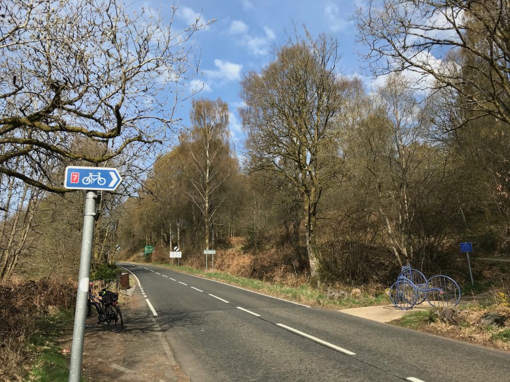
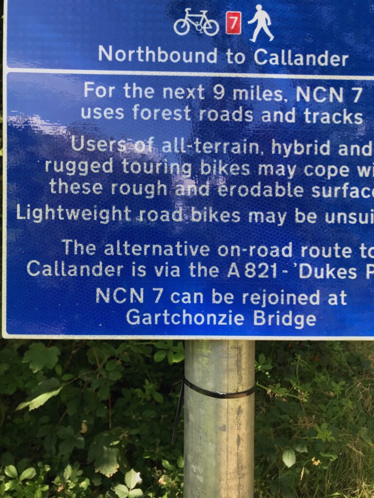
The cycle track leads up to a forest road. The forest road, although wide, is very rough, stoney and steep. It is a bone rattler! This is the warning sign at the start of the cycle path
Continue to climb steadily up on the cycle path as it winds it’s way steeply through the forest. Eventually you will reach the forest road where you turn right.
This stoney road is part of the Three Lochs Forest Drive (shown as Achray Forest Drive in the map above), which the NCN 7 follows until it reaches Loch Venachar.
Further along this road you will reach Loch Drunkie, where there is a car park and toilets.
Loch Drunkie - Callander
The road winds it’s way round the bottom part of the loch and then it heads away from the loch before heading back towards it. It then veers to the left away from Loch Drunkie as it heads towards Loch Venachar.
Further along this stretch of the road the NCN 7 leaves the road and continues on a rough cycle track through the forest. Look out for the NCN sign next to a small lay-by on the right.
The cycle path through the forest is narrow and undulating at times. It is a dirt track with some stoney sections and some sections where there are tree roots.
As it winds it’s way through the forest the cycle path runs alongside Loch Venachar, although there are only glimpses of the loch through the trees.
Eventually you will come out of the forest onto a paved road where you turn left. For most people it will be a great relief to get back onto a paved surface.
The road is the Invertrossachs Road, which hugs the shoreline of Loch Venacher all the way to Callander. There are a few car parks along the way and some small bays with picnic tables where you can stop for a rest whilst admiring fine views of the loch.
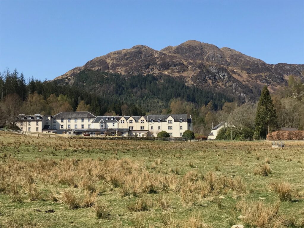
Callander
Callander is a bustling tourist village with shops, cafes, restaurants, hotels and public toilets.
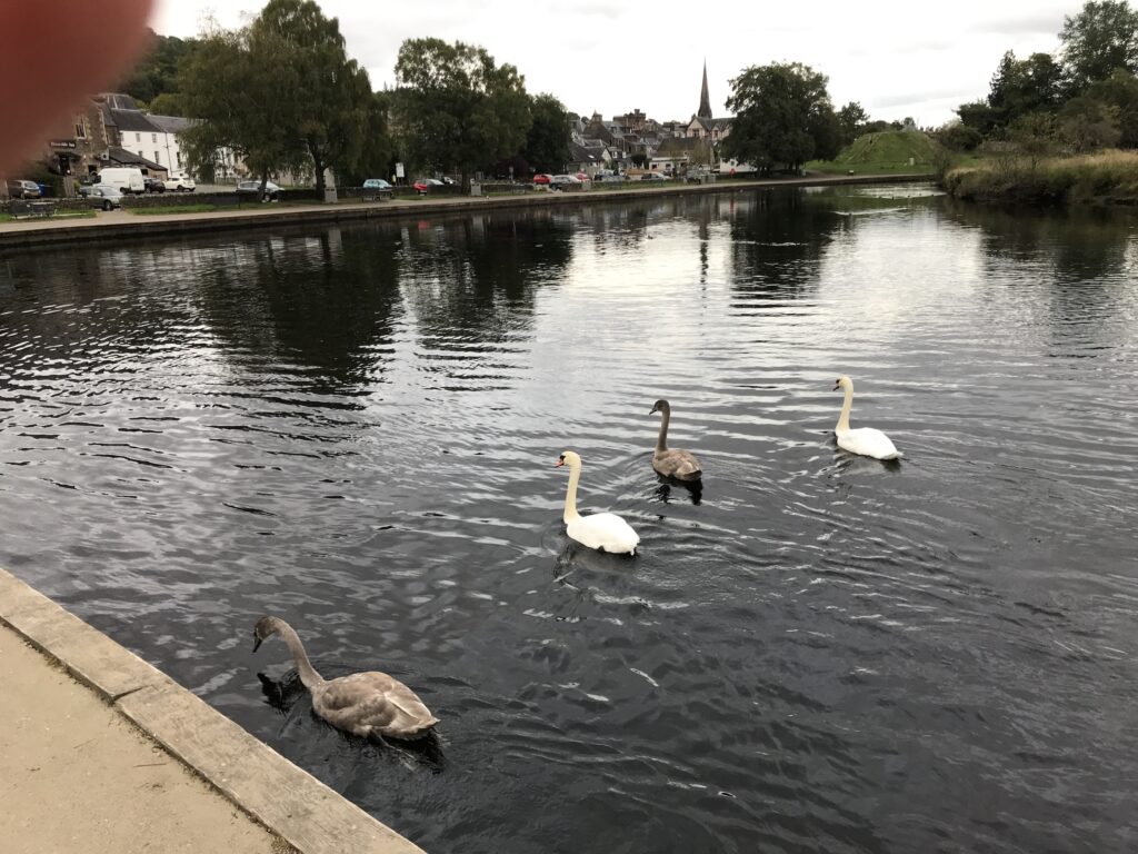
The cycle track leads into the car park behind the Main Street. Here there are benches alongside the River Teith where you can rest and watch the birds on the river.
Return to Aberfoyle
To complete the circular route return to Aberfoyle by road. This also avoids having to return on the rough, stoney track through the forest.
Cycle back to the Invertrossachs Road. Cycle up this road as far as the Gartchonzie Bridge, where you turn right to cross over the bridge. This takes you over to the A821 road where you turn left.
The A821 runs alongside Loch Venachar and provides constant fine views over the loch, unlike the forest track on the other side where there are mostly fleeting glimpses of the loch through the trees, with some gaps where you could stop to admire the view. The A821 is quite a busy road but it isn’t too bad and there are always opportunities for the cars to overtake so you won’t be holding anyone up.
Eventually the A821 continues alongside Loch Achray to the point at the top of the loch where it turns sharply left. (At this point there is a road straight ahead that takes you to Loch Katrine pier.)
Follow the A821 round to the left and start the long, steep, winding climb up to the Dukes Pass. The road at this stage can become busy with groups of four or five cars passing regularly when they can safely do so.
From the top of Dukes Pass it is a very steep and winding descent back to Aberfoyle, so great care should be taken as high speeds can be obtained and there are several winding bends in the road.
Route Alternatives -
Cycle Routes in Scotland : Aberfoyle to Callander (NCN 7)
This being a circular route it is of course possible to do it in reverse by starting at Callander and cycling to and from Aberfoyle. There are two car parks in Callander, although they can get very busy in the summer months.
Also, the route could be started at different points along the route.
For example, you could drive up to the Dukes Pass from Aberfoyle then drive along the Three Lochs Forest Drive to Loch Drunkie. Here there is a car park and public toilets. This start point would have the advantage of cutting out the steep climb up through the forest at the start of the route.
Alternatively, you could decide to do the whole route from Loch Drunkie, where there are camping facilities. However, this would mean that you would still have the steep climb up through the forest at the end of the day when you would be tired.
Cafe / Toilet Stops -
Cycle Routes in Scotland : Aberfoyle to Callander (NCN 7)
There are several shops, cafes, restaurants, etc. along the Main Street in Aberfoyle. There are public toilets next to the Information Centre in Aberfoyle.
There are public toilets at the car park at Loch Drunkie.
In the Main Street in Callander there are many shops, cafes, bars, restaurants and hotels. There are public toilets behind the Dreadnought Hotel at the car park in Station Road in Callander.
Train Options -
Cycle Routes in Scotland : Aberfoyle to Callander (NCN 7)
Unfortunately there is no train station in Aberfoyle. The nearest train stations to Aberfoyle are Dunblane, Ardlui and Balloch. These are all 15 – 16 miles away by road.
If you want to avoid cycling on road from a train station to Aberfoyle the best option would be to go to Balloch train station. From Balloch you can pick up the NCN 7 cycle path all the way to Aberfoyle. However, this would add a round trip of about 38 miles, thus resulting in a total route distance of about 66 miles. This may be too much for some people, although it could be spread over two days.
Unfortunately there is no train station in Callander either. The nearest station is at Dunblane, which is about 11 miles away.
If you want to access the start of the route by train your options to do so will of course depend on where you live and what train lines are nearby and where they run to, which each person will need to investigate for themselves. For a website that can help with this click on the following website address : https://www.thetrainline.com.