The following is a brief summary of the key details for Cycle Routes in Scotland : Callander to Killin (NCN 7).
DISTANCE : 44 miles, linear
TERRAIN : Hilly
TOTAL ASCENT : 3,012 feet
START & FINISH : Car park at Callander
This route is one of the cycle routes in Scotland that I have cycled over the years. Some of the other routes I have cycled over the years are listed in the page “Cycle Routes in Scotland”. (Click here to go to this page.)
The map above is an interactive map so if you press “Play” (click on the white triangle in the middle of the screen) you can zoom in or out by pressing the buttons that appear in the top left of the screen, and you can move the map by dragging it. Once you press Play the hills profile of the route will appear at the bottom of the map. You can get further comprehensive detailed analysis of the hill profile by clicking on “More Detailed Profile” at the top left of the hills profile section. You can also select full screen mode by clicking on the icon in the top right corner of the map.
Route Details -
Cycle Routes in Scotland : Callander to Killin (NCN 7)
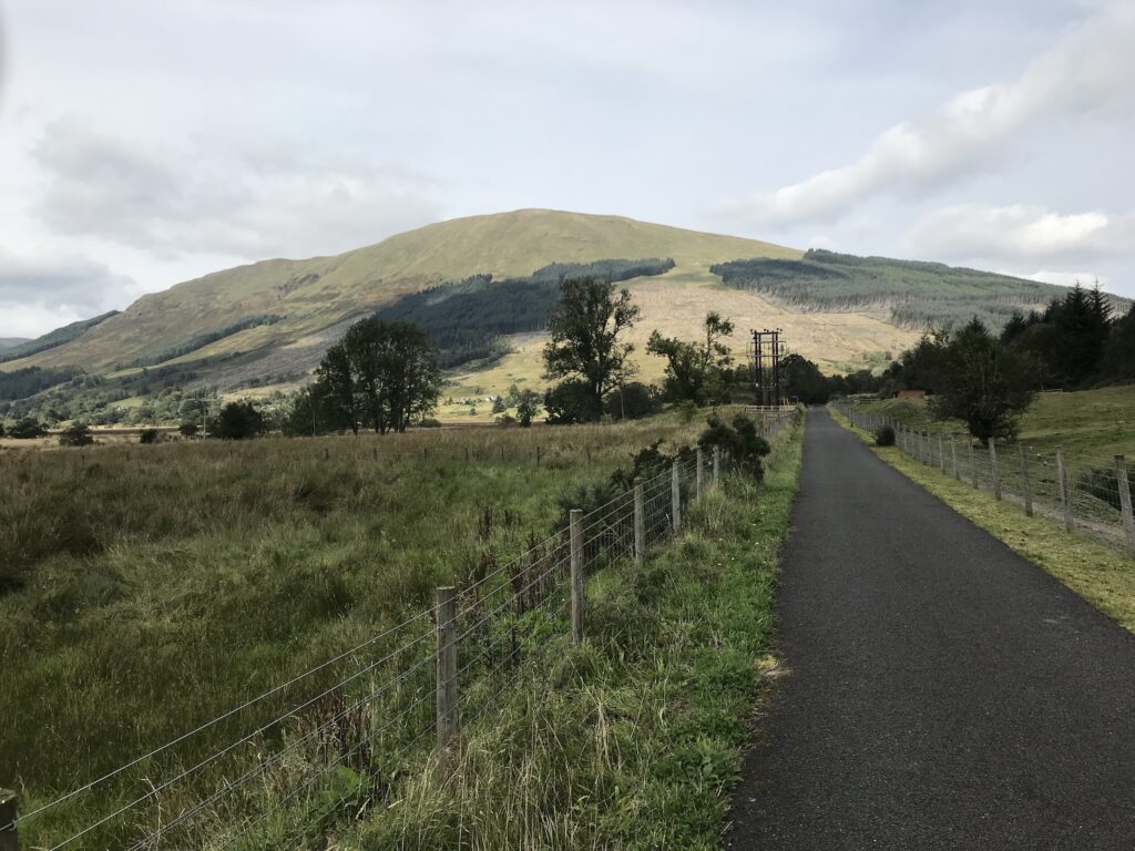
Callander - Ben Ledi
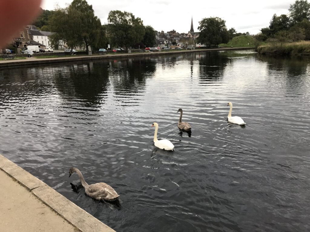
The route starts at the large car park in Callander overlooking the River Teith.
This is where this part of the NCN 7 route begins. The NCN signs are at the edge of the car park.
The first section of the route is alongside the River Teith, which is fast flowing over rocks at the start.
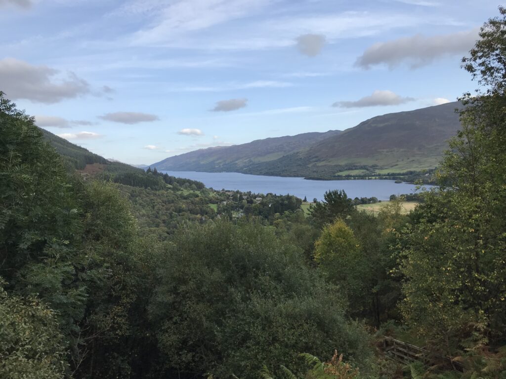
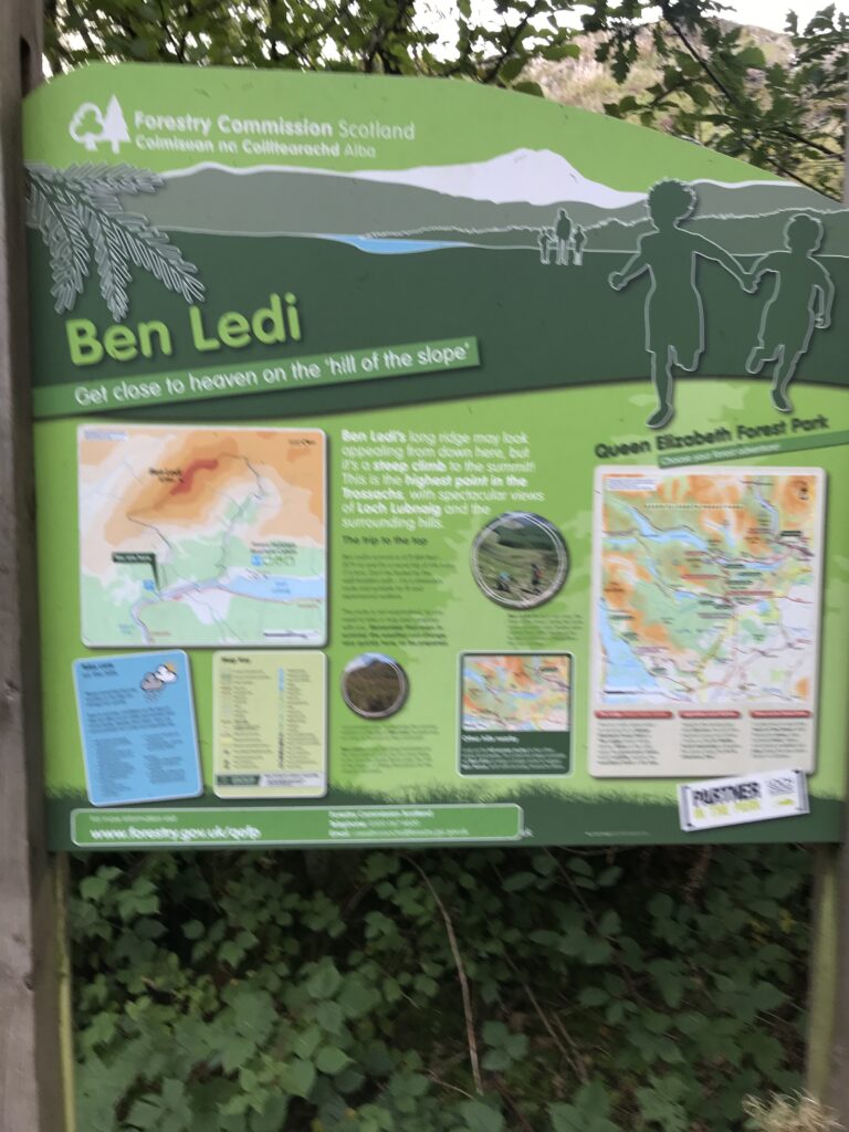
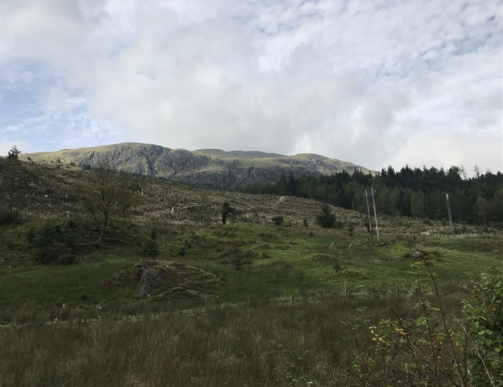
It continues through the trees and emerges at the car park for hill walkers who are climbing Ban Ledi. This is the highest hill in the Trossachs area of Scotland.
The ridge at the top of Ben Ledi can be clearly seen as you cycle along on a paved road.
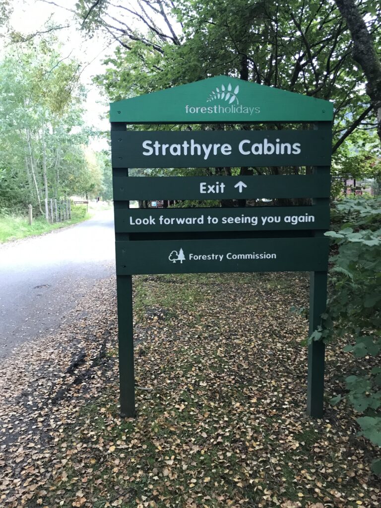
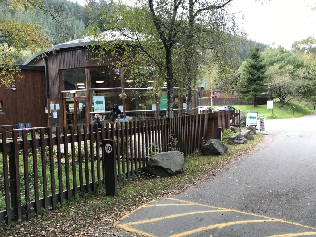
This road leads to the Strathyre Cabins complex that is operated by Forest Holidays.
There is a shop and cafe here for residents that is also open to the public.
Ben Ledi - Loch Lubnaig
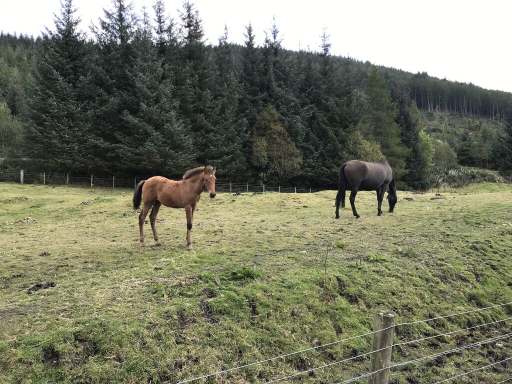
At the end of the road you continue on the cycle track through an area where horse riding is popular. Here there are several stables and paddocks and horses in fields.
The path in this section is paved and is flat.
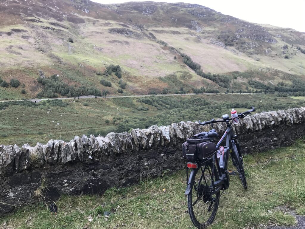
Continue on the route along the side of Loch Lubnaig. It continues to be flat for a good distance along the loch.
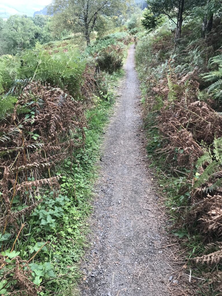
Soon, however, the track begins to gradually narrow. Then it is less than a foot wide with vegetation on either side.
It then suddenly starts to climb up steeply. At times the surface is loose stones and there are several small hairpin bends.
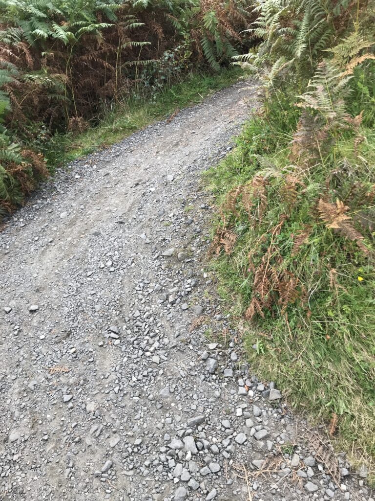
At the top the track joins a wide forest road which is stoney and rutted.
Loch Lubnaig - Strathyre
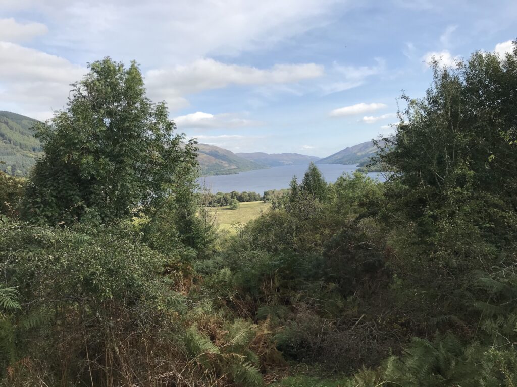
The path recommences at the end of this road and continues to undulate high along the side of Loch Lubnaig. From this high position there are good views down the loch. You can also see clearly over to the main road that runs along the other side of the loch.
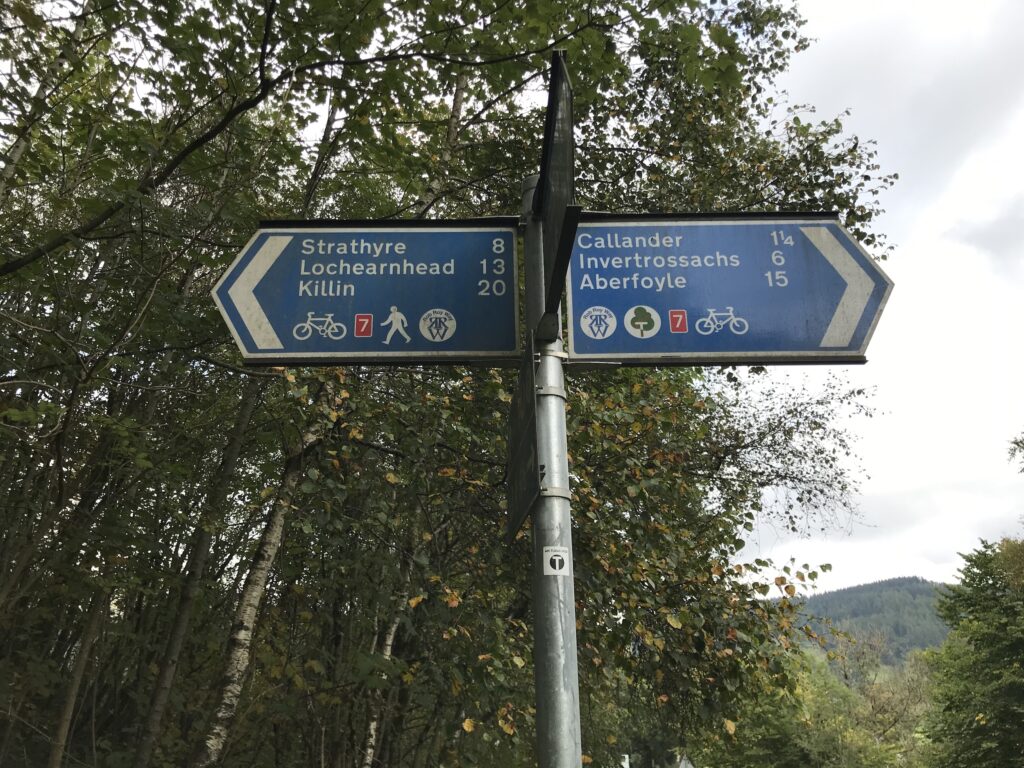
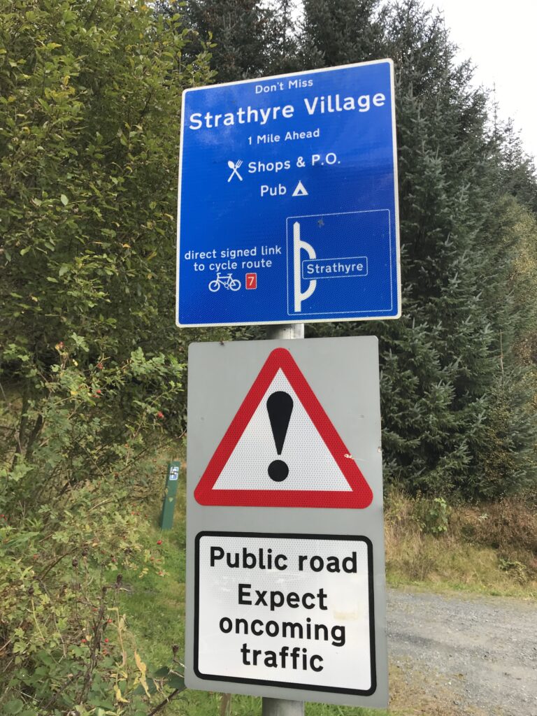
If you need a rest after the climbing up over Loch Lubnaig you can cut off into the small village of Strathyre. Here there is a shop & post office and a pub.
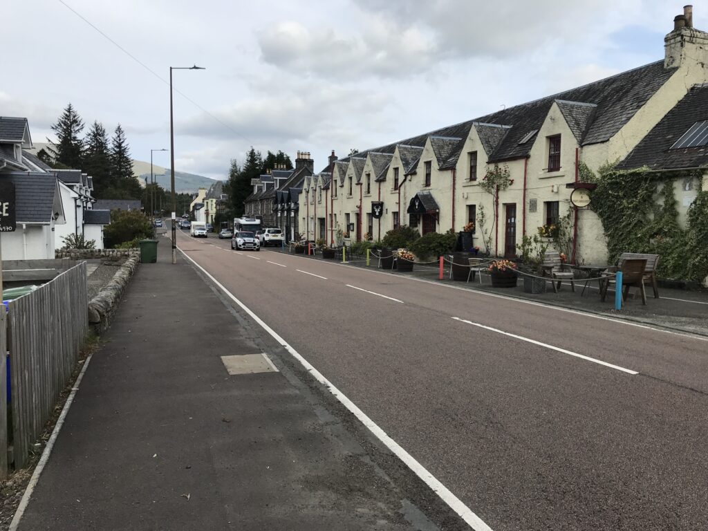
Strathyre is a picturesque little village that sits on the main A84 route to Lochearnhead.
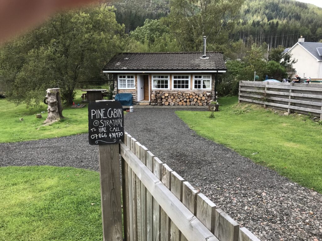
In Strathyre there is a small park on the Main Street. Here you can sit on a bench if you prefer to rest outside. There is also a shop and a pub on the Main Street. There is also a quaint, tiny log cabin for rent.
Strathyre - Glenoglehead
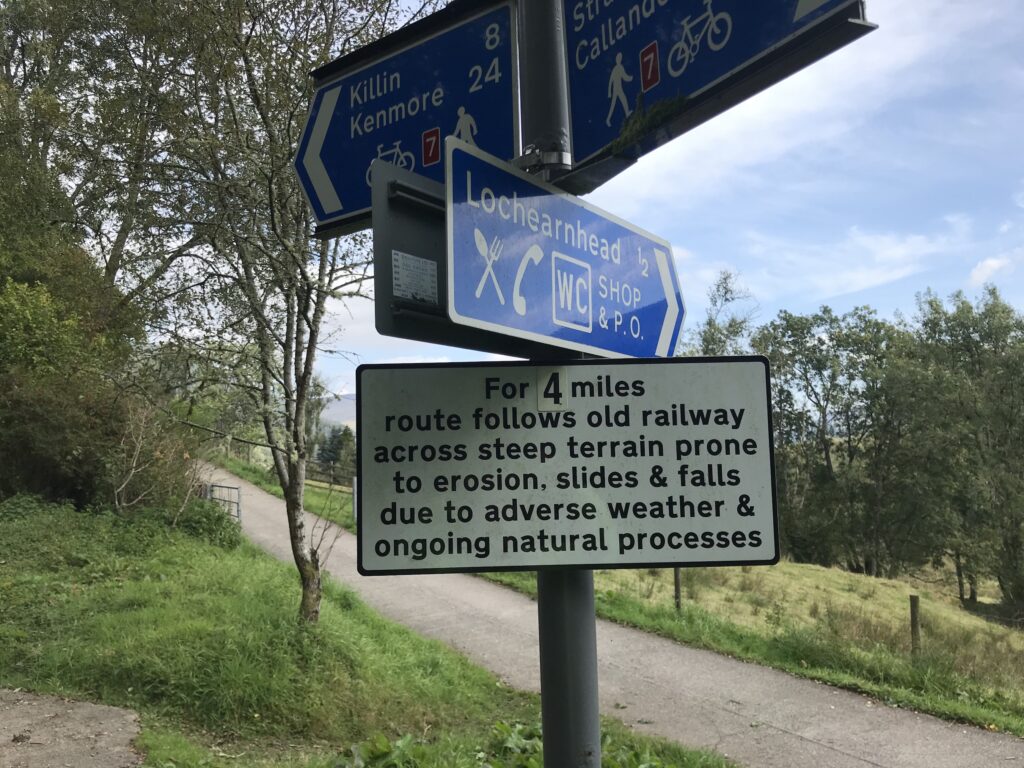
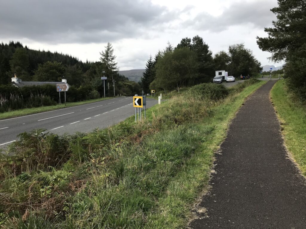
From Strathyre rejoin the cycle path. Continue to cycle along and eventually the cut-off for the village of Lochearnhead will be reached.
Here there is a sign below the sign to the village that warns of “steep terrain prone to erosion, slides & falls” on the route to Killin.
The first mile or so is very steep and winds it’s way gradually up the hill. As it turns out, though, it is on a fine paved surface. Then the path, although still relentlessly uphill, is on a white gravel surface, which is fine. There is no sign of erosion or falls. Perhaps the path was upgraded after the sign was erected?
Once onto the gravel surface the path continues steadily upwards. The slope isn’t too steep but the path climbs upward for such a long time it can be tiring.
As with Loch Lubnaig, the height of the cycle path provides fine views over the loch and the village of Lochearnhead.
Further along there were also views across to the main road on the other side.
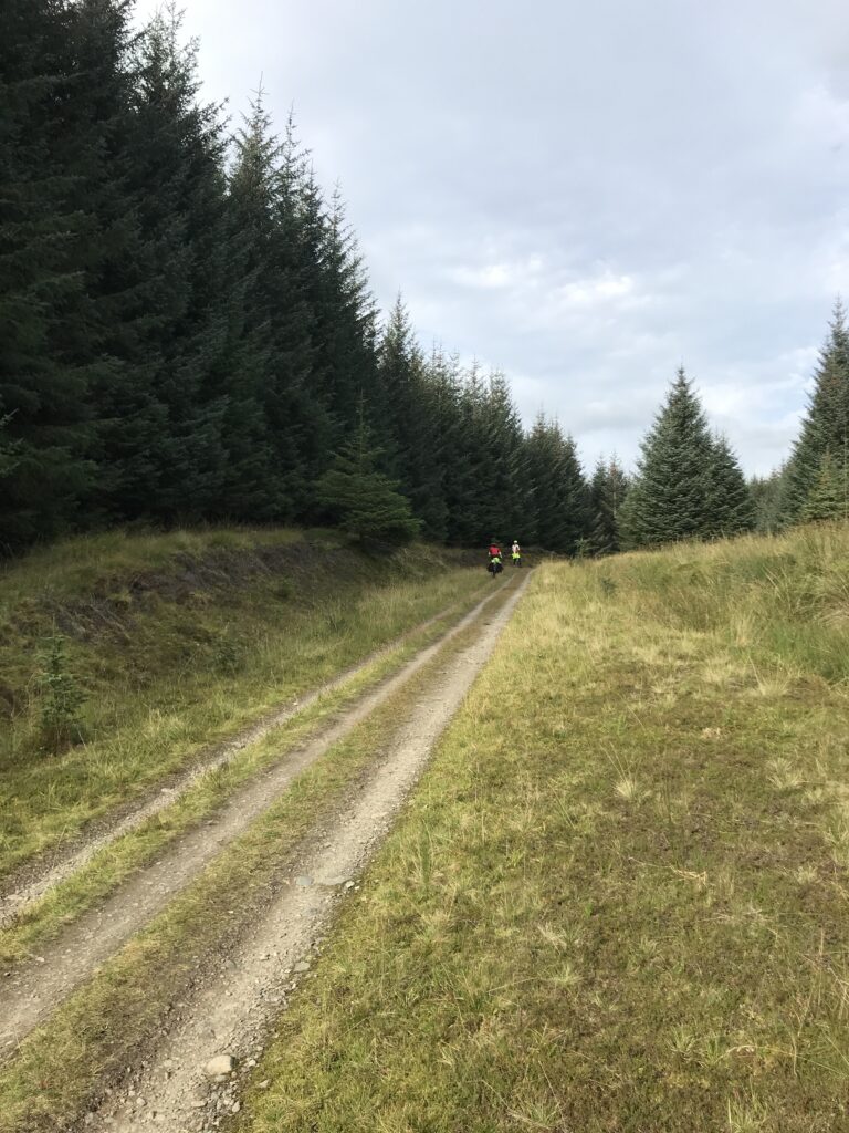
At the top the path eventually emerges at a junction with the A85 road to Killin. Once you cross over this road it is a short distance up to the start of a forest track at Glenoglehead. Here there is a snack van with tables and chairs.
Glenoglehead - Killin
The forest track has narrow ruts and is a bit stoney at times. Also, it is steeply downhill most of the way to Killin. Consequently the going is quite difficult at times.
The track eventually emerges from the forest at the junction with the A827. Here you turn right and follow the road into the popular tourist village of Killin.
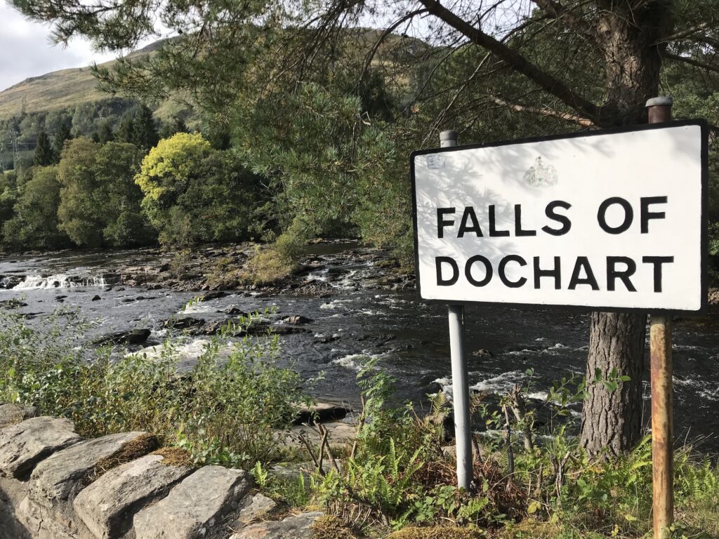
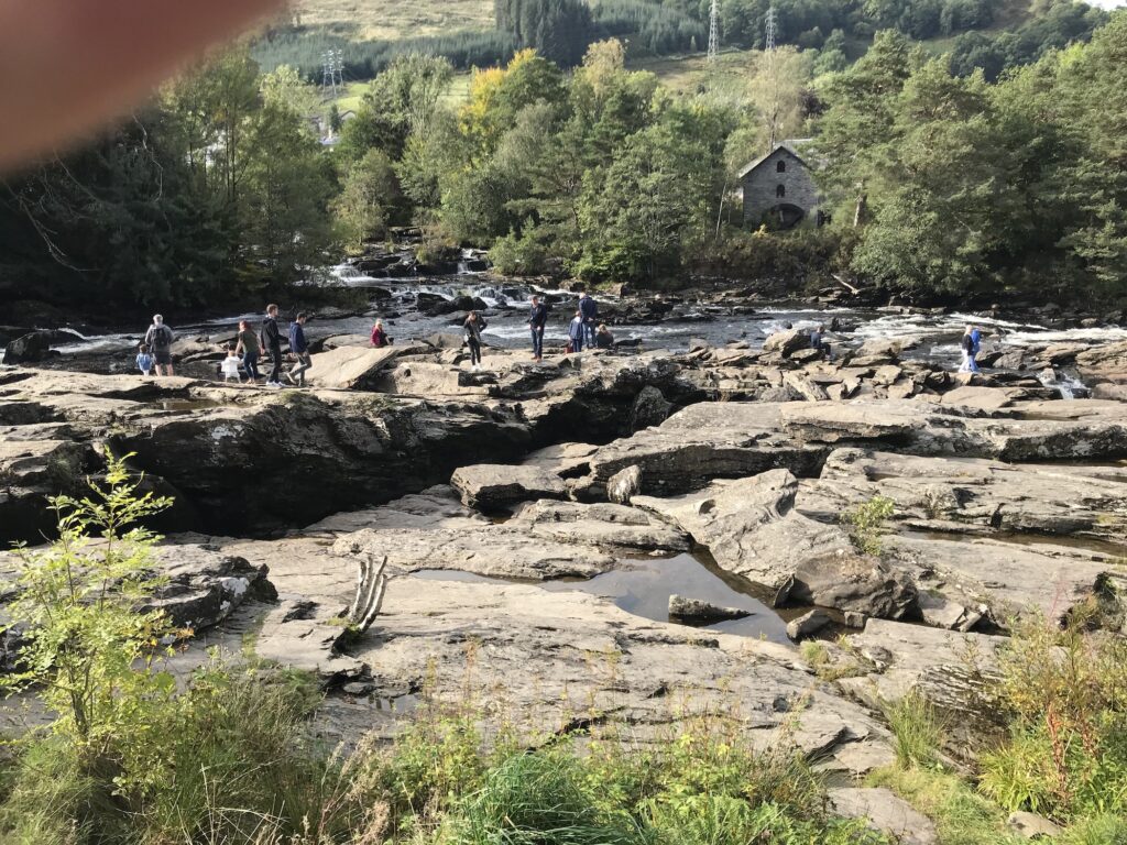
At the start of Killin are the very popular and picturesque rapids called The Falls of Dochart.
In the summer months there are always lots of tourists out walking and exploring on the rocks around the rapids.
To get into the Main Street of Killin cycle past the rapids and turn left over the narrow ancient bridge over the river. On the Main Street there are shops, cafes, restaurants and hotels.
Return to Killin
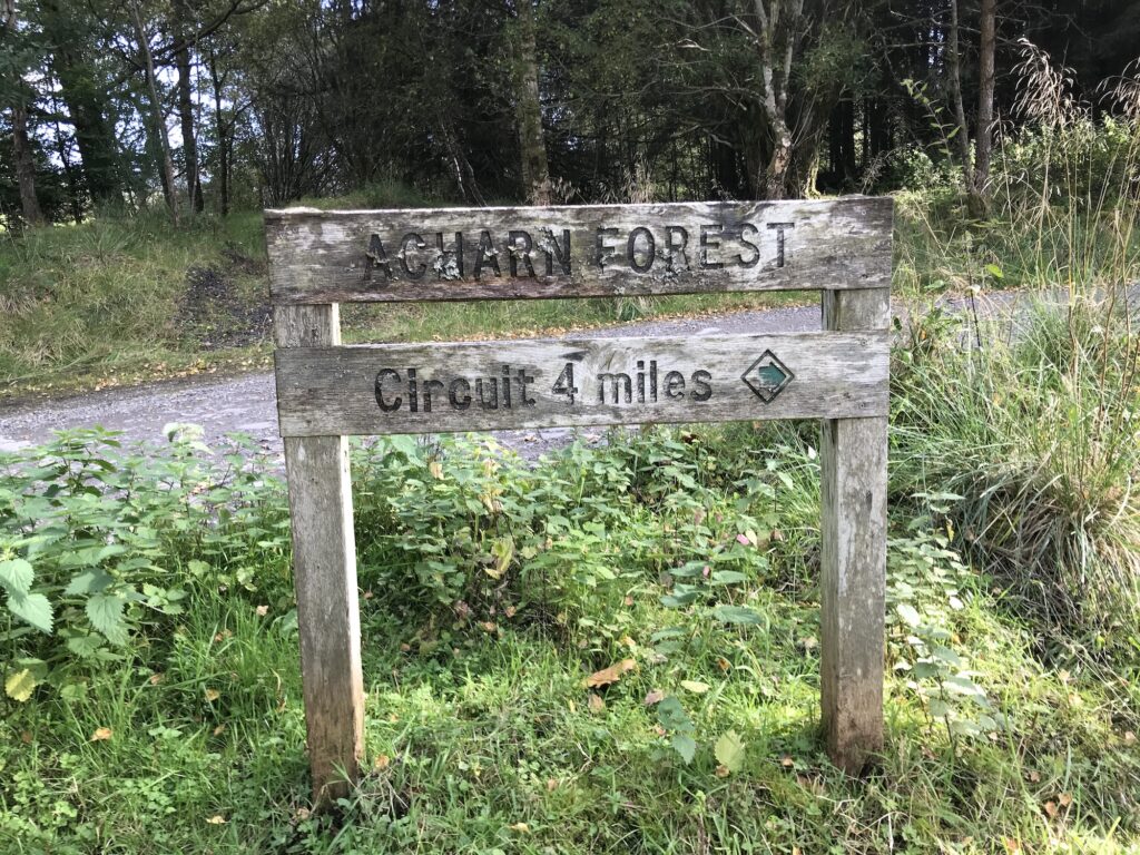
Cycle back to the start of the track through the forest, which is called Acharn Forest.
Although this is a private forest it also caters for recreational users. This can be seen from the old sign at the start of the track that indicates a circuit through the forest for walkers and cyclists.
As the outward journey through the forest to Killin is steeply downhill, obviously there is a stiff climb back up the hills on the return journey to Callander.
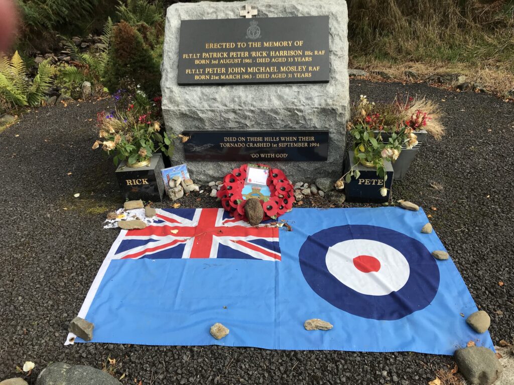
Near the end of the uphill track there is an impressive monument to two fighter pilots in their thirties who had died when their Tornado fighter jet crashed in the hills around here in 1994.
After leaving the forest track cross back over the A827. Then pick up the gravel path at the top of the road. From here it is an easier ride for the next hour or so as it is mostly downhill.
Then it is a climb back up to the top overlooking Loch Lubnaig. After this it is undulating for a while.
Eventually you get back to the narrow zig-zag track leading down from the forest road above Loch Lubnaig. Descend here slowly and carefully to avoid any falls and get down to the bottom safely.
It is good to get back onto the level cycle path that leads all the way back to Callander.
Route Alternatives -
Cycle Routes in Scotland : Callander to Killin (NCN 7)
This being a linear route it could be cycled in reverse by starting at Killin and cycling to Callander. There are a couple of free car parks at the end of the Main Street in Killin.
Alternatively, the route could be shortened by starting and returning to one of the villages on the route, such as Strathyre or Lochearnhead.
Cafe / Toilet Stops -
Cycle Routes in Scotland : Callander to Killin (NCN 7)
There are several facilities in both Callander and Killin, including public toilets.
At the Strathyre Cabins complex there is a shop/cafe that is open to non-residents.
In the village of Strathyre there is a pub / restaurant and a local shop.
In the pretty village of Lochearnhead there is a cafe, a restaurant and a hotel.
There is a mobile snack bar at Glenoglehead at the top of the A827, before you head into Acharn Forest.
Train Options -
Cycle Routes in Scotland : Callander to Killin (NCN 7)
Unfortunately there is no train station in Callander. The nearest station is at Dunblane, which is about 11 miles away.
There is no train station either at Killin. The nearest station to Killin is at Crianlarich, which is about 13 miles away.
If you want to access the start of the route by train your options to do so will of course depend on where you live and what train lines are nearby and where they run to, which each person will need to investigate for themselves. For a website that can help with this click on the following website address : https://www.thetrainline.com.