Cycling Loch Lomond West Glens – 6 Jun 21: This is one of my cycle routes in Scotland that I have cycled on a regular basis. It is included in the list of cycle routes in Scotland on My Day Trips page (click here to go to this page).
This route consists of cycling up the roads in two glens and alongside three lochs. The glens are Glen Fruin and Glen Douglas. The lochs are the Gareloch, Loch Long and Loch Lomond.
Over the last couple of years I only cycled the two glens separately. I last cycled the complete route in 2018. Now I thought that I would like to cycle the complete route again.
Also, I wanted to take photos and gather info on eating places for my Route Details blog on the Loch Lomond West Glens route. (Click here to go to this blog)
Route Map - Cycling Loch Lomond West Glens - 6 Jun 21
The map above is an interactive map. Press “Play” (click on the white triangle in the middle of the screen) to activate it. You can then zoom in or out by pressing the buttons that appear in the top left of the screen. The map can be moved by dragging it. Once you press Play the hills profile of the route will appear at the bottom of the map. Further comprehensive detailed analysis of the hill profile can be obtained by clicking on “More Detailed Profile” at the top left of the hills profile section. You can also select full screen mode by clicking on the icon in the top right corner of the map.
Timings and Distances - Cycling Loch Lomond West Glens - 6 Jun 21
Anytime I cycle on one of my cycle routes in Scotland I use this section to record trip details. I record the times I took for the various parts of the day and the distances cycled. This includes when I started cycling and how long I cycled for between various points in the route. I also record the distances (in miles) between various points in the route and how long I rested for, etc.
I included this section so that I can look back at the timings and distances to help me plan my day if I decide to do this trip again. This section could also assist others with planning their day if they decide to do this route. Each person, of course, will have to adjust the timings to suit their own circumstances, e.g. cycling speed, rest times, etc.
(Note: The figures in brackets are the cumulative distances in miles from the start of the route.)
Arrived at parking at 9.10 / Started cycling 9.35 / Road to Glen Fruin 10.10 – 10.20 (3.8) / Top of other end of Glen Fruin 11.30 (10.22) / Bench overlooking the Gareloch to 11.35 / Bottom of Glen Fruin Road 11.42 (11.37) / Garelochhead 11.55 (12.69) / Lunch to 12.20 / Whistlefield picnic area 12.40 (13.90) / Green Kettle Inn 12.50 (14.47) / Finnart Ocean Terminal 1.00 – 1.15 (15.90) / Glen Mallan Jetty 1.20 – 1.25 (17.09) / Start of Glen Douglas road 1.40 (19.26) / Top of pass in Glen Douglas 2.00 – 2.05 (20.1) / Rested 2.40 – 2.45 / A82 road at Inverbeg 2.55 (25.32) / Luss 3.20 – 3.55 (28.65) / Duck Bay 4.50 (35.53) / Back at car 5.05 ( 37.01) / Left 5.30.
Computer Readings - Cycling Loch Lomond West Glens - 6 Jun 21
At the end of each trip there are a variety of readings on the bike’s computer. I normally just clear these. This time though I thought that I would record them. It may be interesting to review them as the years go by.
For Cycling Loch Lomond West Glens – 6 Jun 21 the readings are as follows :
It is a bit puzzling that the trip time is displayed as 4 hrs. 32 mins. given that I was out on the road for 7.5 hours. Part of the reason, of course, is the rest periods I had, which amounted to about 1.5 hours.
Another explanation is that I stopped many times to take photos. Also, I stopped a couple of times to speak to people I met on the way.
The only other reason I can think of is that perhaps the computer only records the time when the pedals are turning. The many times that I free-wheeled on this trip would therefore not be recorded.
Log - Cycling Loch Lomond West Glens - 6 Jun 21
The weather at the start of the day was good. It was bright with high white clouds and patches of blue sky. There was only a gentle breeze.
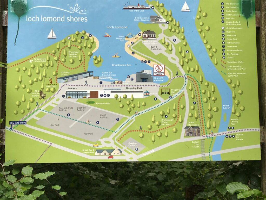
Loch Lomond Shores, Balloch
The Loch Lomond West Glens route commences at the Loch Lomond Shores visitor attraction, which is on the outskirts of the town of Balloch. Balloch is located on the southern shores of Loch Lomond. It’s main street is a thriving tourist area.
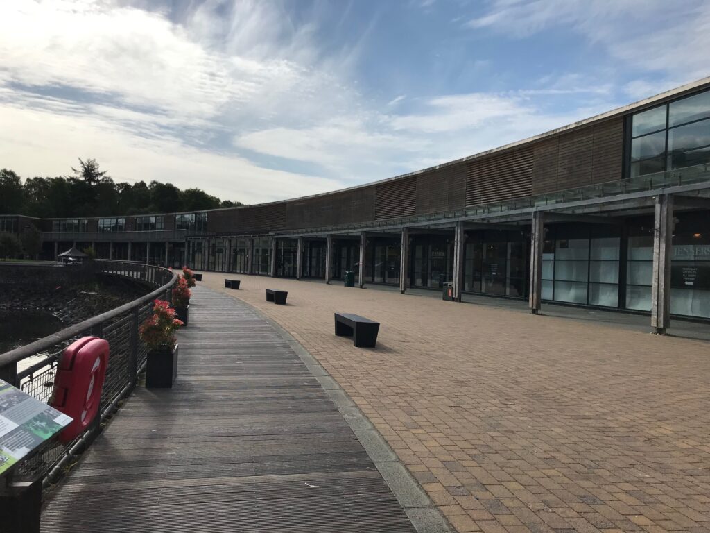
At Loch Lomond Shores there is an indoor shopping mall. There are also attractions like the Bird of Prey Centre, a Tree Zone aerial adventure course and Adventure Golf.
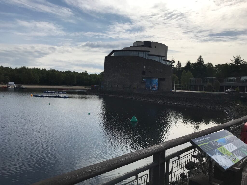
In the large building on the side of the loch there is the Sea Life aquarium.
As well as the indoor shopping mall there are also shops, cafes and restaurants outside overlooking the loch.
Balloch - Glen Fruin
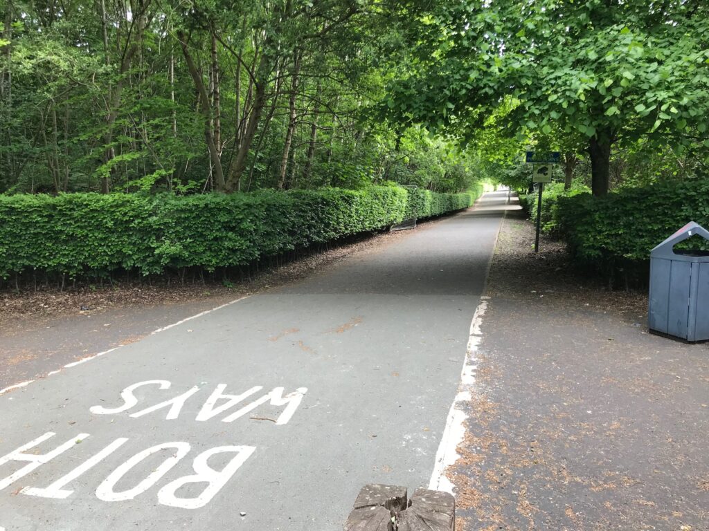
The first section of the Loch Lomond West Glens route is on the West Loch Lomond Cycle path. This path runs along the back of the free car park at Loch Lomond Shores. To get to the cycle path I turned left onto the walkway that runs alongside the car park.
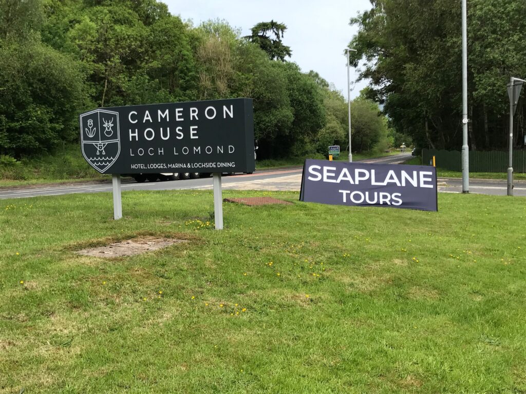
At the end of the walkway I turned right onto a road. I followed this road to the top of the hill. On the right here is the start of the cycle path, which can be narrow and bumpy at times. The path leads past the Cameron House Hotel and Lodges, where seaplane tours are available.
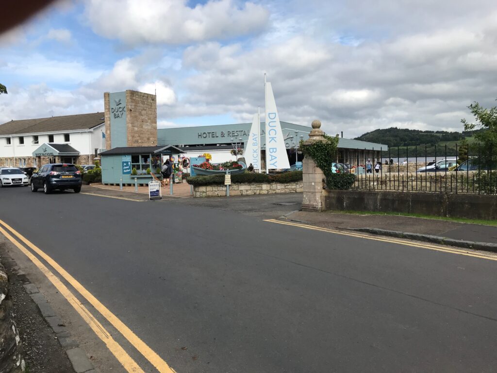
After this I continued for a short distance on the road that leads to Duck Bay. This area is very popular with tourists. Here there is a hotel and marina and there are large grassy areas with picnic benches.
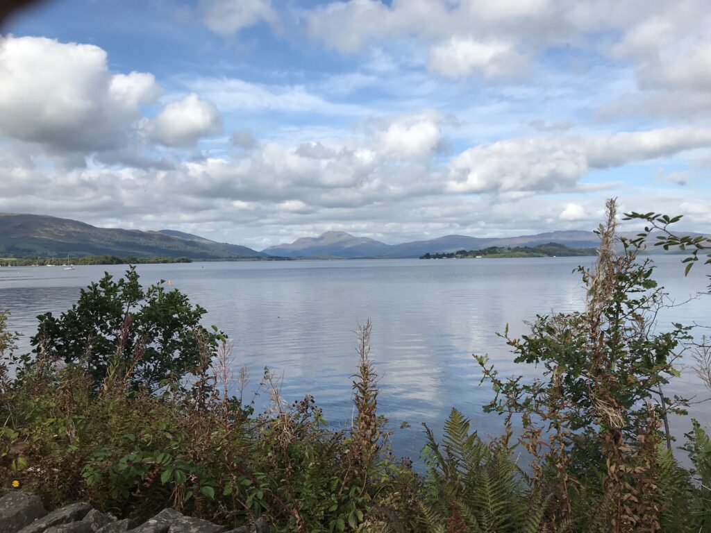
I stopped at Duck Bay for a few minutes to admire the fine views across Loch Lomond towards Ben Lomond.
I cycled along the narrow road round the bay, past all the parked cars. At the end of the road I picked up the cycle path again.
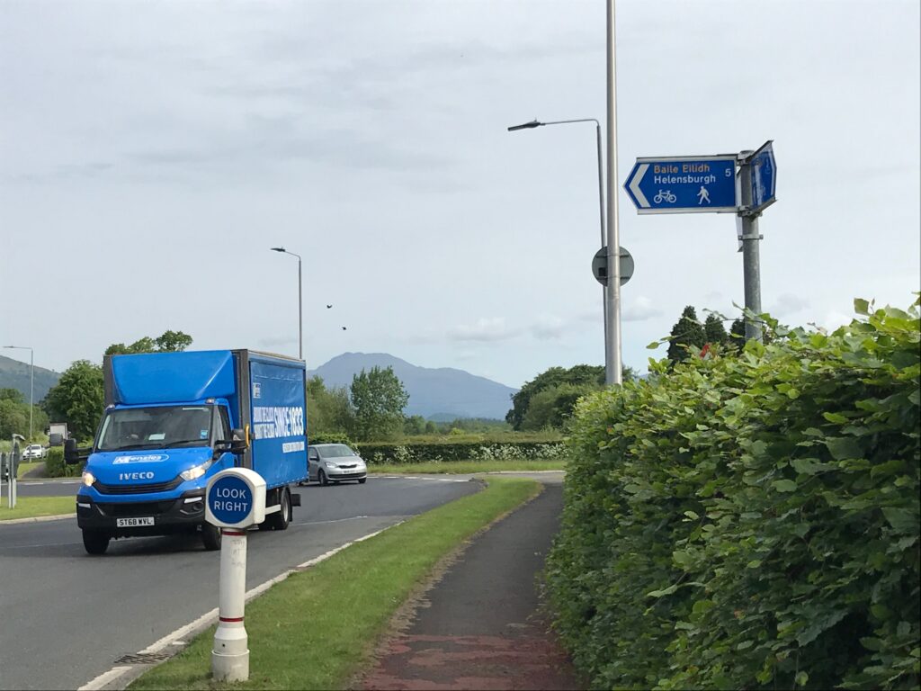
I continued on the path until I reached the Arden roundabout. At this roundabout I needed to turn left onto the Helensburgh cycle path. This cycle path runs alongside the A818 road to Helensburgh.
To do this I had to cross the very busy A82 road, which is busy in both directions. There are two spots where you can cross. I chose the second spot which is just a few yards past the first spot. It has an island in the middle of the road that makes it much safer and easier to cross.
Glen Fruin
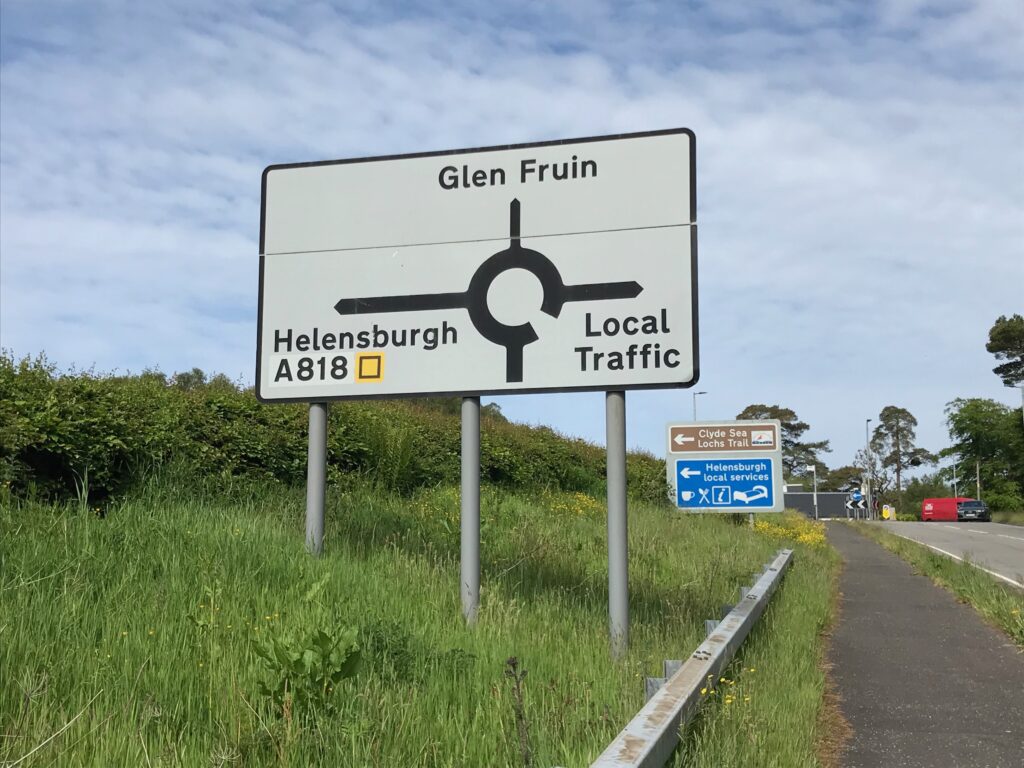
After crossing the A82 I cycled up the hill on the Helensburgh cycle path. At the top of the hill there is a small roundabout. The main road to Helensburgh is on the left. The narrow, single track road up Glen Fruin is straight ahead.
By the time I got to the Glen Fruin road it was still bright with high white clouds and blue skies. Also, there were sunny intervals and it had become quite warm. I stopped to take off my fleece top and to convert into shorts, prior to the climb up the glen.
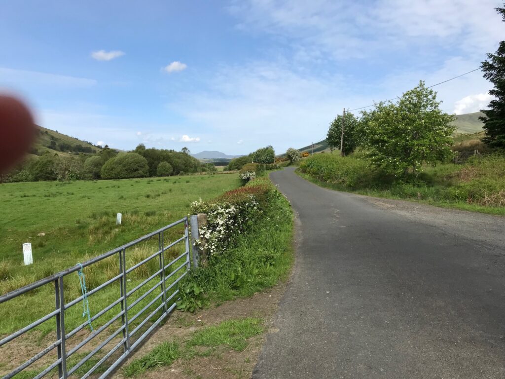
The first section up Glen Fruin is a steady climb and not too steep. After the top of the first climb there is a long, steep winding descent. At the end of this descent there is a road that leads off to the left over a bridge. I ignored that and continued cycling straight on.
The road then levels out as it goes along the floor of the glen.
The weather continued to be bright and sunny, so I was glad that I had taken my fleece top off and had converted to shorts.
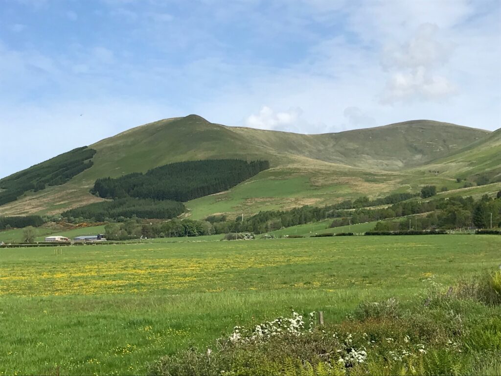
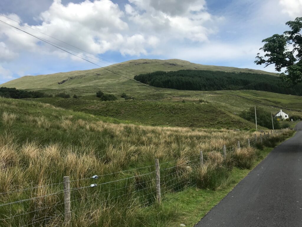
I continued cycling along this pleasant stretch of road. Some distance along I could see on my right the hill called Beinn Tharsuin. This is a low level hill walk that I normally do in the winter months.
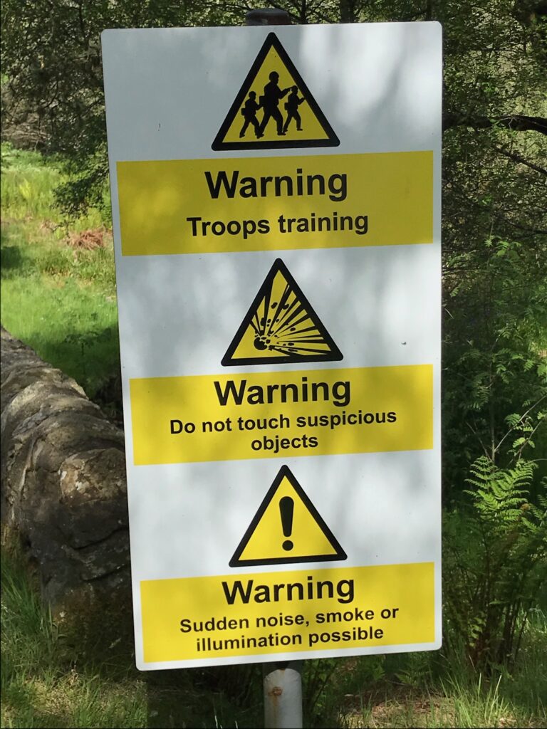
I continued cycling until I reached the other end of the glen. The area around this end of the glen is used by military personnel. This is confirmed by the warning signs that are scattered along the side of the road.
In all the years I’ve cycled this route I’ve never seen anything mentioned in the warning signs, let alone a soldier.
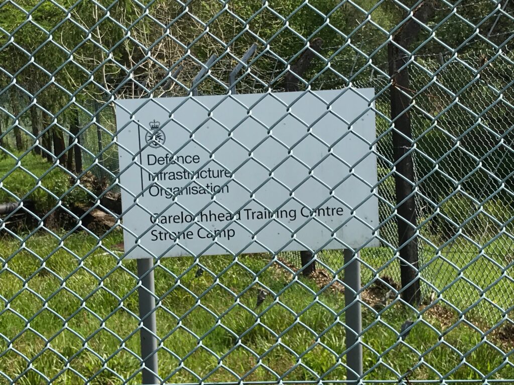
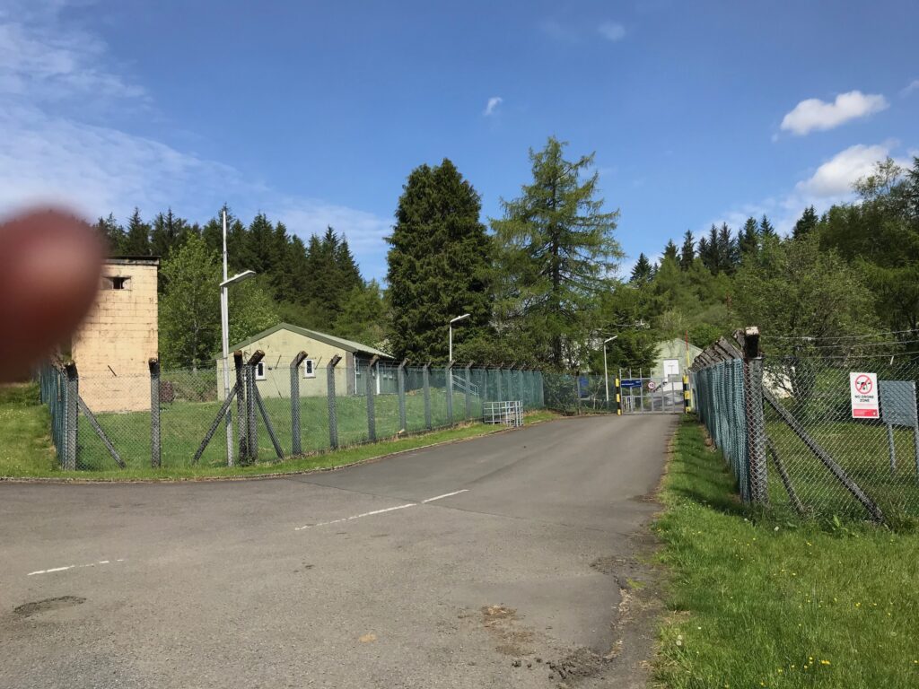
Nevertheless just past the first of these signs there are army barracks that are used as a training centre.
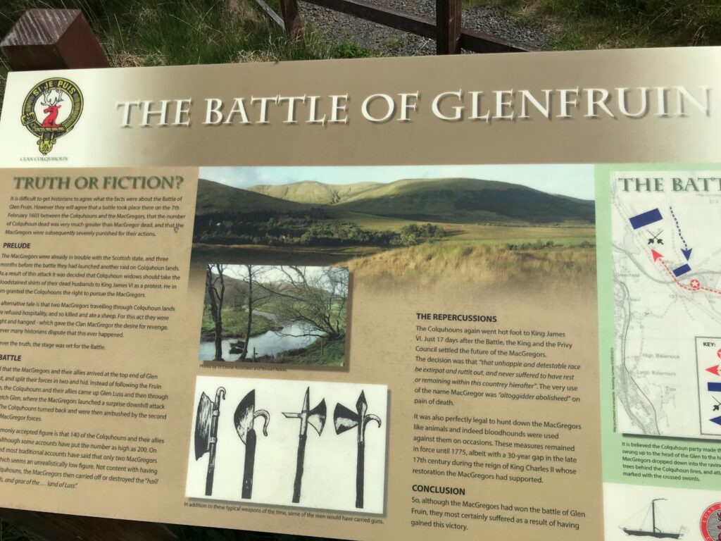
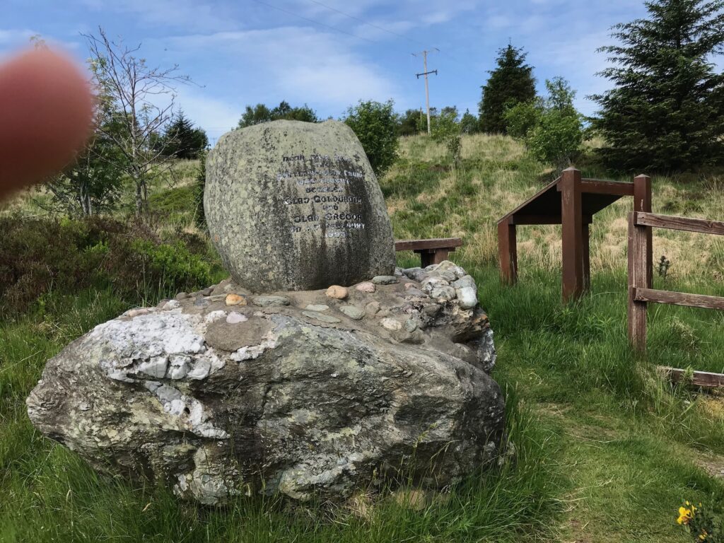
Just past the army barracks there is a monument to a clan battle that was fought near this spot. The monument is accessed via a set of stairs on the right of the road.
The Battle of Glen Fruin took place in 1601. It was between the Colquhouns and the McGregors. An information board and an engraved boulder at the site give full details of the battle.
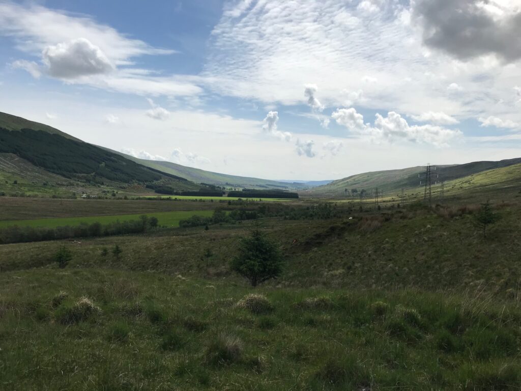
The road then commences to climb steeply up to the high point at this end of the glen. From here there are good views back down the glen.
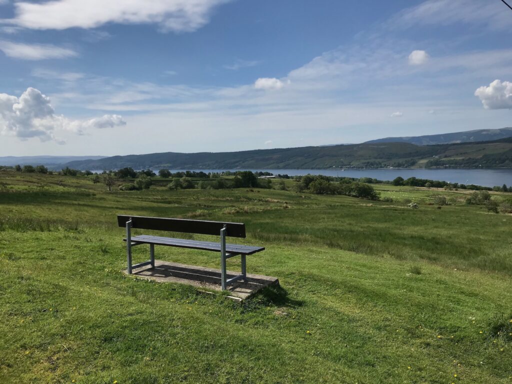
After passing this high point there is a steep descent that affords the opportunity for some welcome free-wheeling. Half-way down the descent there is a bench overlooking the Gareloch, where I normally stop to admire the view.
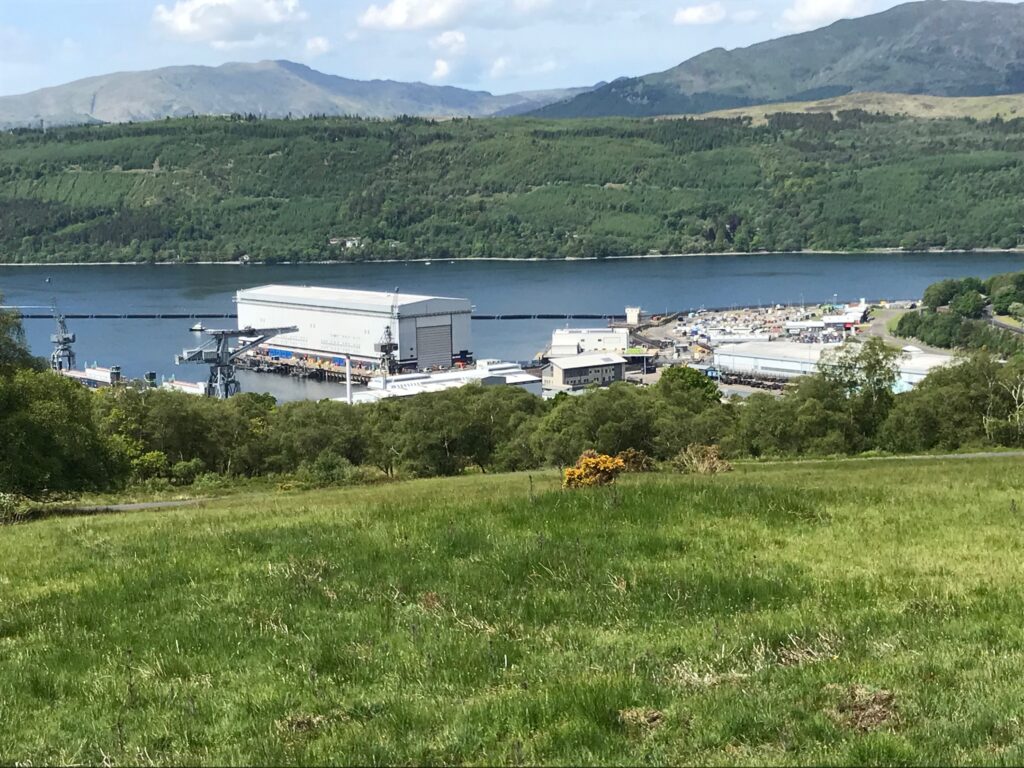
The view down to the left is good, as shown above. However, the view down to the right is spoiled by the Faslane naval base for nuclear submarines.
I continued on the very steep and winding descent all the way down to the A814 Arrochar road at the bottom of Glen Fruin. Here I crossed over the road and turned right onto the cycle path that skirted the Faslane naval base.
Faslane - Garelochhead - Loch Long
This cycle path runs alongside the high barbed wire fence that surrounds the naval base. At the roundabout where the entrance to the naval base is I took the first exit onto the B872 road.
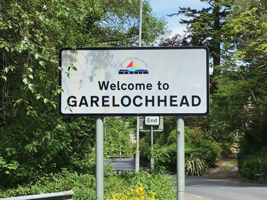
The cycle path continues on the pavement alongside this road all the way to the outskirts of the village of Garelochhead. Here the pavement narrows so I cycled the last short distance into the village on the narrow road.
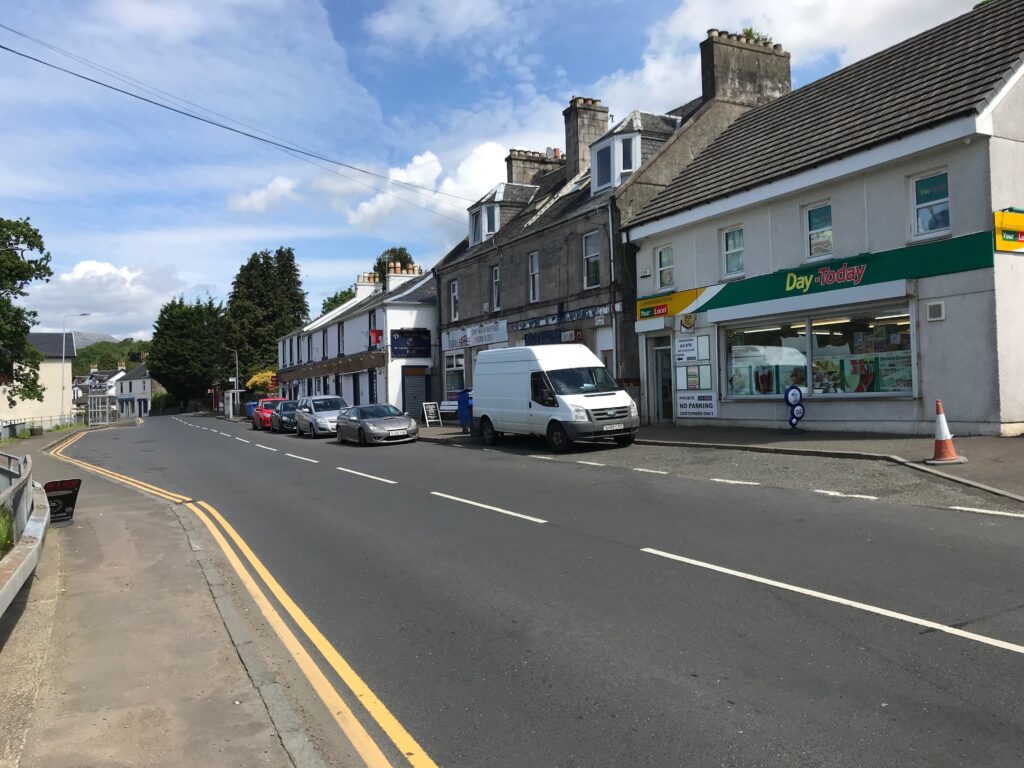
Throughout the morning the sun was out most of the time and there wasn’t too much wind. The sun was still out when I arrived in Garelochhead, so I decided to stop there to eat my lunch.
I found a bench next to a phone box on the main street that overlooked the loch. I sat at the bench and ate my sandwiches and drank some juice, whilst admiring the views over the loch.
In Garelochhead the facilities included the Perch cafe, the Anchor Inn, a Chinese takeaway, a deli shop, a convenience store and a hardware store.
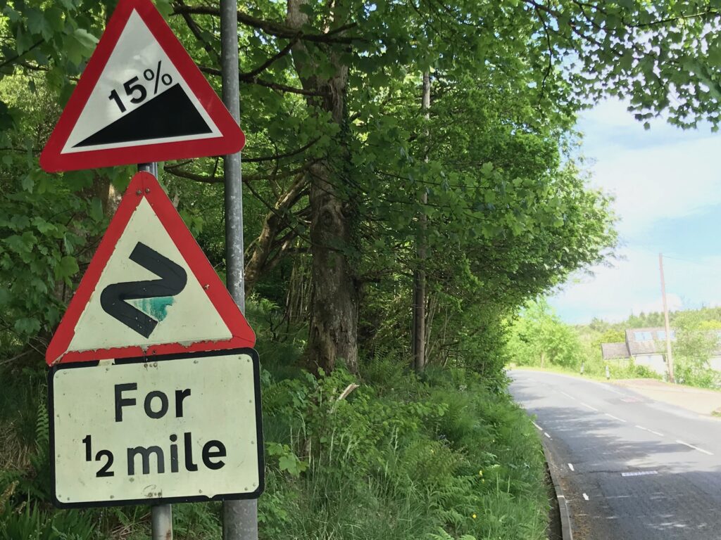
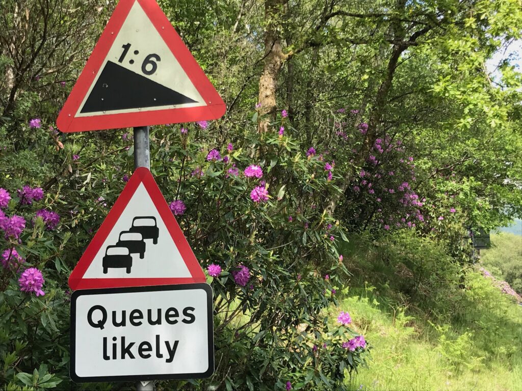
After lunch I cycled out of the village and continued to follow the B872 road. Further on I reached a junction with the B833 road. Here I continued round to the right to follow the B872 road. At this point the road starts to climb really steeply on a 15% gradient.
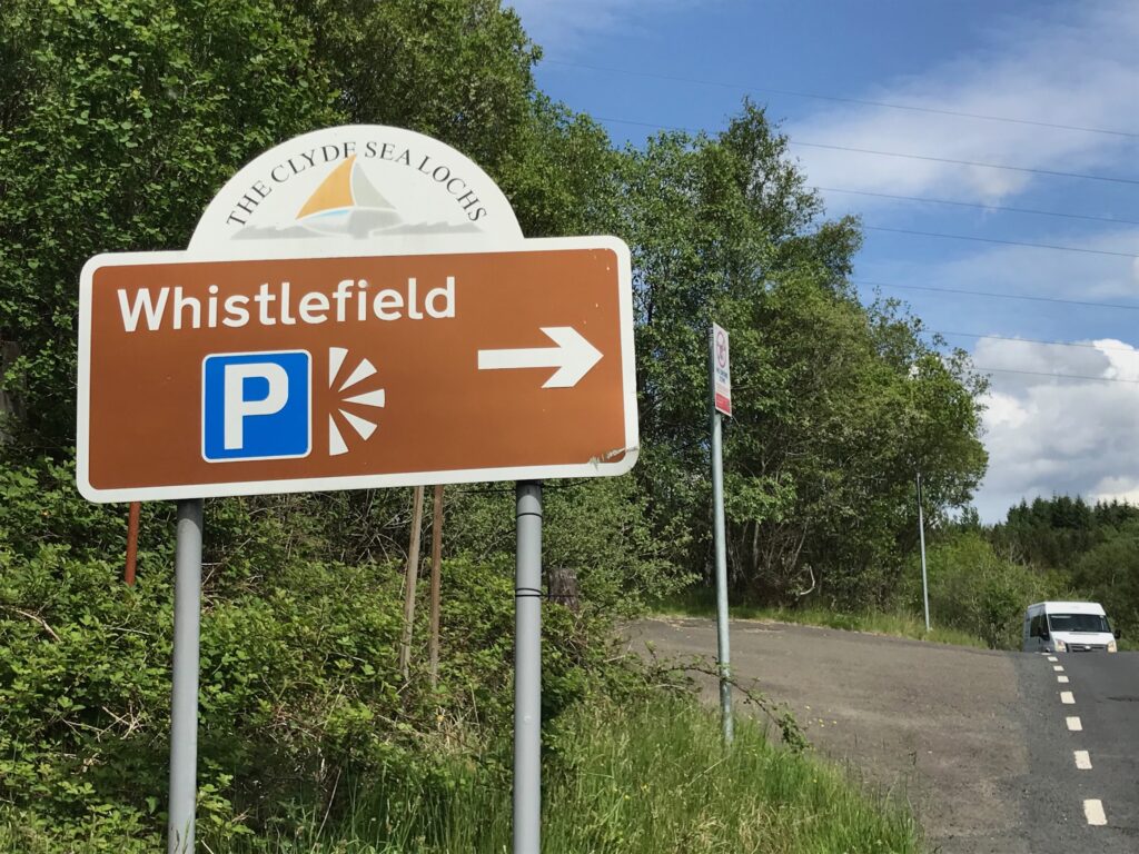
At the top of this road there is the Whistlefield Picnic Area where I stopped for a welcome rest.
The information board here advises that the name of Whistlefield derives from the days of the stagecoach. The stagecoach driver would blow his whistle when part way up the hill. This would alert the innkeeper at the top of the pass to be ready for customers and horses.
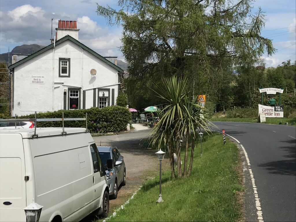
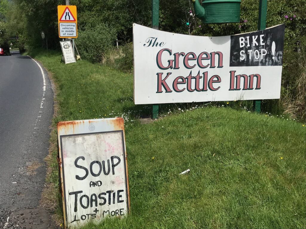
I continued on the B872 until I reached a roundabout where I went back onto the A814 road. Further along this road there is the Green Kettle Inn that serves meals and snacks.
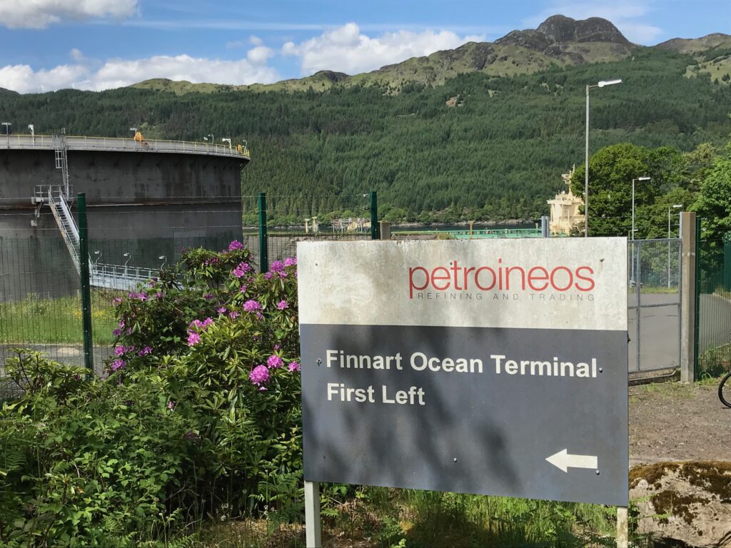
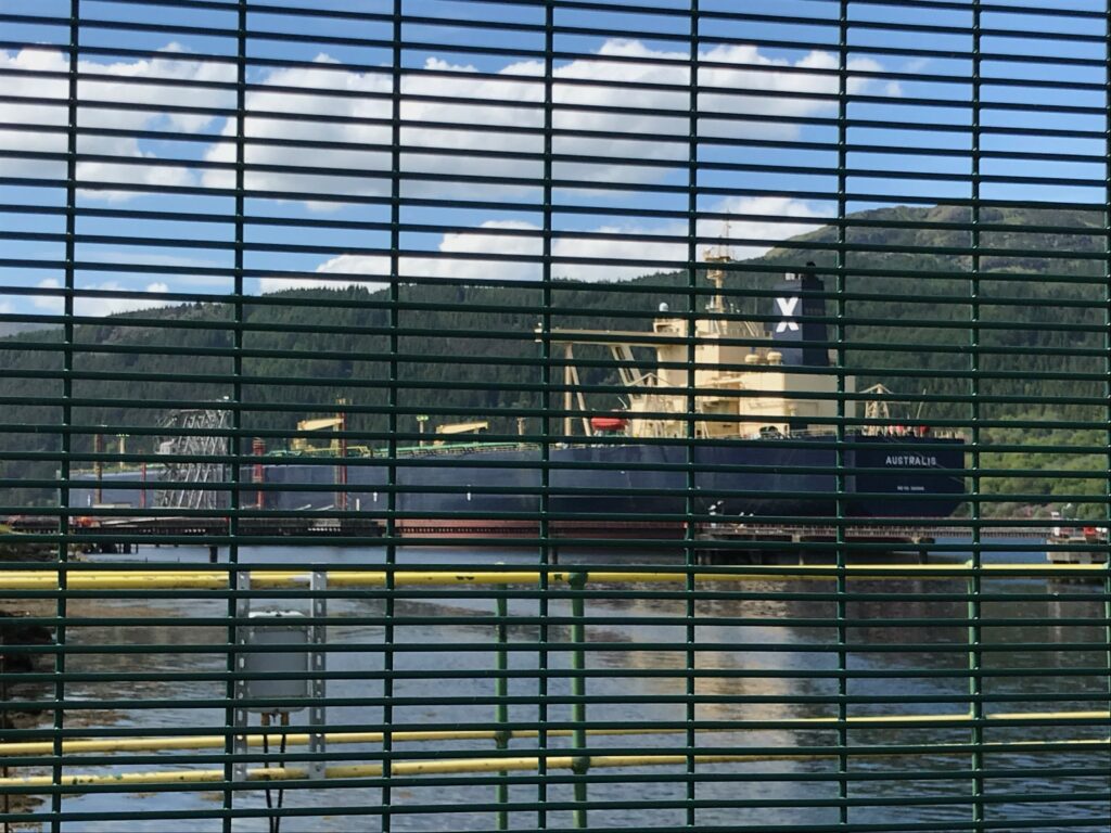
After leaving Whistlefield the route was undulating with some quite steep ascents and descents. I then came to a steep descent that led to the Finnart Ocean Terminal on Loch Long.
When I passed by there was a large oil tanker berthed at the terminal. I could only manage to glimpse it through the wire fencing at the terminal.
The weather had continued to be fine and warm and mostly sunny. I stopped at Finnart to take off my cycling jacket, prior to the climb up Glen Douglas. I also put sun cream on my face, arms and legs. On my saddlebag I dropped down one of the pannier sections and put my cycling jacket and fleece top in it.
From this point the route continued alongside the shores of Loch Long. The road here was undulating but it wasn’t too difficult. This was a fine part of the ride with nice scenery.
Glen Douglas
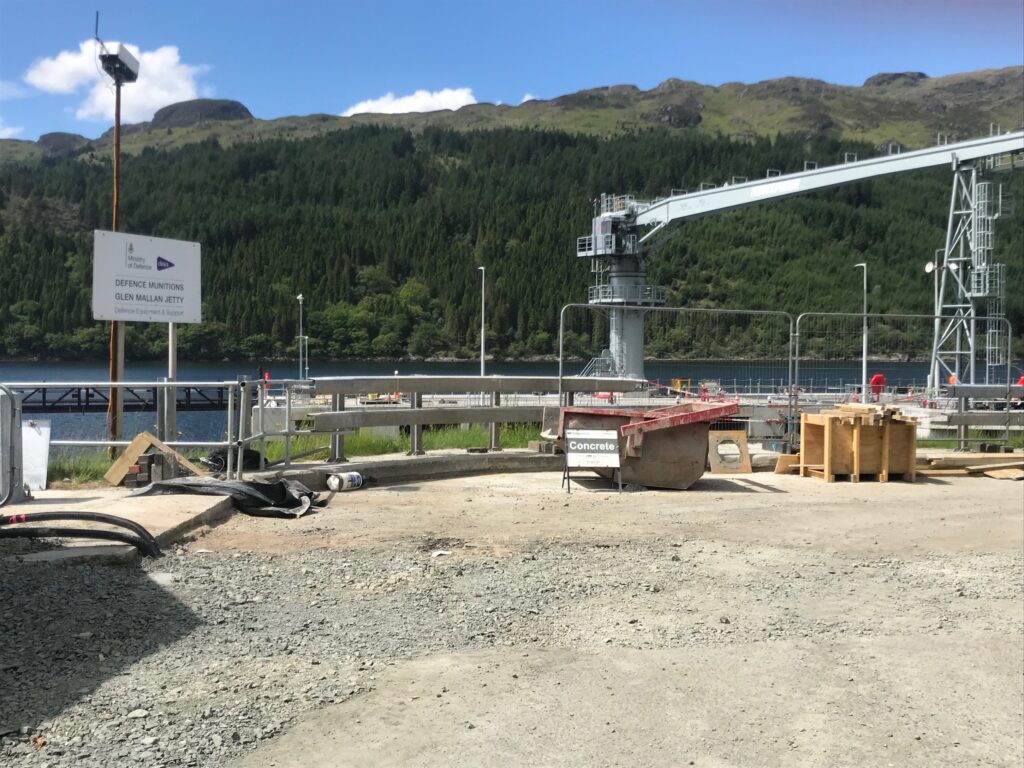
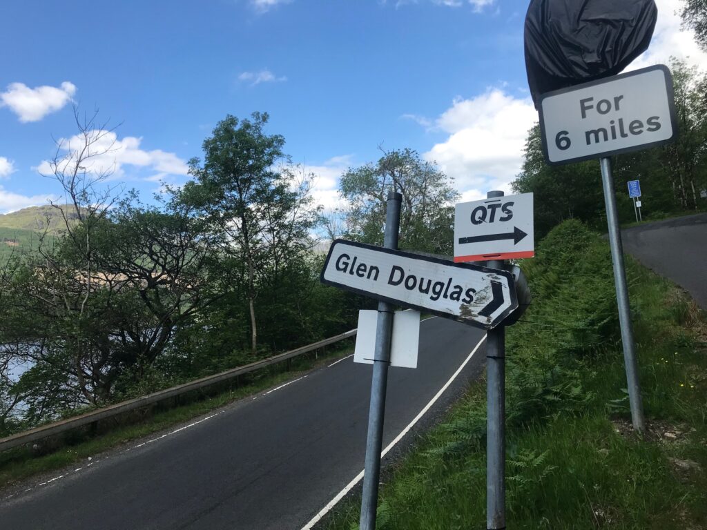
Further along I came to the restricted Ministry of Defence access road to Glen Douglas. This is across from the Glen Mallan Jetty.
I cycled past this and then came to the public access road to Glen Douglas.
Needless to say, since taking off my cycling jacket and putting on sun cream the sun had gone behind the clouds. It was okay though as it was still bright and warm and I was about to climb up the steep road up Glen Douglas.
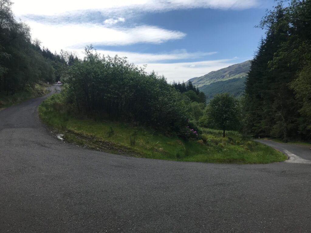
This road consists of steep climbs up to two hairpin bends, then a long steep climb to the top. Despite using the second level of assistance from the electric motor I was still out of breath by the time I reached the first hairpin bend. (At this point I was too stubborn to move up to a higher level of assistance.) I stopped to get my breath back and to take a picture of the hairpin bend.
I continued in TOUR mode until I got to the second hairpin bend. Again I had to stop to get my breath back.
From here it was a steady, straight climb, but it was very steep. As a result, a short distance after this I had to move up to the third level of assistance, the SPORT mode, to get me up to near the top of the pass. Near the top it levelled out a bit and I went down to the first level of assistance, the ECO mode, to get over the top.
From the top there was a descent down to the Glen Douglas Munitions Depot and then there was a steep climb up the side of the depot.
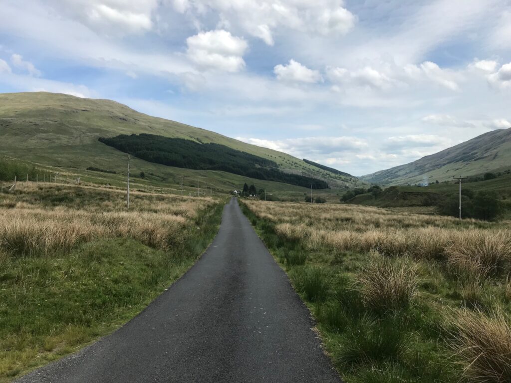
After this there was a long descent which was really good and welcome. There was then a stretch when the route was undulating, and then there was a steady descent again.
As I continued cycling along the glen the sun had gone behind the clouds again. Also, there was a bit of a wind blowing up the glen. It was okay though as it was still bright and warm.
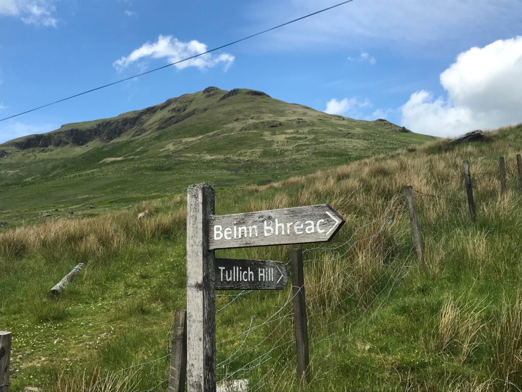
Eventually I came to a spot that I knew from my hillwalking trips. It was where there was a signpost to Tullich Hill and Beinn Bhreach.
The sign post was at the bottom of Tullich Hill, which I’ve not yet climbed. Beinn Bhreac was just a short distance further along. This is a hill that I’ve climbed many times. At the top there are fantastic views up and down Loch Lomond and across to Ben Lomond.
I continued cycling along to near the end of the glen. By this time I was feeling quite tired so I stopped for a rest. I only stopped for five minutes as I was planning on a longer stop when I got to Luss.
When I reached the end of the glen there was a very steep and winding descent. This led down to the very busy A82 road at Inverbeg.
Inverbeg - Luss
I waited patiently to cross over this road, as there is busy traffic in both directions. On the other side of the road I turned right back onto the West Loch Lomond Cycle Path.
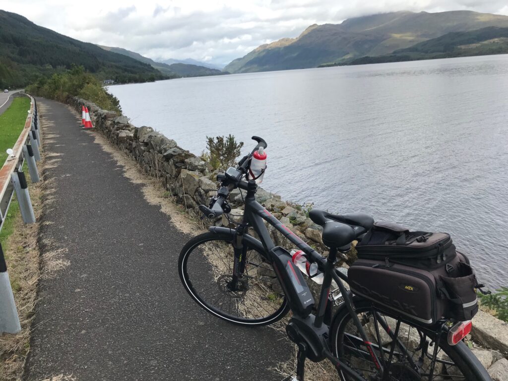
This section of the cycle path, from Inverbeg to Luss, affords great views over Loch Lomond.
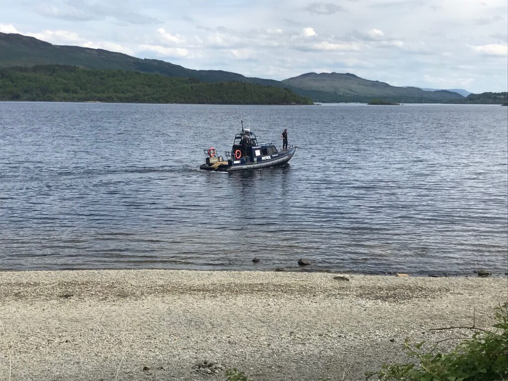
I cycled along this path, taking my time whilst admiring the views. A bit further on I noticed a police patrol boat cruising down the loch.
The presence of this patrol boat was probably mostly to deter reckless speeding by ski jets and motor boats. This has been a problem here over the past few years.
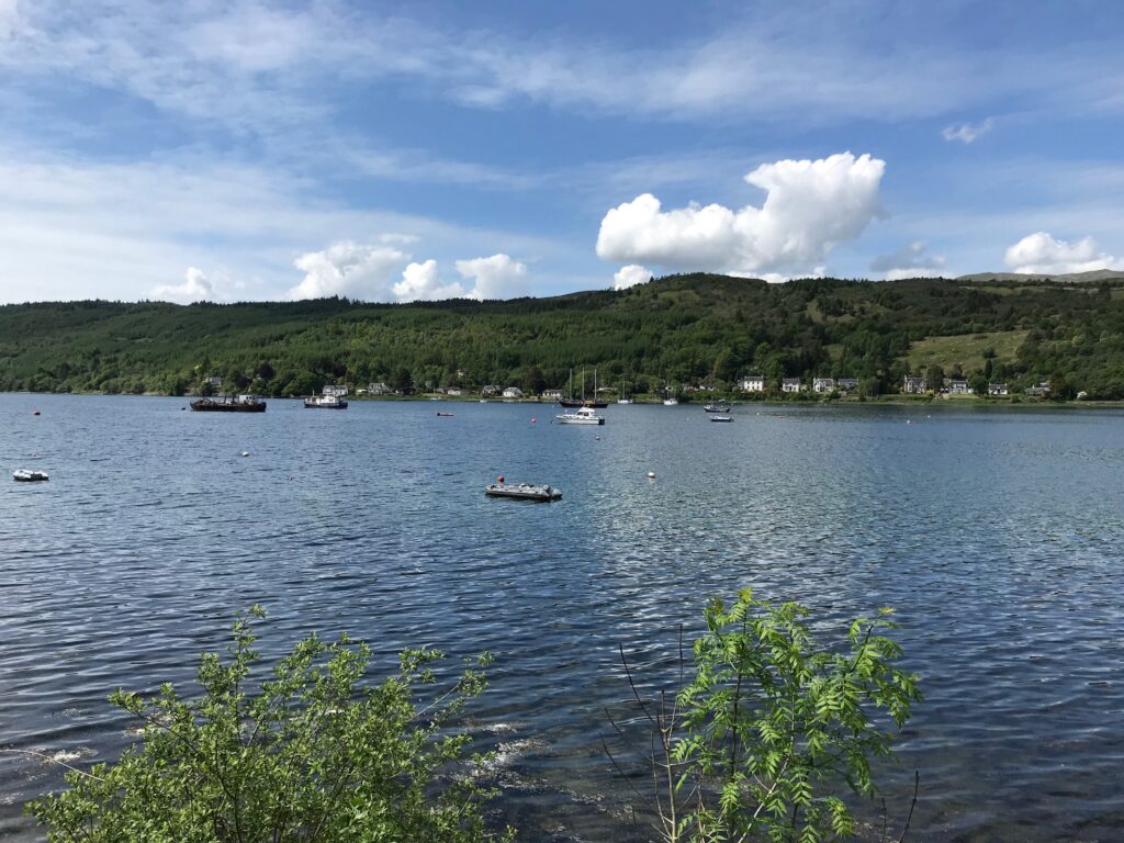
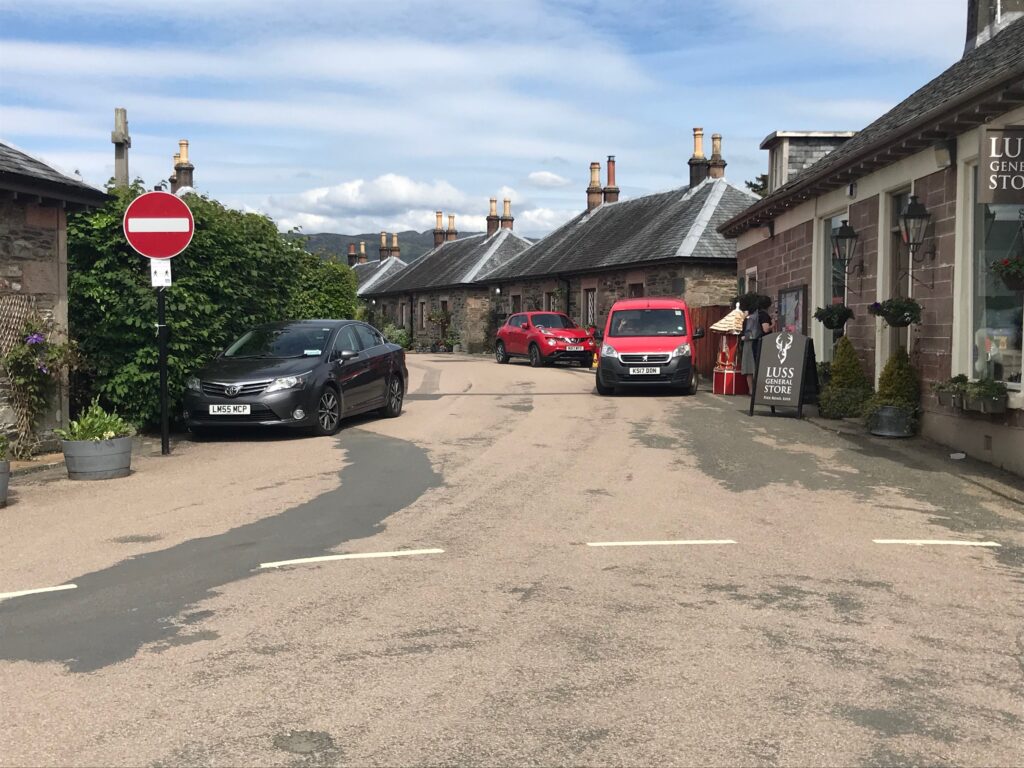
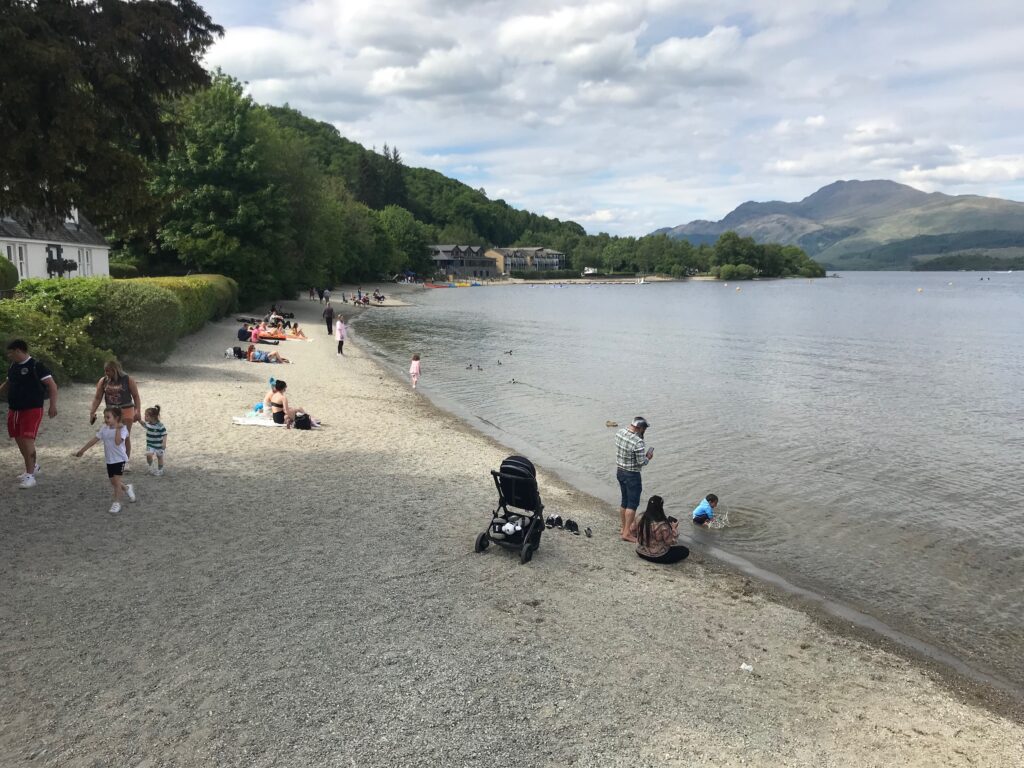
I cycled on until I reached the picturesque village of Luss. This is a popular tourist village. It has quaint cottages that attract the tourists.
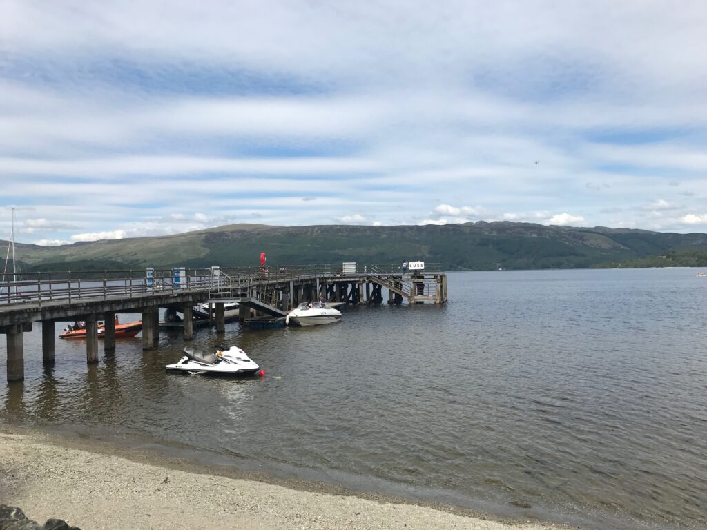
It also has a stony beach and a pier that loch cruises berth at. At the pier there is a gift shop. Also, on the pier there is a takeaway shop that serves tea & coffee, snacks and ice cream.
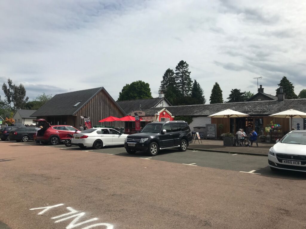
Due to its popularity it has a large car park that caters for coach parties as well as cars. At this car park there is a shop, a snack bar, a 24 hour automatic petrol station and public toilets. Due to the pressure of parking on residents a new car park has now been built at the other end of the village.
In the village there is the Loch Lomond Arms Hotel and there are also two coffee shops.
On reaching Luss I cycled around the village for a wee while. The sun had come out again and it was nice and warm. So I stopped at the pier and bought an ice cream. I also took a very welcome rest, as by this time I was very tired.
Luss - Balloch
The cycle route from Luss is at first on a quiet road. The road passes through the hamlet of Aldochlay.
This road then eventually veers to the right to join the main A82 road. At that point I went left onto another road. This took me up to large double gates with stone pillars. Just before this I went onto the pavement where I picked up the cycle path again.
A good bit further on the cycle path comes out onto a road. I cycled along this road and passed through a gatehouse. Further along this road bends round to the left. On the right at this point there are a couple of large boulders off the side of the road. Behind these boulders is where the cycle path commences again.
I continued cycling until I reached Duck Bay again. The weather had remained sunny and warm, so I took my time and stopped for a few minutes at Duck Bay.
I then cycled back to the start of the route at the car park at Loch Lomond Shores in Balloch.
Electric Motor Assistance - Cycling Loch Lomond West Glens - 6 Jun 21
The first time I used the electric motor was on the small hill up the Helensburgh cycle path. I cycled half-way up the hill unassisted. I then used the first level of assistance, the ECO mode, to get me up to the top of the hill.
On the first section of the climb up Glen Fruin I managed some of it unassisted but at times I had to use ECO mode.
On the level stretch of road along the floor of the glen I didn’t need any assistance from the electric motor.
However, when I got to the other end of the glen I again needed to use the ECO mode at times. This was especially true when climbing up to the high point at that end of the glen.
I didn’t have to use the electric motor again until I got to the 15% hill out of Garelochhead. Here I used a mixture of the first and second levels of assistance, the ECO mode and the TOUR mode.
The next time I used the electric motor was when climbing up Glen Douglas. I used ECO mode for the first 50 yards and then it was so steep I had to go straight into TOUR mode. Then I continued in TOUR mode until a short distance after the second hairpin bend. I then had to go up to the third level of assistance, the SPORT mode, to get me up to near the top. It levelled out a bit here and I went down to ECO mode until I reached the top.
After coming down from Glen Douglas I was on the West Loch Lomond cycle path again. This is mostly flat so I didn’t have to use the electric motor again.
Battery Charging - Cycling Loch Lomond West Glens Route - 6 Jun 21
At the end of the trip there were four of the five bars showing on the battery charge level indicator.
Consequently it only took just under one hour to recharge the battery fully when I got home.
I was quite pleased about this, bearing in mind the steep hills that I climbed on the trip. On the hills up Glen Douglas I mostly had to use the second level of assistance, the TOUR mode. I also had to use the third level of assistance, SPORT mode, for part of the climb.
Of course, the climbs were offset by a large part of the route being on a cycle path. I didn’t use the electric motor on the cycle path as it was mostly flat.
I also continued to try to get up as many hills as possible under my own steam.
Summary - Cycling Loch Lomond West Glens - 6 Jun 21
This was a wonderful day’s cycling on the Loch Lomond West Glens route. It was really good to get back into cycling in Scotland’s glens and hills, and alongside Loch Lomond.
The two glens I cycled, Glen Fruin and Glen Douglas, were quiet glens with little traffic. They were not remote glens, though, being only a short distance from main roads.
I also like to cycle in areas where I have done some hill walking. When I’m cycling along the glens I can look up and see the hills I’ve climbed. When I’m up on the hills I can look down and trace out the routes I’ve cycled.
This route is also quite a varied route. There is the cycling in the roads in the glens. There are also pleasant stretches when cycling alongside the Gareloch, Loch Long and Loch Lomond. The presence of the military buildings and signs in the glens is different. The presence of the Faslane nuclear base in the Gareloch, though, at best spoils the view from Glen Fruin.
Although the sun went behind the clouds at times, for large parts of the day it was sunny. It was dry and warm all day, and there was very little wind.