Today, for a change, I thought that I would like to go to a different part of the country. Also, I would like to cycle a route I had never cycled before. This is why I chose Cycling the Fife Coast on 2 Aug 21.
I remembered when I cycled round the Firth of Forth last year that I had come across the Fife Coastal Path. I looked into this and discovered that a section of this path was also the NCN 76 cycle path.
Therefore I decided to cycle the section of the NCN 76 that ran from Inverkeithing to Kirkcaldy. I decided to start the route in North Queensferry and cycle up the NCN 1 and pick up the NCN 76 at Inverkeithing.
Route Map for
Cycling the Fife Coast on 2 Aug 21
This route follows a section of the NCN 76 cycle path, which is one of the routes on the National Cycle Network run by the charity called Sustrans. Their map of this route can be accessed on their website www.sustrans.org.uk.
I downloaded their map onto my phone and consulted it frequently throughout the course of the day.
After I returned I also prepared my own map, as shown below. I did this to show the short part of the route at the start from North Queensferry that isn’t on the NCN map. I also plotted a minor adjustment I made at the end of the route, where I cycled straight into Kirkcaldy on the main road rather than on the side roads as shown on the NCN map. Also, I wanted to see the hills profile and the total ascent shown on the map below after you press “Play”.
The map above is an interactive map. Press “Play” (click on the white triangle in the middle of the screen) to activate it. You can then zoom in or out by pressing the buttons that appear in the top left of the screen. The map can be moved by dragging it. Once you press Play the hills profile of the route will appear at the bottom of the map. Further comprehensive detailed analysis of the hill profile can be obtained by clicking on “More Detailed Profile” at the top left of the hills profile section. You can also select full screen mode by clicking on the icon in the top right corner of the map.
Timings and Distances
Anytime I cycle on one of my cycle routes in Scotland I use this section to record trip details. I record the times I took for the various parts of the day and the distances cycled. This includes when I started cycling and how long I cycled for between various points in the route. I also record the distances (in miles) between various points in the route and how long I rested for, etc.
I included this section so that I can look back at the timings and distances to help me plan my day if I decide to do this trip again. This section could also assist others with planning their day if they decide to do this route. Each person, of course, will have to adjust the timings to suit their own circumstances, e.g. cycling speed, rest times, etc.
(Note: The figures in brackets are the cumulative distances in miles from the start of the route.)
Left Glasgow 8.00 / Arrived at North Queensferry car park 9.10 / Started cycling 9.30 / Inverkeithing 9.55 – 10.00 (2.16) / Dalgety Bay 10.45 – 10.50 / Aberdour 11.10 – 11.20 (7.7) / Silver Sands Beach 11.25 – 11.35 / Kinghorn 12.35 (12.83) / Kirkcaldy 1.35 (18.1) / Lunch 1.45 – 2.30 / Kinghorn 3.15 (23.15) / Silver Sands Beach 4.05 – 4.25 (28.24) / Inverkeithing 5.30 (34.90) / Back at car 5.45 (37.18) / Left 6.00 / Home 7.05.
Computer Readings for
Cycling the Fife Coast on 2 Aug 21
At the end of each trip there are a variety of readings on the bike’s computer. Some of them I record for future comparison purposes.
For Cycling the Fife Coast on 2 Aug 21 the readings are as follows :
The day before the trip I checked out the route to drive to North Queensferry from Glasgow. It was straightforward. I drove along the M8 to the outskirts of Edinburgh, then took the M9 slip road (I almost missed this). Then I left the M9 and followed the signs for the M90 and crossed the Firth of Forth over the Queensferry Crossing. From there I took exit 1B to North Queensferry.
The drive through from Glasgow was fine and the traffic, although busy at times, moved freely.
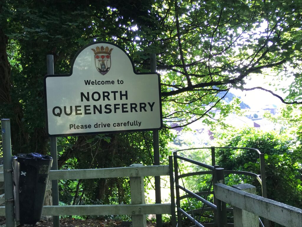
North Queensferry
The day before I also went online to check out the car parks in and around North Queensferry. I opted for the small free car park in Battery Road, North Queensferry (post code KY11 1JZ).
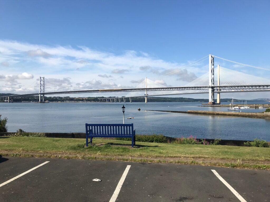
I chose this car park as I hoped it would be more picturesque. This proved to be the case. It was right on the bay with fine views across the Firth of Forth.
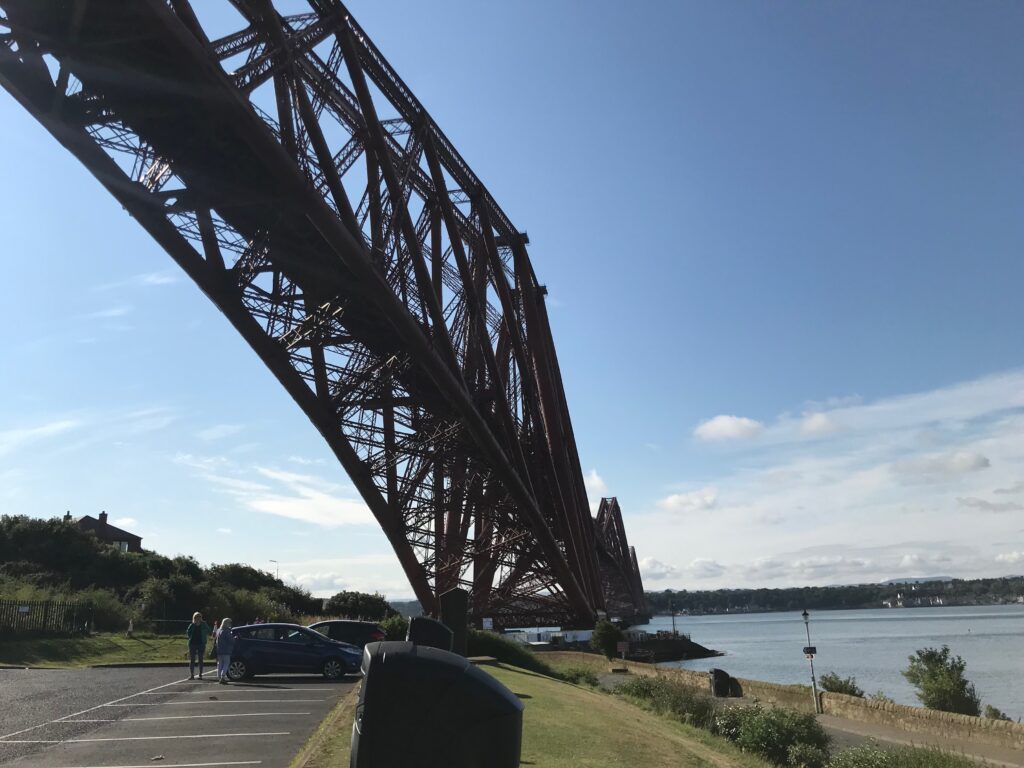
The car park was also directly below the girders of the very impressive Forth Bridge.
It was a fine, bright sunny day.There was a bit of a breeze but it was quite warm.
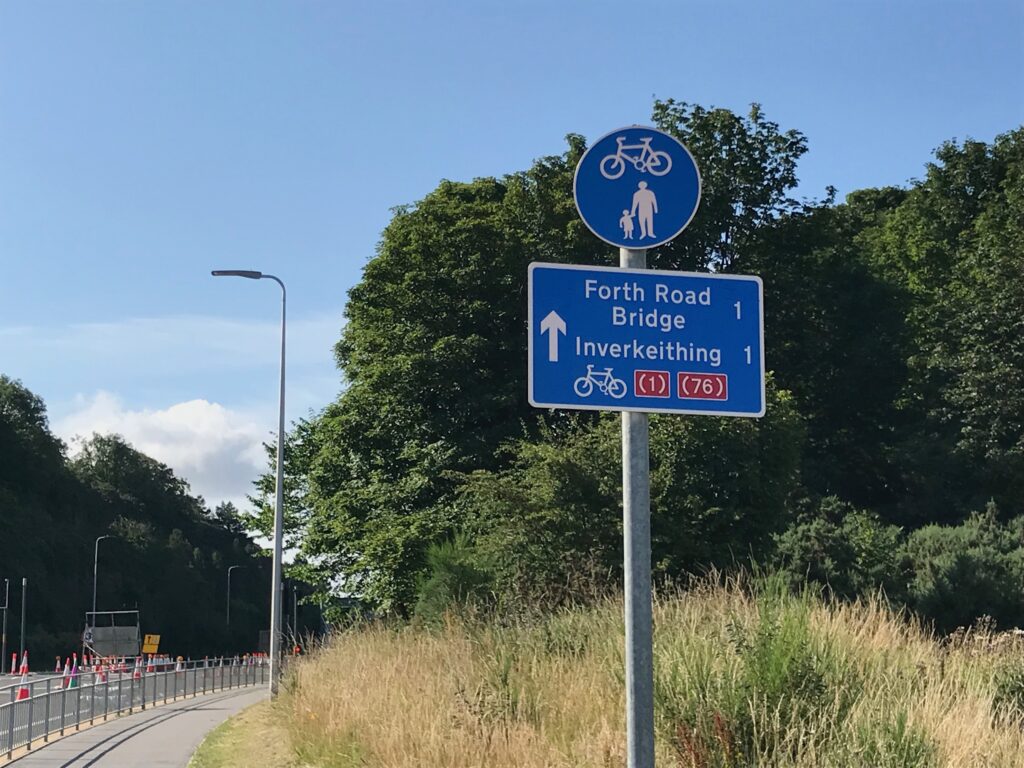
I cycled up the hill out of North Queensferry. Near the top of the hill I crossed over the road at an NCN sign to a cycle path on the other side. I followed the cycle path round to a road that led over to the Forth Road Bridge in one direction, and to Inverkething in the other direction. There was another NCN sign at this point.
I stopped to check the NCN map on my phone. Then I cycled along towards the Forth Road Bridge and crossed over the road at the traffic lights. On the other side I turned left and followed the NCN 1 to Inverkeithing.
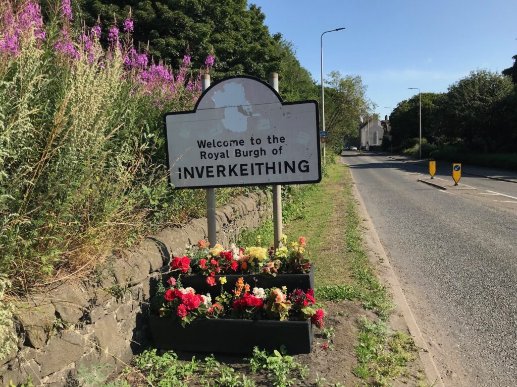
Inverkeithing
In getting to Inverkeithing I stopped several times again to check the NCN map on my phone. As this was the first time I had cycled this route I wanted to make sure that I didn’t take any wrong turnings as this would have been costly in both time and energy.
As a result of all these stops it took me an unbelievable 25 minutes to cycle the 2 miles to Inverkeithing from North Queensferry!
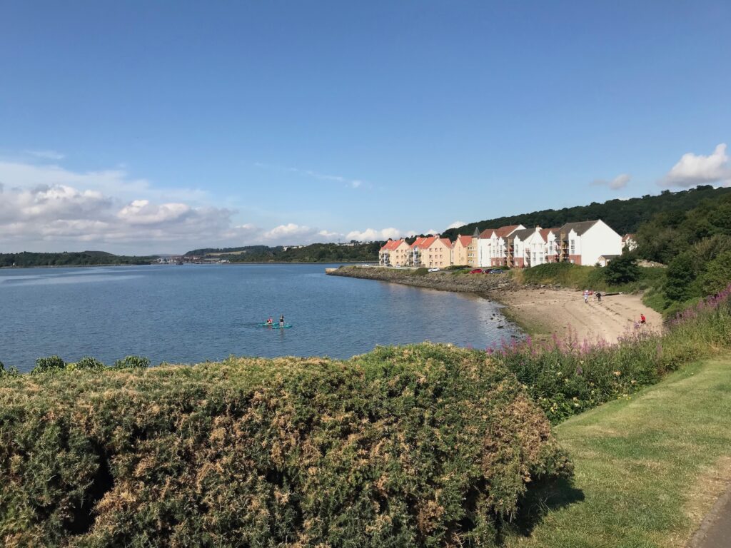
Dalgety Bay
Shortly after leaving Inverkeithing I came to an area called St.David’s Harbour in Dalgety Bay. This is a nice area, with modern luxury flats overlooking a sandy bay.
I cycled to the end of these flats and came to a narrow path that was rough and stony. I wasn’t sure if this was the correct way, so yet again I consulted the NCN map on my phone. Also I asked a guy who was walking along the path and he confirmed that this was the way to go.
As it turned out this narrow path only lasted for a short distance and then I emerged out onto a road in a housing estate.
So far I had also been following the signs for the Fife Coastal Path as the NCN 76 follows this section of the Path. These signs had the NCN 76 logo on them, but strangely the NCN 76 logo had been covered over with a white covering.
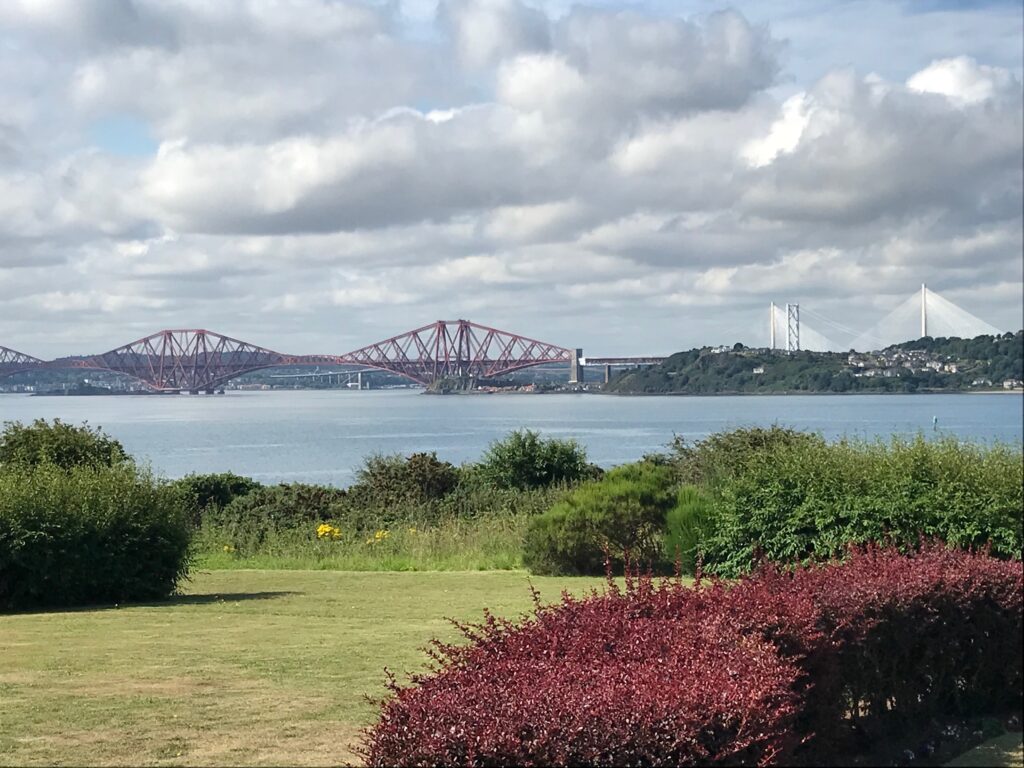
From here there were fine views back across the bay to the Forth Bridge, with the Queensferry Crossing in the background.
The route then headed inland and wound it’s way through housing estates. I was following the signs for the Fife Coastal Path, which now had the small NCN 76 logos clearly displayed on them.
Once through the housing estates the route continued on a rough stony path. It then wound it’s way round Dalgety Bay. The sun was still shining and it wasn’t too windy now so it was nice and warm.
The route continued through woods on the rough stony path. There were a few steep sections with boulders, etc. and I struggled to get up them. After a while it was a relief to come to a tarmac section that continued for a good distance. Whilst some parts of this section were a bit potholed and stony most of it was nice and smooth.
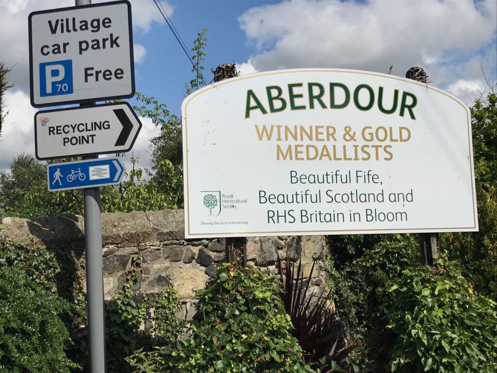
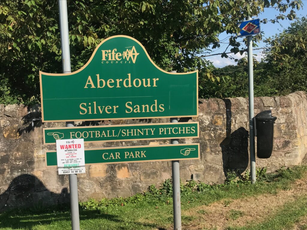
Aberdour
The path continued until I reached the village of Aberdour. Here I turned right onto the Main Street.
I continued cycling along the Main Street until I reached the sign for the train station. Here there was a a small sign for the Fife Coastal Path pointing down towards the station. This didn’t seem right to me.
I thought that I had seen another sign further up the hill so I climbed up to the top of the small hill. Here there was the normal sign for the Fife Coastal Path. I stopped and consulted the NCN map on my phone. From this I could see that I needed to continue on the Main Street and then turn right into Hawkcraig Road. I must have spent about ten minutes determining this.
Eating places in Aberdour were the Aberdour Hotel that serves food all day, and there were several bars and restaurants.
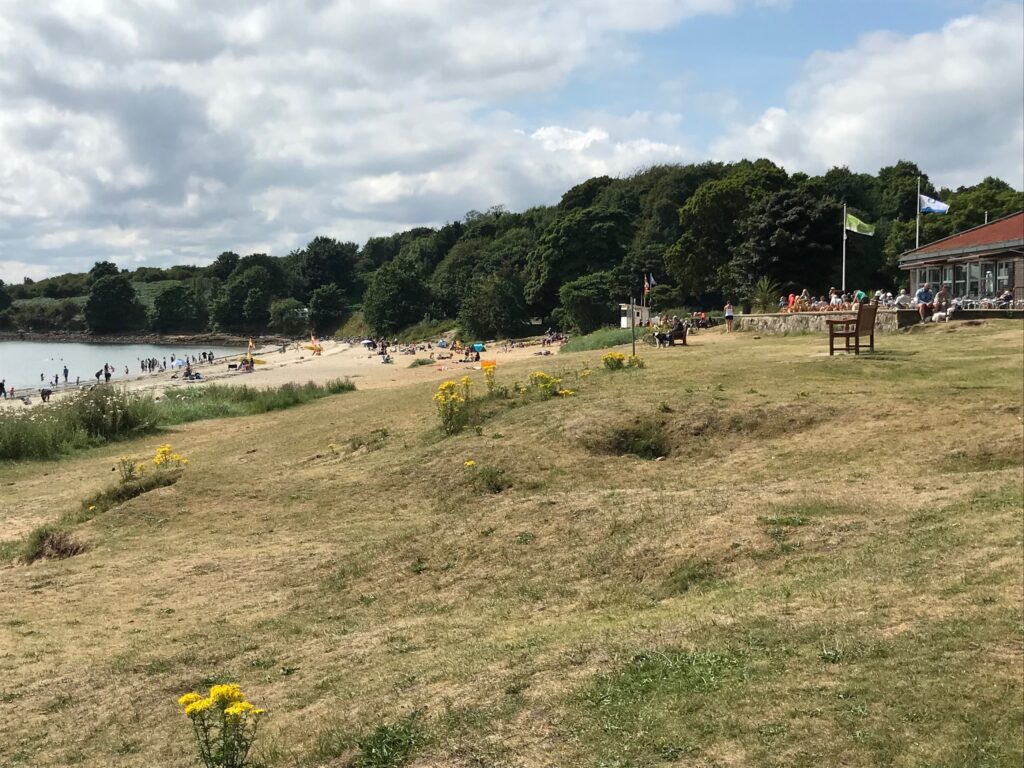
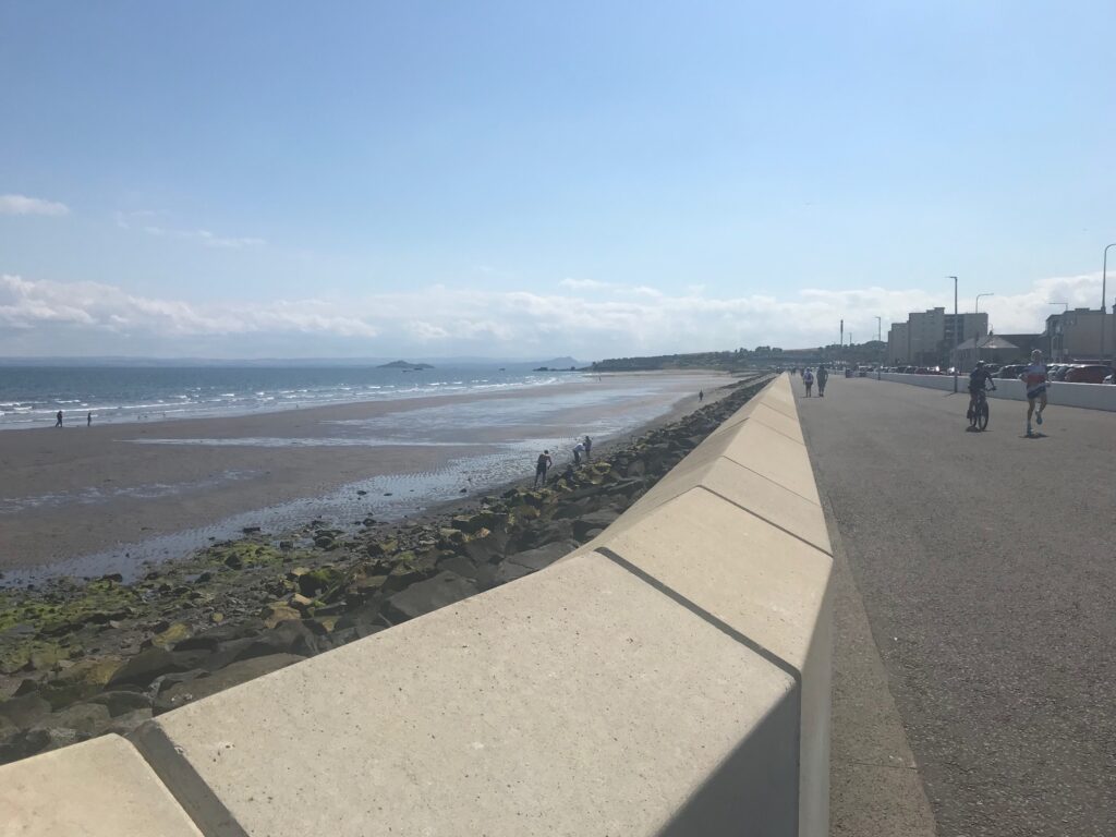
Silver Sands Beach, Aberdour
After cycling along Hawkcraig Road for a short distance I came to the entrance to Silver Sands Beach.
I turned left onto the path leading to the beach. At the beach there is a large cafe/restaurant with outdoor seating. There are also public toilets here. The beach was busy with families and others, and there were people enjoying themselves in the water.
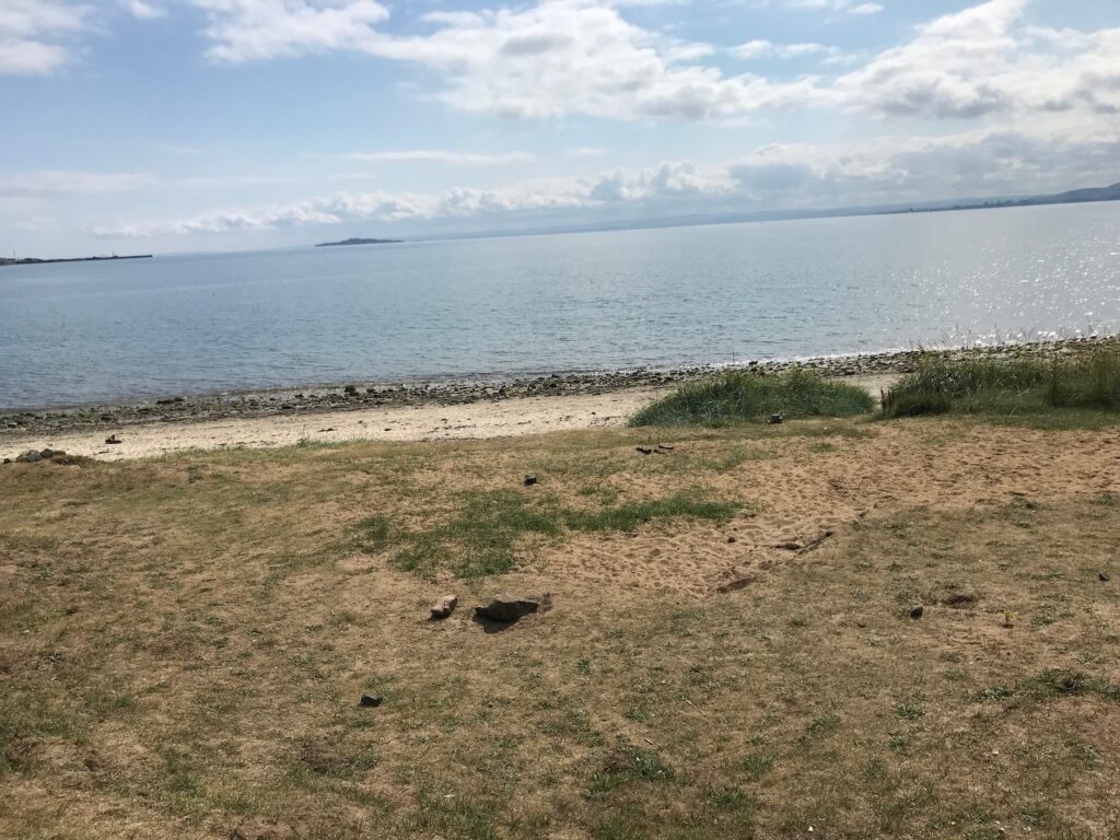
There were fantastic views across the bay from here.
Silver Sands to Burntisland
After Silver Sands the path became narrow and stoney. There were a lot of short, sharp inclines, some of which were steep.
I found this next section to be really hard going. This was due to the loose, sharp stones on the path. Because of this I found it difficult and hard work to get traction to get up the inclines. I also had to be slow and careful on the short descents to make sure I didn’t come off the bike.
Also, the path was so narrow that I had to stop if any cyclists or pedestrians were coming towards me. Consequently it was really slow going over this stretch.
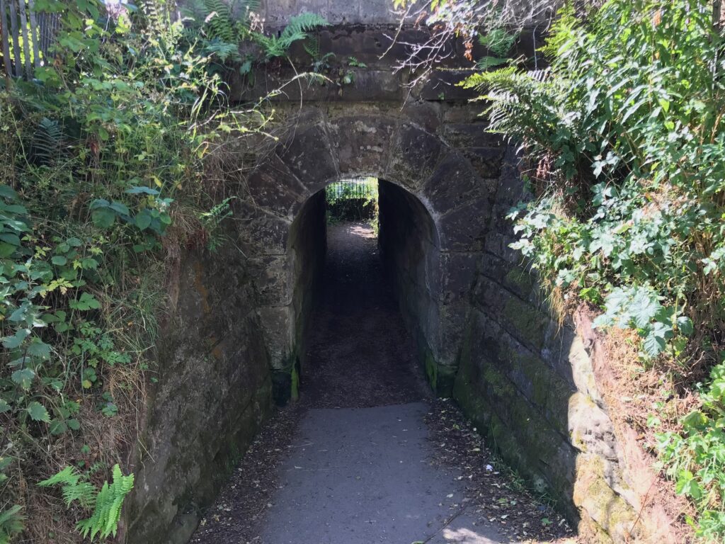
So far the path had been running alongside railway tracks on the left, with the bay on the right. I then came to a very low, narrow pedestrian tunnel under the railway tracks. I had to walk through this tunnel as it was too low to cycle through.
Eventually I came to a paved section at the back of some houses. This didn’t last long though. The path turned right into another low, narrow tunnel to go back under the railway tracks again.
I had to walk through this tunnel as well. At the other side the path was flat and led alongside a pond. It came out at a wide stony road where I turned left. After a short distance I came out on a road on the outskirts of the small town of Burntisland. It was great to be back on paved surfaces again.
Burntisland
At the end of the stony road I turned right and followed the roads up and round through a built-up area.
I then came to a crossroad at the end of West Broomhill Road. Here there was no sign to indicate which way to go. Yet again I had to stop and consult the NCN map on my phone, which indicated I should turn right. I turned right into Lothian Street. At the bottom of this road there was a Fife Coastal Path/NCN 76 sign pointing left along the Main Street.
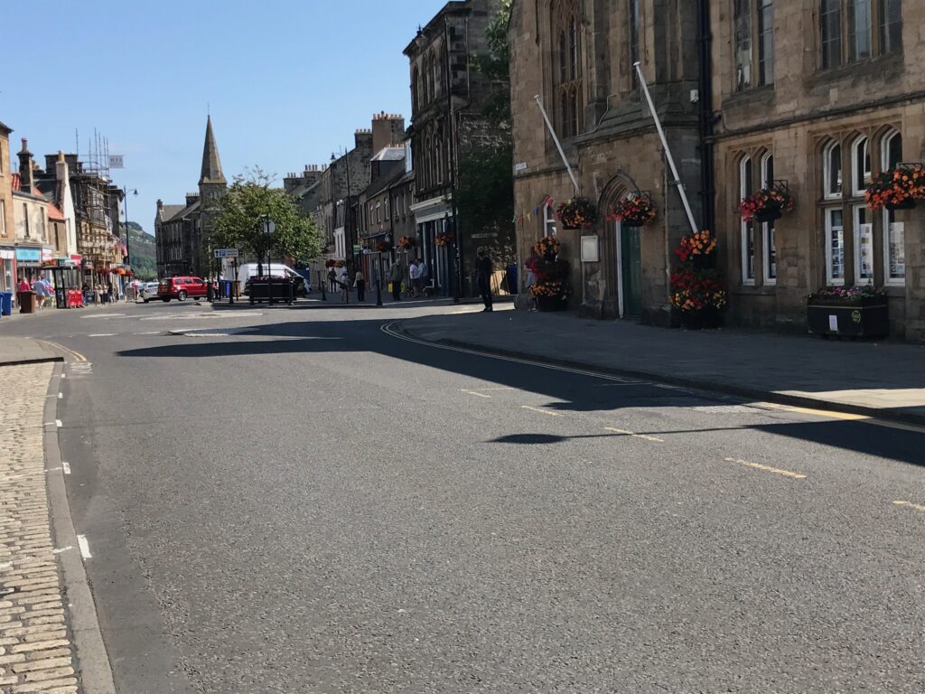
I cycled along the Main Street, which further along was a busy, bustling place. There were several pavement cafes and bar/restaurants and lots of people about.
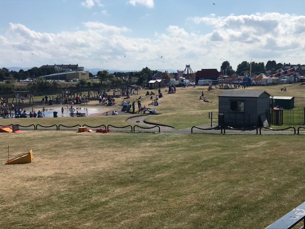
At the end of the busy Main Street there was a quite a large fairground over on the grassy area on the right. There were also children’s play areas and a paddling pool. They were all busy too.
I continued out of Burntisland on the main road. Eventually I came to a very wide pavement with a large yellow stripe at the edge of the pavement. This is a shared use pavement so I cycled on it for a while, which was good.
It passed by the Pettycur Bay Holiday Park and the Bay Hotel.
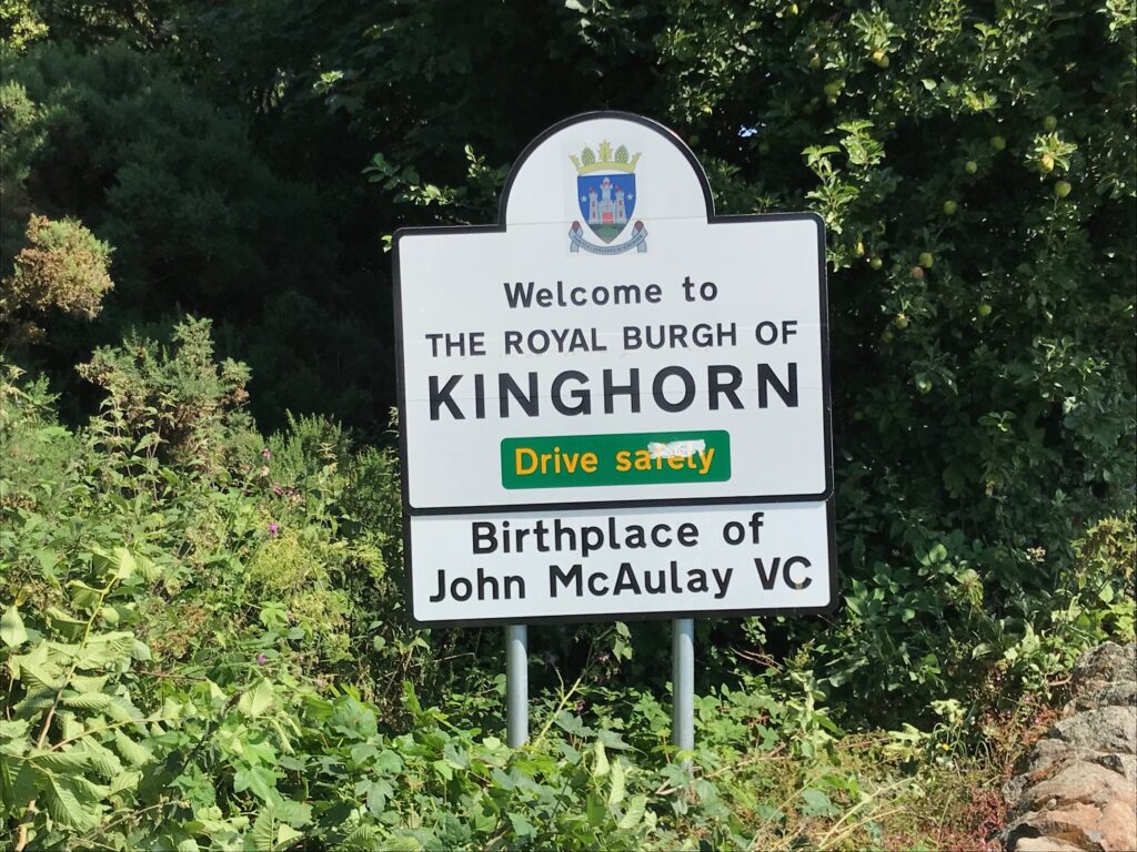
Kinghorn
It soon reached the small village of Kinghorn.
I cycled along the Main Street in Kinghorn and then I saw a sign to turn left. This took me up a long hill and eventually ended up at the bottom of Kilcruik Road. Here there was a junction with the B823 road, with Kirkcaldy sign posted as 3 miles to the right.
Again there was no cycle sign to indicate which way to turn. I stopped yet again to check the NCN map on my phone. It indicated that the route turns left and then immediately right.
I looked around and saw a sign further along to the left, so I cycled up to it. It was a Fife Coastal Path sign pointing to the road to the right at that point. (The NCN sign on it was for NCN 1.)
It was clear then that the cycle route was heading up over the hills to Kirkcaldy. If I hadn’t checked the map and noticed that sign I would have turned right and cycled into Kirkcaldy on the B823.
As expected there was a steep hill to begin with but it was a nice quiet country road. The sun was still shining and, despite being very tired, I found the road pleasant to cycle on.
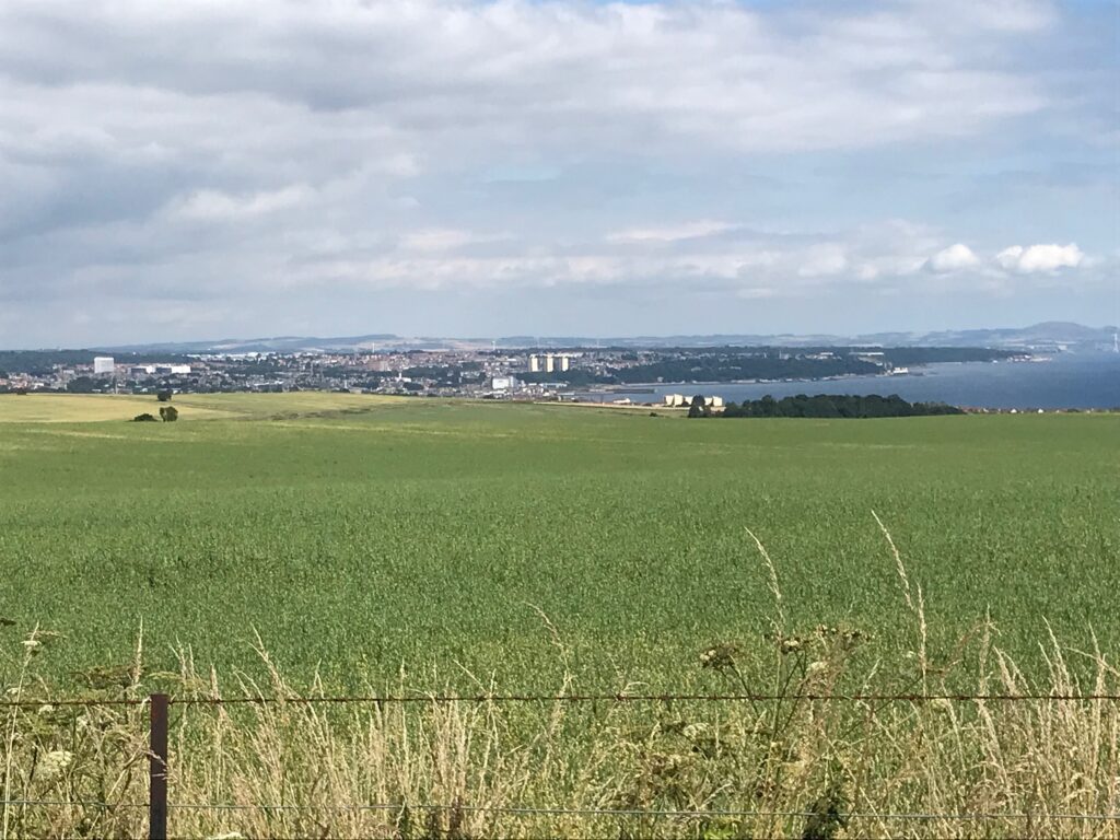
After this first hill the route was undulating and then there was another steep hill. From here there were fantastic views down over the bay towards Kirkcaldy.
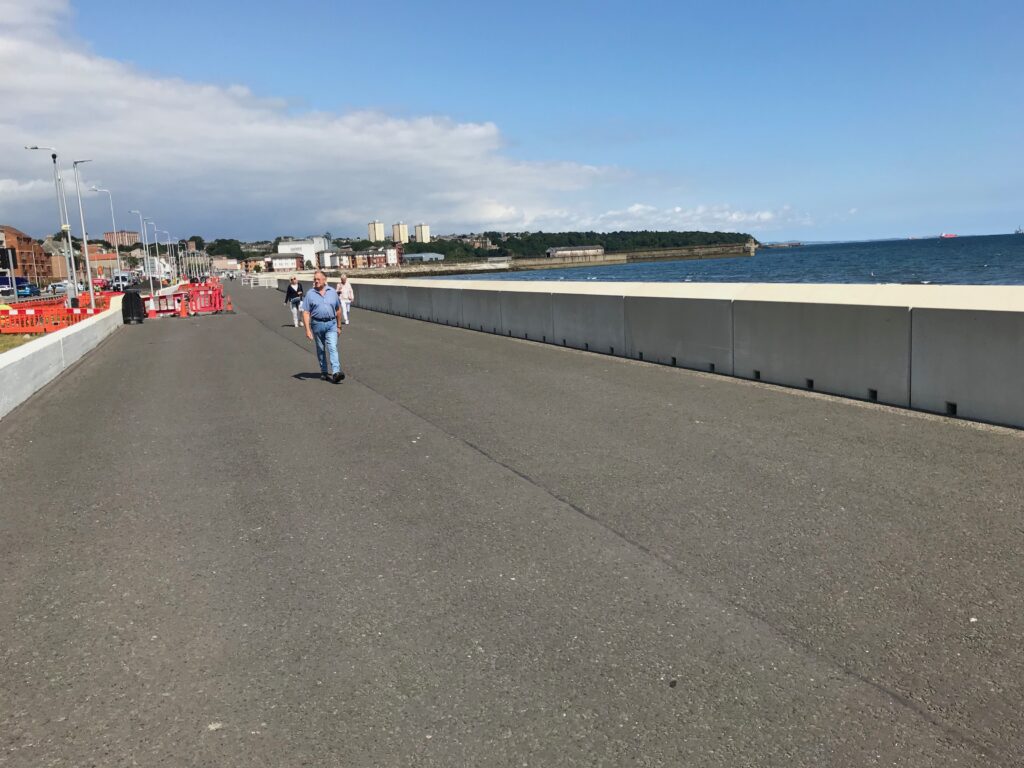
Kirkcaldy
The country road came down from the hills to a main road, where I turned right. The NCN 76 route at this point takes you left through a built up area to avoid cycling along the main road. However, after consulting the map again I decided just to cycle along the main road into Kirkcaldy as it wasn’t very far.
In Kirkcaldy I cycled along the Promenade for a short while looking for somewhere to stop for lunch.
There weren’t too many seats available on the Promenade and there was quite a strong wind coming in off the sea. I therefore decided to cycle back to the main road and go to a small park that I had seen on my way into Kirkcaldy, just across from the Promenade.
The park was called Volunteers Green and it was quiet and secluded. I sat on a bench in the small park and ate my sandwiches and drank my juice. Afterwards the sun was still shining so I lay back on the bench and soaked up the sun for a while. I was grateful for the rest as I was very tired from the exertions of the morning cycling.
After lunch I went back onto the Promenade and cycled back along it rather than on the main road, which is the way I had come into Kirkcaldy.
At the end of the Promenade there are public toilets. I rejoined the main road here. I cycled along the main road until I came to the country road over the hills, where I turned left.
Then I retraced my route all the way back to Silver Sands Beach at Aberdour. Here I stopped for a rest. I lay down on the grass and ate a choc bar and drank the rest of my juice, whilst soaking up the sun.
From there I retraced my route back to North Queensferry.
Levels of Assistance Used When
Cycling the Fife Coast on 2 Aug 21
For the first part of the route as far as Aberdour I only used the first level of assistance, the ECO mode, twice for a very short distance.
After leaving Silver Sands Beach at Aberdour I had to use the ECO mode on some of the steep inclines on the narrow, stony path.
When I came off the path on the outskirts of Burnisland I was really tired with the exertions on the narrow stony paths. I therefore used the ECO mode to get up the hill on the outskirts of Burntisland and for a short distance afterwards.
In the village of Kinghorn when I turned left off the Main Street there was a long hill. I used ECO mode all the way up that hill.
After leaving Kinghorn, when I got to the hills leading to Kirkcaldy I used both ECO and TOUR modes twice. I had to do the same on these hills on returning from Kirkcaldy, but I used the ECO mode more often on the rest of this section.
On the return journey I used the ECO mode a lot more and the TOUR mode several times as I was very tired.
Battery Charging After
Cycling the Fife Coast on 2 Aug 21
At the end of the trip there were three of the five bars displayed on the battery charge level indicator.
When I put the battery on charge when I got home the fourth bar only took about five minutes to charge. The fifth bar took about one hour and five minutes to charge.
So the total time taken to recharge the battery fully was about one hour and ten minutes.
Summary of
Cycling the Fife Coast on 2 Aug 21
It was a fine day weather wise with mostly sunny intervals, although it was a bit windy at times.
The scenery and views were great, from the bridges over the Firth of Forth to the fine sandy beaches and the bays along the coast.
However, I didn’t find it enjoyable to cycle on the long stretches of rough, stony ground on large parts of the route. I struggled to cycle on these sections and found it hard going.
Consequently, by the time I got to Kirkcaldy I felt as if I had no strength left in my knees and my thighs were sore. I couldn’t believe that it had taken an elapsed time of four hours to cycle the 18 miles to Kirkcaldy.
This was only partly due to the long sections of rough, stony terrain that were difficult to cycle on. It was also due to the fact that this was a route I hadn’t cycled before so I had to stop many times to consult the map. This was in addition to rest stops and stops to take photos.
This is confirmed by the computer readings at the end of the trip, which showed a trip time of just under 5 hrs. Whereas the elapsed time from leaving the car to returning to the car was 8 hrs. 15 mins.
Nevertheless, overall it was a good trip in fine weather on a route I hadn’t cycled on before.