The following is a brief summary of the key details for Cycle Routes in Scotland : Portobello – North Berwick.
DISTANCE : 20.5 mls. one way / 41 mls. return
TERRAIN : Mostly flat
TOTAL ASCENT : 1,273 ft.
START & FINISH : Portobello Beach
This route is one of the cycle routes in Scotland that I have cycled over the years. Some of the other routes I have cycled over the years are listed in the page “Cycle Routes in Scotland”. (Click here to go to this page.)
The map above is an interactive map so if you press “Play” (click on the white triangle in the middle of the screen) you can zoom in or out by pressing the buttons that appear in the top left of the screen, and you can move the map by dragging it. Once you press Play the hills profile of the route will appear at the bottom of the map. You can get further comprehensive detailed analysis of the hill profile by clicking on “More Detailed Profile” at the top left of the hills profile section. You can also select full screen mode by clicking on the icon in the top right corner of the map.
Route Details -
Cycle Routes in Scotland : Portobello - North Berwick
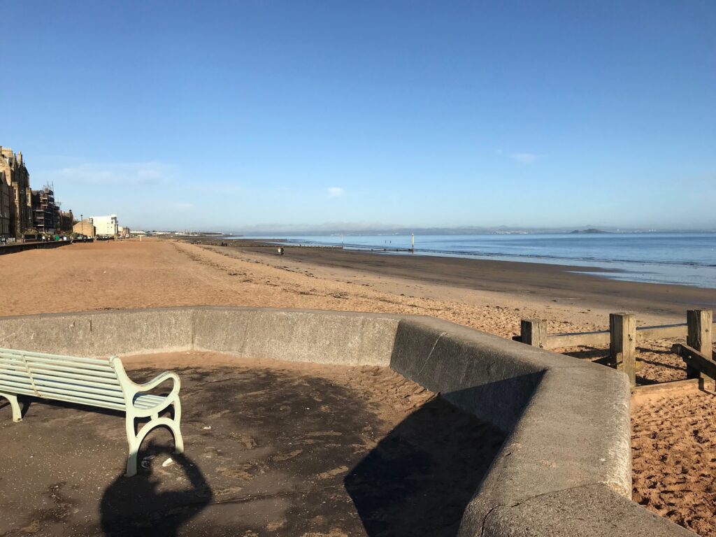
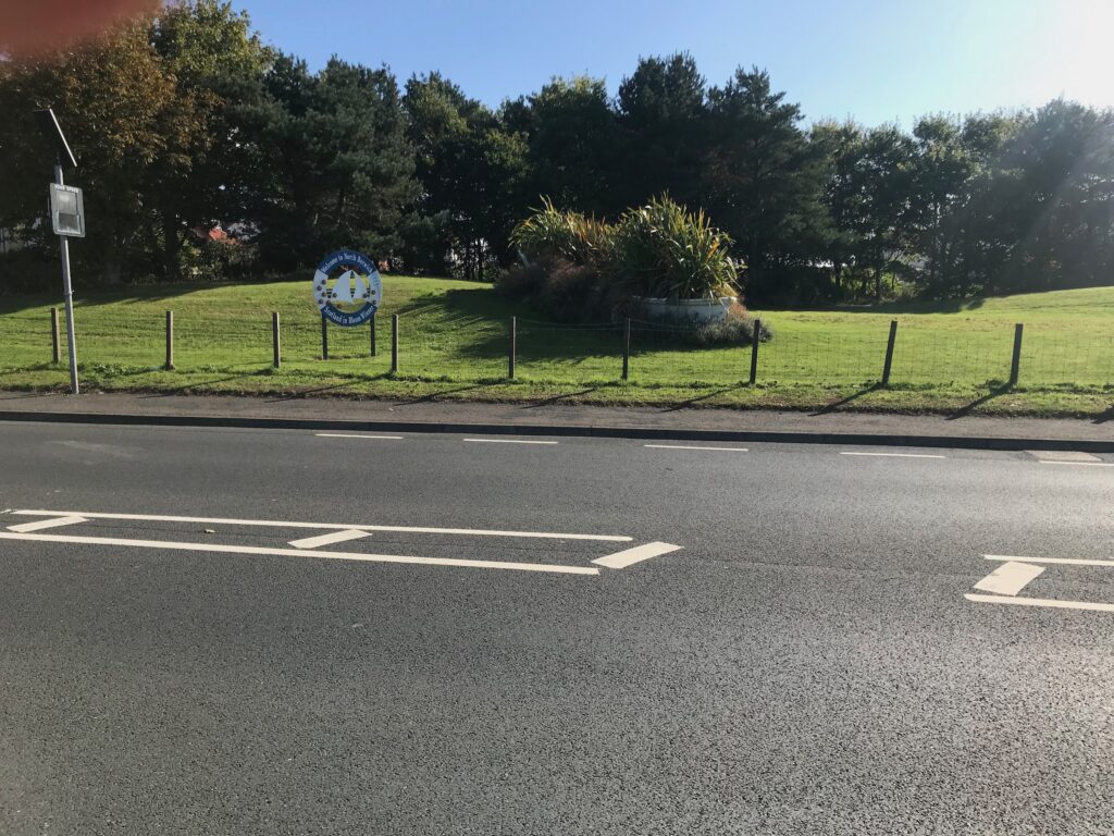
The route commences at Portobello Beach, which is Edinburgh’s 2 mile long sandy beach. Parking is available at points along the promenade in the adjacent side streets. I obtained a postcode for Portobello Beach online (EH15 2DX) and entered it in my satnav. This took me to a residential road called John Street. This road ends right in the middle of the promenade where there were no parking restrictions. If you wanted to cycle the full length of the promenade I believe there is a car park further along near the end of the promenade. It is at Bridge Street and it has 63 spaces.
From this point there are fine views up and down the long, sandy beach. There are also great views across the Firth of Forth to the Kingdom of Fife.
To commence the route turn right and cycle along the promenade, which can be busy with walkers and joggers. At the end of the promenade turn left onto the B6415 Musselburgh Road that leads to the A199 Edinburgh Road.
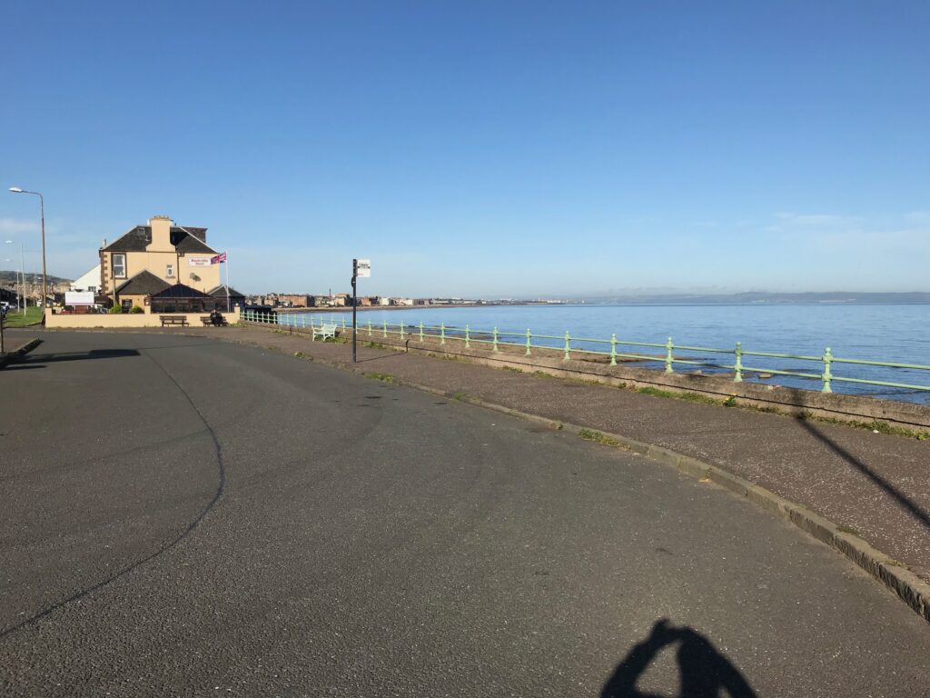
Looking back on Portobello
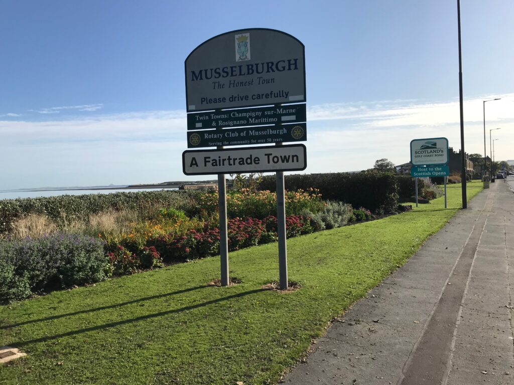
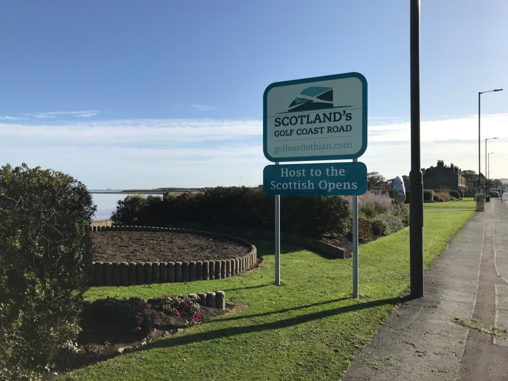
This road leads to the small town of Musselburgh. Here you start to see signs proclaiming this route to be “Scotland’s Golf Coast Road”. This is due to the number of golf courses between here and North Berwick, on either side of the road.
Further along this road there is a sign on the left for Fisherrow Harbour. Here turn left into New Street. Then take the first left and then the second right and continue to cycle past the harbour.
At the other end of the harbour there is a sign for the long distance path called the John Muir Way. This path runs from Helensburgh on the west coast of Scotland to Dunbar on the east coast of Scotland. It is in tribute to the Scottish conservationist, John Muir. He was born in Dunbar in 1838 and he emigrated to the United States. He became a founder of their National Park Service.
Follow the signs for the John Muir Way as it more closely follows the coast. The surface of the path varies from nice smooth tarmac to a gravel surface to a rough stoney surface.
The path continues to the small town of Prestonpans. Here it turns right and then left onto the main road, which is Prestonpans High Street.
Continue to the end of the High Street where you could pick up the John Muir Way again on the left. Following this would take you round Preston Links and along the coast. However, near the end there is a pedestrian bridge over a small inlet. At this point you have to carry your bike up and down four or five wide steps at either end. To avoid this continue on the main road, which is the B1348 Edinburgh Road.
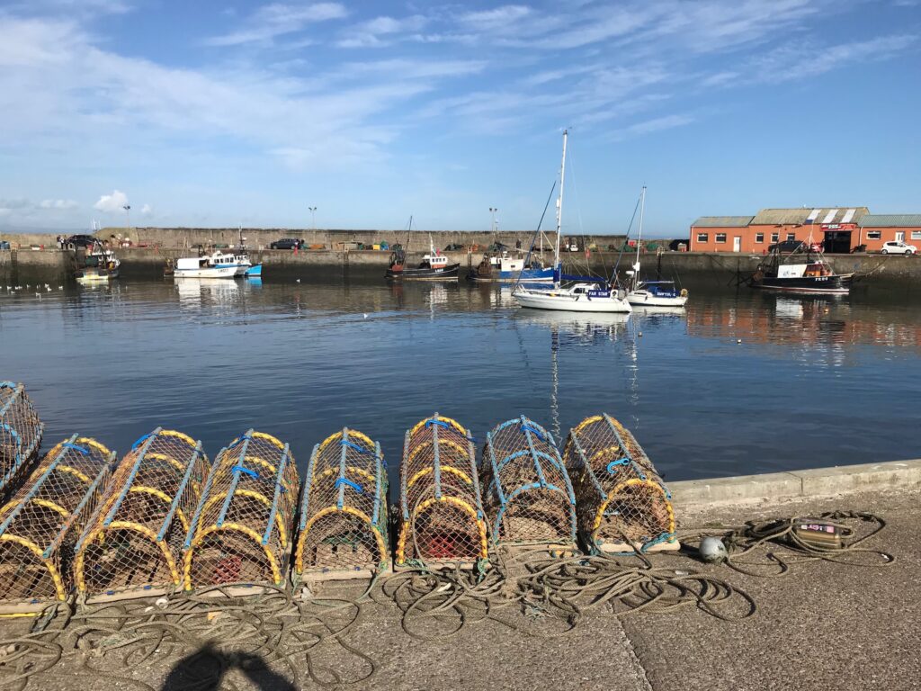
You will soon arrive at the small town of Cockenzie and Port Seton. Here you turn left into West Harbour Road. This road veers round to the right, passing Cockenzie Harbour on the way. The road then leads onto High Street. You then cycle along through other street name changes to a street called Viewforth. Here there are fine views of Port Seton Harbour.
From Port Seton Harbour you can pick up the signs for the NCN 76 cycle path that leads to the esplanade. The path is a mixture of gravel and paved sections and it hugs the coast and then leads back to the B1348 road. After this the route continues on a shared use pavement past Seton Sands Holiday Park.
Further on the John Muir Way cuts off onto a very narrow grassy path. This section of the John Muir Way is more suited to walkers rather than cyclist. This is because there are several sandy sections that are extremely difficult to cycle on. Also, there are sections that have a very bumpy grassy surface and there are sections with overhanging trees.
To avoid this continue cycling on the shared use path to it’s end. Then cycle on the B138 until it joins with the A198, which is quite a busy road. This leads to the village of Aberlady. At the end of this village there is a cycle lane painted on the road.
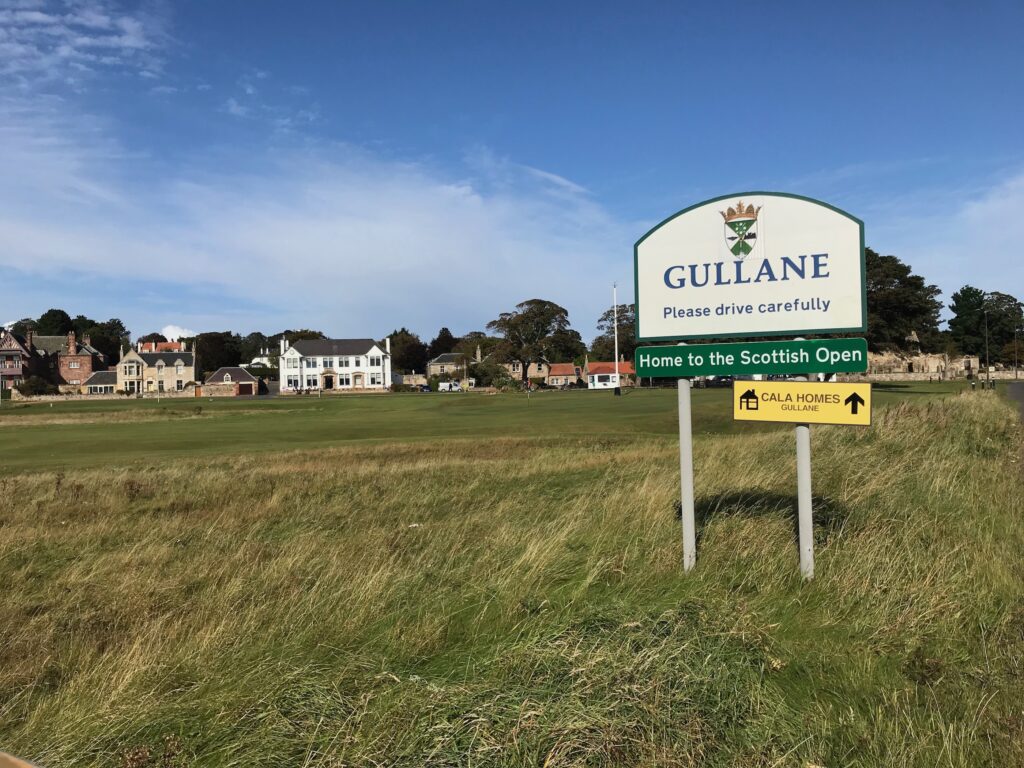
The cycle lane continues on the A198 all the way to the golfing village of Gullane.
Here the cycle lane stops and you cycle up the hill on the village main street and then continue on the A198 through open countryside.
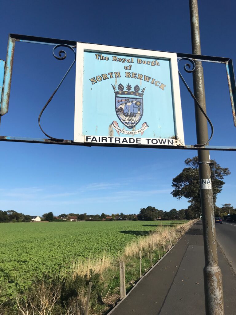
Further along on the A198 cut off to the left onto the B1345 that takes you through the village of Dirleton, where the road is much quieter. When you come back out of Dirleton onto the A198 there is a shared use pavement that takes you all the way to North Berwick.
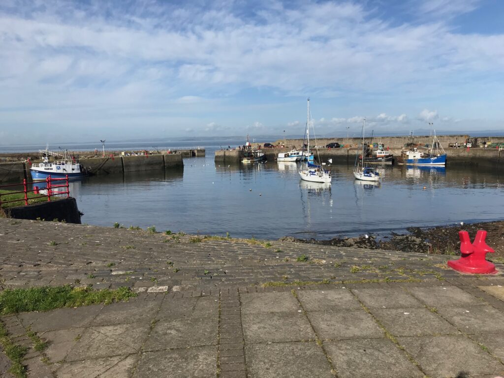
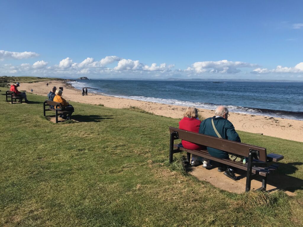
The Royal Burgh of North Berwick is a holiday town with two beaches and a harbour.
The cycle path takes you firstly along the west beach.
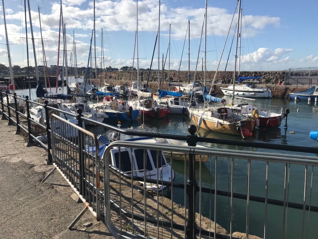
You can then cycle along and around the harbour area, where many yachts are berthed.
Continuing along you come to the busy east beach, where there are several cafes and restaurants, etc,
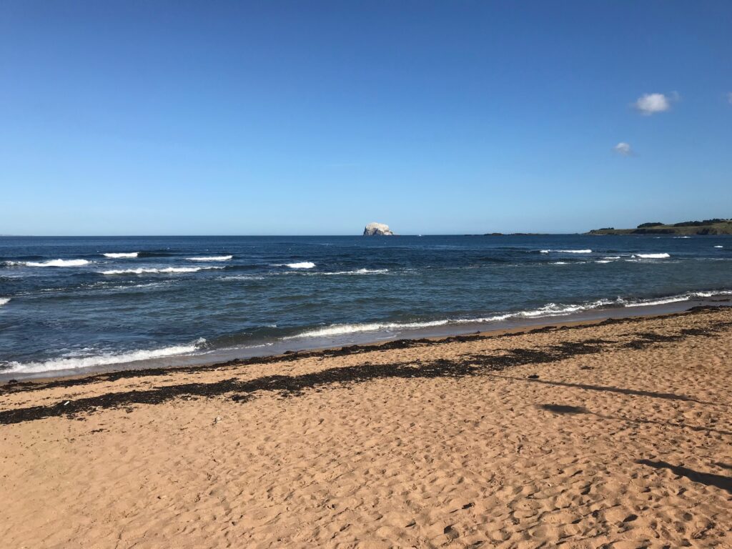
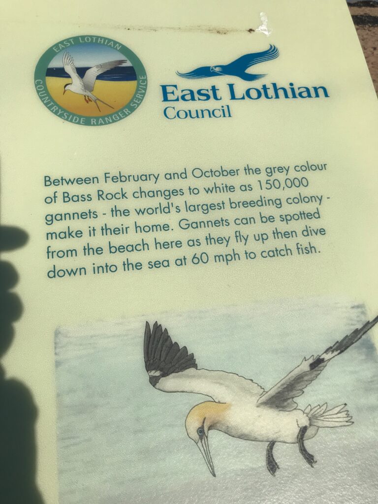
From this beach can be seen the Bass Rock, which appears to be white when viewed from the beach but it is actually grey. The reason for this is explained on this notice board at the beach.
The town centre in North Berwick is adjacent to the East Beach. If you want to have a look at what it has to offer you can start the return journey back to Portobello by cycling through the one-way system in the town centre, and this will take you back to the outskirts of the town where you can retrace the outward route all the way back to Portobello.
Route Alternatives -
Cycle Routes in Scotland : Portobello - North Berwick
To do the one way option you would need to take your bike on the train back to Portobello from North Berwick.
You could of course do the route in reverse by starting the route in North Berwick and cycling to Portobello and then cycle back or take the train back.
Or you could cycle only part of the route from the start point and then return. You could then complete the route on another day or days.
Or you could take one of the train options outlined below to start or end the route at one of the train stations located near to the cycle route.
Cafe / Toilet Stops -
Cycle Routes in Scotland : Portobello - North Berwick
As this route passes through several villages and small towns there are many cafe / toilet stops along the way.
For example there are facilities at Fisher Row Harbour, and the small town of Prestonpans has a busy main street. Further along on the route there are facilities around Port Seton Harbour.
There are also facilities in the villages of Aberlady and Gullane.
A short distance past Gullane, on the left off the A198 up Archerfield Road, is the Archerfield Walled Gardens where there is a garden centre, a cafe and picnic benches on a large grassy area. This is a good alternative to Gullane for a rest stop.
And of course there are many facilities in the holiday town of North Berwick.
Train Options -
Cycle Routes in Scotland : Portobello - North Berwick
If you want to access the start of the route by train your options to do so will of course depend on where you live and what train lines are nearby and where they run to, which each person will need to investigate for themselves. For a website that can help with this click on the following website address : https://www.thetrainline.com. Some possible train options are outlined below.
Edinburgh Waverley Station is a mainline station in the centre of Edinburgh. You could travel to this station then get another train to Musselburgh, which is near the start of the route. Alternatively you could cycle from the centre of Edinburgh to Portobello, although this would involve cycling through heavy traffic and would add about 3.5 miles each way to your cycling trip.
The East Coast Main Line / North Berwick Line runs from Edinburgh Waverley Station all the way to North Berwick Station, with stops at Musselburgh, Wallyford, Prestonpans, Longniddry and Drem. The train stations at each of these stops are not too far away from access to this cycling route.