Cycling Renfrew – Port Glasgow – Kilmacolm on 17/03/21 was an enjoyable route with wonderful views of the Firth of Clyde.
This is one of many great routes I have cycled in Scotland. Other great routes I have cycled are listed on the page Cycle Routes in Scotland.
Route Map
Route map for Renfrew - Port Glasgow - Kilmacolm by Robert McColl on plotaroute.com
The map above is an interactive map so if you press “Play” (click on the white triangle in the middle of the screen) you can zoom in or out by pressing the buttons that appear in the top left of the screen, and you can move the map by dragging it. Once you press Play the hills profile of the route will appear at the bottom of the map. You can get further comprehensive detailed analysis of the hill profile by clicking on “More Detailed Profile” at the top left of the hills profile section. You can also select full screen mode by clicking on the icon in the top right corner of the map.
Timings and Distances -
Cycling Renfrew - Port Glasgow - Kilmacolm 0n 17/03/21
This section details the times I took for the various parts of the day and the distances cycled, i.e. when I started cycling, how long I cycled for between various points in the route, the distances (in miles) between various points in the route, how long I rested for, etc
I included this section so that I can look back at the timings and distances to help me plan my day if I decide to do this trip again. This section could also assist others with planning their day if they decide to do this route. Each person, of course, will have to adjust the timings to suit their own circumstances, e.g. cycling speed, rest times, etc.
(Note: The figures in brackets are the cumulative distances in miles from the start of the route.)
Parked at Braehead car park 9.50 / Started cycling 10.00 / Inchinnan 10.25 (2.87) / Bishopton outskirts 10.50 (5.74) / Bishopton centre 11.05 (6.59) / Cut-off to Langbank 11.40 (9.43) / Alpaca farm 12.00 (10.70) / Port Glasgow outskirts 12.25 (12.63) / Port Glasgow centre 1.00 (15.74) / Lunch to 1.30 / Kilmacolm 2.55 (23.98) / Left 3.25 / Back at car 5.05 (36.84) / Left 5.20.
Choice of Route -
Cycling Renfrew - Port Glasgow - Kilmacolm 0n 17/03/21
I had cycled separate parts of this route before and decided to join them together. This was to create a longer, more difficult route that would be more of a challenge.
Also, I hadn’t cycled in this area for a wee while so it was a change to go back there.
The route also complied with the current Covid restrictions.
Log -
Cycling Renfrew - Port Glasgow - Kilmacolm 0n 17/03/21
The route starts at the large, free car park at the entertainment centre at Braehead (previously called “Soar” now called “XSite”). From here you cycle along the shared use pavement all the way along to the traffic lights at the end of Kings Inch Road. At this point you leave the cycle path, and the rest of the route back to this point is mostly on quiet roads.
Although it was a bit cloudy to begin with, it was quite bright and there were a couple of patches of blue sky. Once I got up onto the bike it was a bit windy but it wasn’t too bad.
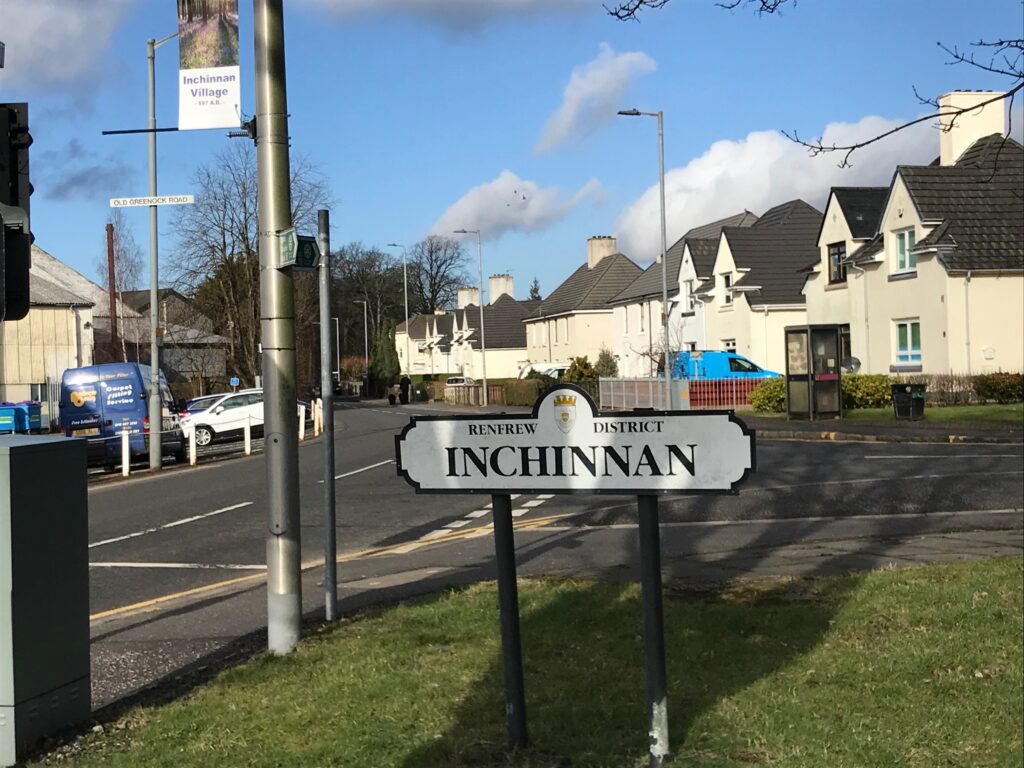
At the village of Inchinnan I cycled along the main road, which is called the Old Greenock Road. I cycled to the very end where there is a No Entry section except for buses. I normally just walk with my bike on the pavement through the short No Entry section. This time, however, I thought I would see if there was another way round it.
I turned left at Inchinnan Cemetery onto Niamh Road. Further along this road I crossed over to a tarmac path that led down to a road called Arnish. I turned right here and this quickly took me to a large roundabout where I turned left and rejoined the route on a main road.
On reflection, I don’t think this is worth doing compared to walking with the bike on the pavement up the short No Entry section, then turning left onto the main road at the top.
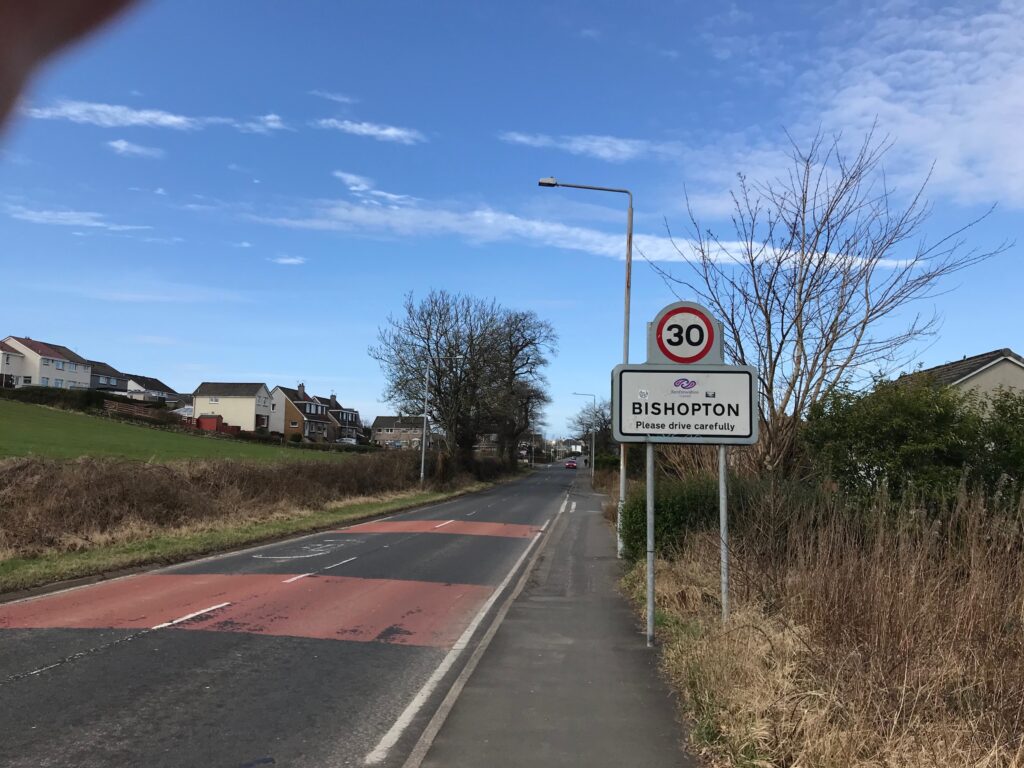
By the time I got to Bishopton the sun had come out for a short period and it was now nice and bright.
When you get to the end of Old Greenock Road in Bishopton, straight ahead is Porton Place, which is No Entry. You therefore have to turn left and cycle along to the traffic lights. Here you turn right onto the village main street, which is the A8 Greenock Road.
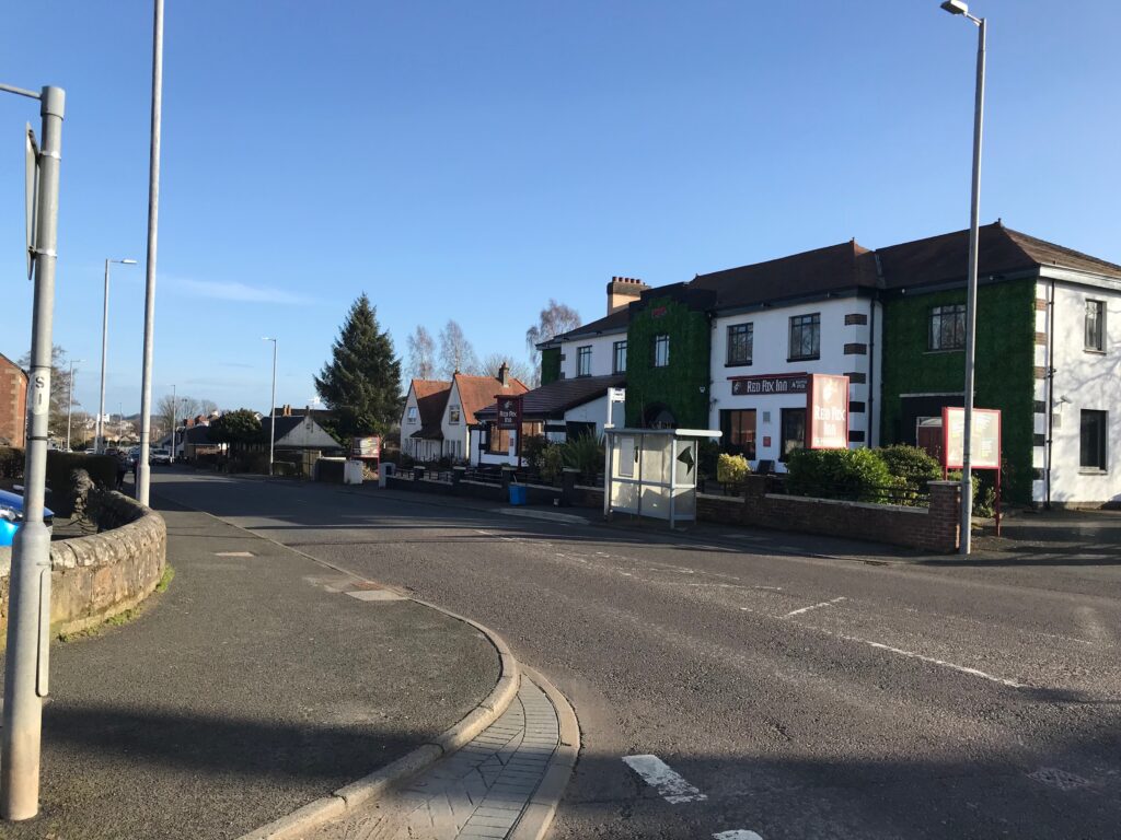
Eating places in the village are May’s Coffee Shop, a large bar/restaurant called the Red Fox Inn and there is a Tandoori takeaway. There is also a Co-op mini-market and a hardware store.
I cycled to just past the end of the main street. Here, across from a garage, the Old Greenock Road can be picked up again. The second part of this section is traffic free, but only for a short distance. At the end of this section you cross a road to pick up the Old Greenock Road again. This time with traffic, albeit it’s quite a quiet road.
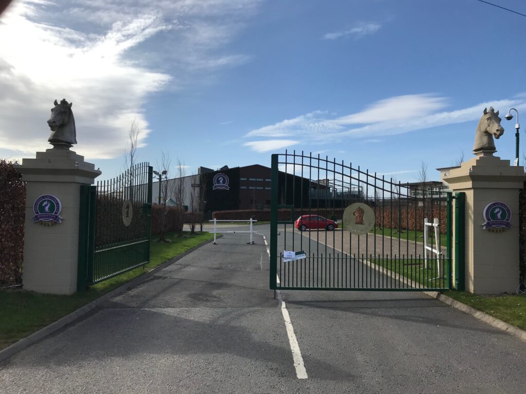
The road winds up a hill and at a junction you go to the right. Then at the top of the hill on the left is Ingliston Country Club and Equestrian Centre. The Centre also has a hotel. The bar in the Country Club serves food. There are benches outside on the road where you can rest and admire the views over the Firth of Clyde.
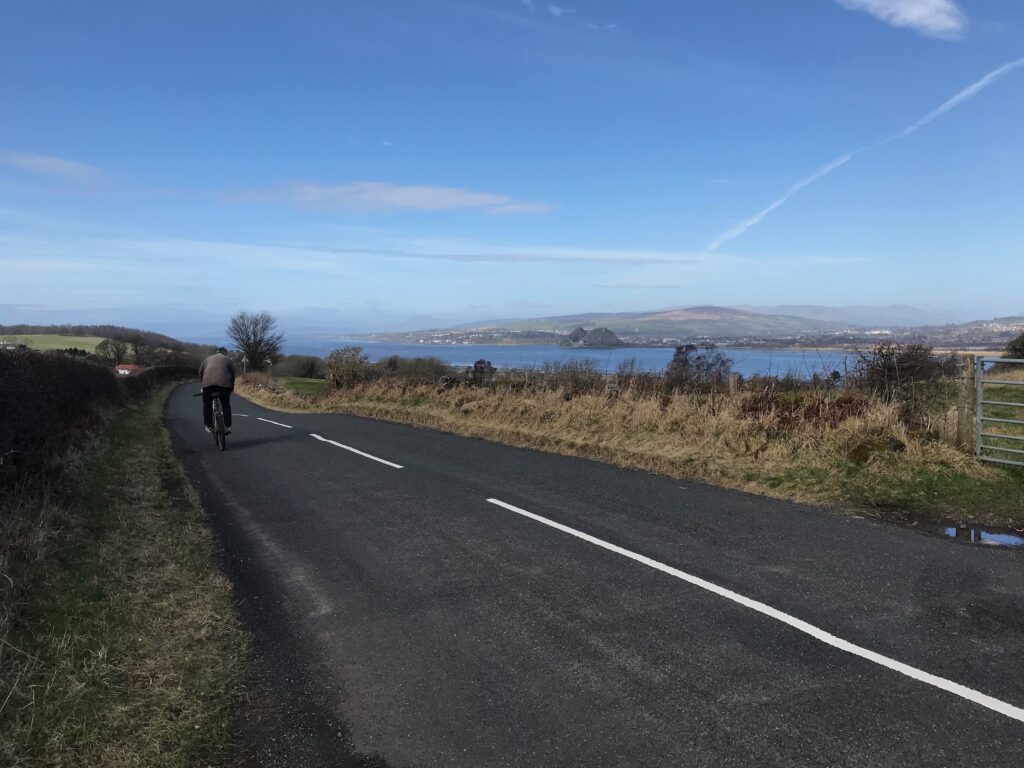
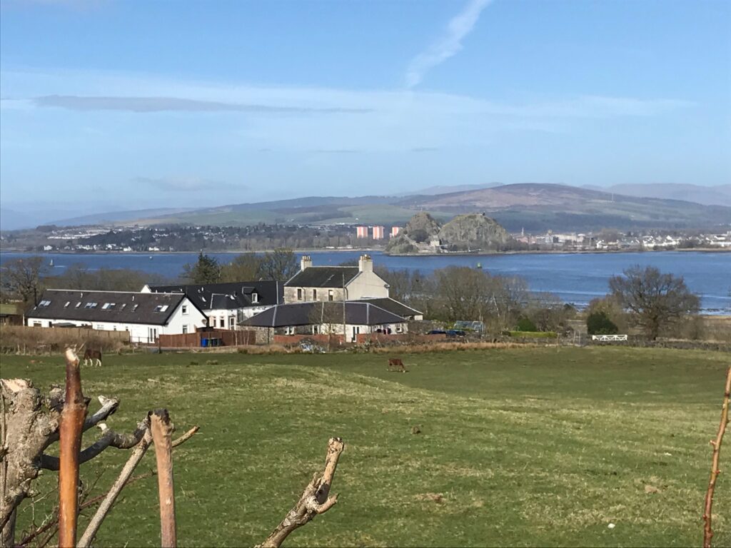
The road continues high above the River Clyde. Here there are fantastic views over the river and to the towns and hills beyond. Further along there are clear views of the Dumbarton Rock in front of the town of Dumbarton.
The road winds it’s way down to the B789 road where you turn right. Further along the road there is a junction where the main road winds round to the right. It then descends steeply to the village of Langbank.
I swithered whether to cycle down to Langbank and eat my sandwiches there. I had cycled down this way several times before and I knew there was quite a tough climb ahead. Therefore I decided just to cycle straight on.
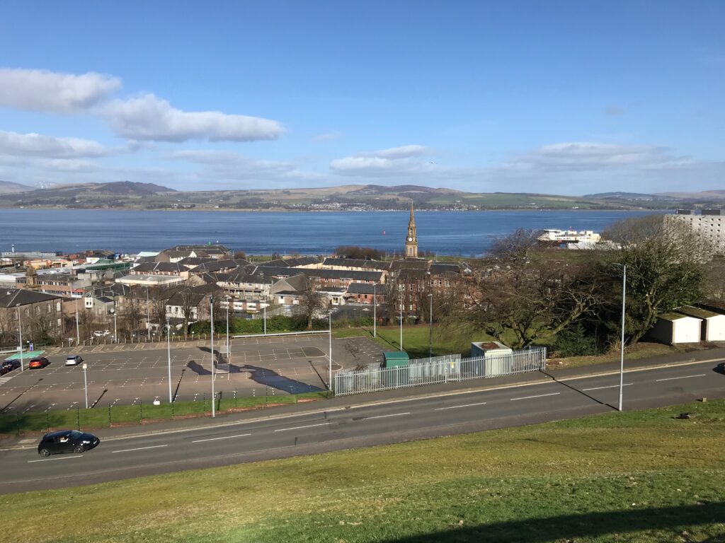
I cycled on up the hills and eventually reached the high point of the headland overlooking the town of Port Glasgow. The sun had been out for a wee while now and it was quite pleasant.
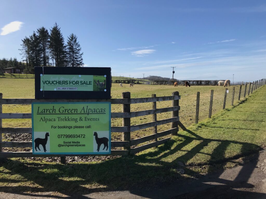
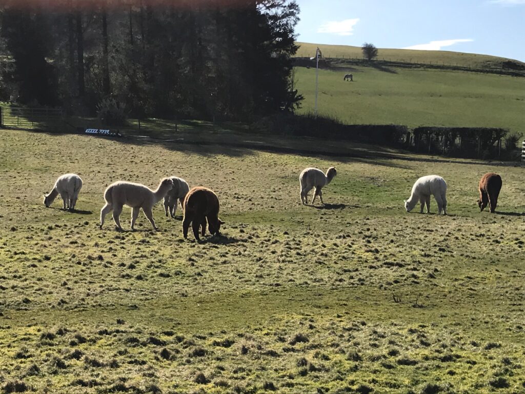
Just at this point there is a farm that has Peruvian Alpacas in a field and that offers trekking and other events with the alpacas.
The views here across the river continued to be fantastic. Also, now there was a hazy outline of Ben Lomond in the background.
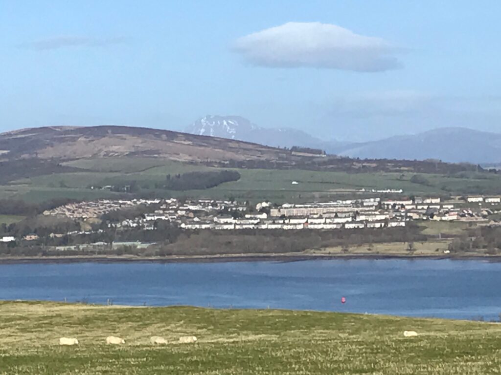
After this there was quite a steep descent. Then there was a short climb before the long descent to the outskirts of Port Glasgow. Part way down you could look down over the town of Port Glasgow
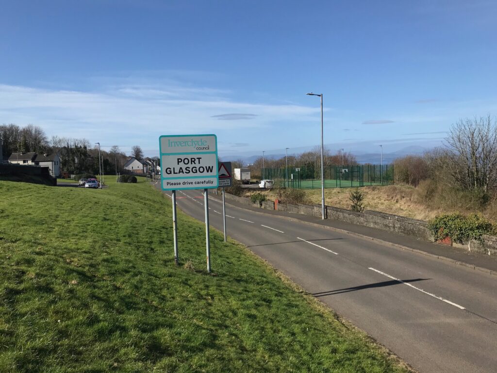
The Old Greenock Road continues into Port Glasgow. Then it leads onto Parkhill Avenue which is the start of the residential area of Port Glasgow.
The road continues to High Carnegie Road. At the end of this road there is a sharp left turn up a short steep brae. This leads to the A761 road where you turn left and climb up the hill to the roundabout.
At the roundabout you take the fourth exit onto Boglestone Avenue. That leads onto Armore Road and then Springhill Road. From here there is a very steep descent to the centre of Port Glasgow.
In the last part of the descent you pass by Port Glasgow train station. It is on the right just before where Springfield Road leads into Highholm Avenue.
Highholm Avenue continues down. It then veers to the right where it becomes Balfour Street for a short stretch. (Although Balfour Street is not shown on the map above).
The descent ends at the junction with Shore Street. This is directly facing a large car park for Tesco and McDonalds, and leading to a large retail park.
I could have stopped here to have a rest and eat my sandwiches. However, I preferred to continue to a shared use path on the shore that I had cycled to on a previous trip.
To get there I turned right into Shore Street. I then took the first left and cycled along to a large, busy roundabout. Here I took the third exit into Anderson street. I picked up the shared use path just at the start of Anderson Street. Then I cycled along the shore to a spot where there are three concrete benches overlooking a burn.
I stopped here for a rest and ate my sandwiches and drank my juice. Whilst eating my lunch I enjoyed the views across the river to the coastal town of Helensburgh.
There are of course many eating places in Port Glasgow. They would be available for lunch if it were not for the covid restrictions. In the large retail park there is a cafe and toilet in Tesco. There is also a McDonalds next to Tesco. There is a bar/restaurant at the far end of the Retail Park. Port Glasgow town centre is just to the right off Shore Street. Here there are cafes, shops and bar/restaurants.
Whilst eating my sandwiches I had consulted the OS Map App on my phone. I needed to plot the next part of the route to Kilmacolm as I hadn’t cycled this part before.
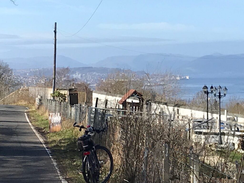
After lunch I retraced my steps to Balfour Street. I then cycled up the steep hill on Highholm Avenue to just across from the train station. Here I turned right into Glenhuntly Road. This road winds it’s way very steeply up the hill. Part-way up I stopped to look down at the view over Port Glasgow and to take a picture.
The hills out of Port Glasgow are so steep that I was sweating cycling up them. Also, it was a fine afternoon. I therefore took the opportunity to take off my winter buff that I wore under my helmet. I also took off my normal buff that I wore round my neck, as well as my gloves. Then I put them all in my saddlebag.
Further along I stopped to consult the map again. I knew I had to turn right off Glenhuntly Road at some point, but I wasn’t sure which road to turn right into. The OS Map App didn’t display street names. I therefore consulted the map app that came with my iPhone and it was much better. It did display street names, so I knew I had to turn right into Barr’s Brae.
I continued cycling up Glenhuntly Road and along to a junction with Kinross Avenue and Barr’s Brae. Here I turned right into Barr’s Brae. I continued along and ever upwards to a junction at the end of this road.
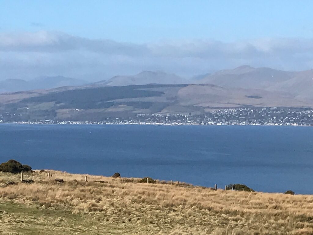
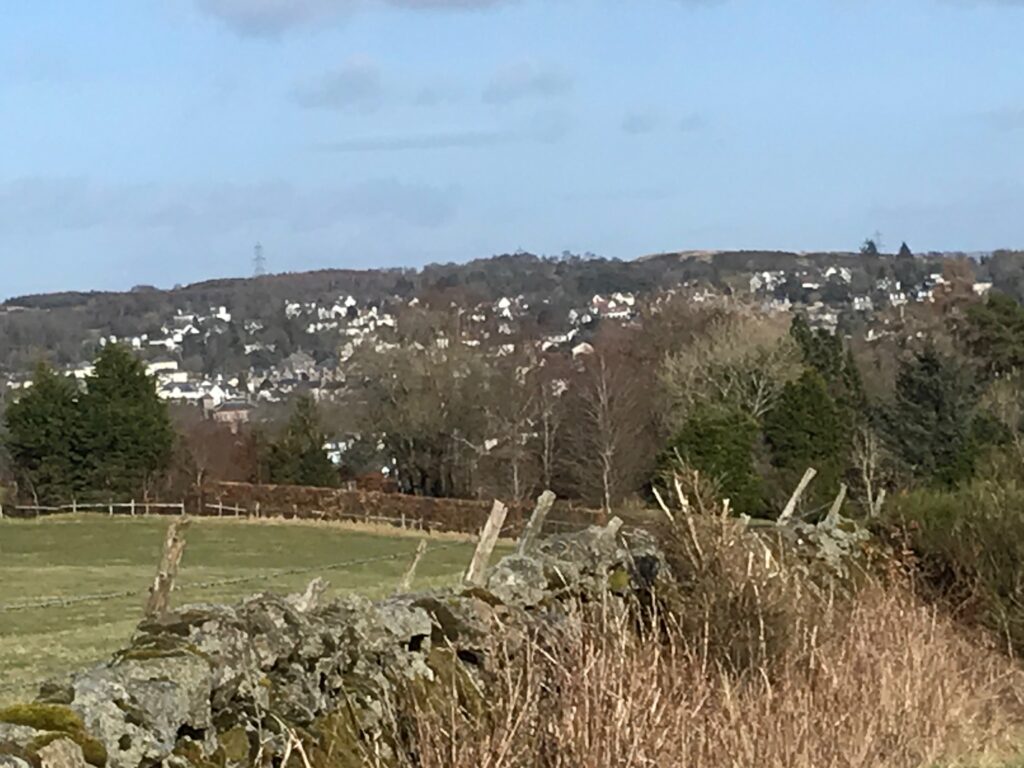
Here I turned right into Dougliehill Road. Soon I had left the residential area behind and I was in open countryside. It had turned out be a fine sunny afternoon with a clear blue sky and only a few wispy clouds. What a view there was from here down over the river and across to the hills beyond. Also, Ben Lomond could be seen in the background – fantastic!
Dougliehill Road continued to climb up through open countryside It soon became very narrow with passing places. I had to be careful in this section, especially approaching blind hills where I couldn’t see oncoming traffic. After reaching the top there was a short downhill section to a junction where I turned left onto the B788.
On the B788 there were a few small hills to begin with. Then there was a very welcome steep descent where I could free-wheel for a while. After this there was a section that was undulating. Then there was a very long descent where I free-wheeled practically all the way to Kilmacolm!
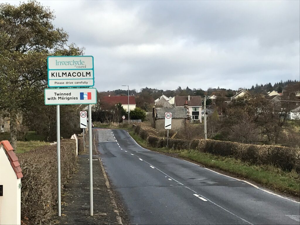
The B788 continued to a junction where I turned left onto the B786. At this point there was a good view across to the village of Kilmacolm.
Further along I reached the outskirts of Kilmacolm and then I cycled through this pleasant village to the village centre.
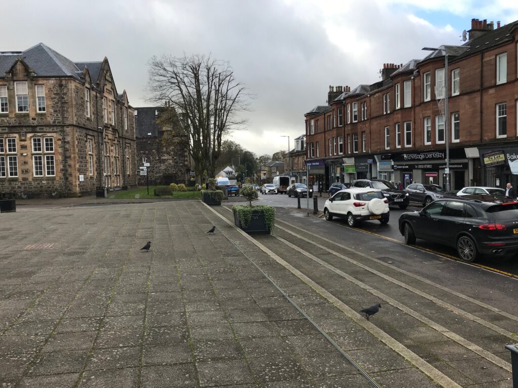
I sat at a bench in the village centre at Kilmacolm Cross and ate a chocolate bar and drank some juice, whilst watching the world go by.
I also took a note of the eating places in Kilmacolm. There is the Cargill Cafe at the Kilmacolm Community Centre right at the cross. The Carriages bar/restaurant is just down from the cross. This is where the railway used to be and which is now the NCN cycle path. The Cross Cafe is just round the corner from Kilmacolm Cross.
The next section of the route was from Kilmacolm back to Bishopton. I had previously cycled the first part of this section when I cycled from Kilmacolm to Houston. However, I consulted the map app on my phone to refresh my memory. Also, I wanted to confirm the location of the cut-off to Bishopton.
To get to the route out of Kilmacolm I knew from the map that I had to cycle along the High Street. To get there, firstly I cycled along the main road that runs alongside the cross. (This is the A761 and not the High Street as you would think.) Then after a very short distance, just at the Cross Cafe, I turned first right into Market Place. This road veers round to the left into High Street. Further along I turned right into West Glen Road, which climbs steeply out of Kilmacolm.
I eventually got to the top of West Glen Road. After this the road was undulating for a while. This was followed by a great descent with lots of free-wheeling.
Further along on this road there was another very long stretch of descent where I free-wheeled for ages. This took me down to a junction where I turned left onto the B789.
I cycled along the B789 until I saw the sign for Formakin Estate, where I turned right. There was a wee bit of a climb up this road, past Bishopton Cemetery to the junction at Ingliston House. This is the start of the circular part of the route. I turned right here and followed the outward route back to the start point in Renfrew.
Electric Motor Assistance -
Cycling Renfrew - Port Glasgow - Kilmacolm 0n 17/03/21
Whilst I continued to strive to get up hills as far as possible on my own steam, I had to use the electric motor for assistance quite a lot today due to the very steep hills on this route.
The first time I used it was on the hill up to the Alpaca Farm outside Bishopton. I managed half-way up this hill and then I used the first level of assistance from the electric motor (ECO mode) to help me up the rest of the hill. I used the ECO mode again a couple of times on a few hills just after this.
Once I reached Port Glasgow and I came to the point where I turned left onto the A761, I had to use the ECO mode to help me up the hill to the roundabout.
Coming out of Port Glasgow after lunch was one of the two times when I had to use the electric motor a lot as the hills were very steep right from the start.
The road from Balfour Street up to the train station was so steep that I had to use the second level of assistance (TOUR mode) from the electric motor to help me for several hundred yards.
I continued to use the ECO and TOUR modes as required all the way up Glenhuntly Road, into Barr’s Brae and up to the summit in Dougliehill Road.
The second time I had to use the electric motor a lot was on the sharp steep hill coming out of Kilmacolm. I had to use mostly the TOUR mode to help me get up the long, steep hill on West Glen Road.
A consequence of using more battery power today, particularly the TOUR mode, was of course that the battery charge level was significantly reduced. At the end of the trip the battery charge level indicator was showing two bars out of five available, although this was partly due to the fact that I hadn’t charged it up after my last two trips as I had hardly used it on these trips. It therefore took about 1.5 hours to charge the battery back up to it’s full capacity.
Summary -
Cycling Renfrew - Port Glasgow - Kilmacolm 0n 17/03/21
This was another most enjoyable trip in fine weather and with great views.
I had forgotten how good the views were from high on the headlands overlooking the River Clyde and to the towns and hills beyond, including views of Ben Lomond.
It was also very good exercise as, even though I had to use the electric motor to help me up the steep hills, I continued to try to get up the hills on my own steam as far as possible. Also, even with the assistance from the electric motor you still have to pedal. As a result I was very tired at the end of the trip.
I was really pleased to have plotted this circular route from previous trips I had done, and was very satisfied to have completed the trip.