The following is a brief summary of the key details for Cycle Routes in Scotland : Renfrew – Port Glasgow – Kilmacolm.
Port Glasgow
DISTANCE :
37 miles – linear then circular
24 miles – circular only
TERRAIN : Hilly
TOTAL ASCENT : 2575 ft.
START & FINISH :
37 miles – Car park at Braehead, Renfrew
24 miles – anywhere along the circular route
This route is one of the cycle routes in Scotland that I have cycled over the years. Some of the other routes I have cycled over the years are listed in the page “Cycle Routes in Scotland”. (Click here to go to this page.)
The map above is an interactive map so if you press “Play” (click on the white triangle in the middle of the screen) you can zoom in or out by pressing the buttons that appear in the top left of the screen, and you can move the map by dragging it. Once you press Play the hills profile of the route will appear at the bottom of the map. You can get further comprehensive detailed analysis of the hill profile by clicking on “More Detailed Profile” at the top left of the hills profile section. You can also select full screen mode by clicking on the icon in the top right corner of the map.
Route Details -
Cycle Routes in Scotland : Renfrew - Port Glasgow - Kilmacolm
The route starts at the large, free car park at the entertainment centre at Braehead (previously called “Soar” now called “XSite”). From here you cycle along the shared use pavement all the way along to the traffic lights at the end of Kings Inch Road. At this point you leave the cycle path, and the rest of the route back to this point is mostly on quiet roads.
At the traffic lights you turn left onto Ferry Road and then immediately turn right into Campbell Street. Further along turn right into Hamilton Crescent and at the end of this road turn right into Blythswood Road. Here the road ends after a short distance, but you can continue straight ahead on a short path through small woods. This leads to a road where you veer left onto North Lodge Road. Continue on this road all the way to it’s end, emerging at Inchinnan Road where you turn right.
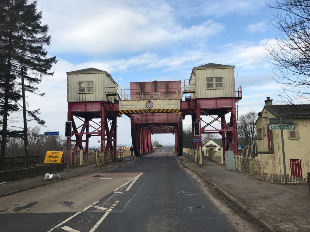
Follow Inchinnan Road for a few hundred yards and you will come to an unusual bridge over a river called the White Cart Water. This type of bridge is called a Scherzer Rolling Lift Bascule Bridge. It is the only remaining rolling lift bridge in the country. The carriageway on the bridge is narrow so care should be taken.
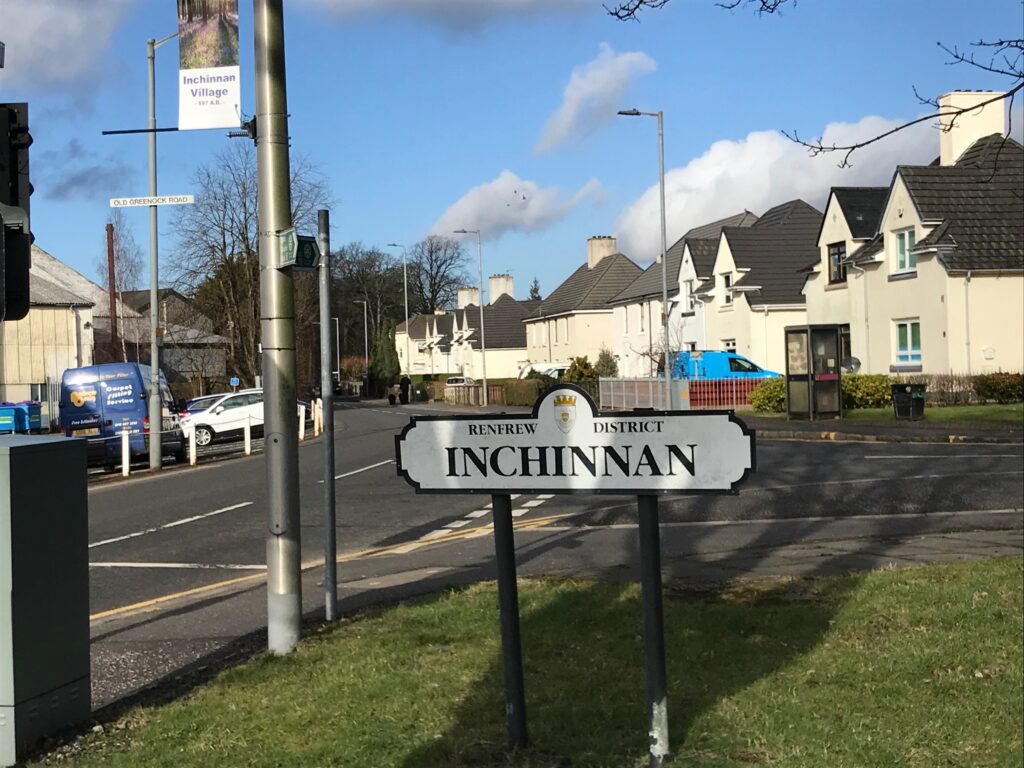
At the other end of the bridge take the right hand junction onto the A8 Greenock Road. Cycle along and up the slight hill and turn right at the traffic lights. This takes you into the village of Inchinnan.
The road through Inchinnan is called the Old Greenock Road. This is the road that will mostly be followed all the way to Port Glasgow.
Cycle to the end of this road to where there is a section that is No Entry, except for buses. Walk with your bike on the pavement through this section and then turn left onto the main road. Follow this road through two smaller roundabouts until you reach a large roundabout at the junction with the A726. Here continue straight through and this will take you back onto the Old Greenock Road.
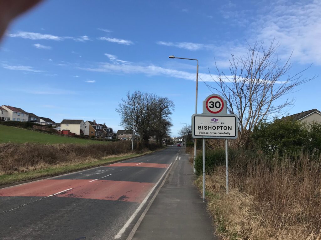
Continue on this road, passing the outskirts of the town of Erskine, until you reach the village of Bishopton.
When you get to the end of Old Greenock Road in Bishopton, straight ahead is Porton Place, which is No Entry. You therefore have to turn left and cycle along to the traffic lights. Here you turn right onto the village main street, which is the A8 Greenock Road.
Just past the end of the main street, across from a garage, the Old Greenock Road can be picked up again. The second part of this section is traffic free, but only for a short distance. At the end of this section you cross a road to pick up the Old Greenock Road again. This section of the road does have some traffic on it, but it is quite a quiet road.
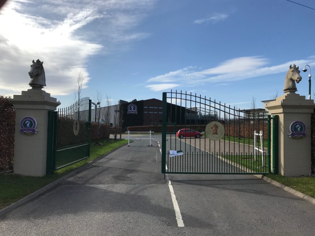
The road winds up a hill and at a junction you go to the right. Then at the top of the hill on the left is Ingliston Country Club and Equestrian Centre. The Centre includes a hotel. The bar in the Country Club also serves food. There are benches outside on the road where you can rest and admire the views over the Firth of Clyde.
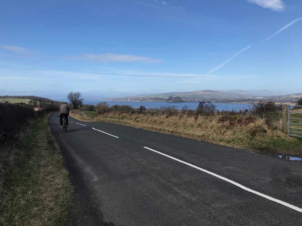
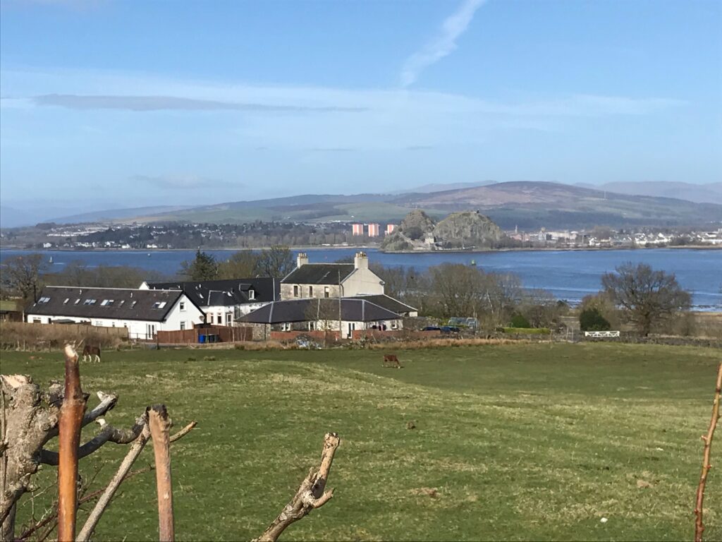
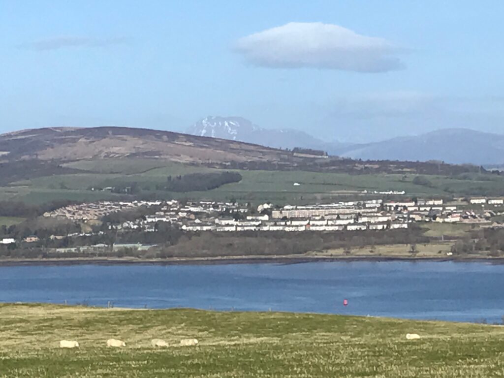
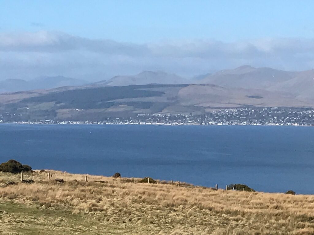
The road continues high above the River Clyde. From here there are fantastic views over the river and to the towns and hills beyond. Further along there are clear views of the Dumbarton Rock in front of the town of Dumbarton.
The road winds it’s way down to the B789 road where you turn right. Further along the road there is a junction. At this point the main road winds round to the right and descends steeply to the village of Langbank. Here cycle straight on up the hill.
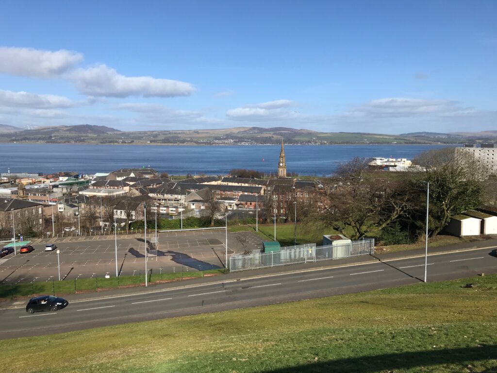
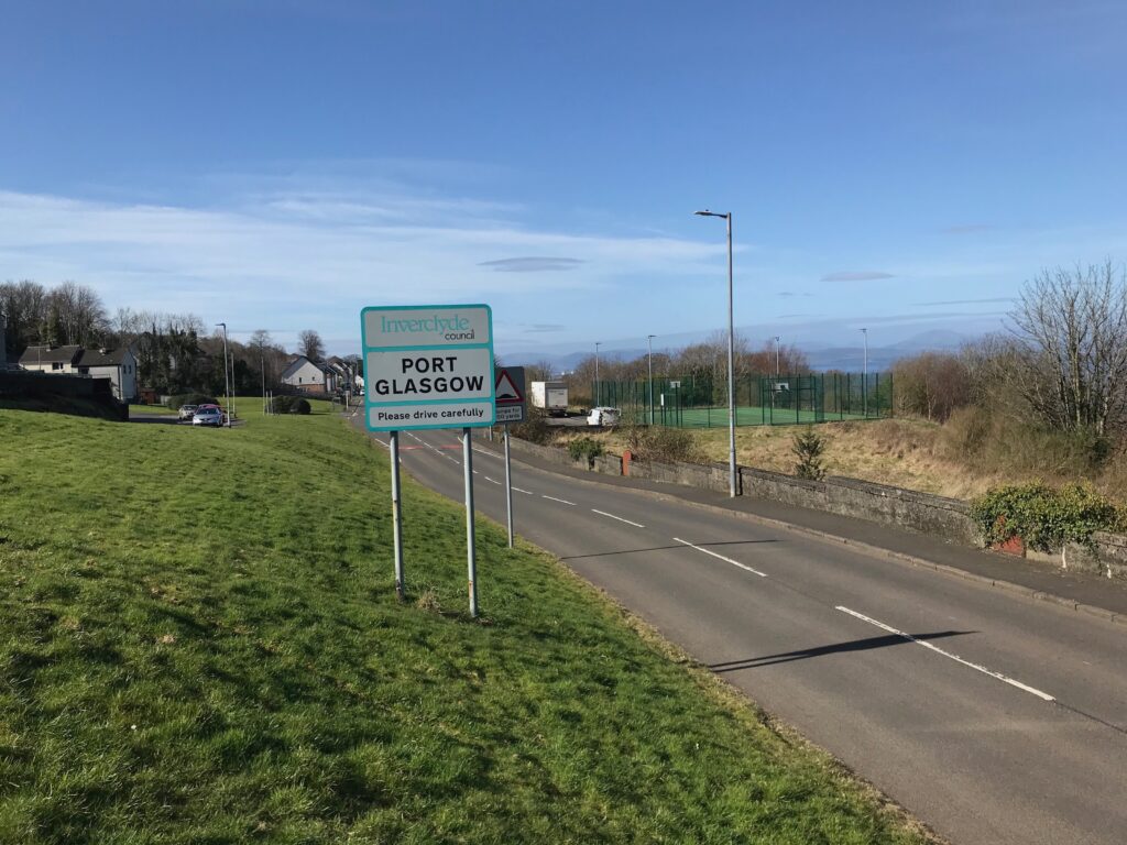
Eventually you will reach the high point of the headland overlooking the town of Port Glasgow.
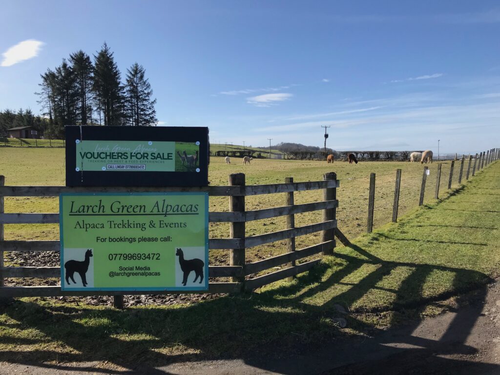
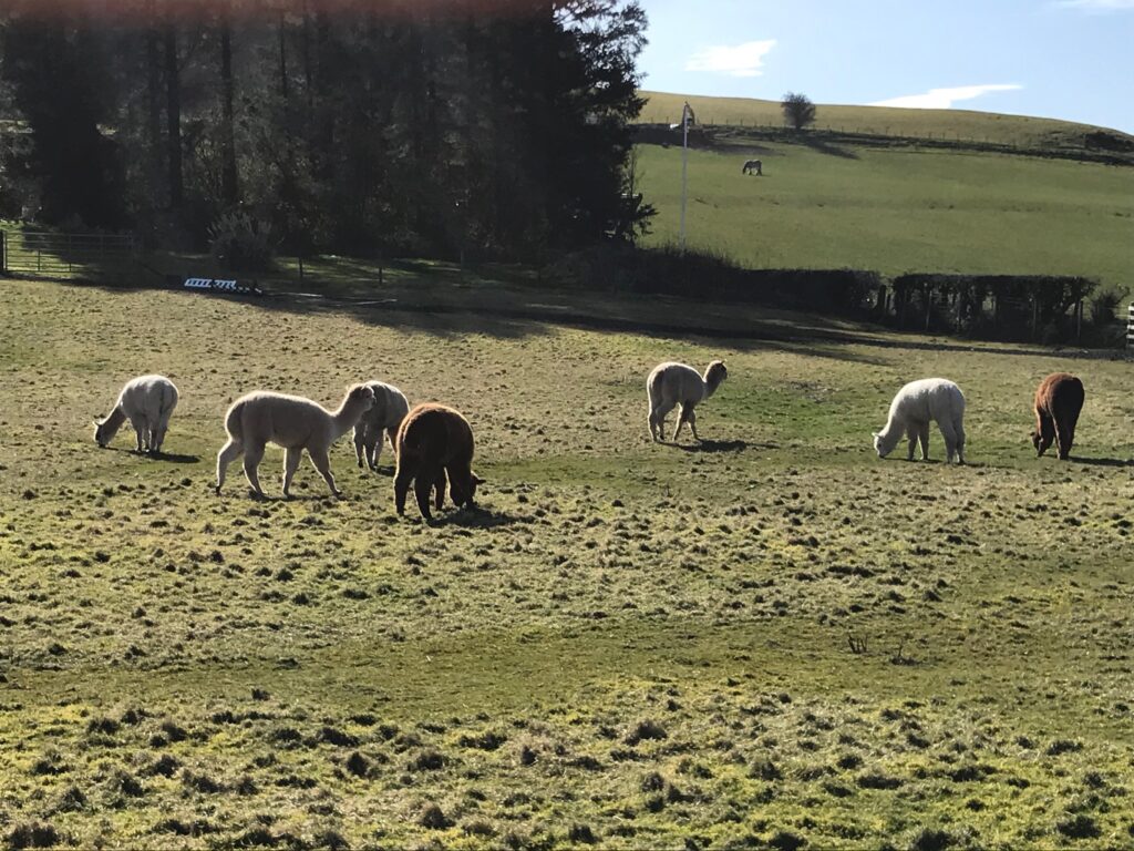
Just at this point there is a farm that has Peruvian Alpacas in a field and that offers trekking and other events with the alpacas.
The views here across the river continue to be fantastic and on a clear day you can see Ben Lomond in the background.
After this there is quite a steep descent. Then there is a short climb before the long descent to the outskirts of Port Glasgow. Part way down you can look down over the town of Port Glasgow.
The Old Greenock Road continues into Port Glasgow. Then it leads onto Parkhill Avenue which is the start of the residential area of Port Glasgow.
The road continues to High Carnegie Road. At the end of this road there is a sharp left turn up a short steep brae. This leads to the A761 road where you turn left and climb up the hill to the roundabout.
At the roundabout you take the fourth exit onto Boglestone Avenue, that leads onto Armore Road and then Springhill Road. From here there is a very steep descent to the centre of Port Glasgow.
In the last part of the descent, where Springfield Road leads into Highholm Avenue, on the right is Port Glasgow train station.
Highholm Avenue continues down the hill. The road then veers to the right where it becomes Balfour Street for a short stretch. (Although Balfour Street is not shown on the map aboveThe descent ends at the junction with Shore Street. Here you are directly facing a large car park for Tesco and McDonalds. Behind Tescos there is a large retail park.
You can stop here for a lunch break. However, if you prefer somewhere quieter you can continue on a shared use path to some benches on the shore. Here it is more peaceful and there are some nice views.
To get to the shared use path turn right into Shore Street. Then take the first left and cycle along to a large, busy roundabout. Here you take the third exit into Anderson street. You pick up the shared use path just at the start of Anderson Street. Then you can cycle along the shore to a spot where there are three concrete benches overlooking a burn.
You can stop here for a rest whilst enjoying the views across the river to the coastal town of Helensburgh.
After lunch retrace your steps to Balfour Street. Then cycle up the steep hill on Highholm Avenue to just across from the train station. Here you turn right into Glenhuntly Road. This road winds it’s way very steeply up the hill. Part-way up there are fine views down over Port Glasgow.
Continue cycling up Glenhuntly Road and along to a junction with Kinross Avenue and Barr’s Brae. Here turn right into Barr’s Brae and continue along and ever upwards to a junction at the end of this road.
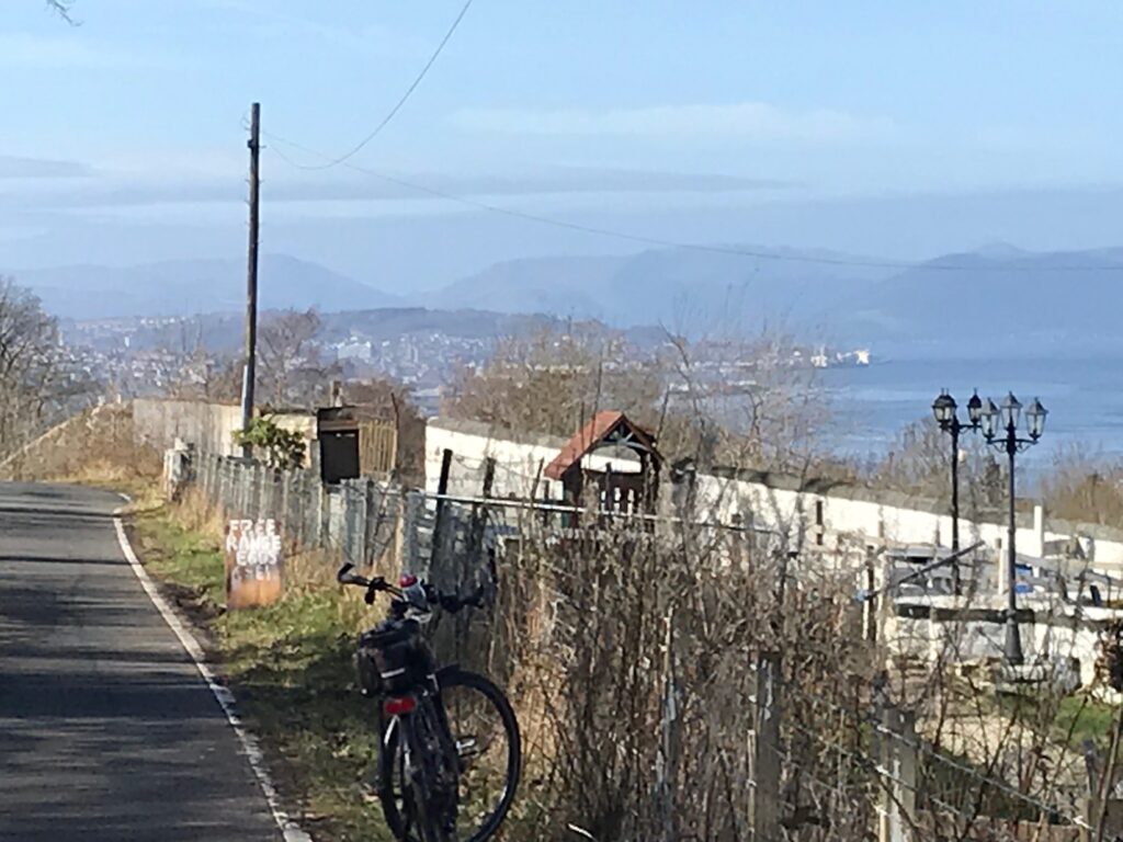
Here turn right into Dougliehill Road and soon you will have left the residential area behind and be in open countryside. From here there is a wonderful view down over the river and across to the hills beyond, with Ben Lomond in the background – fantastic!
Dougliehill Road continues to climb up through open countryside and it soon becomes very narrow with passing places. Care should be taken in this section, especially approaching blind hills where you can’t see oncoming traffic. After reaching the top there is a short downhill section to a junction where you turn left onto the B788.
On the B788 there are a few small hills to begin with but then there is a very welcome steep descent where you can free-wheel for a while. After this there is a section that is undulating. Then there is a very long descent where you can free-wheel practically all the way to Kilmacolm!
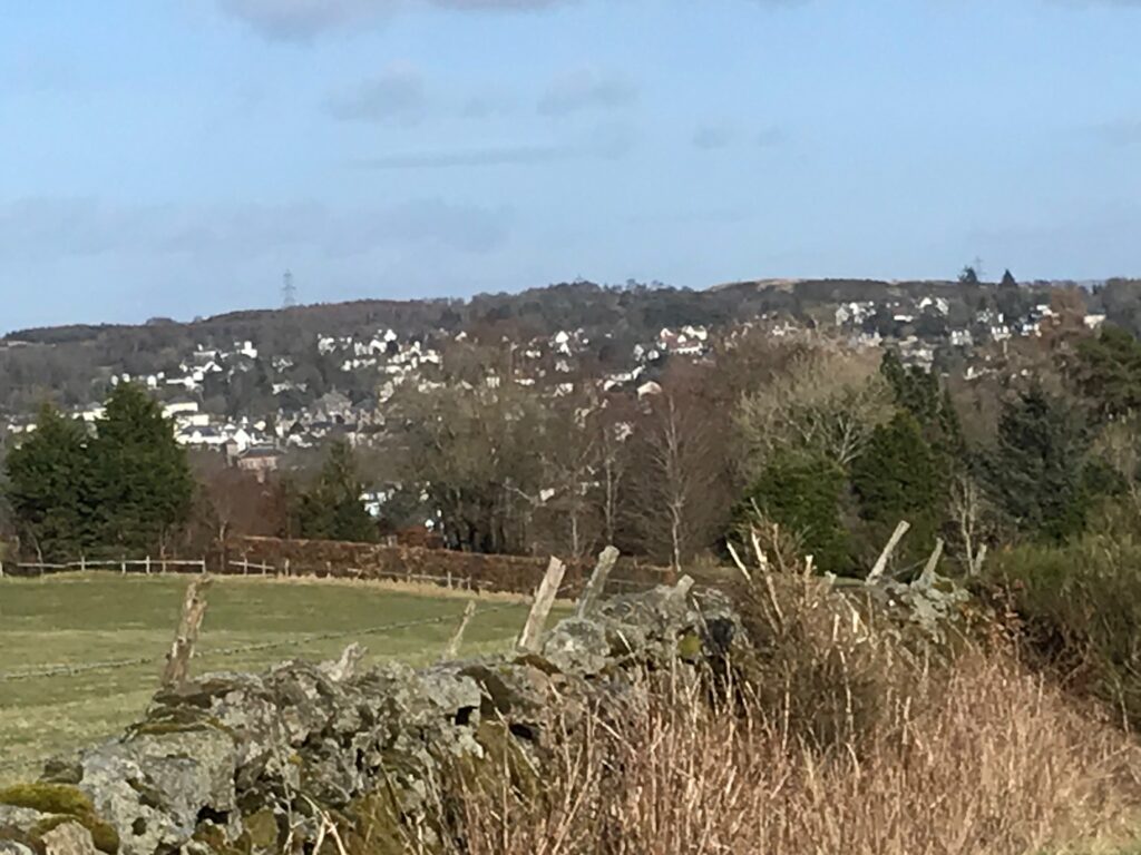
The B788 continues to a junction where you turn left onto the B786. At this point there is a good view across to the village of Kilmacolm.
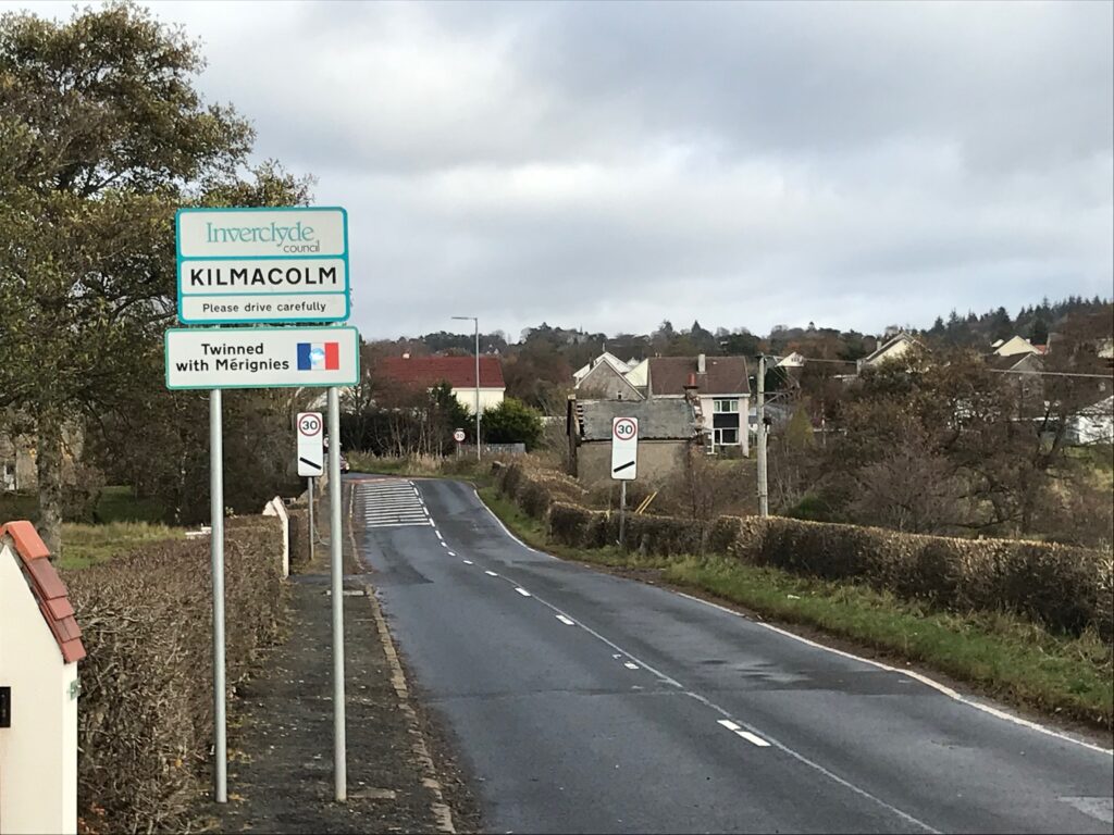
Further along you reach the outskirts of Kilmacolm and then you cycle through this pleasant village to the village centre.
There are benches in the village centre at Kilmacolm Cross where you can rest, and there are a couple of cafes and a bar/restaurant.
The next section of the route is from Kilmacolm back to Bishopton
To get to the route out of Kilmacolm firstly cycle along the main road that runs alongside the cross. (This is the A761 and not the High Street as you would think.) Then after a very short distance, just at the Cross Cafe, turn first right into Market Place, which veers round to the left into High Street. Further along turn right into West Glen Road, which climbs steeply out of Kilmacolm.
You will eventually get to the top of West Glen Road. After this the road is undulating for a while, followed by a welcome descent with lots of free-wheeling. Further along on this road there is another very long stretch of descent where you can free-wheel for ages. This takes you down to a junction where you turn left onto the B789.
Cycle along the B789 until you see the sign for Formakin Estate, where you turn right. There is a wee bit of a climb up this road, past Bishopton Cemetery to the junction at Ingliston House. This is the start of the circular part of the route.
Turn right here and follow the outward route back to the start point in Renfrew.
Route Alternatives -
Cycle Routes in Scotland : Renfrew - Port Glasgow - Kilmacolm
The route could be significantly shortened by cutting out the section from Renfrew to Bishopton, and thus just doing the circular section of the route. This would reduce the overall distance by about 13 miles, resulting in a circular route of about 24 miles.
Another alternative would be to do the circular part of the route in an anti-clockwise direction.
Or you could do different sections of the route on different days.
Cafe / Toilet Stops -
Cycle Routes in Scotland : Renfrew - Port Glasgow - Kilmacolm
At the start of the route, in the Braehead entertainment complex there are several bar/restaurants and many other eating places. There are also public toilets in the complex.
At Inchinnan there is the Braehead Tavern that serves food, and the Post Office/shop next to the Braehead Tavern sells takeaway snacks.
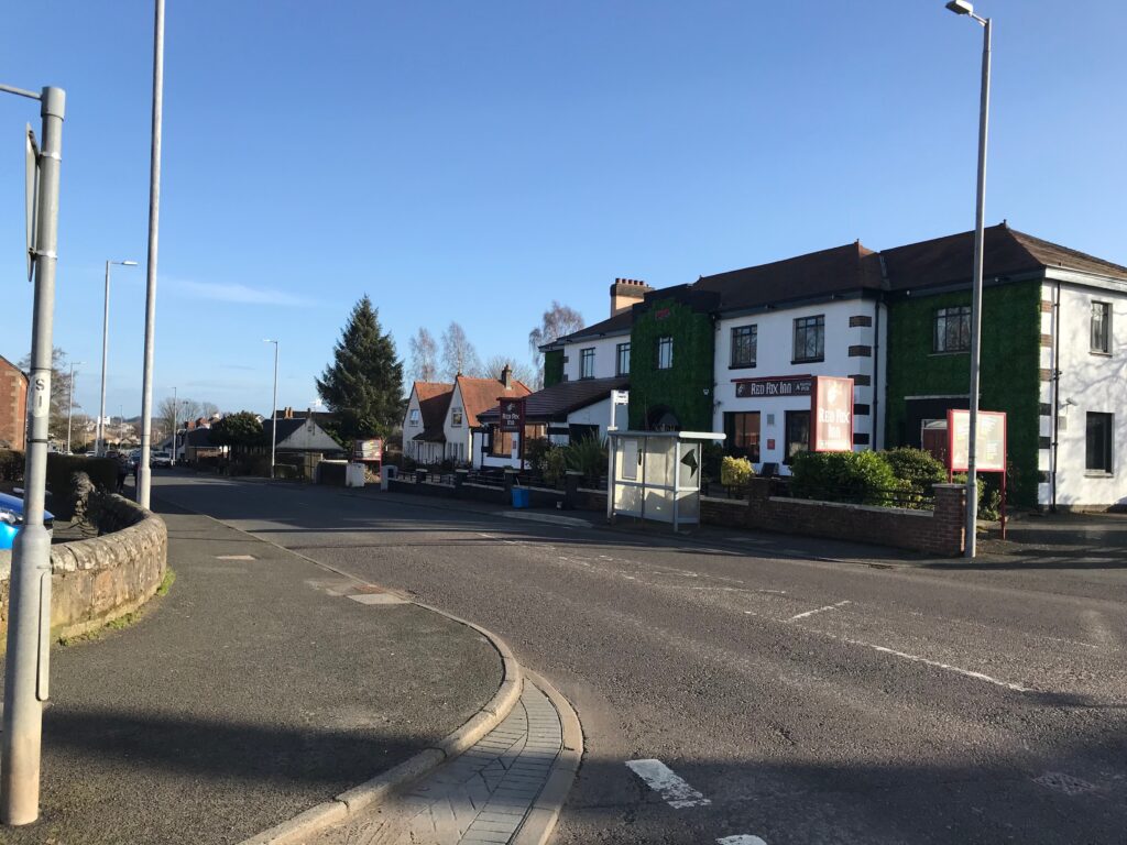
Eating places in the village of Bishopton are May’s Coffee Shop, a large bar/restaurant called the Red Fox Inn and there is a Tandoori takeaway. There is also a Co-op mini-market and a hardware store.
At the top of the hill on the Old Greenock Road just past Bishopton, food is served in the bar/restaurant at the Ingliston Country Club & Equestrian Centre.
There are of course many eating places in Port Glasgow. In the large retail park that faces you when you arrive at the centre of Port Glasgow there is a cafe and toilet in Tesco. There is also a McDonalds next to Tesco, and there is a bar/restaurant at the far end of the Retail Park. Port Glasgow town centre is just to the right off Shore Street, where there are cafes, shops and bar/restaurants.
In the village of Kilmacolm there is the Cargill Cafe at the Kilmacolm Community Centre right at Kilmacolm Cross. The Carriages bar/restaurant is just down from the cross where the railway used to be and which is now the NCN cycle path. The Cross Cafe is just round the corner from Kilmacolm Cross.
Train Options -
Cycle Routes in Scotland : Renfrew - Port Glasgow - Kilmacolm
If you want to access the start of the route by train your options to do so will of course depend on where you live and what train lines are nearby and where they run to, which each person will need to investigate for themselves. For a website that can help with this click on the following website address : https://www.thetrainline.com. Some possible train options are outlined below.
Although there is no train station in Renfrew you could take the train to the nearest main station, which is Paisley Gilmour Street, and cycle to the start point in Renfrew from there. This would involve cycling on some busy roads for about 3.5 miles, and thus this would add about 7 miles overall to the journey time.
There is a train from Glasgow Central Station to Port Glasgow that stops at both Paisley Gilmour Street and at Bishopton.
There is a train from Bishopton to Port Glasgow that stops at the villages of Langbank and Woodhall.